There's already a "found" Houston photo thread, but it focuses on highrise architecture and skyline views. So I wanted to create a thread specifically for the Houston Metro's Bay Area (Galveston Bay and Clear Lake). This is one of my favorite areas of the metro. A lot of this area is within the Houston city limits.
Interestingly, the updated Google Earth satellite view was taken right after some flooding, and tons of mud flowed into Clear Lake.
The area in large part was developed in the 60s due to the development of NASA as a centerpiece. Due to its age, to me a lot of the bay area is a bit dated, and could use a lot of redevelopment. From what I've seen, the momentum seems to be building and the area is starting to change for the better.
Since I don't have any photos of the bay area of my own, I went to Google Street View and selected views of the some areas that I find interesting, or which I wanted to comment on. So here goes. I hope you enjoy seeing this area.
[IMG]
 Taylor Lake Village
 by
dharper615, on Flickr[/IMG]
Source: Google Street View
http://www.flickr.com/photos/4041197...n/photostream/
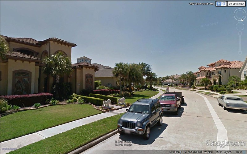
The above is a view of a new development on Taylor Lake. I like it because of the tropical look of the development. Each home is on the waterfront.
[IMG]
 Clear Lake Shores_4
 by
dharper615, on Flickr[/IMG]
Source: Google Street View
http://www.flickr.com/photos/4041197...n/photostream/
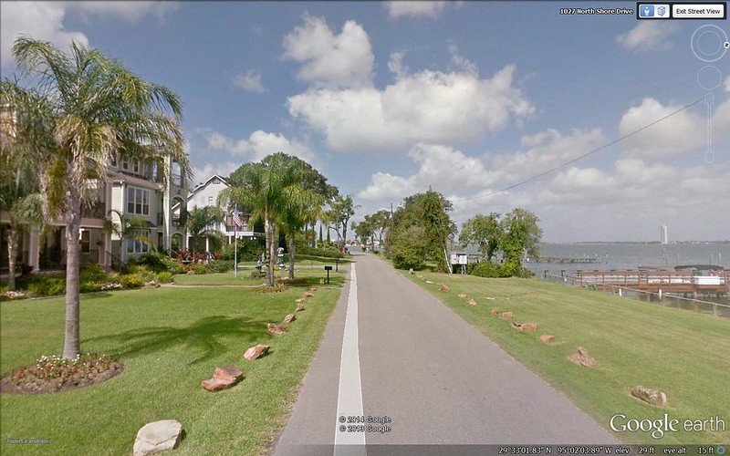
Above is a view from an old neighborhood called Clear Lake Shores, which is being redeveloped.
[IMG]
 Clear Lake Shores_3
 by
dharper615, on Flickr[/IMG]
Source: Google Street View
http://www.flickr.com/photos/4041197...n/photostream/
The above is a view of some of the redevelopment of Clear Lake Shores.
[IMG]
 Clear Lake Shores_2
 by
dharper615, on Flickr[/IMG]
Source: Google Street View
http://www.flickr.com/photos/4041197...n/photostream/
The above is more redevelopment of Clear Lake Shores.
[IMG]
 Clear Lake Shores
 by
dharper615, on Flickr[/IMG]
Source: Google Street View
http://www.flickr.com/photos/4041197...n/photostream/
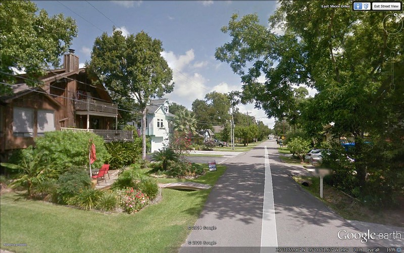
The above photo is of an interior street in Clear Lake Shores. Many of the old homes have been replaced, but the area retains an eclectic coastal vibe. Many of the homes have their living quarters on the second level, with an open carport below (due to flooding potential from tropical storms and hurricanes). This is my favorite enclave in all of the bay area.
[IMG]
 Kemah_3
 by
dharper615, on Flickr[/IMG]
Source: Google Street View
http://www.flickr.com/photos/4041197...n/photostream/
The above photo is of the Kemah boardwalk area right on the bay (very touristy). Kemah historically was a tacky, shabby fishing village on the bay. Now it's a tacky, redeveloped fishing/tourist community. It's definitely been cleaned up a lot, though.
[IMG]
 Kemah
Kemah by
dharper615, on Flickr[/IMG]
Source: Google Street View
http://www.flickr.com/photos/4041197...n/photostream/
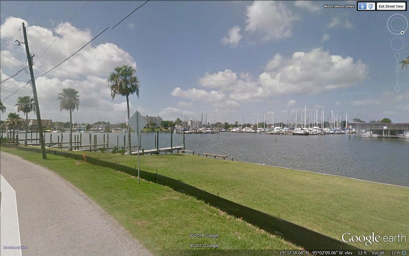
Above is more of the Kemah boardwalk area, including one of many marinas in the area.
[IMG]
 Nassau Bay
 by
dharper615, on Flickr[/IMG]
Source: Google Street View
http://www.flickr.com/photos/4041197...n/photostream/
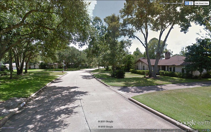
The above photo shows a street in Nassau Bay. This is pretty typical of most parts of the bay area. These areas were built in the 60s and were once the home of astronauts (maybe still?). Seems like in the movie Apollo 13, there were scenes from one of these neighborhoods.
[IMG]
 NASA
NASA by
dharper615, on Flickr[/IMG]
Source: Google Street View
http://www.flickr.com/photos/4041197...n/photostream/
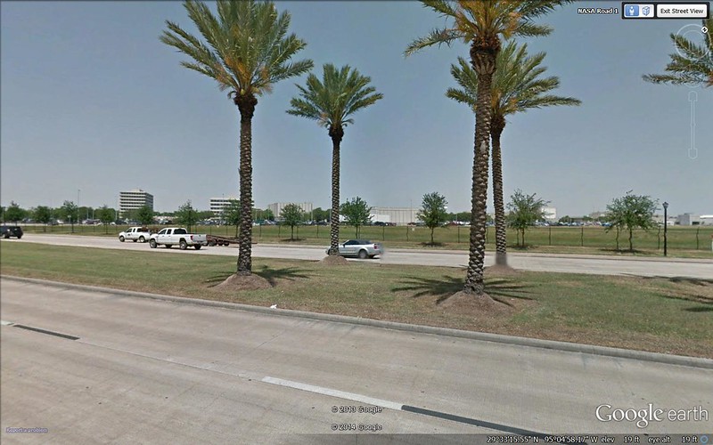
NASA in the distance. It's a huge complex but you can only see a little of it in the photo.


 .
.


 Linear Mode
