A thread was recently started in the London section, but I thought it would be interesting to see historical maps of any kind, from across Canada. I am currently reading the Historical Atlas of Toronto, by Derek Hayes, which has some great examples! But I would love to see more, that demonstrate the development of our cities, provinces/territories, and nation.
__________________
"Sometimes I wonder if the world's so small, that we can never get away from the sprawl.
Living in the sprawl the dead shopping malls rise like mountains beyond mountains and there's no end in sight." -Arcade Fire
__________________
"Sometimes I wonder if the world's so small, that we can never get away from the sprawl.
Living in the sprawl the dead shopping malls rise like mountains beyond mountains and there's no end in sight." -Arcade Fire
__________________
The whole problem with the world is that fools and fanatics are always so certain of themselves, and wiser people so full of doubts. (Bertrand Russell)
I'm actually in the process of reading the Historical Atlas of Vancouver and the Lower Fraser Valley from the library which features some amazing old maps. Maybe I'll scan a few of 'em if I get around to it.
Here's a teaser here: http://www.derekhayes.ca/vancouver.htm
I'm actually in the process of reading the Historical Atlas of Vancouver and the Lower Fraser Valley from the library which features some amazing old maps. Maybe I'll scan a few of 'em if I get around to it.
Here's a teaser here: http://www.derekhayes.ca/vancouver.htm
I would love to read that book. Looks like it was written by the same author as the Historical Atlas of Toronto, which I am currently reading. It's got some excellent maps in it!
__________________
"Sometimes I wonder if the world's so small, that we can never get away from the sprawl.
Living in the sprawl the dead shopping malls rise like mountains beyond mountains and there's no end in sight." -Arcade Fire
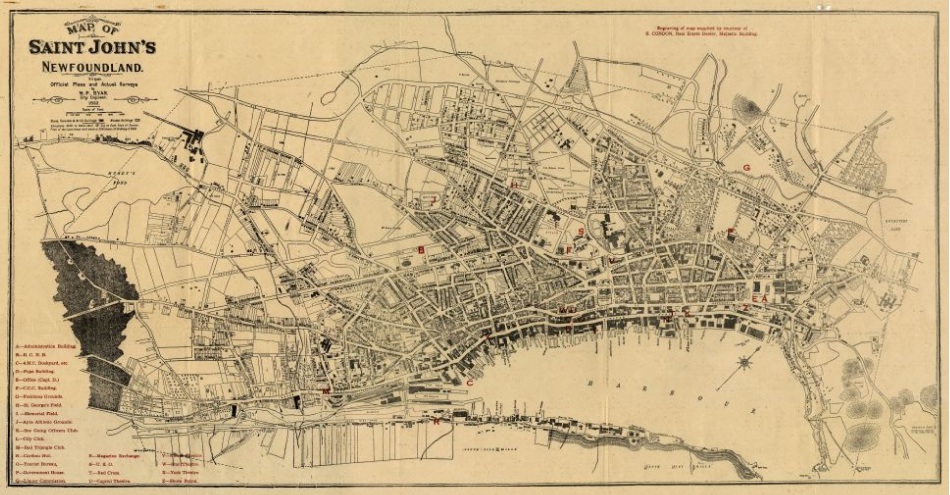
Includes many purposed streets that were never built.
That's great, I own a house on Pennywell / Fitzpatrick (proposed street on that map) that was originally built in the 1920s and can clearly see the property there, I've always wondered how long there has been a dwelling on that spot.
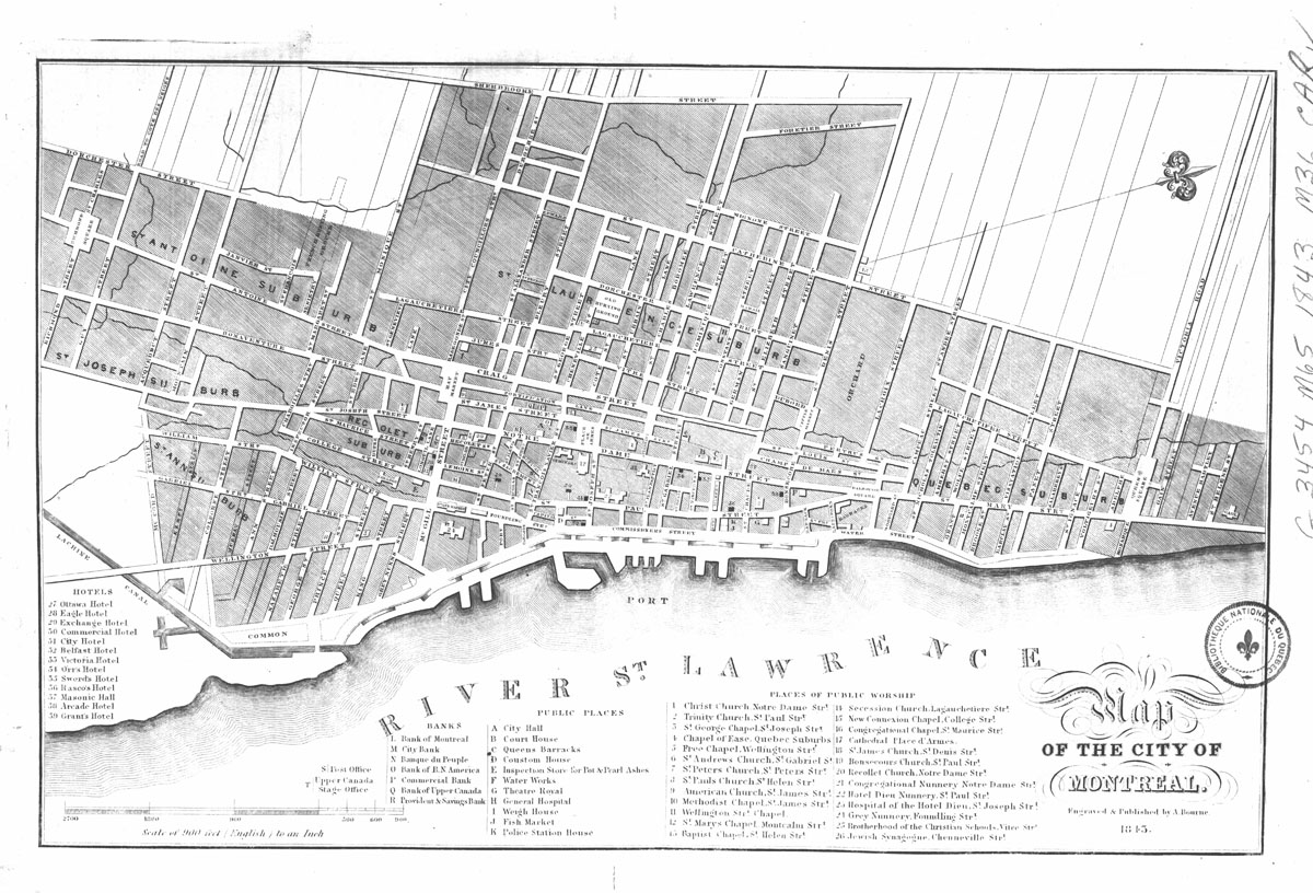
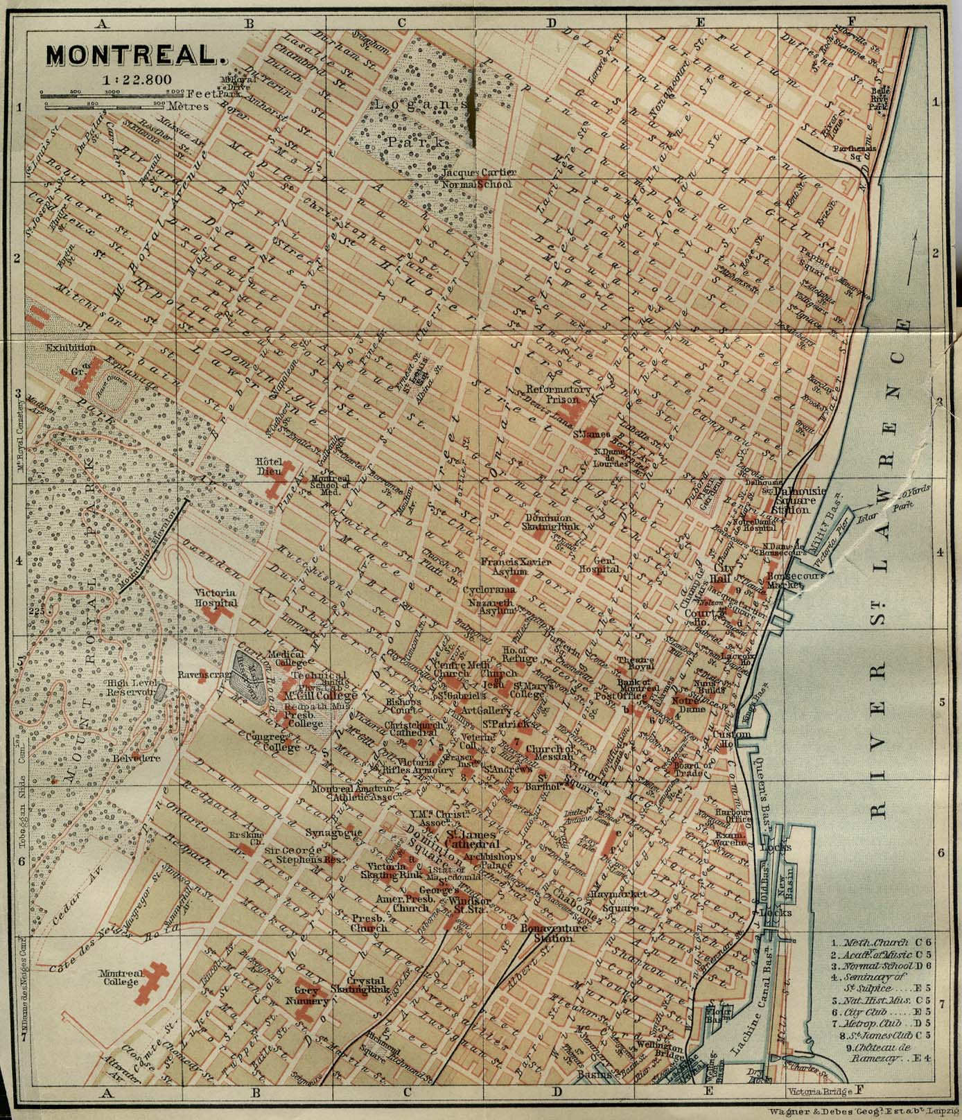
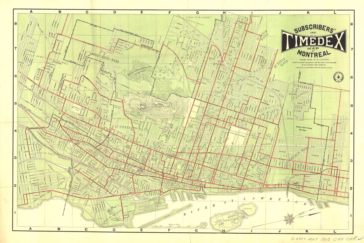
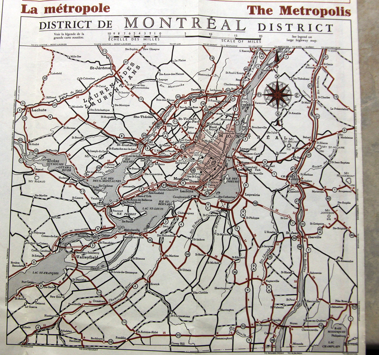
Really cool maps of Toronto and Montreal here. Not sure where to find any ones of Hamilton. A quick google image search returned some rather lame maps.
__________________
"Above all, Hamilton must learn to think like a city, not a suburban hybrid where residents drive everywhere. What makes Hamilton interesting is the fact it's a city. The sprawl that surrounds it, which can be found all over North America, is running out of time."


 Prev
Prev


 Linear Mode
