HomeDiagramsDatabaseMapsForum About
     

Go Back   SkyscraperPage Forum > Photography Forums > Found City Photos

Reply

 
Thread Tools Display Modes
     
     
  #28721  
Old Posted May 24, 2015, 12:39 AM
tovangar2 tovangar2 is offline
Registered User
 
Join Date: Nov 2012
Location: West Los Angeles
Posts: 2,625
Quote:
Originally Posted by MichaelRyerson View Post
I'm happy to have the book. Which just arrived five minutes ago.
All I got was an email saying 'shipment delayed'....

There's always more recent mayhem: 53, not '53, (mostly) murders in four days. 22 remain unsolved.

Last edited by tovangar2; May 24, 2015 at 4:42 AM.
Reply With Quote
     
     
  #28722  
Old Posted May 24, 2015, 4:41 AM
Tourmaline Tourmaline is offline
Registered User
 
Join Date: May 2012
Posts: 996
Quote:
Originally Posted by ethereal_reality View Post
A brief recap:


The Earl Carroll Theater at 6230 Sunset Boulevard.


calisphere


...and as the Moulin Rouge (very successful throughout the 1950s)


ebay/postcard

____
Quote:
Originally Posted by ethereal_reality View Post


Beryl postcard
http://grapefruitmoongallery.com/gal..._beryl-417.jpg


Beryl Wallace, who is among those pictured above happens to be the model for Earl Carroll's neon facade. Her Wiki bio can be found here:http://en.wikipedia.org/wiki/Beryl_Wallace The shorter version is she had film roles, a radio show and performed at Carroll's dinner theater. Sadly, in 1949, she and Carroll perished in a plane crash.


Per source:
Quote:
Exterior view of the Earl Carroll Theatre, located at 6230 Sunset Boulevard in Hollywood, showing the 20-foot high neon portrait of Beryl Wallace.
http://jpg1.lapl.org/00085/00085626.jpg


http://jpg1.lapl.org/00101/00101432.jpg


http://earlcarrollgirls.com/EC%20PIC...%20Wallace.gif


Quote:
From left to right: Beryl Wallace, Jane Ellison and Earl Carroll. Producer of "Let Freedom Ring" directs rehearsals. [U]nderstudy [Ellison] takes over the scanties and lines of his singing and dancing star [Wallace], who dons more formal attire to appear for boys at Camp Pendleton.
June 4, 1943
http://jpg1.lapl.org/pics33/00036038.jpg


http://1.bp.blogspot.com/_XRrU8-3Nmi...+Wallace+1.gif


http://4.bp.blogspot.com/_XRrU8-3Nmi...ghtclub+v3.gif


http://forum.skyscraperpage.com/show...postcount=5751 According to this brief bio, "Carroll was in the final planning stages of opening a larger theater just one block from his current location. The new one would rival New York's Radio City Music Hall and cost upwards of $15,000,000." http://moviespictures.org/biography/Wallace,_Beryl


http://grapefruitmoongallery.com/gal...yl-wallace.jpg


More Carroll theater here:http://skyscraperpage.com/forum/show...170279&page=76

Last edited by Tourmaline; May 24, 2015 at 5:36 AM.
Reply With Quote
     
     
  #28723  
Old Posted May 24, 2015, 5:34 AM
Beaudry's Avatar
Beaudry Beaudry is offline
Registered User
 
Join Date: Nov 2009
Posts: 714
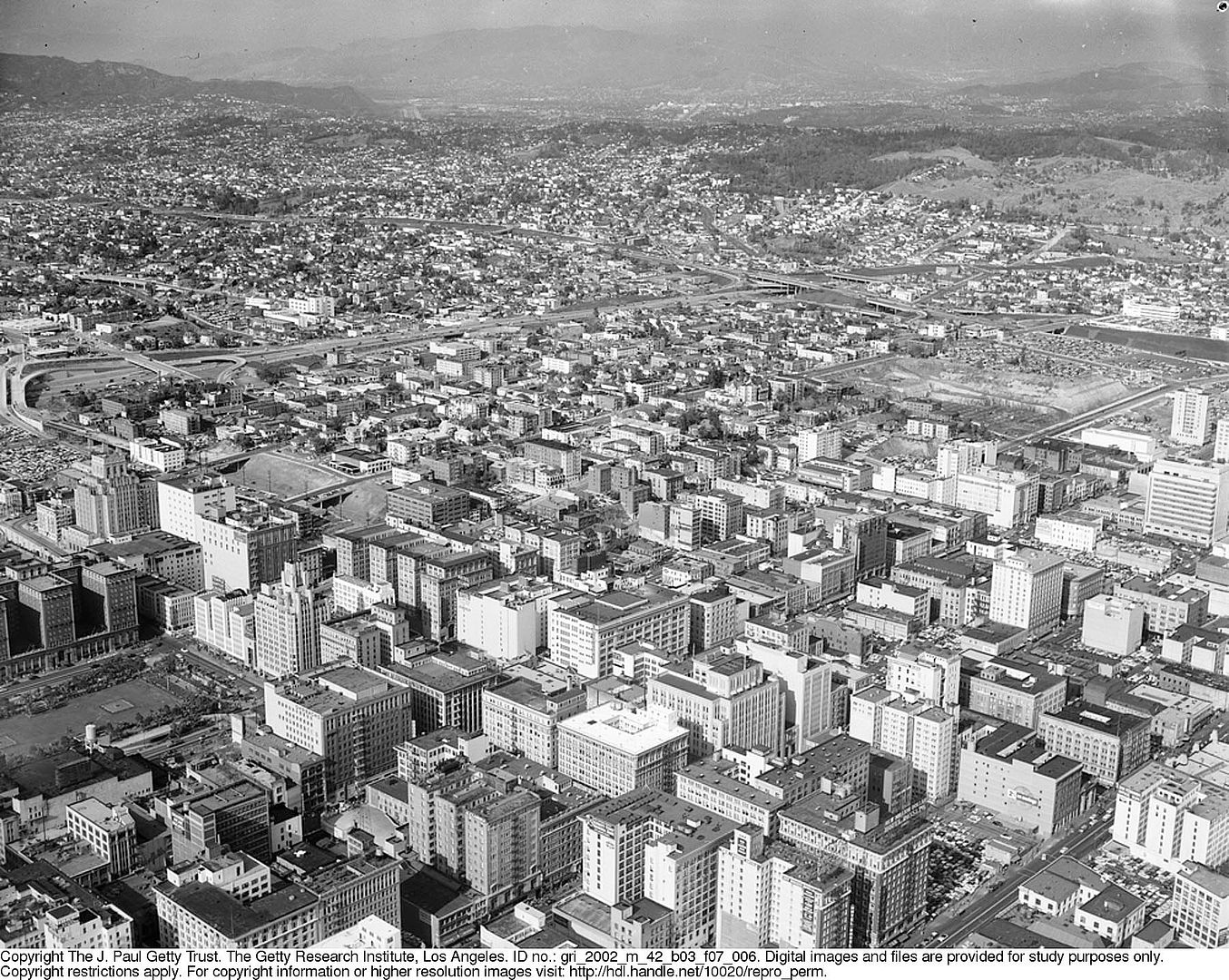
I'm guessing most in the Noirish community are familiar with Leonard Nadel—postwar photographer for the LA Housing Authority, about whom Stefano Bloch writes "Nadel captured images of abject poverty and substandard housing reminiscent of New York City's Lower East Side at the turn of century. Nadel may not, however, be included on the list of great social reformist photographers such as Jacob Riis, because his images, perhaps unwittingly, inspired slum clearance, the displacement of communities, and the bad policy that led to some of the worst housing stock and concentrated poverty in the nation. Nevertheless, students and scholars may find more to discuss in the juxtaposition of his images, using Nadel's pictures as visual data and a view of post-War housing upheavals and short-lived triumphs in Los Angeles."

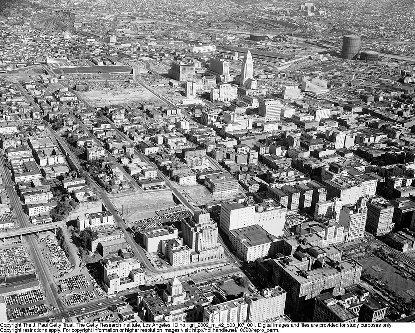
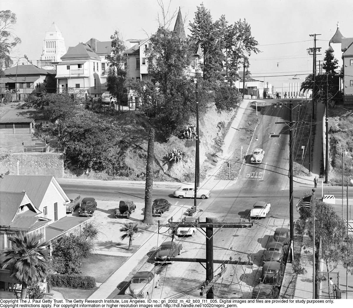
If you don't know of Nadel, at least you've seen his shots. For example, here is one of his, and note the lamentation that the image is not bigger.

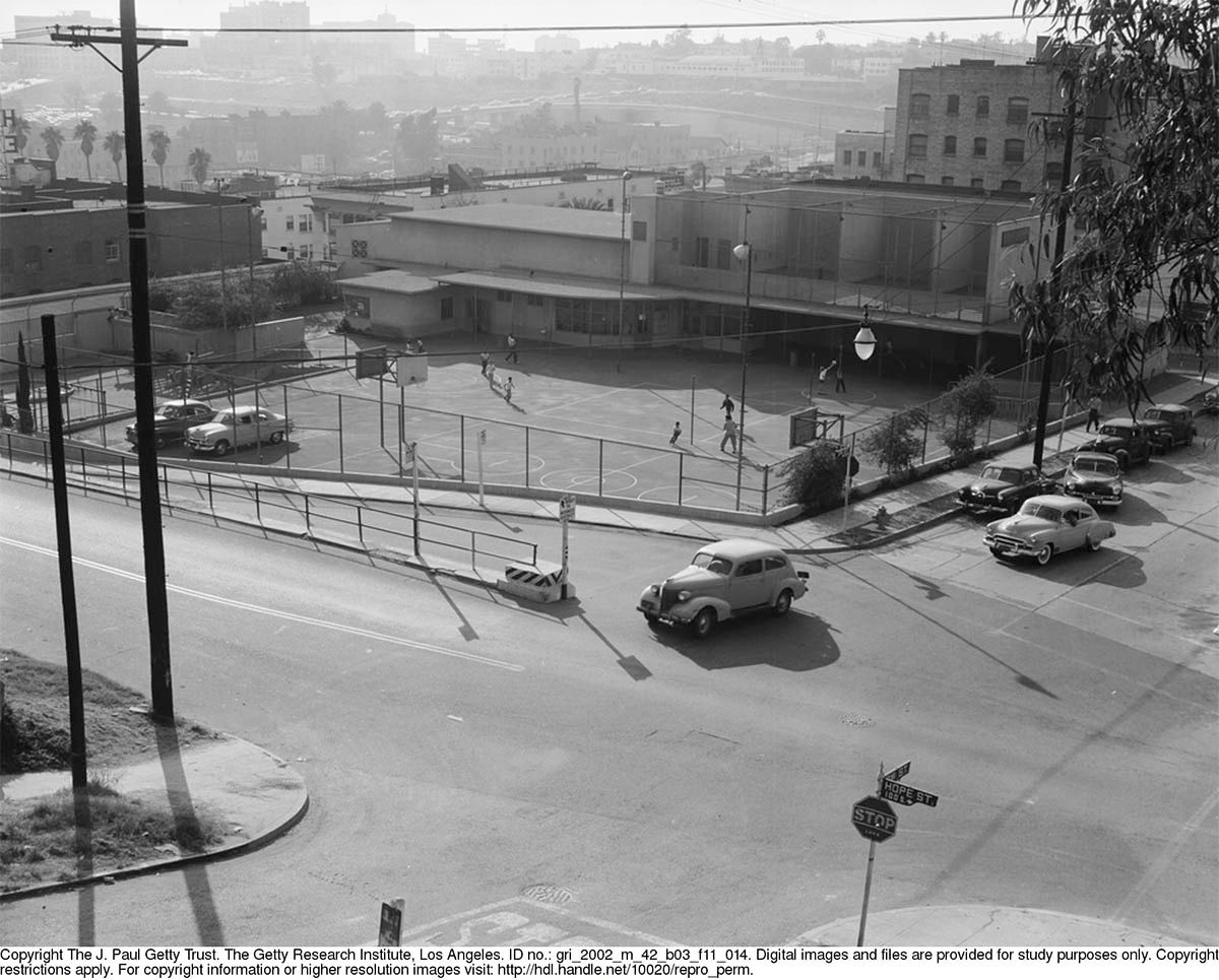
Well, did you know that all Nadel's stuff is online, in high-res? Neither did I until I was poking around for Nadel and stumbled upon the lot, and they're...amazing. And in countless number. And all shots of stuff no tourist or architecture fan would ever shoot. (By way of example, I never thought I'd see a whole gaggle of pix of the 1950 Bunker Hill Recreation Center other than the one at LAPL...)

So here's the deal. You click here and you'll see the five categories: photographs of various subjects, undated, undated; photographs of Pueblo del Rio, 1947-1948, 1947-1948; photographs for the Housing Authority of the City of Los Angeles, 1948-1997, 1948-1997, undated; photographs of Community Redevelopment Agency projects, 1948-1998, 1948-1998, undated; photographs of Aliso Village, 1948-1994, bulk 1948-1949, Bulk, 1948-1949. Click one of those, and in that next window click "Display Item" and it'll open up a new window with a side scroll-bar. This is broken into subcategories. Scroll through the photos and enjoy! Don't forget to press the 1:1 button as that's the automatic enlargement to full size, but also use the magnifying glass to fly in. The down arrow button is download to desktop, which it does at about 1500 across, which is pretty nice. Also, it's a little funky to go back and forth between picture numbers and the envelope numbers at the end, which you'll want to do because the envelopes and sometimes note cards are scanned that have the addresses and names of subjects/places.

So, just to whet your appetite:

from photographs of various subjects/storefronts and people on streets, undated --


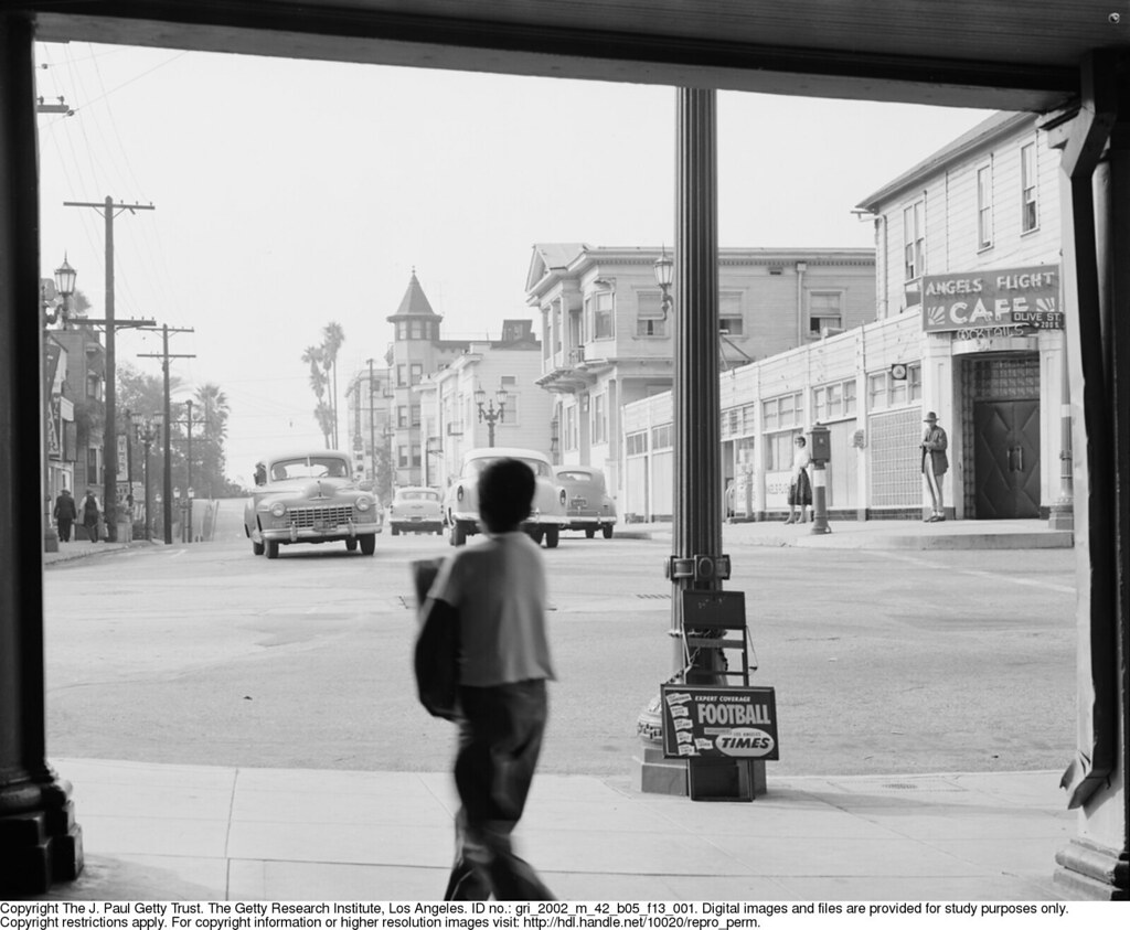
Looking west on 3rd from the upper Angels Flight, of course

Various subject/Richard Lewis:
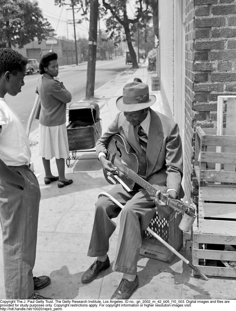
16th & Central

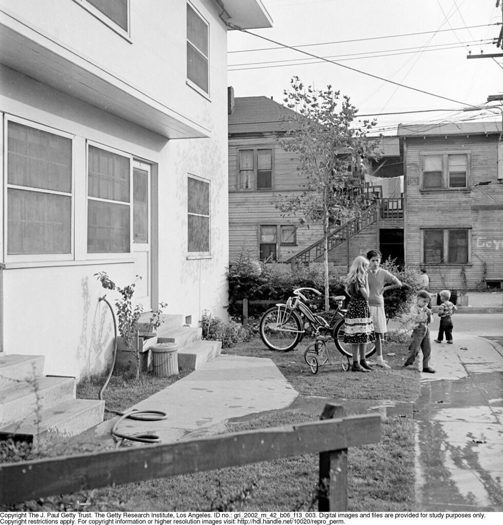
Housing Authority for the City of Los Angeles/Tent Living on Rose Hill 1948:

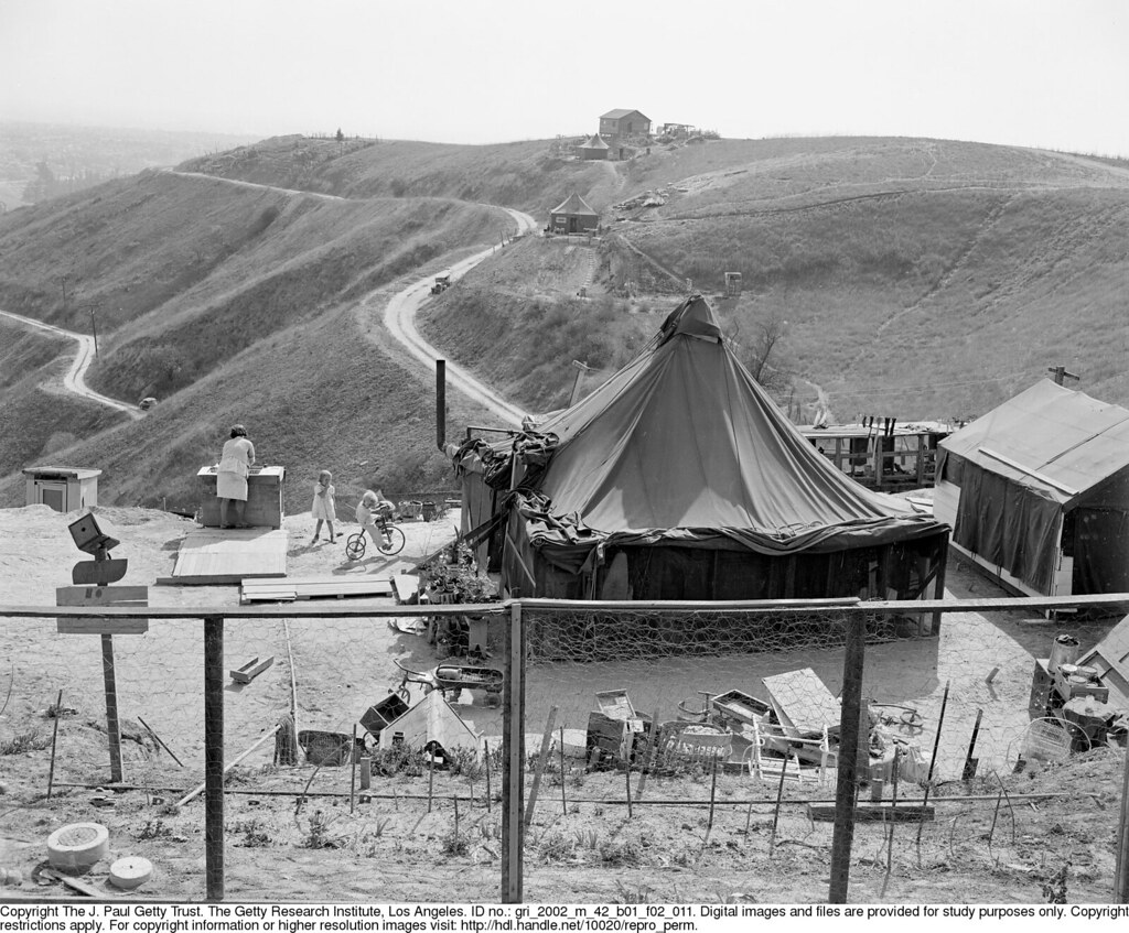
This is where Amethyst ends at Paradise Drive, I believe

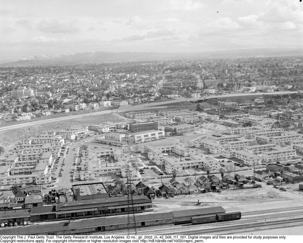
From Housing Authority/San Pedro/Channel Heights:
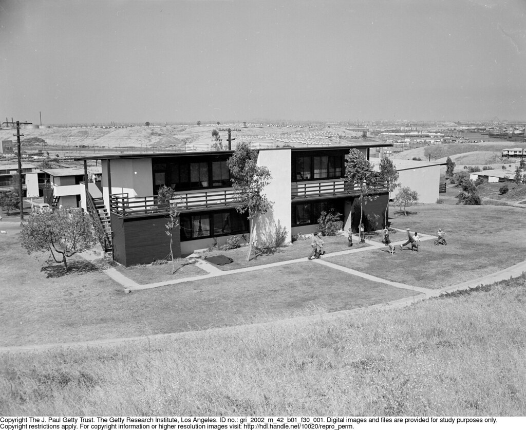
A lost Neutra wonderland...

From the Aliso Village Collection:

"Gosh I'm sure glad we live in these Garden City-style projects and not those old slums over there! There's certainly no way in our lifetime they'll become so unlivable it will be necessary to tear them down."


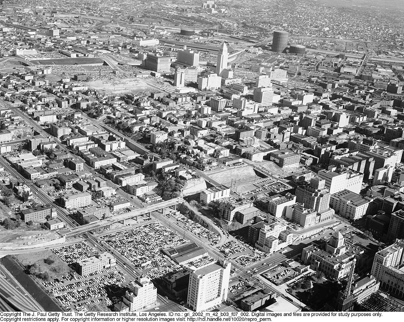
(Unless I miss my guess, Nadel climbed a gasometer to get this shot.)

From the Pueblo Del Rio/Exterior Views:

Looking east down E 55th across Holmes. The view is pretty similar today. A couple hundred feet to the north was the site of the grisly 1947 Vesta Belle Sapenter murder.

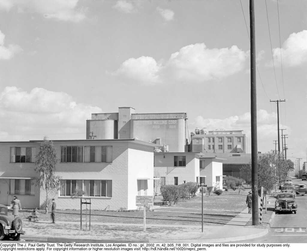
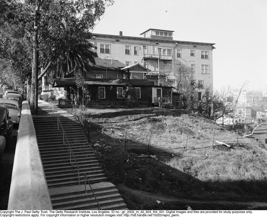
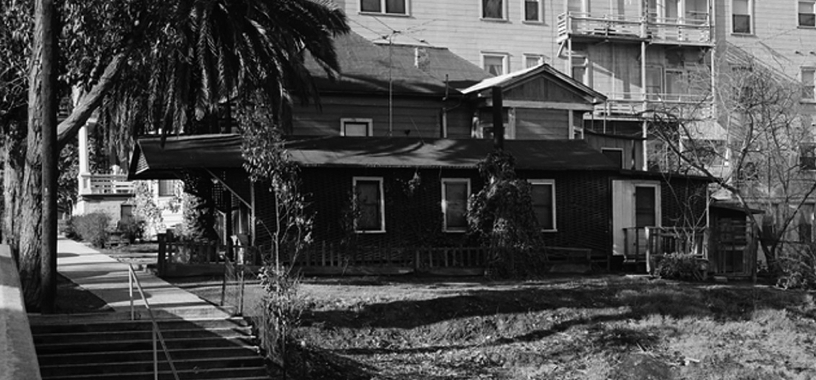
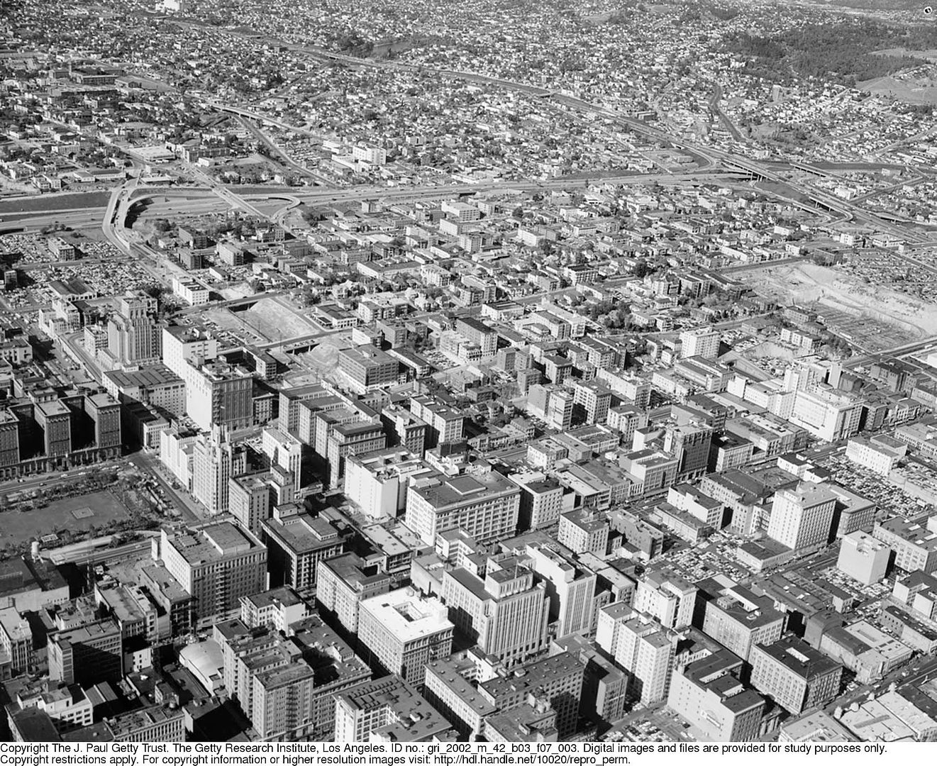
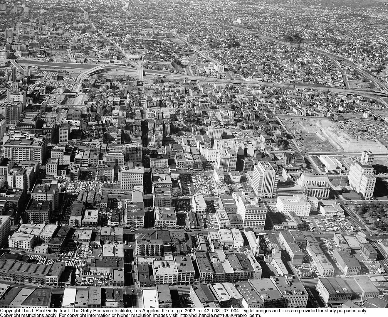
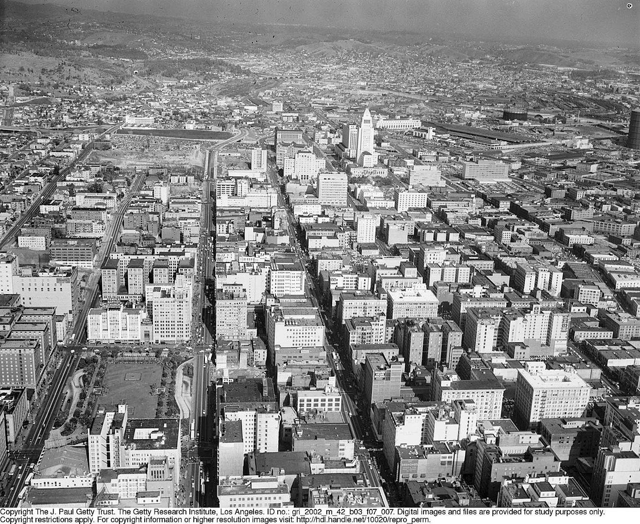
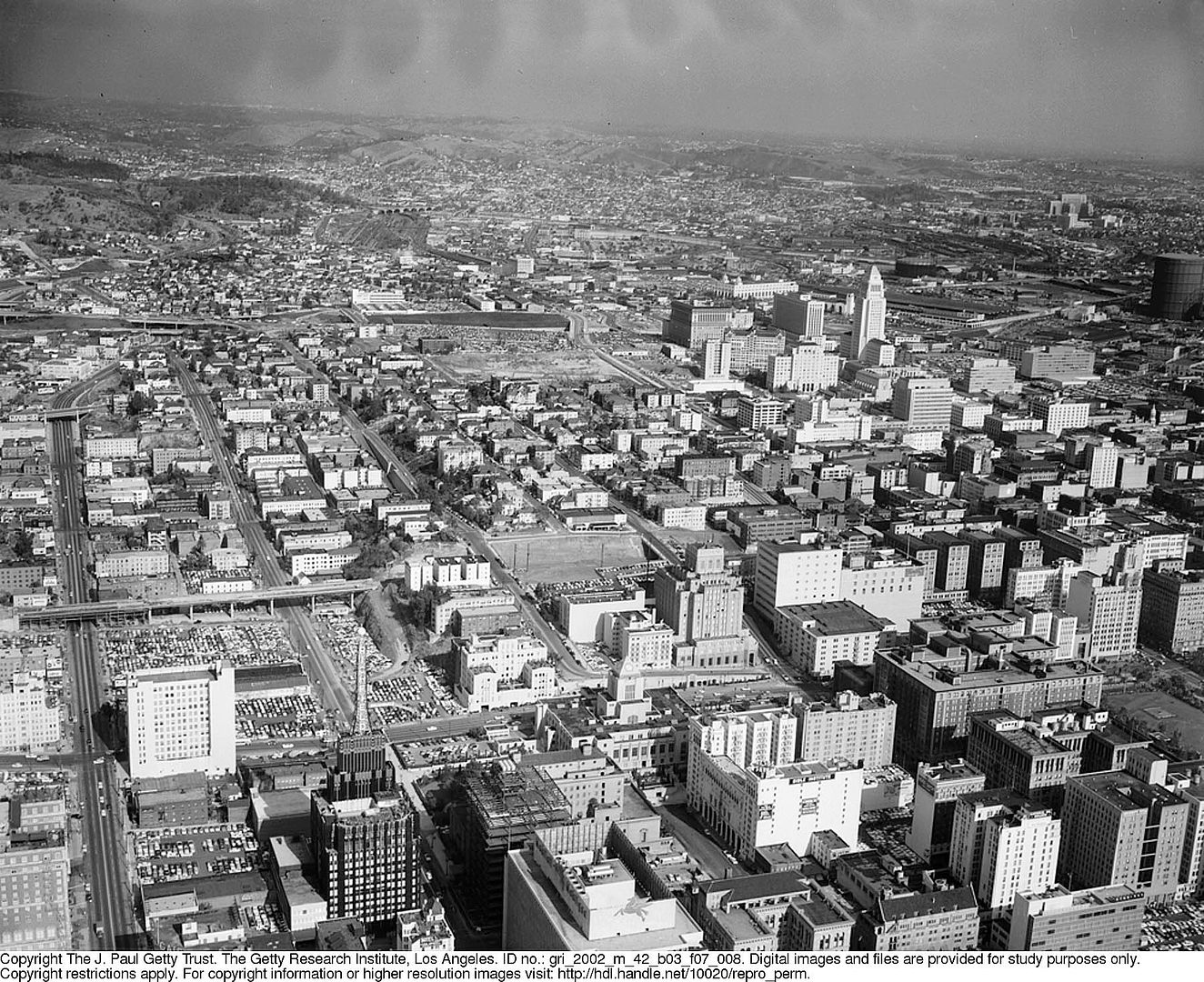
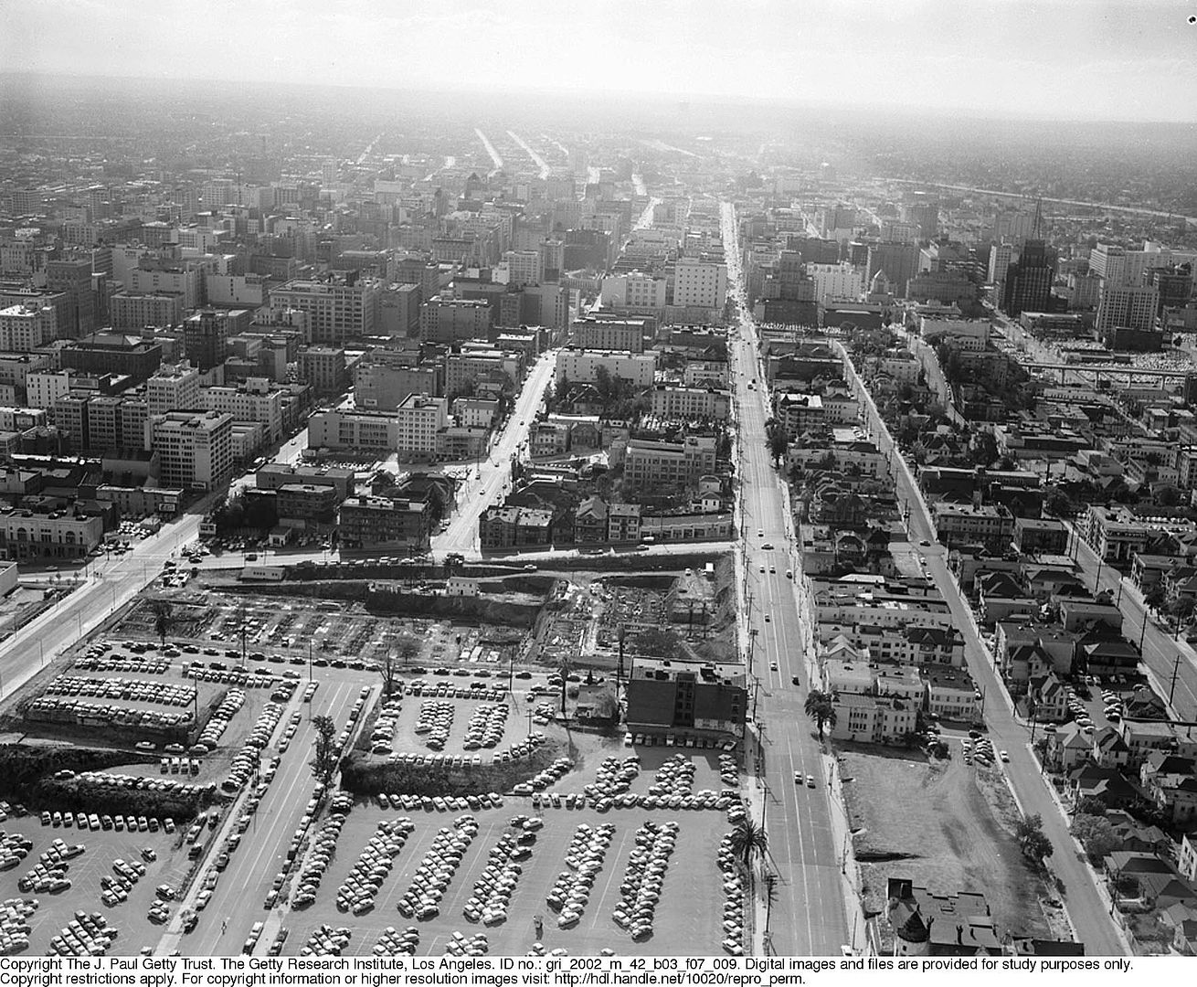
It is the folder called Photographs of Community Redevelopment Agency Projects that is complete madness, though. There's enough there to keep NLA in clover for a year. Here's one from Temple Area 1948-57/Views and housing, undated:


No explanatory envelope for this one, but I figure we have First on our right (out of frame), Temple on our left, and we're looking from Boylston.

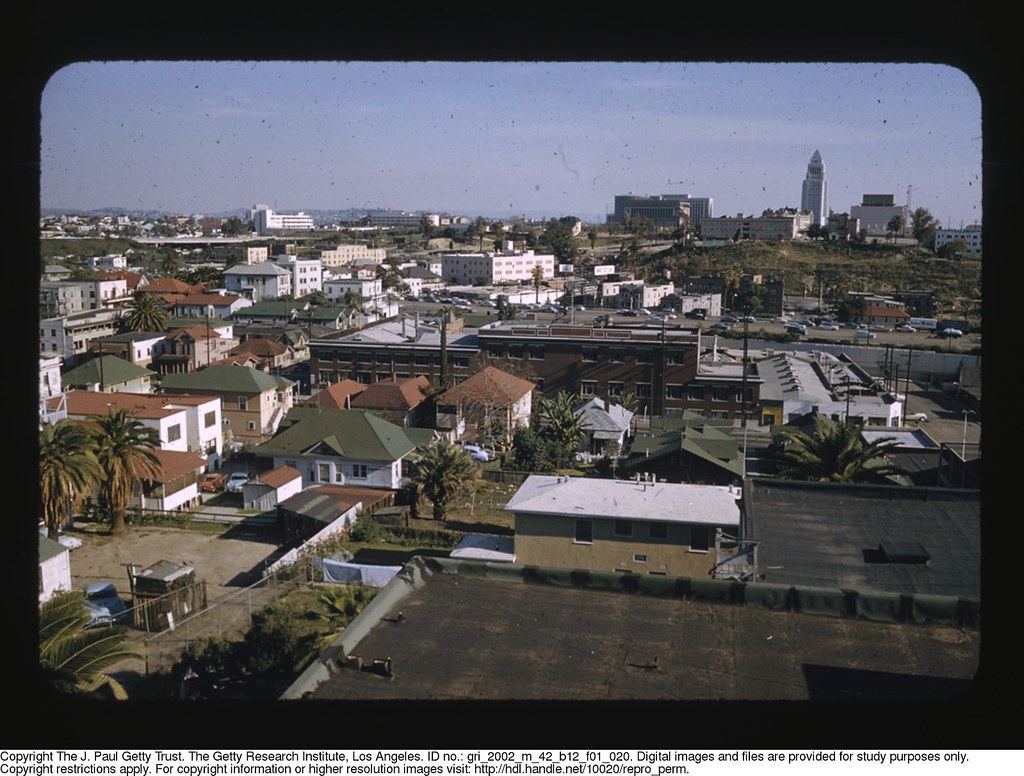
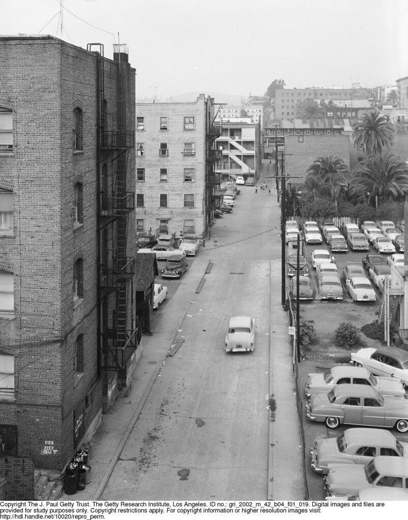
And the Bunker Hill—it's just too much—wonderful the way he gets inside and shoots people's lives in the apartment houses we've looked at for so many years. And I've gone on long enough, and like I said, just tempting the palate. So I'll just throw one out there...when was the last time you saw a good photo of Sack Alley?

Reply With Quote
     
     
  #28724  
Old Posted May 24, 2015, 8:50 AM
Beaudry's Avatar
Beaudry Beaudry is offline
Registered User
 
Join Date: Nov 2009
Posts: 714
Quote:
Originally Posted by MichaelRyerson View Post
I found it, rick!


The Hope Street cottage, Leonard Nadel, 1951

How I wish Mr. Nadel was working in a larger format.


Oh that does my heart good.
Reply With Quote
     
     
  #28725  
Old Posted May 24, 2015, 10:42 AM
mrfredmertz mrfredmertz is offline
Registered User
 
Join Date: Aug 2014
Location: Studio City
Posts: 56
Here's a few more shots of Earl Carrol and his mistress Beryl Wallace from a collection sold on Ebay.


Beryl was certainly no Hemmingway...


But seriously, who cares if she could type?

Reply With Quote
     
     
  #28726  
Old Posted May 24, 2015, 1:17 PM
MichaelRyerson's Avatar
MichaelRyerson MichaelRyerson is offline
Registered User
 
Join Date: Feb 2011
Location: Houston, Texas
Posts: 1,155
What a trove! And just in time...

Quote:
Originally Posted by Beaudry View Post


Oh that does my heart good.

I received LAPD '53 Friday and finished it yesterday, devoured it, was almost sorry I went at it that way, kind of a binge thing. Left me wanting more, too few pages. Didn't even notice Ellroy. But now this. Wow. Very, very cool. Thank you. And I've never seen a good pic of Sack Alley. You think there's any chance Nadel spent any time on Cahuenga Pass north of Barham?

Last edited by MichaelRyerson; May 24, 2015 at 1:42 PM.
Reply With Quote
     
     
  #28727  
Old Posted May 24, 2015, 2:23 PM
HossC's Avatar
HossC HossC is offline
Registered User
 
Join Date: Aug 2013
Posts: 4,245
Thanks a lot, Beaudry! I had things to do today, and instead I've spent hours looking at the fascinating photos of Leonard Nadel .

Does everyone remember these pictures from about a year ago?

Quote:
Originally Posted by AlexandreL View Post

I am currently working on finding locations for Stanley Kubrick's 1956 movie The Killing.

...

Business #2 - Money To Loan pawn shop at 831???


The second picture is basically the camera looking right. I couldn't find anything about any "Herman's Cafe" in the L.A. area. There seems to be a theater to the right, but which one? Hard to tell.
It was actually Beaudry who quickly identified the location as the 800 block of W 3rd Street in post #21799, and the theater as the Lux. Leonard Nadel must've visited W 3rd at almost the same time as Stanley Kubrick. The Fig Leaf Cafe, the "Money to Loan" store and Herman's Cafe all look the same as the screengrabs. This shot also shows the Hotel Jonathan, the Lux Theater and the Pitch Inn.


getty.edu
It looks like direct links timeout. This is "Leonard Nadel photographs of Community Redevelopment Agency projects, 1948-1998" > "Bunker Hill Renewal Project, 1951-1956" > "Fremont Ave., Figueroa St., 1955 September 16" > "BH2-3 (negative 3)".
Reply With Quote
     
     
  #28728  
Old Posted May 24, 2015, 2:24 PM
Greg H Greg H is offline
Registered User
 
Join Date: Apr 2013
Posts: 16
Tamale bldg. preservation effort

I've been away for several days and can see I have some catching up to do. Rich stuff here. I know we've talked about this building before but I'm no good at finding things through the search engine. This article just came out in the Times:
http://www.latimes.com/local/califor...523-story.html

I was unaware the building even existed anymore. There's getting to be just a handful of these programmatic buildings left. Hope LA realizes how important they are to their heritage and begins to preserve them.
[IMG][/IMG]
Los Angeles Times http://www.latimes.com/local/califor...614872&slide=1
Reply With Quote
     
     
  #28729  
Old Posted May 24, 2015, 3:32 PM
HossC's Avatar
HossC HossC is offline
Registered User
 
Join Date: Aug 2013
Posts: 4,245


Here are a couple of previous mentions:

Quote:
Originally Posted by 3940dxer View Post

The Tamale Restaurant, 6421 Whittier Blvd., East L.A. in 1920


http://www.skyscrapercity.com/showth...86986&page=161


LAPL

And today


http://www.flickr.com/photos/6845356...1740/lightbox/
Quote:
Originally Posted by gsjansen View Post

The Tamale restaurant located at 6421 Whittier Boulevard East Los Angeles - 1930's


LAPL

The Tamale would become charley's beauty salon


LAPL
Reply With Quote
     
     
  #28730  
Old Posted May 24, 2015, 3:54 PM
HossC's Avatar
HossC HossC is offline
Registered User
 
Join Date: Aug 2013
Posts: 4,245
I make no apologies for the size or quantity of these Leonard Nadel images from 1955. I think they're wonderful.
They are all from the "Leonard Nadel photographs of Community Redevelopment Agency projects, 1948-1998" > "Bunker Hill Renewal Project, 1951-1956" > "Aerials, 1955 November 15" section at getty.edu.
NB. I've tweaked the levels of all of these images to bring out the background detail.

Bunker Hill looking northeast. The Central Library, Sunkist and Edison Buildings are in the foreground.


A slightly different angle - I don't think there's any roadway in the 4th Street Cut. The temporary ramp from Flower Street suggests that work was very much still in progress.


Looking northwest across Bunker Hill and the Harbor Freeway from around Main Street. The Biltmore and Pershing Square are on the left.


Another slight shift of angle. This one looks virtually straight along 3rd Street from Los Angeles Street. The towers on the Westminster Hotel can be seen on the left.


A reverse view with 1st Street running up the left side.
NB. The original of this image was split in two with the pieces placed the wrong way around.


Another north-looking shot.


Looking north up Hill Street and Broadway.


This one is similar to the first, but includes the Richfield Buildind at the bottom.
NB. The original of this image was mirrored left to right.


A view straight down Grand Avenue. The area north of 1st Street has already been excavated for the new courthouse.


The Harbor Freeway looking south from 1st Street.


And finally, the Civic Center.

Reply With Quote
     
     
  #28731  
Old Posted May 24, 2015, 6:45 PM
HossC's Avatar
HossC HossC is offline
Registered User
 
Join Date: Aug 2013
Posts: 4,245
Quote:
Originally Posted by ethereal_reality View Post

OK, the caption on this photo was
"looking southwest from 1st and Clay Street."

But isn't this the west entrance to the 3rd Street tunnel? (I recognize the 3-story building from previous pics)
Obviously many buildings have already been torn down.
But where's 2nd Street then? And I can't find Clay Street on the map I have.

Perhaps it was mislabeled.


usc digital archive
Quote:
Originally Posted by gsjansen View Post

This is actually a photo of Cinnabar street, which was a one block street that ran from 2nd to the 3rd street between flower and hope.
Cinnabar Street, as photographed by Leonard Nadel in September 1955.


getty.edu
"Leonard Nadel photographs of Community Redevelopment Agency projects, 1948-1998" > "Bunker Hill Renewal Project, 1951-1956" > "W. Second St. area, 1955 September 21-1955 September 22" > "BH2-30 (negative 9)"

This is the other side of the buildings on the left of the picture above. The intersection in the foreground is 2nd and Hope. The building in the top right is the Stanley. There are several other shots in the collection that show it better from a similar viewpoint, but the view of the intersection isn't as good.


getty.edu
"Leonard Nadel photographs of Community Redevelopment Agency projects, 1948-1998" > "Bunker Hill Renewal Project, 1951-1956" > "W. Second St. area, 1955 September 21-1955 September 22" > "BH2-33 (negative 14)"

The same intersection from near the top of Cinnabar Street. It was probably taken from the Stanley. The top of the Dome Apartments is just visible on the right.


getty.edu
"Leonard Nadel photographs of Community Redevelopment Agency projects, 1948-1998" > "Bunker Hill Renewal Project, 1951-1956" > "W. Second St. area, 1955 September 21-1955 September 22" > "BH2-26 (negative 5)"
Reply With Quote
     
     
  #28732  
Old Posted May 24, 2015, 6:53 PM
Martin Pal Martin Pal is offline
Registered User
 
Join Date: Sep 2013
Posts: 2,453
Quote:
Originally Posted by MichaelRyerson View Post
You think there's any chance Nadel spent any time on Cahuenga Pass north of Barham?


............
Reply With Quote
     
     
  #28733  
Old Posted May 24, 2015, 8:53 PM
BifRayRock BifRayRock is offline
Registered User
 
Join Date: Apr 2012
Posts: 1,366

Last edited by BifRayRock; May 26, 2015 at 2:40 PM.
Reply With Quote
     
     
  #28734  
Old Posted May 24, 2015, 9:12 PM
BifRayRock BifRayRock is offline
Registered User
 
Join Date: Apr 2012
Posts: 1,366

Last edited by BifRayRock; Sep 23, 2015 at 11:49 PM.
Reply With Quote
     
     
  #28735  
Old Posted May 24, 2015, 9:39 PM
HossC's Avatar
HossC HossC is offline
Registered User
 
Join Date: Aug 2013
Posts: 4,245
I found these slides on eBay last night. Both say that they show the Airmotive building in Burbank in the 1950s, but no address is given. I found a company called the Pacific Airmotive Corporation who were at 2940 N Hollywood Way and 3000 N Clybourn Avenue at different times in roughly the right era, but I'm not convinced that either address is correct for the building in the slides. The former address is now an empty lot, while the latter has a similarly-sized but different building. I checked Historic Aerials, and neither location looked right. I'm guessing it was somewhere near the Lockheed Air Terminal (Bob Hope Airport), but does anyone know where? Is it still standing?


eBay


eBay
Reply With Quote
     
     
  #28736  
Old Posted May 24, 2015, 10:48 PM
ethereal_reality's Avatar
ethereal_reality ethereal_reality is offline
Registered User
 
Join Date: Feb 2008
Location: Lafayette/West Lafayette IN, Purdue U.
Posts: 16,354
I saw that first slide on eBay and was intrigued by it as well HossC.


Here's another 'aviation' business that was located in the Los Angeles Area.


eBay

If I remember correctly, the seller thought this might have been near Grand Central Airport (Glendale), as opposed to Burbank.
Someone with better vision than I have, will have to read the street numbers. 3225?
__


Hamilton Aero MFG. Propeller Service

Last edited by ethereal_reality; May 25, 2015 at 3:32 AM.
Reply With Quote
     
     
  #28737  
Old Posted May 24, 2015, 10:55 PM
ethereal_reality's Avatar
ethereal_reality ethereal_reality is offline
Registered User
 
Join Date: Feb 2008
Location: Lafayette/West Lafayette IN, Purdue U.
Posts: 16,354
Here's something for you 'noir' lovers to keep you warm on cold nights.


http://www.ebay.com/itm/Vintage-1956...item23500ab93a

A wool blanket from the Los Angeles County Jail !


detail

http://www.ebay.com/itm/Vintage-1956...item23500ab93a

The seller says you can buy it now for $45.00.

My birthday is July 4th.
Reply With Quote
     
     
  #28738  
Old Posted May 24, 2015, 11:52 PM
CityBoyDoug CityBoyDoug is offline
BANNED
 
Join Date: Apr 2013
Posts: 2,868
Quote:
Originally Posted by ethereal_reality View Post
Here's something for you 'noir' lovers to keep you warm on cold nights.


My birthday is July 4th.
Scary looking blanket ER....
Reply With Quote
     
     
  #28739  
Old Posted May 25, 2015, 12:47 AM
BifRayRock BifRayRock is offline
Registered User
 
Join Date: Apr 2012
Posts: 1,366
Quote:
Originally Posted by Lwize View Post
Robinsons-May Beverly Hills has finally met the wrecking ball.


(latimes.com)


(buildinglosangeles.blgspot.com)

Here's a 2009 article talking about the iconic department store:


http://www.latimes.com/local/la-hm-l...r14-story.html

Last edited by BifRayRock; Sep 22, 2015 at 5:04 PM.
Reply With Quote
     
     
  #28740  
Old Posted May 25, 2015, 3:20 AM
ethereal_reality's Avatar
ethereal_reality ethereal_reality is offline
Registered User
 
Join Date: Feb 2008
Location: Lafayette/West Lafayette IN, Purdue U.
Posts: 16,354
This an oil well, right?

just posted by BifRayRock


So where would have it been located? I'm not sure which direction we're looking.
__

Last edited by ethereal_reality; May 25, 2015 at 3:34 AM.
Reply With Quote
     
     
This discussion thread continues

Use the page links to the lower-right to go to the next page for additional posts

Reply

Go Back   SkyscraperPage Forum > Photography Forums > Found City Photos
Forum Jump


Forum Jump


All times are GMT. The time now is 10:55 AM.

     
SkyscraperPage.com - Archive - Privacy Statement - Top

Powered by vBulletin® Version 3.8.7
Copyright ©2000 - 2024, vBulletin Solutions, Inc.