Quote:
Originally Posted by tovangar2

What happened to this area still makes me boil. There was no reason to tear it down except for Sterling's hatred of the last vestiges of old Chinatown. I'll never get over the loss of Lugo House.
The demolition was pointless. There's no there there:

google maps |
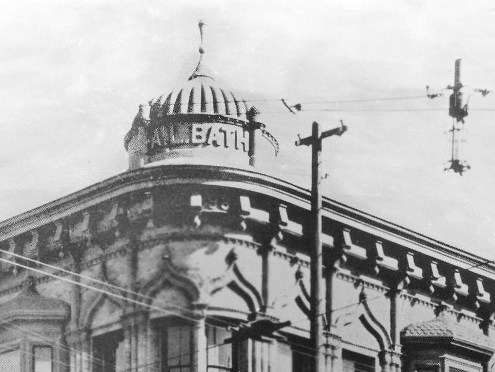
Whatever Christine Sterling's feelings were toward the Lugo House, she seems to have had a soft spot for the Sentous Building, a couple blocks over at 617 N. Main. Ms. Sterling is shown below on August 12, 1957, the day after she learned the Sentous Block would be torn down for a parking lot, which it still is today (
ER posted this photo way back on Page 2):
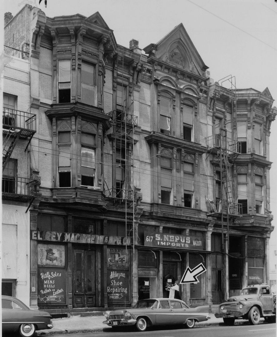
USC Digital -
http://digitallibrary.usc.edu/cdm/re...id/90580/rec/1
"For awhile, Governor Pio Pico (the last Mexican governor of California) spent his declining years in an apartment there. It once housed the Wells Fargo office," said Ms. Sterling. "I had always hoped that the Sentous Building would be included in the city, county and state's plans to restore the Plaza area. But it looks like another part of our past is going to be carried away in a truck."
I bet she had help carrying that wreath:
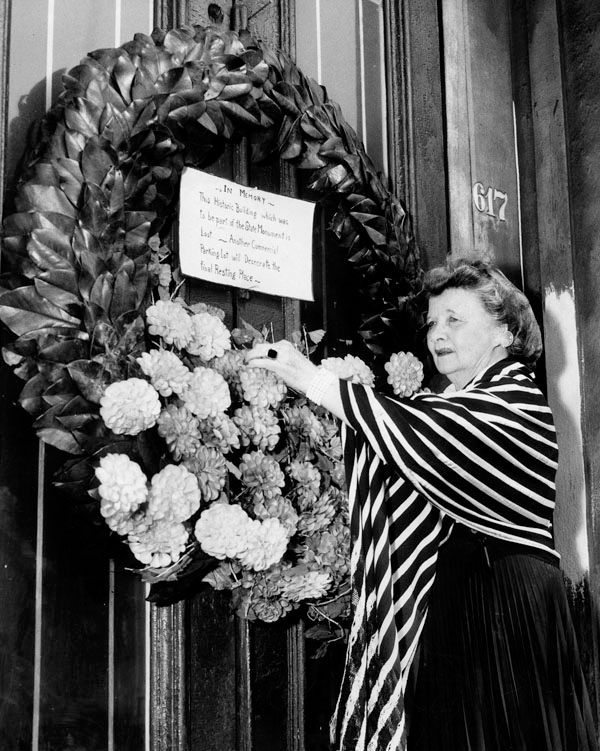
LAPL -
http://jpg1.lapl.org/pics35/00037038.jpg
"In Memory, This Historic Building which was to be part of the State Monument is lost--Another Commercial Parking lot will desecrate the final Resting Place."
More pics, starting with this undated one:
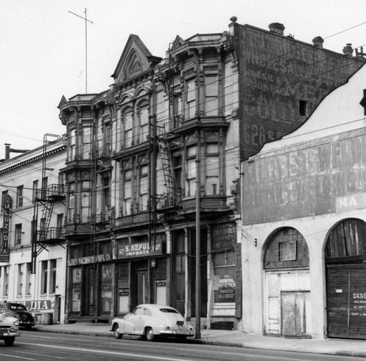
LAPL -
http://jpg2.lapl.org/pics19/00019044.jpg
William Reagh, 1940:
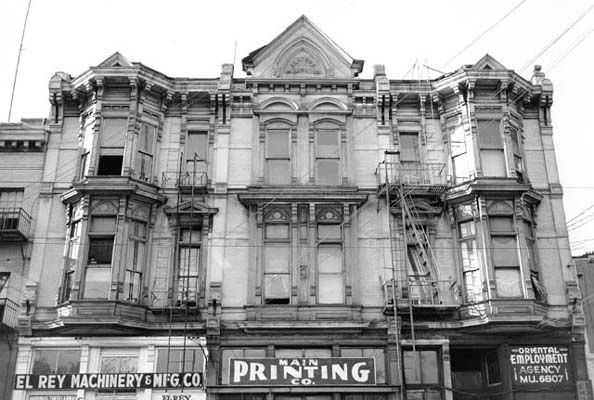
LAPL -
http://jpg2.lapl.org/spnb1/00017073.jpg
This 1920 photo was the oldest I could find (and no close-ups of the west side of the building). The Sentous Block was already 40 years old:
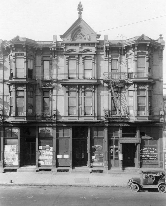
LAPL -
http://jpg2.lapl.org/pics48/00058904.jpg
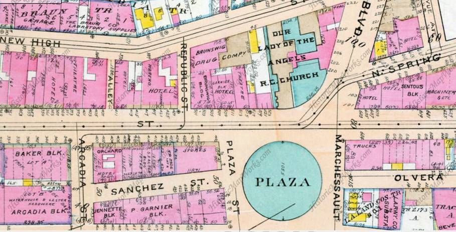
Here's the Sentous Block on the 1888 Sanborn Map:
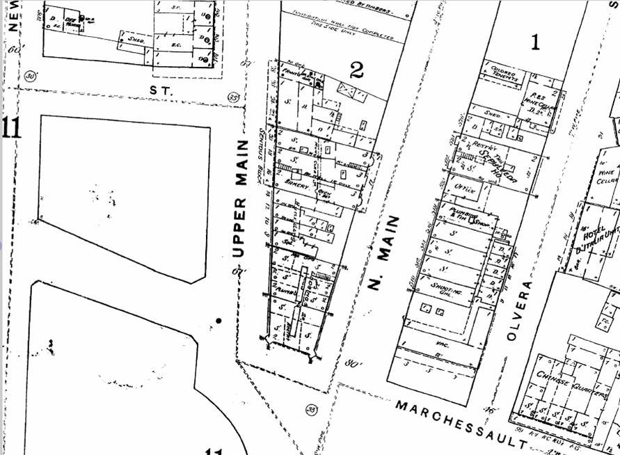
LAPL -
http://sanborn.umi.com.ezproxy.lapl....68&image.y=459
On the 1906 Sanborn Map we see that Upper Main is now San Fernando:
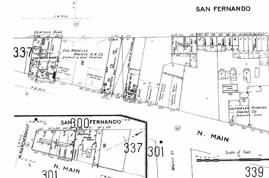
LAPL -
http://sanborn.umi.com.ezproxy.lapl....43&image.y=460
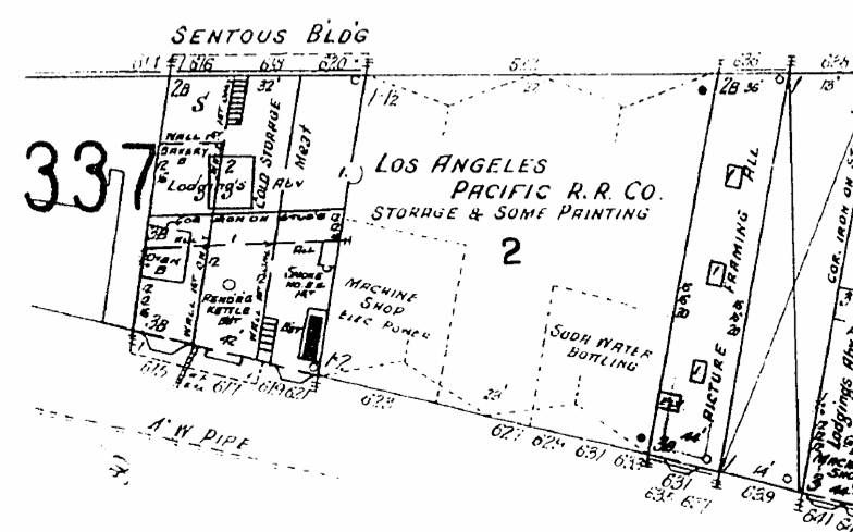
Let's look at that 1906 map a little closer. I hope Pio Pico (d. 1894) didn't spend his declining years living over a rendering kettle:
I include the 1921 Baist Map only to show that Upper Main, which retained that name until at least 1894 and then became San Fernando, is now North Spring. That's three names in less than 27 years!:
Historic Mapworks -
http://www.historicmapworks.com/Map/US/19409/Plate+003/
The Sentous Block was built in 1880 by Louis Sentous, where he operated a meat market:
http://books.google.com/books?id=sMJ...entous&f=false
As Harris Newmark wrote in his
Sixty Years in Southern California (1913), "Among the meat-handlers, there were several Sentous brothers, but those with whom I was more intimately acquainted were Jean [1837-1903] and Louis [1839-1911], father of Louis Sentous [Jr] the present French Consul, both of whom, if I mistake not, came about the middle of the fifties. They engaged in the sheep business; and later Louis had a packing-house of considerable importance located between Los Angeles and Santa Monica, where he also owned over a thousand acres of valuable land which he sold some time before his death. They were very successful; and Sentous Street bears their name. Jean died in 1903, and Louis a few years later."
http://www.ebooksread.com/authors-en...of-h-hci.shtml
FWIW, this March 21, 1906 news article about the new Sentous Co. meat packing plant (the company had been sold by the family the year before) refers to Louis already being deceased:
http://physics.usc.edu/Undergraduate...Sentous%29.pdf
The confusion might be explained by this article, which says that Louis Sentous Jr. was the son of Jean Sentous, not Louis Sentous Sr:
http://books.google.com/books?id=YMU...entous&f=false
Anyway, I believe this is a postcard of the meat packing plant "between Los Angeles and Santa Monica" that Mr. Newmark wrote about
:
 http://www.ebay.co.uk/itm/ADVERTISIN...p2047675.l2557
The reverse side:
 http://www.ebay.co.uk/itm/ADVERTISIN...p2047675.l2557
This 1903 map shows where the Sentous meat packing plant was apparently located:
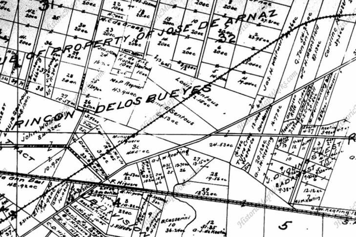
Historic Mapworks -
http://www.historicmapworks.com/Map/...03/California/
You see the Sentous properties in the middle of the map ("Louis Sentous" and "[V] and E Sentous") . . . the "Y" intersection in the lower right of the Sentous rectangle is Washington and Adams. The squiggly line below that is Ballona Creek, and the railroad line running through the Sentous properties (upper right to lower left across the map) is the Los Angeles-Pacific RR referred to in the 1906 news article above and which would become the future path of Venice Blvd:
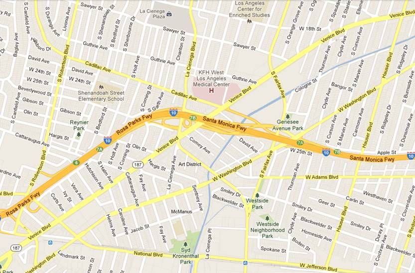
GoogleMaps
P.S. Or, the meat packing plant may have been located at the SE corner of today's Jefferson/La Cienega intersection:
http://forum.skyscraperpage.com/show...ostcount=13738
P.P.S. As it turns out, there were two Sentous Stations:
http://forum.skyscraperpage.com/show...ostcount=13875


 Prev
Prev


 That parking lot is the future site of a Museum of Los Angeles (in my dreams)


 Linear Mode
