Quote:
Originally Posted by tovangar2

What is going on with that block? I've wondered before why 4th is so wiggly east of Vermont. That often denotes water when there are no hills around. A rec center, school, etc often ends up on former wetlands too. And then there's phantom Diana Street running half way through the block.:

google maps
The entrance to Diana Street is chained:
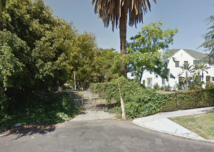
gsv
Just curious. |
I have a theory on what's up with Diana Street.
I think the reason there's even a Diana Street in the first place has to do with 3rd Street (and maybe 4th Street) not originally crossing Bimini Slough/Sacatela Creek. Third Street comes in from the left of the map, just under the big circled 24, stops at Vermont, then jogs north. After 3rd Street was put straight across the creek, the old northern jog was renamed 2nd Street:
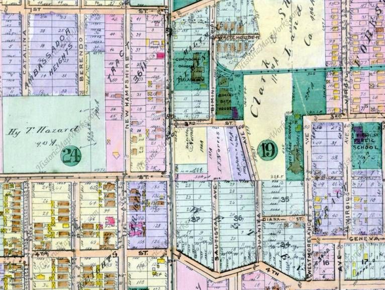
1921 Baist Map from Historic Mapworks (
http://www.historicmapworks.com/Map/US/19422/Plate+016/)
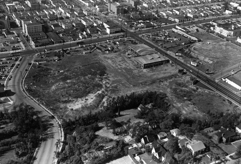
I've marked Diana Street with a red line on this 1929 photo. Apparently, not everything on the Baist Map came into existence. Curvy 4th Street is at the bottom; keep in mind the straight road leading from the northern apex of the 4th Street curve, just above and to the left of the black plus sign. I'm not sure if 4th Street is being laid out or is being dug up for construction; if the latter, we might be looking at the undergrounding of Sacatela Creek in progress:
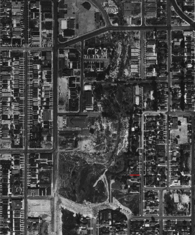
LAPL (
http://jpg1.lapl.org/pics42/00040733.jpg)
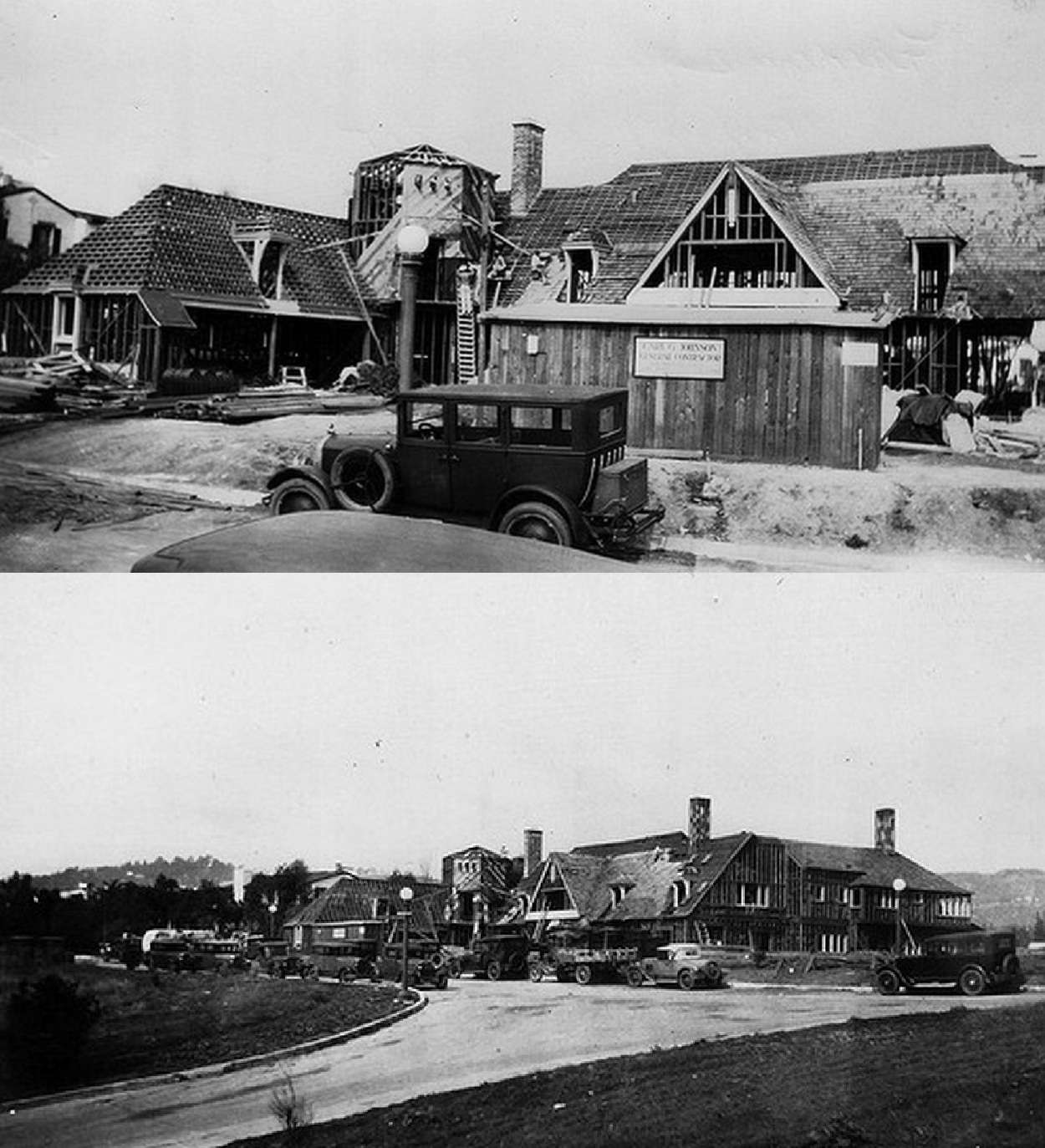
Here's an undated shot of the Sacatela undergrounding, possibly between 3rd and 4th, looking southwest towards the Ambassador Hotel; I assume the streetcars are on Vermont. I wish I could confirm that this photo shows the same area as in
BifRayRock's posts 12289 and 12291, but on my old computer those pics are broken up into so many pieces, it's hard for me to tell what I'm looking at. Sorry.

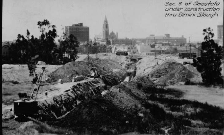
USC Digital Library (
http://digitallibrary.usc.edu/cdm/si...id/5569/rec/10)
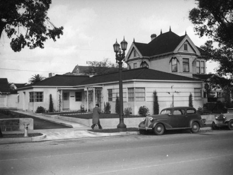
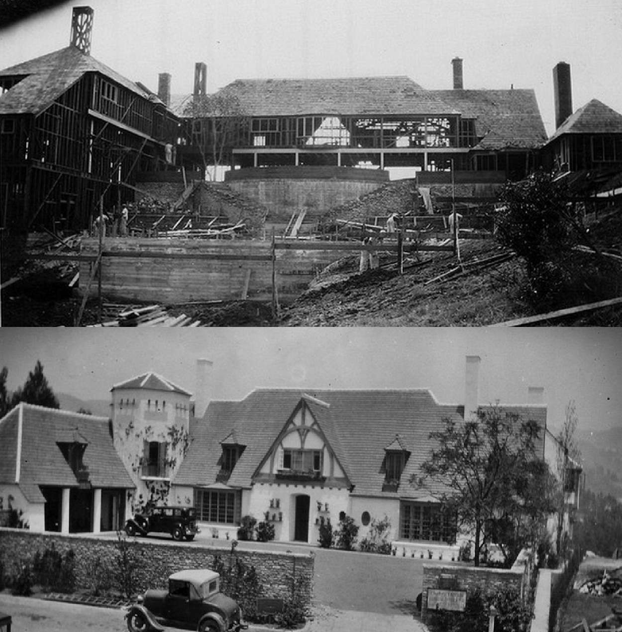
Anyway, back to Diana Street. It's hard to see in the 1929 shot, but in this undated photo from I'm guessing the mid/late 1940s, there's clearly a house and grounds to the west of and behind the homes on the west side of Westmoreland:
LAPL (
http://jpg3.lapl.org/pics33/00066409.jpg)
So here's my theory: I think that before Fourth Street was put through, Diana Street was the driveway to that house, or at least used as another entrance. Here there seems to be a tree-lined entrance of some sort, in the same place as the road in the 1929 photo, leading up from 4th Street to the house. Google Maps shows a phantom 3274 Diana Street; maybe that was that house's address? Diana Street isn't as overgrown in the 1929 photo -- which you'd be able to see if I hadn't put that red line there

-- as it appears in later pics.
Here's roughly the same shot; the house and grounds are now part of the park and it looks like some courts have been built on the home's footprint:
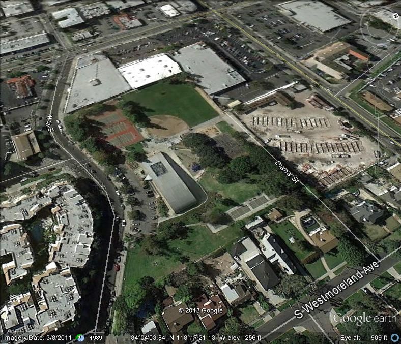
Google Earth
Looking closely at the west end of Diana Street on Google Earth, you can see parallel parking spaces painted on both sides of the street. I'm guessing it was parking for the Shatto Rec Center when it opened, but its relatively secluded location drew too much unwholesome activity for it to remain open.


 Prev
Prev


 Linear Mode
