Quote:
Originally Posted by Innsertnamehere

That's like 80% mixed traffic running, no?
Also, why are all of calgaries transit lines to innecessently radial? Do all roads lead downtown?
|
Yes that specific line is very radial, as are all of our existing LRT lines. I'd say it's more like 65% mixed traffic (the dotted section along Crowchild has bus lanes for the entire dotted length), but yes it's still not perfect.
Calgary is, for better or worse, the most centralized city in the country in almost every way (and no that's not boasting, if anything its a negative). The primary nodes outside of downtown (NW Hub and Chinook) are already located along the skeletal LRT network. Of course we have a comprehensive TOD plan underway do densify employment and residential districts outside the core, but development in that respect is only in its infancy, with only about a dozen TOD towers built over the past 6 years or so, but with dozens planned and a few officially proposed. The only major mixed-use district development underway that isn't connected to the LRT network is Currie Barracks and that neighbourhood is only in its first phases, with no high rises proposed just yet. The neighbourhood is connected to both the SW BRT and the MAX South Crosstown BRT though, so it's not too bad.
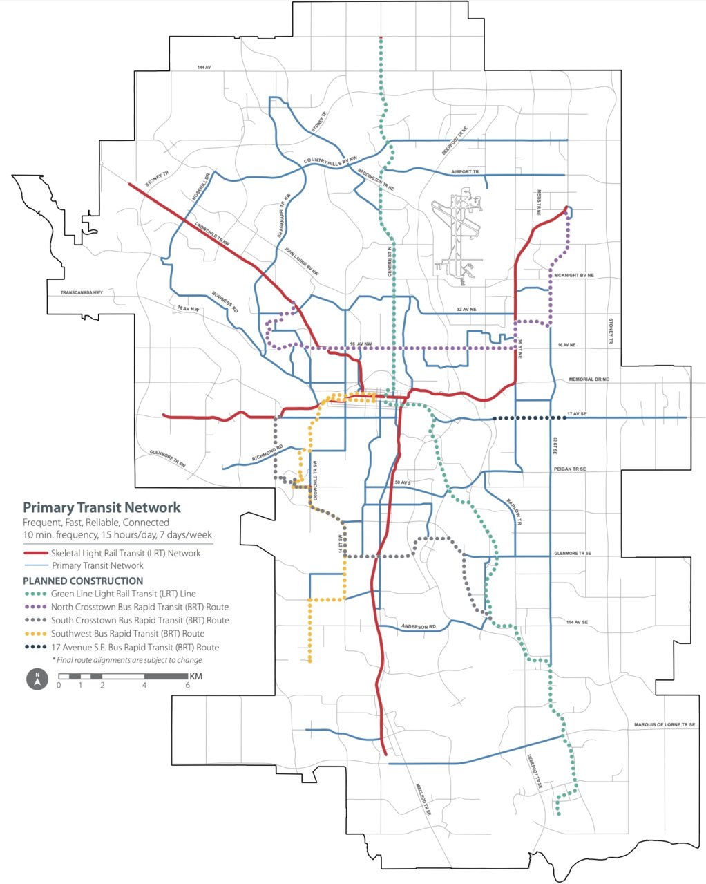
Also, here is a full map of Calgary's primary transit network. Been looking for something like this for ages. The purple, brown, and blue lines are all coming online in less than a month, the yellow line by summer 2019, and the Green Line in early 2026. The map doesn't accurately reflect the 17 Ave SE BRT, as it is on a fully dedicated ROW until it reaches 9 Ave in Inglewood.





 Prev
Prev




 Source:



 Linear Mode
