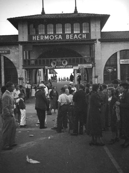
A little further afield, the arched entrance to the Hermosa Beach Pier (1913-1961), AKA the Pavilion, here in ca 1947
(I've seen this building referred to as "The Auditorium" in print, but never heard it called that IRL)
The Pavilion originally held the offices of the Hermosa Beach Land and Water Company, the Post Office
and the Civic Center (Hermosa was incorporated in 1906):
 oursouthbay
Opening Day, 1914. The new concrete pier replaced the old timber pier, built in 1904 and washed away in 1913:
 podunk
Development was slow going during the 14-18 War:
 ebay (detail)
Circa 1920:
 hermosa beach historical society
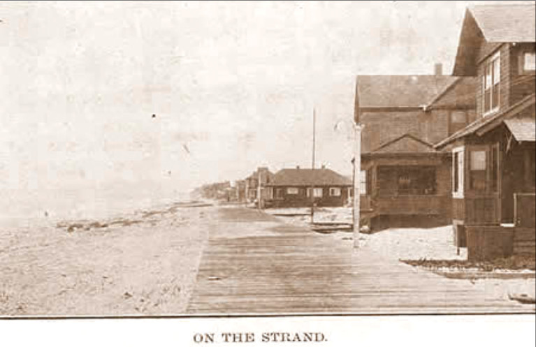
The Strand's timber planking was replaced with concrete between 1914 & 1926. Looking north:
 hermosabeachhistoricalsociety
An early long shot:
 maureenmegowan.com
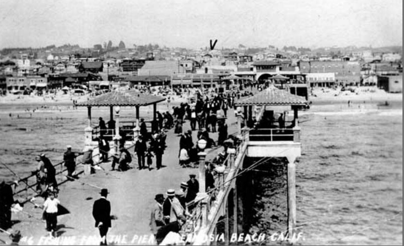
The view east from out on the pier. The distinctive lamp posts were recreated for the current pier:
 hermosabeachhistoricalsociety
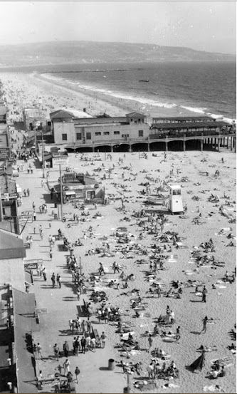
A view from the north, 1950s. Palos Verdes in the distance. One can also see the Redondo breakwater.
The City of Hermosa Beach actually owns its beach. The beaches at Redondo and Manhattan are owned by the state or the county, I can't remember which.
The part of the 1913 pier out over the water was closed in ca 1945 after a series of storms damaged it.
It was finally demolished in 1961, along with the Pavilion:
 lapl
lapl
A view from the south, ca 1920s. The Redondo power plant may be seen at the lower edge. Santa Monica Bay curves around to Malibu, upper left.
The Manhattan Beach Pier is the next one north. Farmland (including the famous flower farms) and countryside were not far away.
Tiny Hermosa is just 15 blocks from east to west and 40 blocks from north to south.
This view explains why my mother was always so anxious to escape "into town". Hermosa was too provincial for her.
My childhood home was five blocks south of the pier at 7th and Strand, now demolished and replaced with condos:
 lapl
lapl
Tiny Hermosa, insulated by its larger beach-town neighbors:

The pier entrance in 1937:
 lapl
lapl -
Herman J. Schultheis
The well-used library in 1955. The library was first in the Tower Room, then moved to the North Pavilion wing
and finally, in 1926, to the South Pavilion, formerly known as the Dance Pavilion:
 LA Co. Public Library
The reverse view, looking east up Pier Ave, through the Pavilion's beautiful arch, in 1941:
 hermosabeachhistoricalsociety
The Pavilion being wrecked in 1961 :-(
Although the pavilion building has now been gone longer than it existed, I still miss it:
 daily breeze
The Red Car tracks along Hermosa Avenue connected Hermosa Beach with DTLA.
This 1920s view of Pier Ave is looking west from Hermosa Ave:
 thehoffs.com
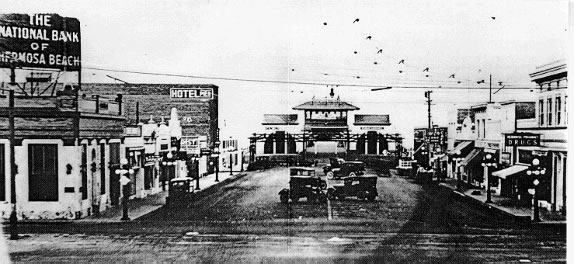
Here's our well-loved, little downtown in 1955:
 lapl
lapl
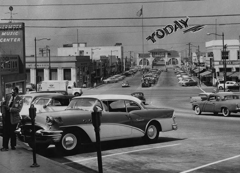
The same view today:

gsv
1901, pre-pier:
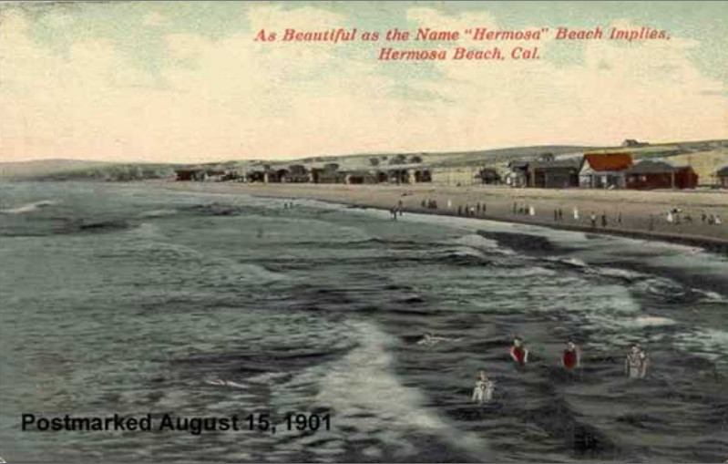 southbay
A look back at the old timber pier, built in 1904 and wrecked in a 1913 storm:
 daily breeze
The current pier seems to be holding up just fine:
 daily breeze
The Lighthouse jazz club, just three doors in from the pier at 30 Pier Ave.
Opened in 1940, it was Hermosa's own center of noir & naughtiness.
As a child, I was told to stay well clear of it. (It did smell mightily of weed):
 thelighthousecafe.net
The Lighthouse today. In the 50s Hermosa was a ramshackle town of misfits.
I cannot imagine what Chet Baker and Miles Davis would make of today's gentrification.:
 panoramino
'Round the back of the Lighthouse:

gsv
Chet Baker (left) and Miles Davis (center) recording at the Lighthouse, September 13, 1953:
 scpr
scpr
The current pier (The building on the south side of the pier entrance is the LA County Lifeguards Southern HQ, no match for the long-gone Pavilion building):
 google maps
No hyperbole here:
 pinterest
It still is the "most beautiful beach":
 google maps images
__


 Prev
Prev


 Linear Mode
