HomeDiagramsDatabaseMapsForum About
     

Go Back   SkyscraperPage Forum > Regional Sections > Canada


Reply

 
Thread Tools Display Modes
     
     
  #1001  
Old Posted May 26, 2015, 5:27 PM
SignalHillHiker's Avatar
SignalHillHiker SignalHillHiker is offline
I ♣ Baby Seals
 
Join Date: Jul 2012
Location: Sin Jaaawnz, Newf'nland
Posts: 35,166
Usually they physically can't drift close to shore at this size.

__________________
Note to self: "The plural of anecdote is not evidence."
Reply With Quote
     
     
  #1002  
Old Posted May 26, 2015, 6:33 PM
MichaelS's Avatar
MichaelS MichaelS is offline
Registered User
 
Join Date: Jan 2006
Location: Calgary
Posts: 2,402
That's amazing. I am touring Newfound Land for the first time this summer, July 4-19. Going all the way from L'Ans Aux Meadows to St. John's, and most points in between (that are on the main tourist trail, plus Bai D'espoire for visiting inlaws). Any chance I will still see icebergs that time of year?
Reply With Quote
     
     
  #1003  
Old Posted May 26, 2015, 6:39 PM
SignalHillHiker's Avatar
SignalHillHiker SignalHillHiker is offline
I ♣ Baby Seals
 
Join Date: Jul 2012
Location: Sin Jaaawnz, Newf'nland
Posts: 35,166
It's unlikely but anything is possible. They've made it almost as far south as Bermuda in the past so they can survive the heat. It's just that they usually drift south of us by that late. But if one gets caught in such a way that the tides can't get it, it could stay. And you are going as far north as you can, which helps.

You can use icebergfinder.com before you come. This website closes with the season so check it in mid-June and keep tabs on them because by July I don't think you'll get any info from the site even if there are a few around.
__________________
Note to self: "The plural of anecdote is not evidence."
Reply With Quote
     
     
  #1004  
Old Posted May 28, 2015, 3:41 AM
MichaelS's Avatar
MichaelS MichaelS is offline
Registered User
 
Join Date: Jan 2006
Location: Calgary
Posts: 2,402
Thanks.
Reply With Quote
     
     
  #1005  
Old Posted Jun 2, 2015, 7:49 PM
Laceoflight's Avatar
Laceoflight Laceoflight is offline
Montérégien
 
Join Date: Nov 2014
Location: Montréal, QC <> Paris, FR
Posts: 1,238
Deleted.

Last edited by Laceoflight; Sep 24, 2015 at 1:40 PM.
Reply With Quote
     
     
  #1006  
Old Posted Jun 2, 2015, 11:30 PM
SignalHillHiker's Avatar
SignalHillHiker SignalHillHiker is offline
I ♣ Baby Seals
 
Join Date: Jul 2012
Location: Sin Jaaawnz, Newf'nland
Posts: 35,166
A city strung across the cliffs - a little hike around Signal Hill through the Battery this evening.


__________________
Note to self: "The plural of anecdote is not evidence."
Reply With Quote
     
     
  #1007  
Old Posted Jun 3, 2015, 10:43 PM
SignalHillHiker's Avatar
SignalHillHiker SignalHillHiker is offline
I ♣ Baby Seals
 
Join Date: Jul 2012
Location: Sin Jaaawnz, Newf'nland
Posts: 35,166
Not nearly as impressive as the west coast of the island, but gorgeous aerial shots of St. John's, St-Pierre-et-Miquelon, etc.

Video Link
__________________
Note to self: "The plural of anecdote is not evidence."
Reply With Quote
     
     
  #1008  
Old Posted Jun 6, 2015, 6:58 PM
SignalHillHiker's Avatar
SignalHillHiker SignalHillHiker is offline
I ♣ Baby Seals
 
Join Date: Jul 2012
Location: Sin Jaaawnz, Newf'nland
Posts: 35,166
Ayreonaut and I went for a quick hike out to Red Cliff:


Red Cliff by R C, on Flickr

Red Cliff by R C, on Flickr

Red Cliff by R C, on Flickr

Red Cliff by R C, on Flickr

Red Cliff by R C, on Flickr

A few quick mobile pics...


He creeped a pic of the b'ys driving off the cliff, and I creeped one of him. lol We managed to take them at the same time, it looks like. They're standing on an old WWII bunker built into the cliff. You can climb a ladder down into that thing.


Suburbia has now reached Red Cliff. I couldn't believe it. This was all wilderness last summer. Now this portion of the trail is basically someone's backyard.

__________________
Note to self: "The plural of anecdote is not evidence."

Last edited by SignalHillHiker; Jun 6, 2015 at 7:58 PM.
Reply With Quote
     
     
  #1009  
Old Posted Jun 23, 2015, 10:06 PM
Klazu's Avatar
Klazu Klazu is offline
Registered User
 
Join Date: Apr 2012
Location: Above Metro Vancouver clouds
Posts: 10,226
Last weekend we celebrated the midsummer solstice by driving around the Coastal Mountains. It's a beautiful 600km drive that we did last time back in 2013. The route from Vancouver is Hope-Lytton-Lillooet-Pemberton-Whistler and back.

I highly recommend this long day trip as it offer best views in BC! This time around it took us 14 hours to drive this loop route.


Fraser Canyon views along Trans-Canada Highway.


High above the canyon floor.


Hell's Gate is a quiet tourist stop along the route. It's the narrowest point along Fraser River.


Trains passing by every 30 minutes are up to 3 kilometers long.


Nearby Lytton there is a forest fire raging since two weeks. They got some rain (and snow) a week ago, but it wasn't enough to put it off. Looks spectacular from a distance.


Museum train cart in Lytton.


Valley panorama nearby Lytton.


Seton Lake is a crystal-clear reservoir nearby Lillooet.


On Sea to Sky Highway between Lillooet and Pemberton.


Beautiful Joffre Lake before Pemberton.

Reply With Quote
     
     
  #1010  
Old Posted Jun 27, 2015, 1:21 PM
SignalHillHiker's Avatar
SignalHillHiker SignalHillHiker is offline
I ♣ Baby Seals
 
Join Date: Jul 2012
Location: Sin Jaaawnz, Newf'nland
Posts: 35,166
Gorgeous, Klazu.

A few - not mine - of Western Brook Pond on the west coast of NL.

&quot;Western Brook Pond&quot; by Harrogate, on Flickr

&quot;Western Brook Pond&quot; by Harrogate, on Flickr

&quot;Western Brook Pond&quot; by Harrogate, on Flickr

&quot;Western Brook Pond&quot; by Harrogate, on Flickr

The Tablelands. Love the treeless mantle rock.

Norris Point by Harrogate, on Flickr

Norris Point, Newfoundland by Harrogate, on Flickr
__________________
Note to self: "The plural of anecdote is not evidence."
Reply With Quote
     
     
  #1011  
Old Posted Jun 27, 2015, 6:53 PM
Klazu's Avatar
Klazu Klazu is offline
Registered User
 
Join Date: Apr 2012
Location: Above Metro Vancouver clouds
Posts: 10,226
Wow, those are some epic cliffs in NL!

Here are some views from the legendary Grouse Grind in North Vancouver which I did for the first time last week. Can't say I enjoyed it as it is more exercise than a hike, but it is something one has to do.

This very strenuous hike is 2.9 kilometers in length and it climbs 853 meters. There are 2830 steps and altogether four people have died of an heart attach while doing it. Normal time for first timers is around 1.5 hours and I did in 1h and 33min while taking lots of photos. The record time is 23 minutes and 48 seconds. There is a person that has done The Grind over 2200 times and another one that has done it 17 times in one day!

It's a must-do for many tourist visiting Vancouver.


Gentlemen, start your timers!


Here we go. 2830 steps ahead.


Second quarter is the steepest section.


The forest gets more open on the third quarter. Still very steep.


On last leg.


Goal line in sight!


Reply With Quote
     
     
  #1012  
Old Posted Jun 28, 2015, 11:50 PM
SignalHillHiker's Avatar
SignalHillHiker SignalHillHiker is offline
I ♣ Baby Seals
 
Join Date: Jul 2012
Location: Sin Jaaawnz, Newf'nland
Posts: 35,166
(Love your car BTW, Klazu.)

Today we did one 5k and one 7k path on the East Coast Trail - Tinker's Path and the Beaches Path. It was GORGEOUS! We had out first dip (to the knees only, ) of the year.

East Coast Trail by R C, on Flickr


East Coast Trail by R C, on Flickr

East Coast Trail by R C, on Flickr

East Coast Trail by R C, on Flickr

All those dots are birds. Hard to tell from this distance but presumably puffins. They're the only ones that numerous. Gannets gather in far greater numbers but generally farther south of the city.

East Coast Trail by R C, on Flickr

East Coast Trail by R C, on Flickr

East Coast Trail by R C, on Flickr

East Coast Trail by R C, on Flickr

East Coast Trail by R C, on Flickr

East Coast Trail by R C, on Flickr

East Coast Trail by R C, on Flickr

East Coast Trail by R C, on Flickr

East Coast Trail by R C, on Flickr

East Coast Trail by R C, on Flickr

East Coast Trail by R C, on Flickr

East Coast Trail by R C, on Flickr

Pre-war.

East Coast Trail by R C, on Flickr

Post-war.

East Coast Trail by R C, on Flickr

And a little video... complete with J. trying to scale a difficult bank.

Video Link
__________________
Note to self: "The plural of anecdote is not evidence."

Last edited by SignalHillHiker; Jun 29, 2015 at 12:14 AM.
Reply With Quote
     
     
  #1013  
Old Posted Jun 30, 2015, 5:03 PM
TorontoDrew's Avatar
TorontoDrew TorontoDrew is offline
Registered User
 
Join Date: Nov 2014
Posts: 9,880
Great pics Klazu and SignalHillHiker.
Reply With Quote
     
     
  #1014  
Old Posted Jul 4, 2015, 10:38 PM
SignalHillHiker's Avatar
SignalHillHiker SignalHillHiker is offline
I ♣ Baby Seals
 
Join Date: Jul 2012
Location: Sin Jaaawnz, Newf'nland
Posts: 35,166
Thanks, TO.

*****

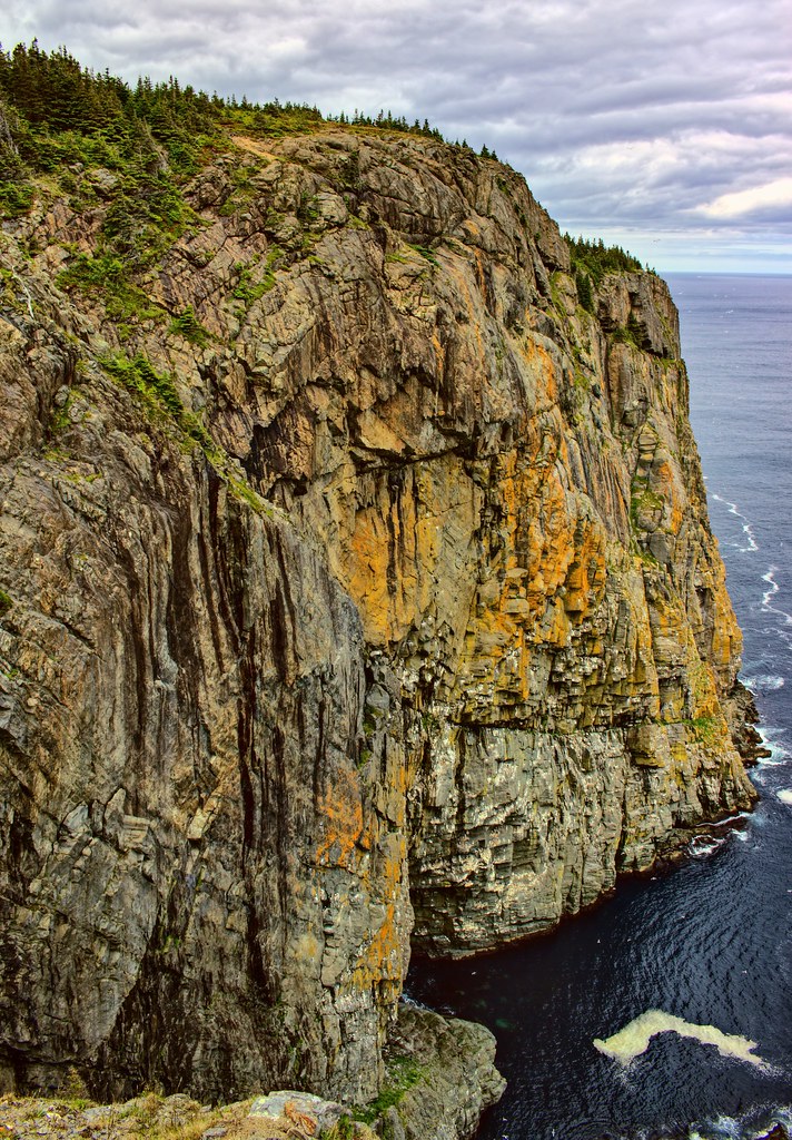
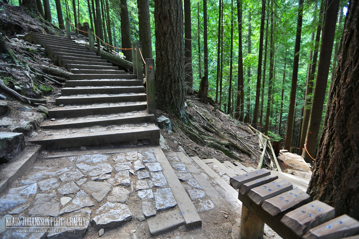
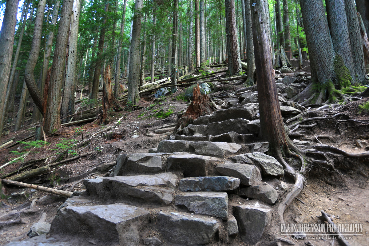
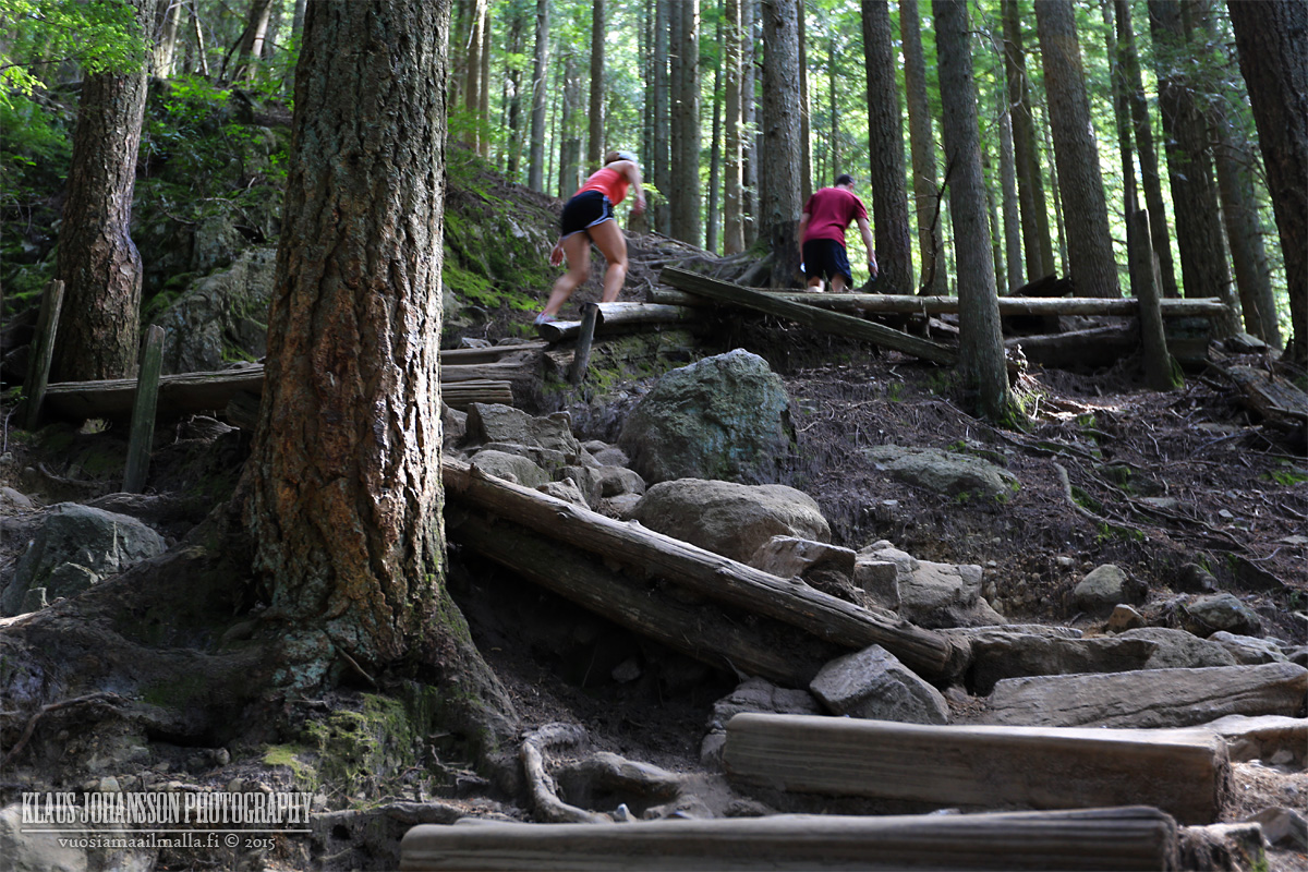
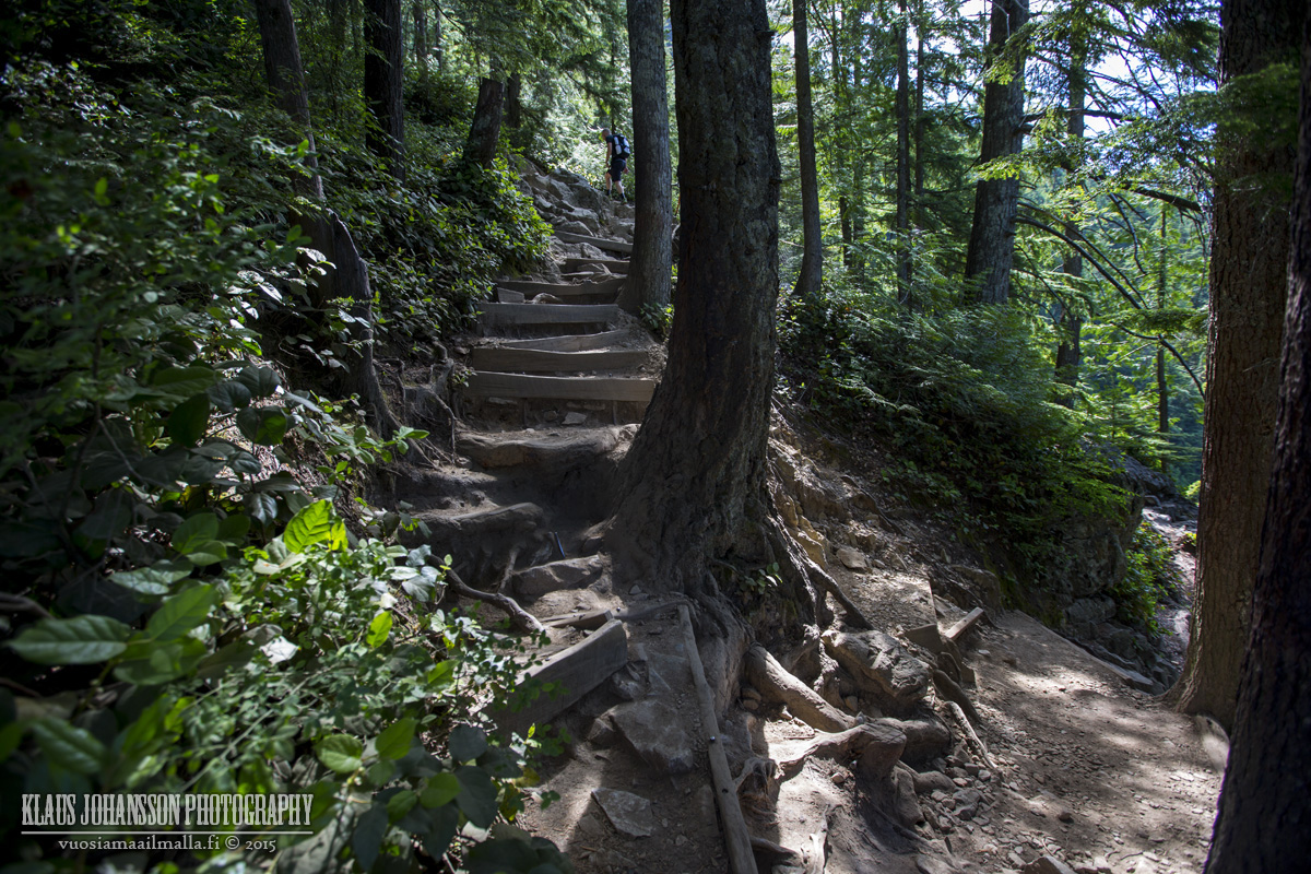
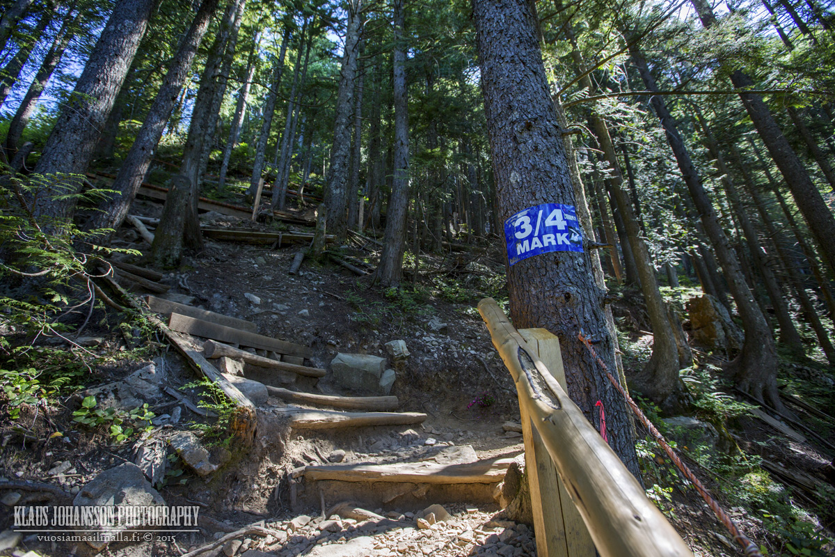
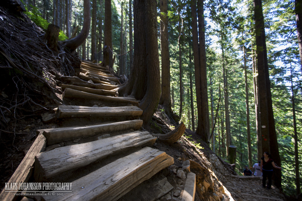
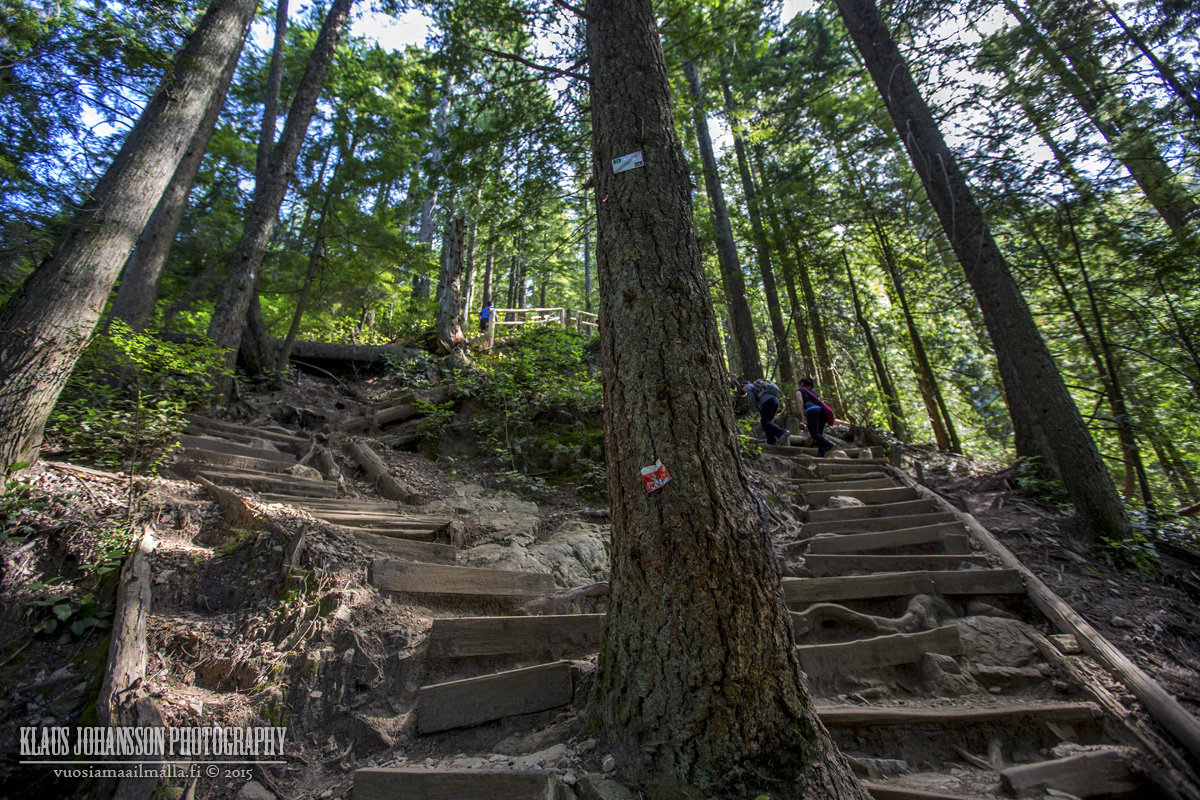
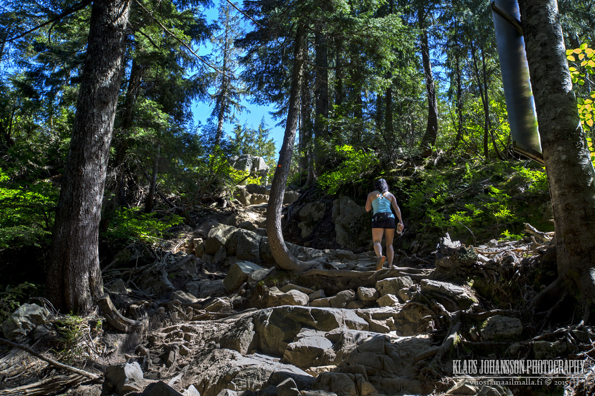
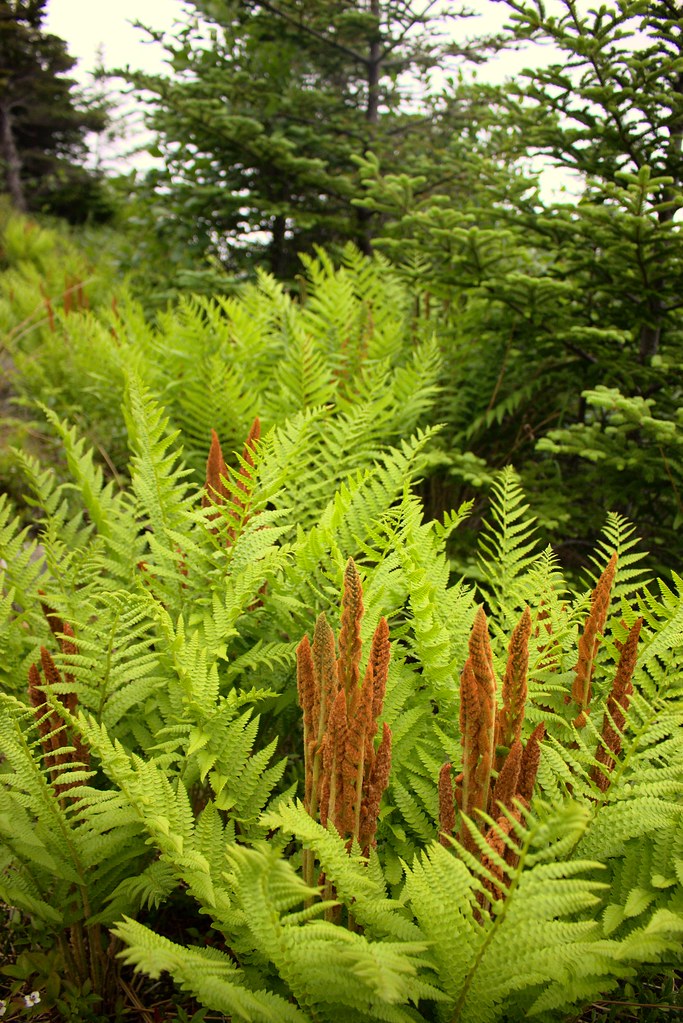
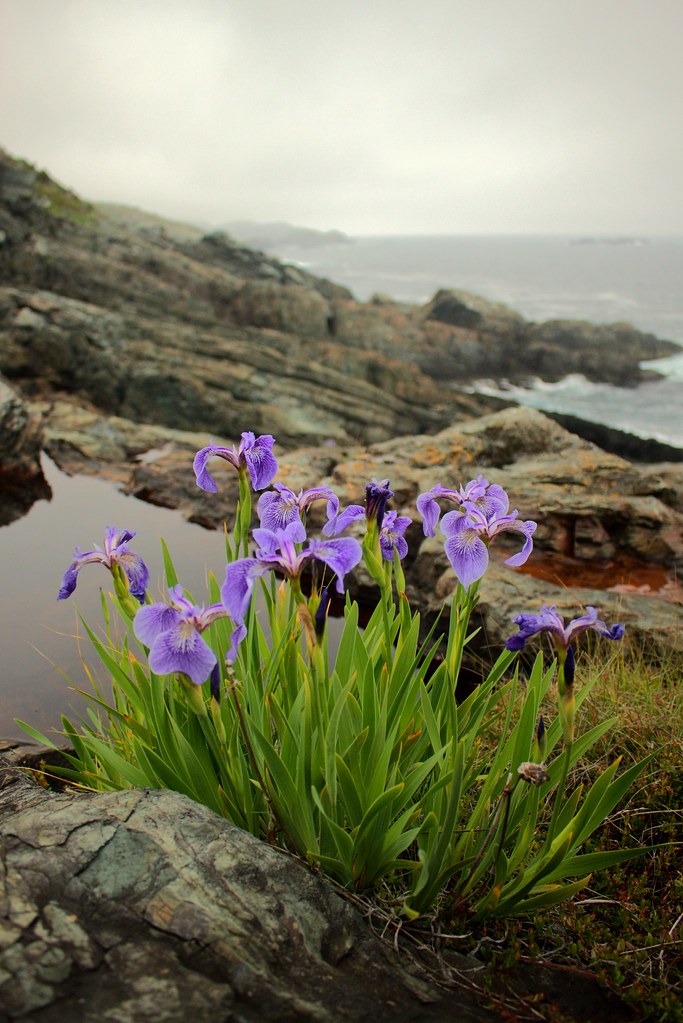
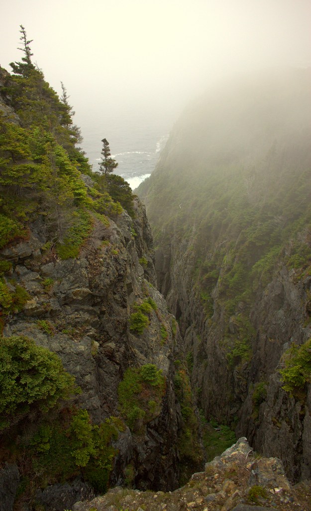
Today we did the trail from Flatrock to Torbay. It's kinda vertigo-inducing and has a couple of hard bits. But it's great fun.


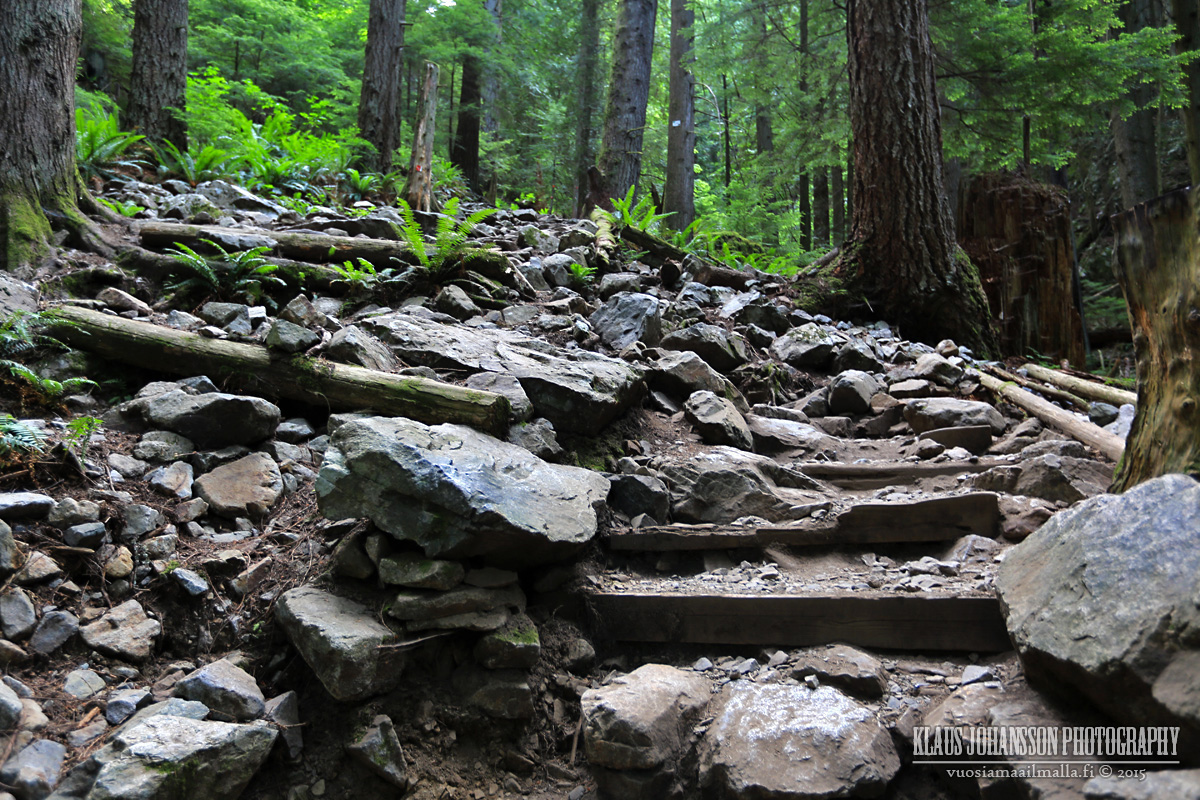
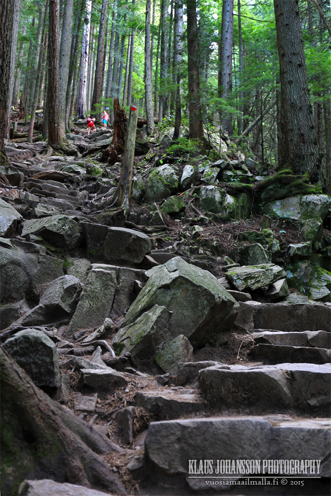
A few parts were as bit WTF... such as the rockslide-turned-stairs:

Video Link


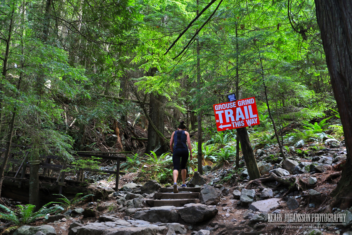
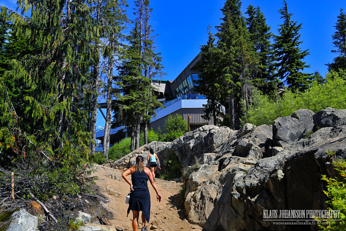
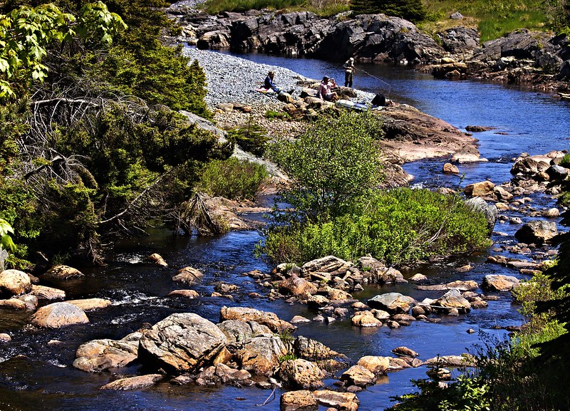
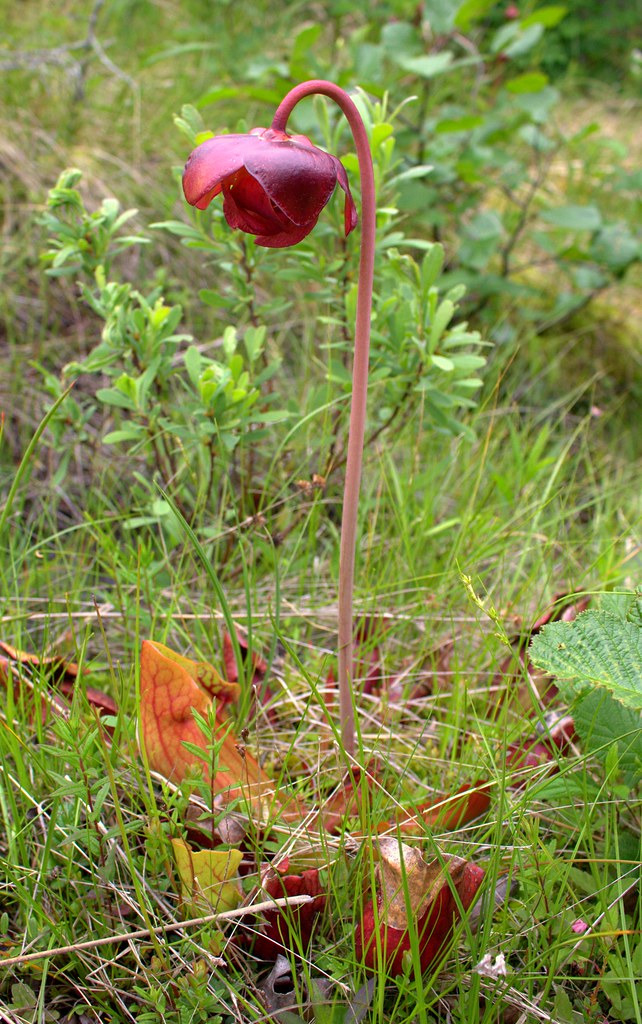
A few mobile pics of the beginning:


A few tourists die every other year. They just get WAY too close.

Torbay by R C, on Flickr

Torbay by R C, on Flickr

Torbay by R C, on Flickr

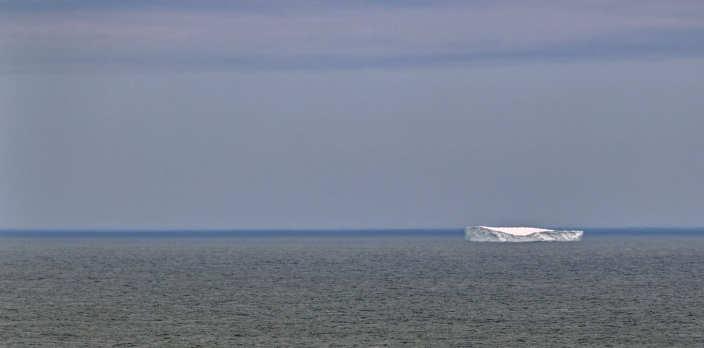
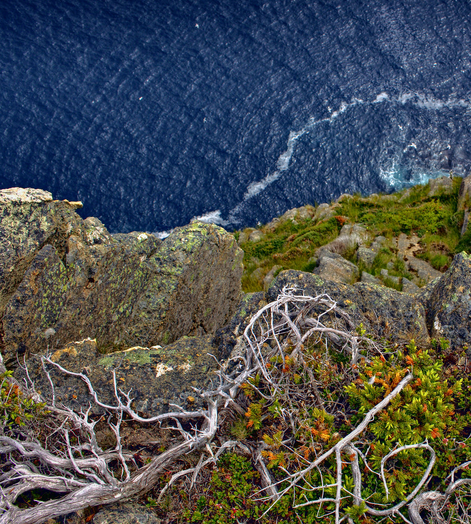
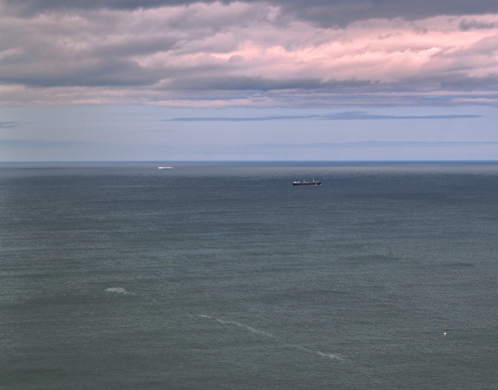
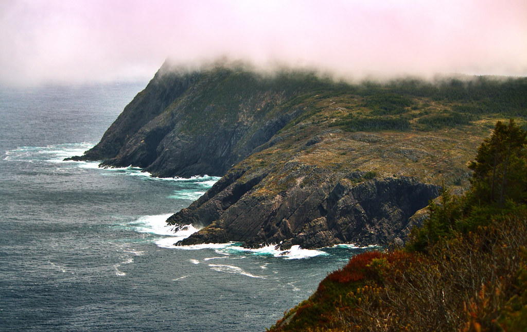
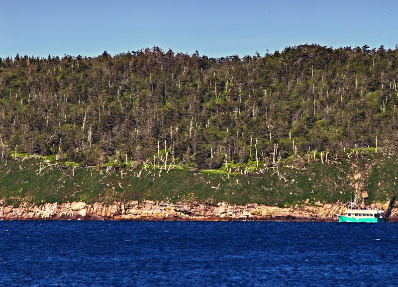
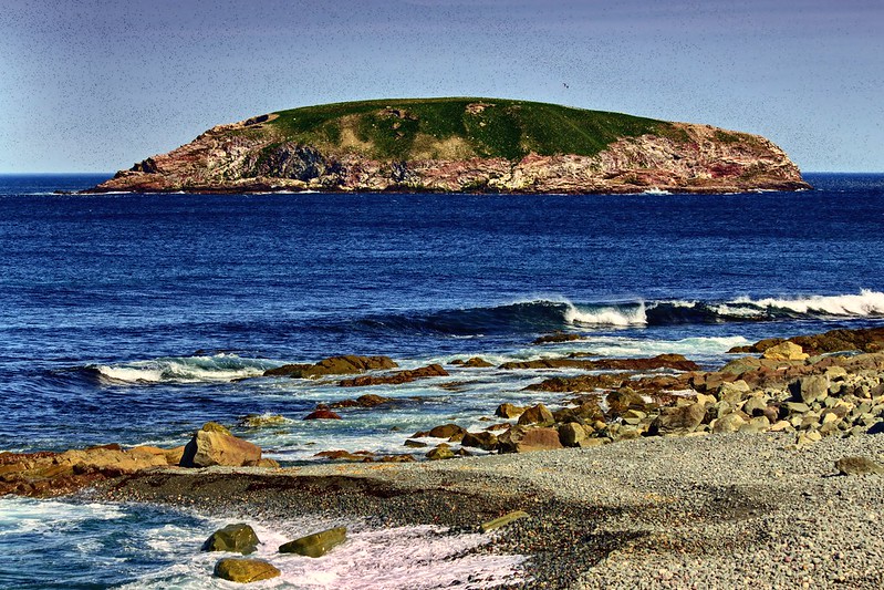
There were three little bergie bits well off the coast.

Torbay by R C, on Flickr

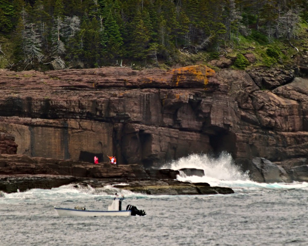
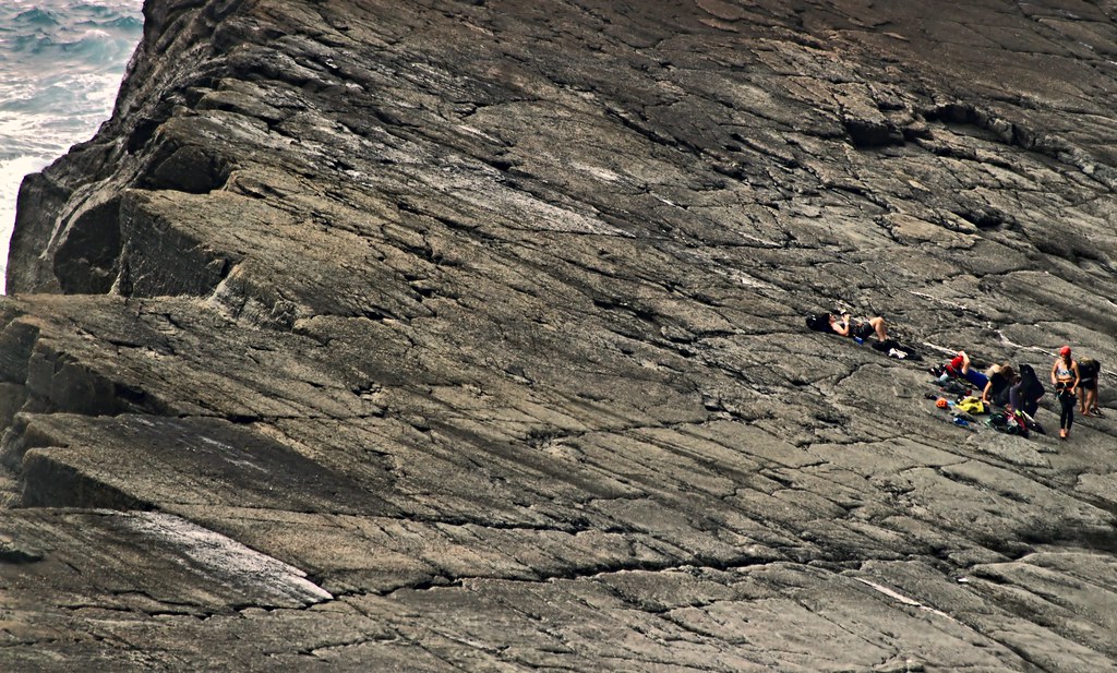
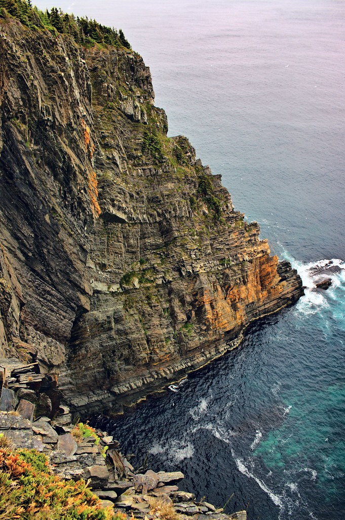
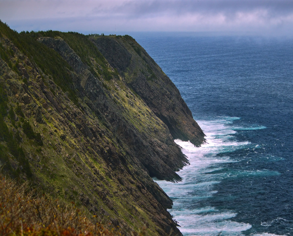
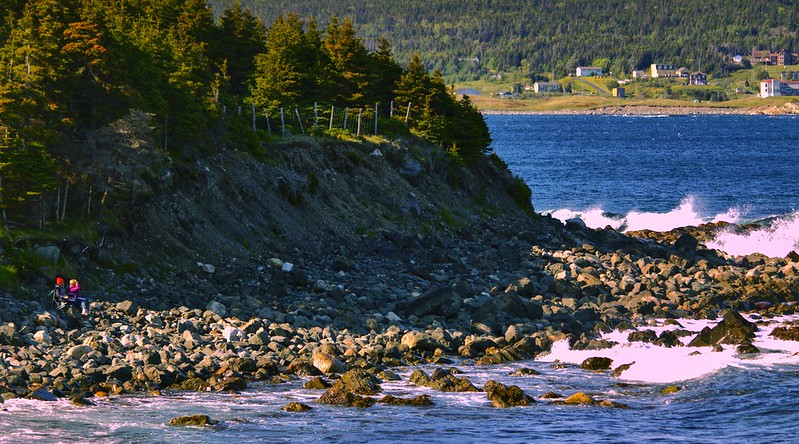
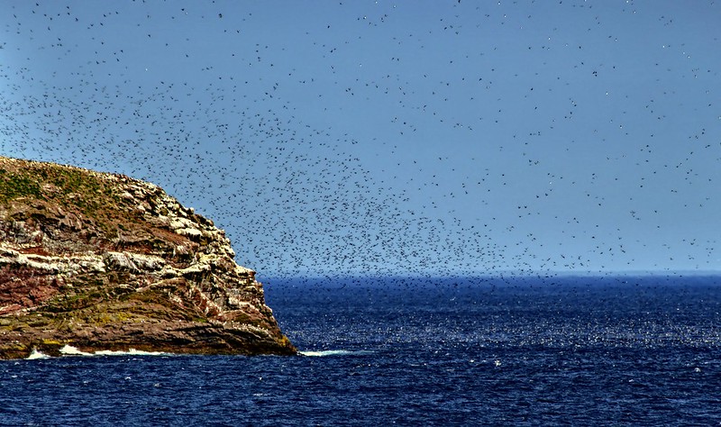
See the shelf at the lower left?


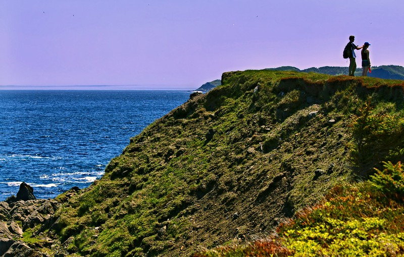
People actually climbed down from up where we were hiking. And one girl was wearing heels down there. You can take the girl off George Street...

Torbay by R C, on Flickr

Torbay by R C, on Flickr

I'd never do it!

Torbay by R C, on Flickr

Torbay by R C, on Flickr

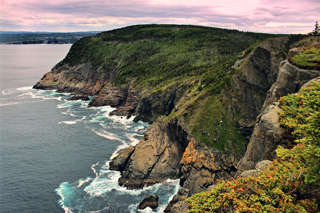
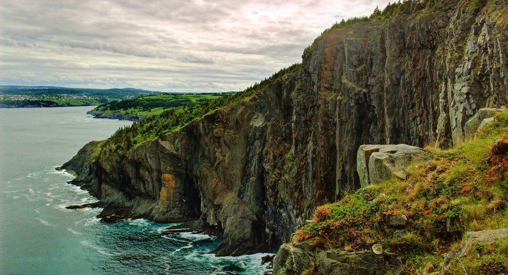
You can barely see them but there are a couple of girls hiking at the top of this. We'd just come down from it.

Torbay by R C, on Flickr

A boat and icebergie bit.

Torbay by R C, on Flickr

From an island to an island, from the green to the green,
They left their homes to settle in a place they'd never seen;
They exchanged the hills of Newfoundland for the ones they'd left behind,
And the green of the shamrock for the green of the pine.


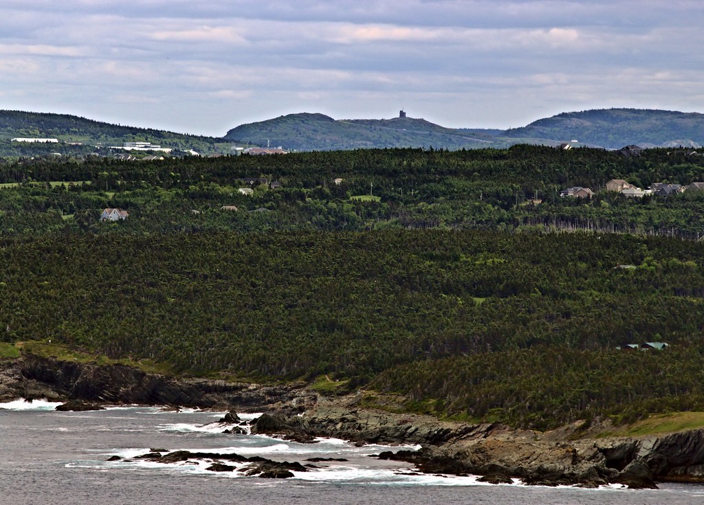
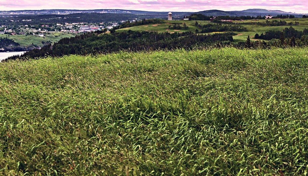
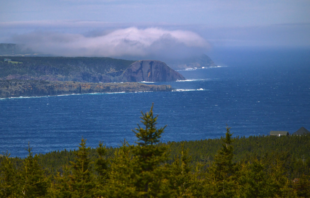
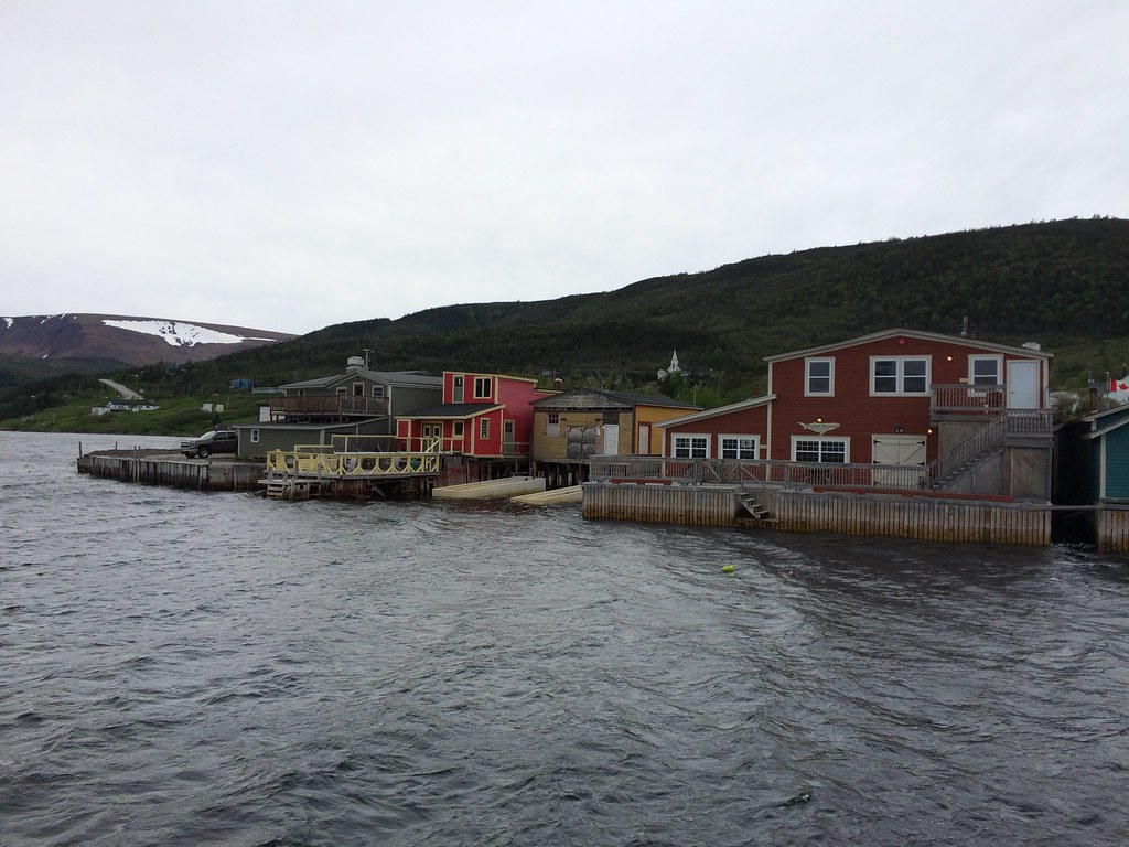
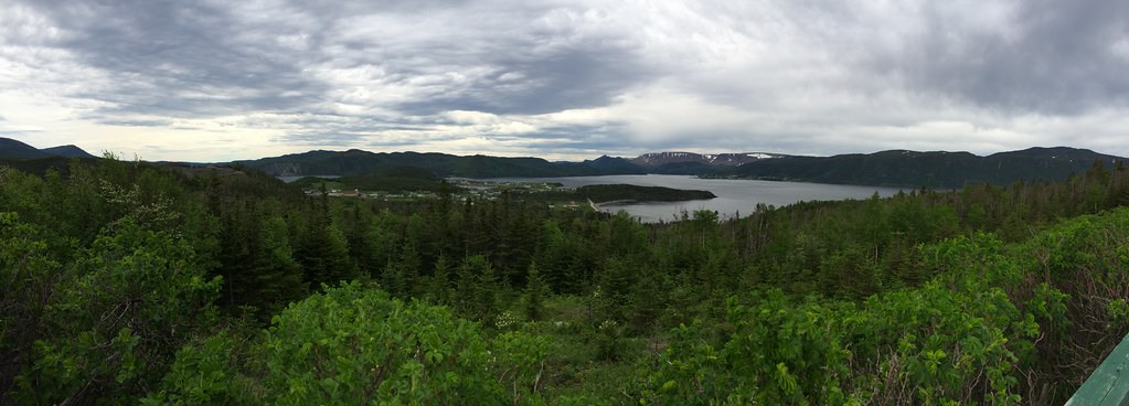
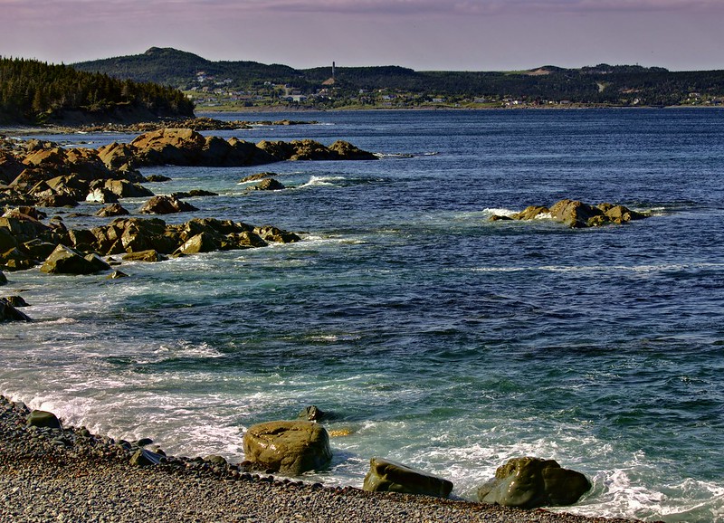
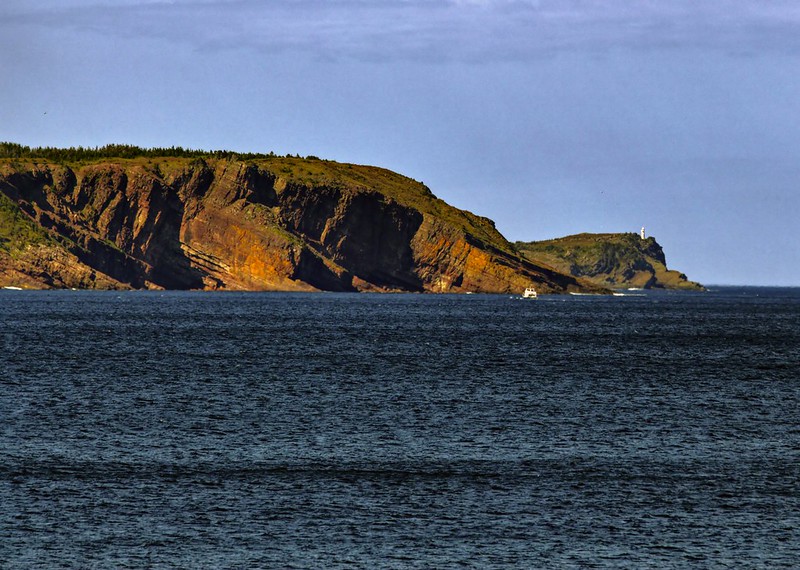
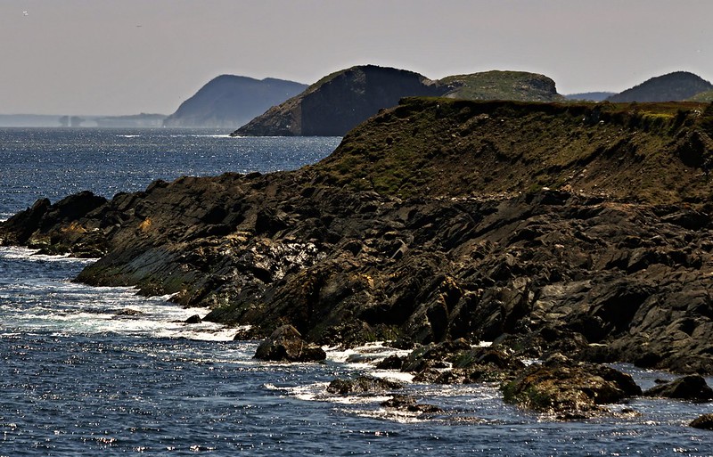
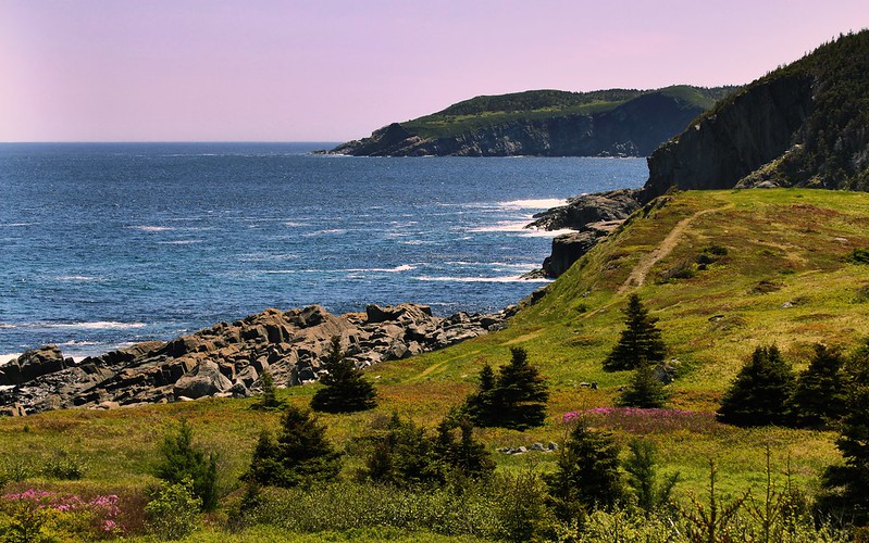
Torbay (Tor is just an old Irish word for rocky) in the distance. It's a separate town, 450 years old a few years ago. It's where YYT is located.

Torbay by R C, on Flickr

Torbay by R C, on Flickr

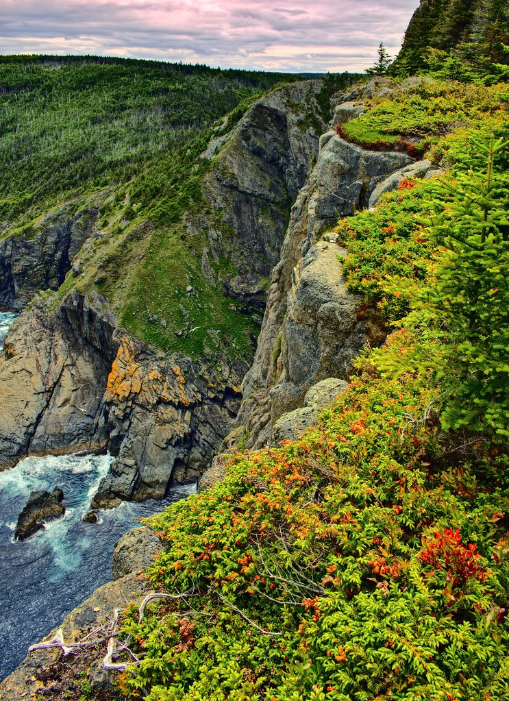
Omnipresent Signal Hill.

Torbay by R C, on Flickr

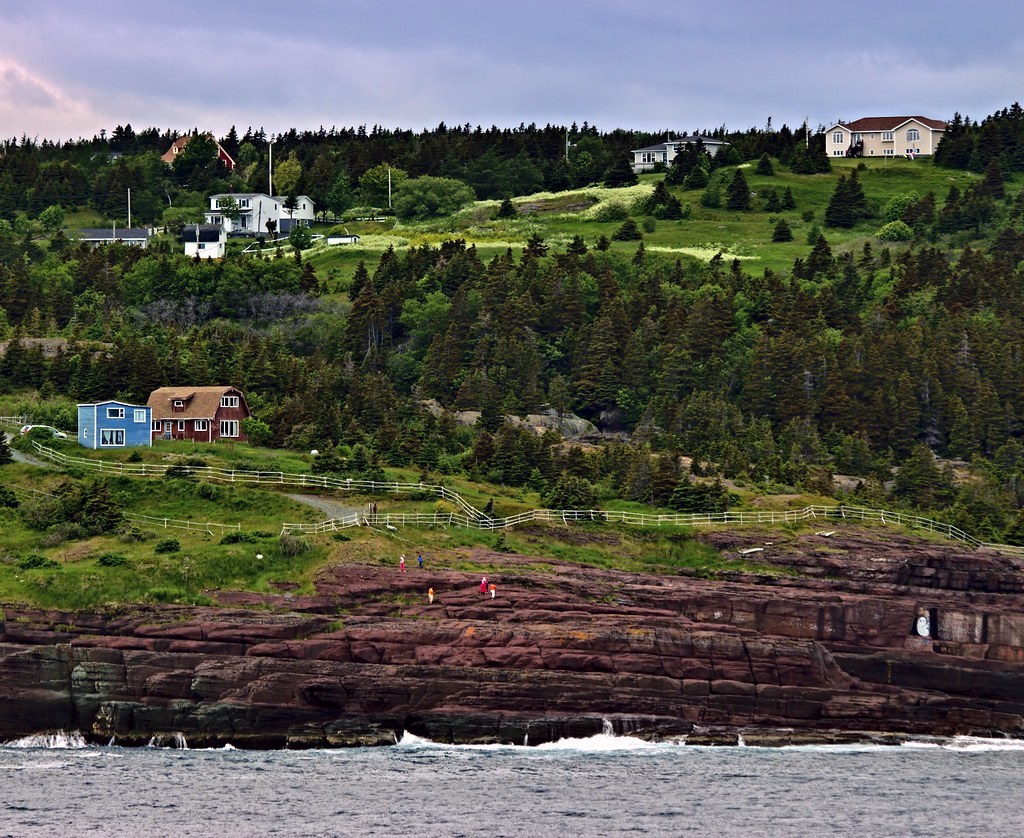
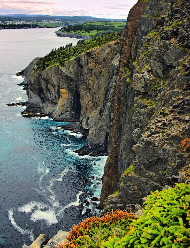
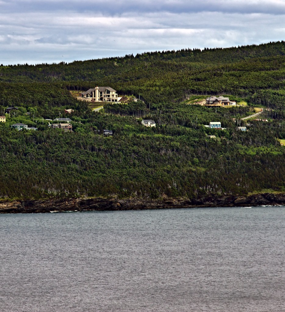
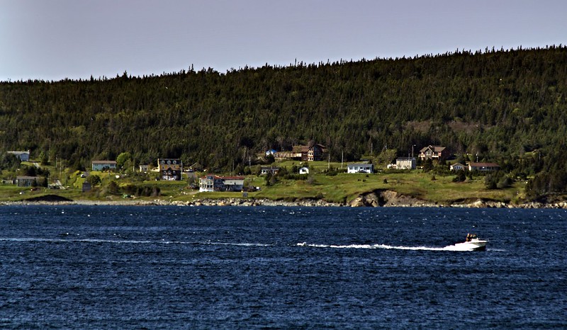
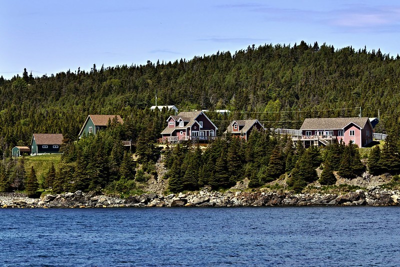
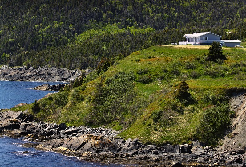
The suburbs of Torbay with the edge of the East End of St. John's in the background.
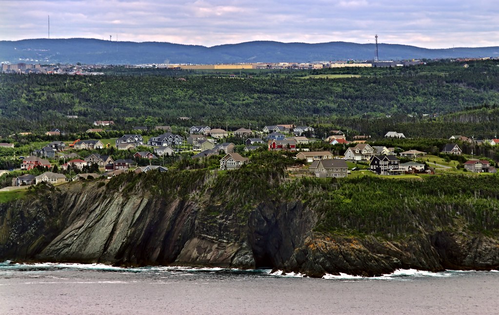
Torbay by R C, on Flickr

The main residential part of Torbay in the foreground, YYT in the background.
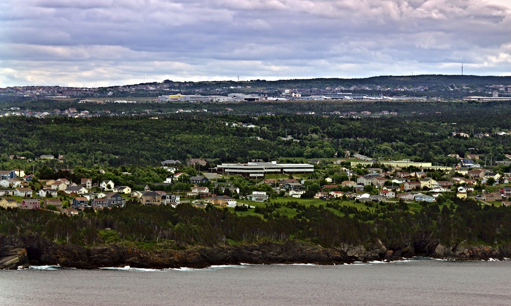
Torbay by R C, on Flickr

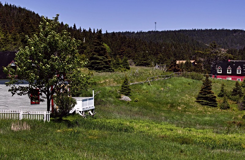
Logy Bay-Middle Cove-Outer Cove, where our rich folks live.
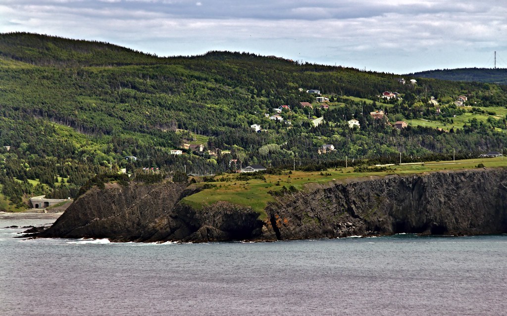
Torbay by R C, on Flickr

Torbay by R C, on Flickr

Torbay by R C, on Flickr

Almost in Torbay...

Torbay by R C, on Flickr


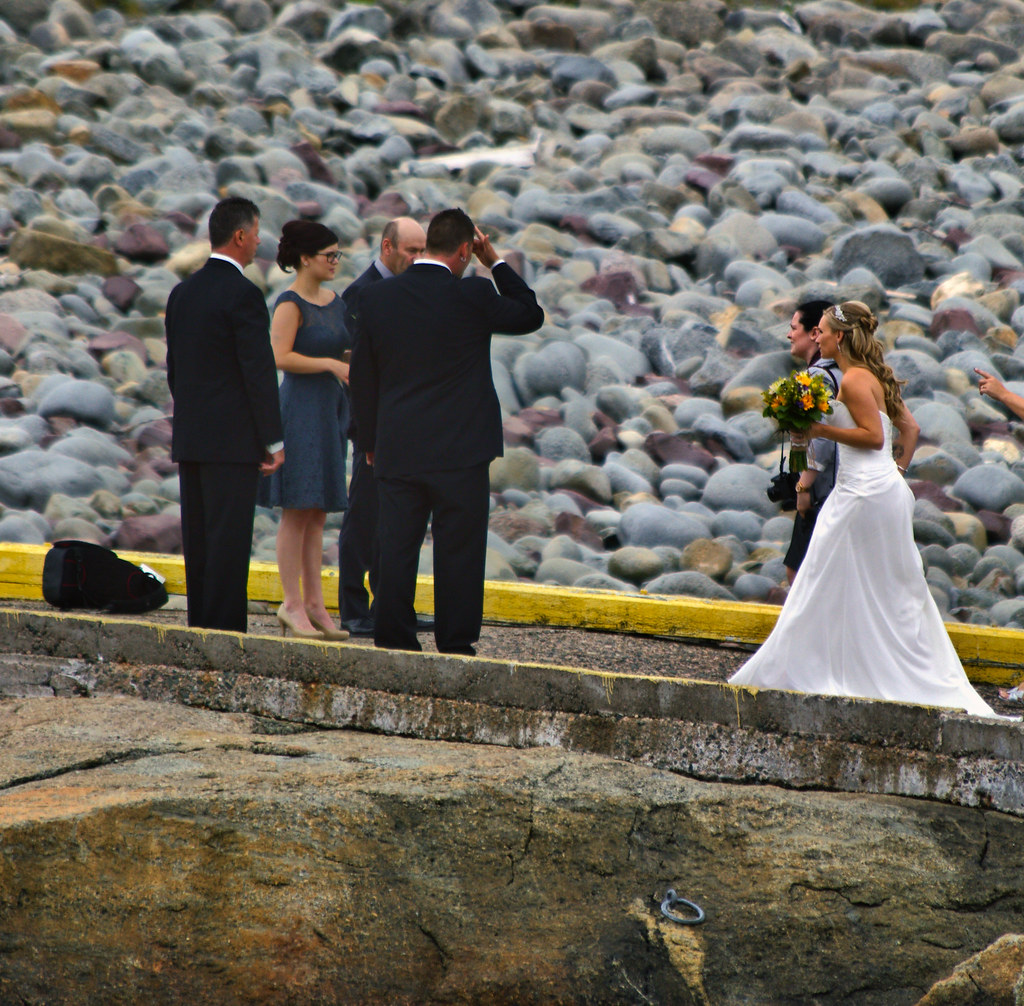
Just in time to crash a wedding. But we didn't, of course.

Torbay by R C, on Flickr
__________________
Note to self: "The plural of anecdote is not evidence."
Reply With Quote
     
     
  #1015  
Old Posted Jul 4, 2015, 11:02 PM
eemy's Avatar
eemy eemy is offline
Closed account
 
Join Date: Aug 2006
Posts: 4,456
You should get hiking poles Ryan; it makes it much easier going down steep and rough terrain and it saves your knees.
Reply With Quote
     
     
  #1016  
Old Posted Jul 5, 2015, 11:49 AM
SignalHillHiker's Avatar
SignalHillHiker SignalHillHiker is offline
I ♣ Baby Seals
 
Join Date: Jul 2012
Location: Sin Jaaawnz, Newf'nland
Posts: 35,166
Yeah - J. has a pair and we tried them once. It was just too annoying having to carry them and everything else. We're loading ourselves up with more shit than usual to practice for a couple of overnight hikes we want to do this summer. One of them being a return to the Spout (it's 23km and takes about 9 hours - the spout is right in the middle. We want to camp right beside it overnight). The full thing in one go was a bit much and we were wrecked for a couple of days.


It's such an annoying trail. It's like a vertical switchback road. Straight down the hill, straight back up, around every little crag and crack. The distance to hike it is probably many, many times the straight distance.

Poles might help then.
__________________
Note to self: "The plural of anecdote is not evidence."

Last edited by SignalHillHiker; Jul 5, 2015 at 8:49 PM.
Reply With Quote
     
     
  #1017  
Old Posted Jul 5, 2015, 5:38 PM
eemy's Avatar
eemy eemy is offline
Closed account
 
Join Date: Aug 2006
Posts: 4,456
If you aren't using the poles, most packs designed for hiking will be designed to be able to fix them to the outside of the pack. Over uneven or steep terrain, though, they are invaluable.
Reply With Quote
     
     
  #1018  
Old Posted Jul 5, 2015, 8:50 PM
SignalHillHiker's Avatar
SignalHillHiker SignalHillHiker is offline
I ♣ Baby Seals
 
Join Date: Jul 2012
Location: Sin Jaaawnz, Newf'nland
Posts: 35,166
Maybe we're just used to it because the city itself is so hilly? There's not much that's smooth and even on the East Coast Trail. I think we will use them when we take our mothers to the Bay Bulls lighthouse next weekend.

So, a weird thing from today's hike... the trail entrance for the Pouch Cove-Cape St. Francis hike (7.3k) is surreal. It's instant woods path, right next to suburban Pouch Cove.

__________________
Note to self: "The plural of anecdote is not evidence."
Reply With Quote
     
     
  #1019  
Old Posted Jul 5, 2015, 9:44 PM
SignalHillHiker's Avatar
SignalHillHiker SignalHillHiker is offline
I ♣ Baby Seals
 
Join Date: Jul 2012
Location: Sin Jaaawnz, Newf'nland
Posts: 35,166
And just a couple of pictures from Cape St. Francis today. It's the tip of the Northeast Avalon, it'd only be a day or two hike to go all the way south to St. John's.

Cape St. Francis by R C, on Flickr

Cape St. Francis by R C, on Flickr

American fleur-de-Lys

Cape St. Francis by R C, on Flickr

Cape St. Francis by R C, on Flickr

And our national emblem, the carnivorous Pitcher Plant. It digests small insects that get trapped in the jugs around the flower's base.


Cape St. Francis by R C, on Flickr
__________________
Note to self: "The plural of anecdote is not evidence."
Reply With Quote
     
     
  #1020  
Old Posted Jul 7, 2015, 6:27 PM
Klazu's Avatar
Klazu Klazu is offline
Registered User
 
Join Date: Apr 2012
Location: Above Metro Vancouver clouds
Posts: 10,226
Jug Island Beach is a nice short walk from the small village of Belcarra and has a great view of Indian Arm.


Deep Cove and Quarry Rock on the other side.


The small Jug Island.


Reply With Quote
     
     
This discussion thread continues

Use the page links to the lower-right to go to the next page for additional posts
 
 
Reply

Go Back   SkyscraperPage Forum > Regional Sections > Canada
Forum Jump


Forum Jump


All times are GMT. The time now is 10:53 PM.

     
SkyscraperPage.com - Archive - Privacy Statement - Top

Powered by vBulletin® Version 3.8.7
Copyright ©2000 - 2024, vBulletin Solutions, Inc.