Quote:
Originally Posted by rousseau

The only solution is for Toronto to keep building towers until they bump up en masse against natural or articficial borders. There's a reason no one really cares about Sao Paolo's skyline, after all.
|
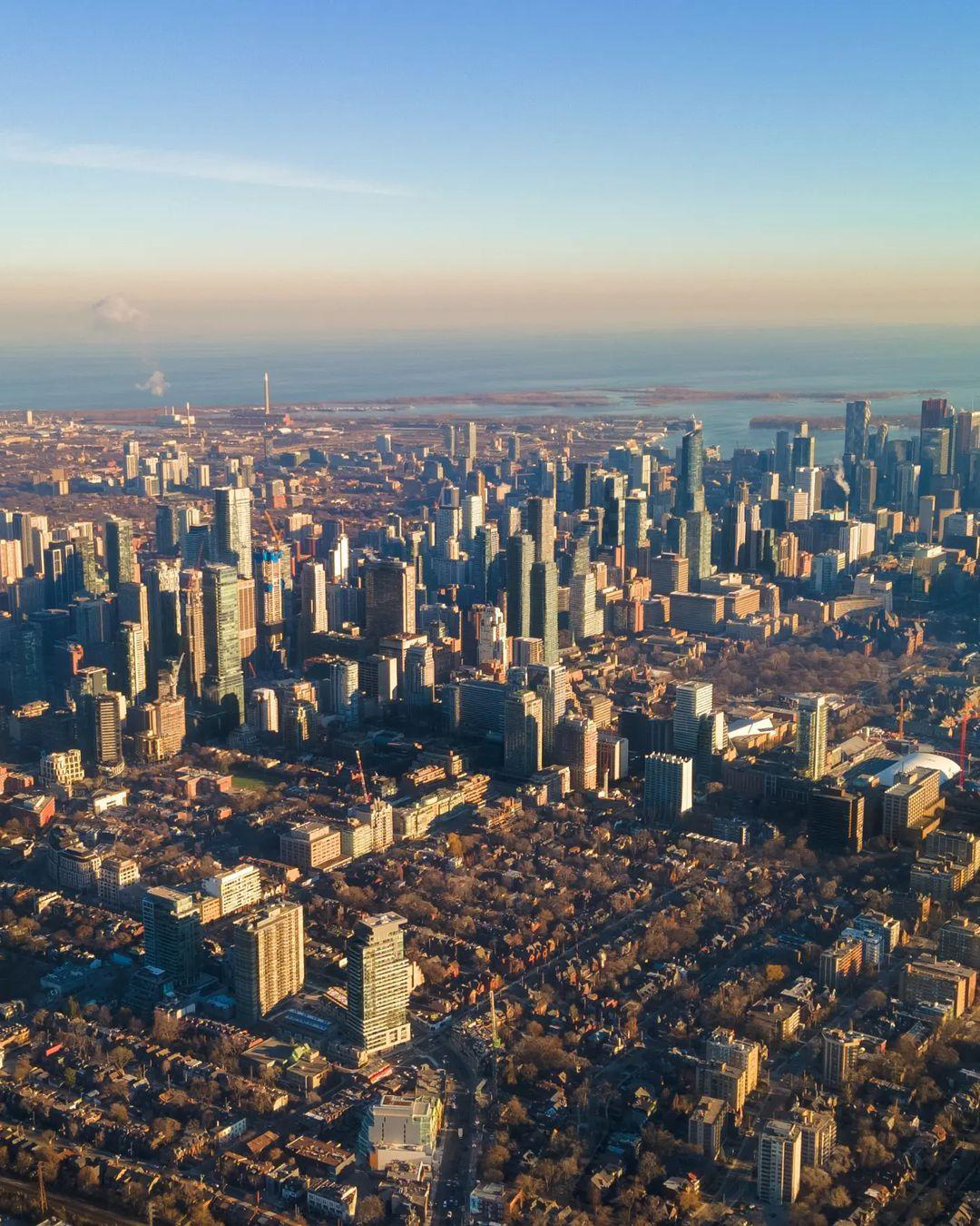
There are very clearly defined areas where tall buildings are permitted in Toronto. They're not allowed to be put randomly like in Houston or Sao Paolo. There are sharp borders all over the place (High Park, Allan Gardens, Queens Park, Dundas Square, Moss Park, Nathan Phillips Square, etc). The difference in Toronto vs European cities is that Toronto is still being built out while those much older European cities got built out decades/centuries ago. The juxtaposition/borders in European cities are, predictably, more extreme/noticeable. That doesn't mean Toronto won't end up in the same place.
The downtown is going to keep filling in with towers till they bump up against the lake to the south, roughly Davenport to the north, University Avenue to the west, and Jarvis to the east while butting up against the many 'breaks' that already exist. Areas like the Annex, Cabbagetown, University of Toronto, etc. will create increasingly visible 'borders' between high-rise/midrise and low rise. Beyond downtown, arterial roads are earmarked for intensification as are major intersections which, in many cases, are where 2 or more transit corridors meet.
We will end up with what looks like a grid when viewed from above: density along the north/south roads and low rise inside these 'squares'. You can already see one of those squares forming in your photo above (bounded by Avenue, Bloor, Davenport, Spadina). Unless of course, we cave to growing pressure to open up parks/squares or low rise residential neighbourhoods like High Park, the Beaches, or Trinity Bellwoods to re-development. A huge mistake imo and something we can't ever un-do.
Toronto is a planned city. Toronto intensification may look random to someone who doesn't know what they're looking at but it's not at all.


 Prev
Prev


 that was my point. I just threw in the population for comparison. Not sure why you need to pick my comment apart.


 Linear Mode
