HomeDiagramsDatabaseMapsForum About
     

Go Back   SkyscraperPage Forum > Regional Sections > Canada > Alberta & British Columbia > Vancouver > Transportation & Infrastructure


Closed Thread

 
Thread Tools Display Modes
     
     
  #921  
Old Posted Dec 21, 2021, 2:04 AM
jollyburger jollyburger is offline
Registered User
 
Join Date: Dec 2015
Posts: 15,648
Quote:
Originally Posted by Alex Mackinnon View Post
That probably wouldn't do much. If anything the right lane is the most congested at that point. A large amount of traffic gets off at Main St. and Dollarton Hwy.
I guess it would be better to have a flyover for traffic exiting Mt Seymour Parkways and it wouldn't conflict with traffic merging from Dollarton. Again, not sure about the amount of traffic etc so that might be overkill.
     
     
  #922  
Old Posted Dec 21, 2021, 7:39 AM
madog222 madog222 is offline
Moderator
 
Join Date: Jan 2014
Posts: 4,159
Quote:
Originally Posted by Alex Mackinnon View Post
That probably wouldn't do much. If anything the right lane is the most congested at that point. A large amount of traffic gets off at Main St. and Dollarton Hwy.
This, I've driven that stretch on the morning rush more than I would like to in a lifetime. The only regular backup is the right lane exiting onto Main. Centre and left lane are pretty much free flowing, only hold ups are from people changing late from the right lane or merging from the Dollarton on ramp so a third lane under the overpass wouldn't do anything.
     
     
  #923  
Old Posted Dec 21, 2021, 8:15 PM
esup21 esup21 is offline
Registered User
 
Join Date: Oct 2021
Posts: 18
It'll make things worse

Quote:
Originally Posted by Alex Mackinnon View Post
That probably wouldn't do much. If anything the right lane is the most congested at that point. A large amount of traffic gets off at Main St. and Dollarton Hwy.
Not only will a third lane under the Dollarton flyover not improve things, it'll actually make them worse. Today, traffic in the right lane is free of all traffic wanting to go to Mount Seymour or Mountain Highway. Once you extend that right lane, you'll be mixing the Main and Dollarton traffic with the Mount Seymour and Mountain Highway bound traffic that would change lanes early.
     
     
  #924  
Old Posted Dec 21, 2021, 11:20 PM
Tvisforme's Avatar
Tvisforme Tvisforme is offline
Registered User
 
Join Date: Sep 2014
Location: Metro Vancouver
Posts: 2,150
I don't know, I still think that an extended third lane could help with the reconfigured Exit 22. The combined on-ramp from Dollarton and off-ramp to Fern/Lillooet was not great to begin with, since you have traffic entering and exiting (plus those who use the ramp for local travel) in a tight space with limited visibility. If there are concerns about the Main/Dollarton traffic in the third lane, then perhaps the existing Dollarton exit should become the exit for Main as well, with a new, separated, parallel westbound overpass (as with what they did eastbound for Dollarton) getting Main Street traffic out of the system that much earlier.

Imagine this new lane running through where the signs are.


The existing third lane could be reworked at this point so that all traffic must exit for Main Street/Dollarton, just as it presently does at the Main Street ramp:

Main Street exit

Then the third lane could open up again just after Main/Dollarton (roughly here) giving traffic for Seymour and Mountain Highway lots of time and room to move over, freeing up room in the two through lanes and also reducing the number of vehicles merging off of the highway at the same time traffic from Dollarton is merging onto the highway in the same space.

EDIT: Taking this one step further, the Dollarton on-ramp lanes could be swapped; westbound traffic would take the left lane from Dollarton beneath a rebuilt eastbound underpass here:

Dollarton westbound to the left, underneath the underpass

That would greatly increase visibility of westbound vehicles merging onto the highway from Dollarton; with Exit 22 lengthened from the current 250m to almost 700m, highway traffic would have 300m or so to get into the third lane before Dollarton traffic merges in.



Last edited by Tvisforme; Dec 22, 2021 at 12:17 AM.
     
     
  #925  
Old Posted Dec 23, 2021, 4:51 AM
Jimbo604 Jimbo604 is offline
Registered User
 
Join Date: Jan 2012
Posts: 1,888
Quote:
Originally Posted by Tvisforme View Post
I don't know, I still think that an extended third lane could help with the reconfigured Exit 22. The combined on-ramp from Dollarton and off-ramp to Fern/Lillooet was not great to begin with, since you have traffic entering and exiting (plus those who use the ramp for local travel) in a tight space with limited visibility. If there are concerns about the Main/Dollarton traffic in the third lane, then perhaps the existing Dollarton exit should become the exit for Main as well, with a new, separated, parallel westbound overpass (as with what they did eastbound for Dollarton) getting Main Street traffic out of the system that much earlier.

Imagine this new lane running through where the signs are.


The existing third lane could be reworked at this point so that all traffic must exit for Main Street/Dollarton, just as it presently does at the Main Street ramp:

Main Street exit

Then the third lane could open up again just after Main/Dollarton (roughly here) giving traffic for Seymour and Mountain Highway lots of time and room to move over, freeing up room in the two through lanes and also reducing the number of vehicles merging off of the highway at the same time traffic from Dollarton is merging onto the highway in the same space.

EDIT: Taking this one step further, the Dollarton on-ramp lanes could be swapped; westbound traffic would take the left lane from Dollarton beneath a rebuilt eastbound underpass here:

Dollarton westbound to the left, underneath the underpass

That would greatly increase visibility of westbound vehicles merging onto the highway from Dollarton; with Exit 22 lengthened from the current 250m to almost 700m, highway traffic would have 300m or so to get into the third lane before Dollarton traffic merges in.

Ya that re-configured straight-ahead merge could help. The merge there now is a bit crap with people coming on and off the highway along with the always helpful people using the onramp not as an onramp but as a don't-mind-me I'm just cutting from Main/Dollarton up to Superstore deal.

I bet replacing this bridge came up in planning. However, seeing as the forward-thinking person that designed it thought "okay four lanes and one foot of clearance on either side is good we'll never need any more than that" then it would have to be demolished and replaced which would be a pain and/or expensive for an already long project.

Google Street View

Weird stuff: Three lanes for kilometers south of this, and kilometers north of this but after major reno-project still goes to 2 lanes for 250 meters.
     
     
  #926  
Old Posted Dec 23, 2021, 6:25 AM
madog222 madog222 is offline
Moderator
 
Join Date: Jan 2014
Posts: 4,159
Quote:
Originally Posted by Jimbo604 View Post
Weird stuff: Three lanes for kilometers south of this, and kilometers north of this but after major reno-project still goes to 2 lanes for 250 meters.
??? North of this it’s only three lanes up the cut and between Lonsdale and Westview.
     
     
  #927  
Old Posted Dec 23, 2021, 5:29 PM
Jimbo604 Jimbo604 is offline
Registered User
 
Join Date: Jan 2012
Posts: 1,888
Quote:
Originally Posted by madog222 View Post
??? North of this it’s only three lanes up the cut and between Lonsdale and Westview.
If you are taking the Dollarton exit I do agree that it is nice as the east lane is likely clearer at busy times than it would be if it continued on. At a cost of the thru lanes being more congested.

Its a highway, though, thru-traffic should be optimized [with no bottlenecks].

Same situation on the south bound side where they fixed it and prioritized thru-traffic over traffic coming onto the highway (from Dollarton).
     
     
  #928  
Old Posted Dec 23, 2021, 7:34 PM
makr3trkr makr3trkr is offline
Registered User
 
Join Date: Jun 2012
Posts: 593
Quote:
Originally Posted by Jimbo604 View Post
Weird stuff: Three lanes for kilometers south of this, and kilometers north of this but after major reno-project still goes to 2 lanes for 250 meters.
Welcome to BC
     
     
  #929  
Old Posted Dec 23, 2021, 7:52 PM
jollyburger jollyburger is offline
Registered User
 
Join Date: Dec 2015
Posts: 15,648
Quote:
Originally Posted by makr3trkr View Post
Welcome to BC
In the 1990s there were signaled intersections along those stretches of highway as well so this is progress
     
     
  #930  
Old Posted Dec 23, 2021, 9:16 PM
Alex Mackinnon's Avatar
Alex Mackinnon Alex Mackinnon is offline
Can I has a tunnel?
 
Join Date: May 2008
Location: East Van
Posts: 2,202
Quote:
Originally Posted by Jimbo604 View Post
If you are taking the Dollarton exit I do agree that it is nice as the east lane is likely clearer at busy times than it would be if it continued on. At a cost of the thru lanes being more congested.

Its a highway, though, thru-traffic should be optimized [with no bottlenecks].

Same situation on the south bound side where they fixed it and prioritized thru-traffic over traffic coming onto the highway (from Dollarton).
This is confusing to me.

The demand on either side of a bridge drops off, because all the traffic going many disparate directions are channelized into a corridor. The through traffic demand here isn't 3 lanes with the bridge as-is.

Prioritizing this through traffic beyond what's there would just be a waste of space and money.

The arrangement is the same on the south side of the bridge. There's only 2 through lanes between the McGill off-ramp and on-ramp. It's not a problem.
__________________
"It's ok, I'm an engineer!" -Famous last words
     
     
  #931  
Old Posted Dec 23, 2021, 9:21 PM
Tvisforme's Avatar
Tvisforme Tvisforme is offline
Registered User
 
Join Date: Sep 2014
Location: Metro Vancouver
Posts: 2,150
Quote:
Originally Posted by jollyburger View Post
In the 1990s there were signaled intersections along those stretches of highway as well so this is progress
Yes, the lineups for the lights at both Westview and Lonsdale could get pretty bad during rush hours; it was not uncommon back then to be jammed up from Capilano Road in the afternoon. There was also the almost constant backup on the south side of the IWM for the lights at Hastings and Cassiar before that tunnel was built. I can also recall the level crossing at Lloyd, between Westview and Capilano Road.
     
     
  #932  
Old Posted Dec 23, 2021, 9:29 PM
Tvisforme's Avatar
Tvisforme Tvisforme is offline
Registered User
 
Join Date: Sep 2014
Location: Metro Vancouver
Posts: 2,150
Quote:
Originally Posted by Alex Mackinnon View Post
This is confusing to me.

The demand on either side of a bridge drops off, because all the traffic going many disparate directions are channelized into a corridor. The through traffic demand here isn't 3 lanes with the bridge as-is.

Prioritizing this through traffic beyond what's there would just be a waste of space and money.

The arrangement is the same on the south side of the bridge. There's only 2 through lanes between the McGill off-ramp and on-ramp. It's not a problem.
Getting traffic off of the through lanes as early as possible makes a huge difference. The flow westbound has improved substantially because through traffic does not get mired down with the previous setup at Exits 22 and 21, where vehicles getting off for Mountain Highway were jostling for position with those entering the freeway from the Seymour area. This resulted in constant slowdowns for both lanes in that stretch. In the new layout, Mountain Highway traffic is off the highway at Exit 22 and Seymour traffic doesn't enter the freeway until the Cut, and even then they have their own lane for the length of the hill climb.

Also, McGill isn't just two through lanes. The third lane on the bridge helps to filter out departing traffic, the onramp feeds into the third lane of the tunnel rather than merging into the through lanes, and the the offramp actually widens to three lanes in total which reduces slowdowns in that stretch.

I don't know if there is a need for three lanes along the entire Upper Levels as of yet. However, the Lynn/Seymour area is so congested now, and such a choke point for anyone looking to pass through there in any direction on both the freeway and the local roads, so anything to improve the flow would be helpful.

Last edited by Tvisforme; Dec 23, 2021 at 9:41 PM.
     
     
  #933  
Old Posted Dec 23, 2021, 9:31 PM
aberdeen5698's Avatar
aberdeen5698 aberdeen5698 is offline
Registered User
 
Join Date: May 2010
Posts: 4,786
Quote:
Originally Posted by Tvisforme View Post
Yes, the lineups for the lights at both Westview and Lonsdale could get pretty bad during rush hours; it was not uncommon back then to be jammed up from Capilano Road in the afternoon.
The times I've been there in the afternoon it's still jammed up almost back to Capilano road. I almost think if they put those lights back in on the Upper Levels it wouldn't make a whole lot of difference during rush hour. (It'd suck off-peak, though).
     
     
  #934  
Old Posted Dec 23, 2021, 9:45 PM
Tvisforme's Avatar
Tvisforme Tvisforme is offline
Registered User
 
Join Date: Sep 2014
Location: Metro Vancouver
Posts: 2,150
Quote:
Originally Posted by aberdeen5698 View Post
The times I've been there in the afternoon it's still jammed up almost back to Capilano road. I almost think if they put those lights back in on the Upper Levels it wouldn't make a whole lot of difference during rush hour. (It'd suck off-peak, though).
The backups were with a substantially lower volume of cars; when the freeway underpasses were built at Lonsdale and Westview and the tunnel at Cassiar, it really cut down of those backups. Of course, time and increased traffic volume has led to these massive backups returning, but if the lights were still there with the current volume of traffic I think you'd be looking at a road that is heavily congested and essentially unusable for most of the day.
     
     
  #935  
Old Posted Dec 23, 2021, 10:06 PM
jollyburger jollyburger is offline
Registered User
 
Join Date: Dec 2015
Posts: 15,648
And even earlier when Taylor Way had a signal


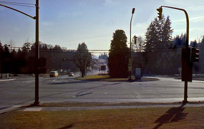
https://digital.westvanlibrary.ca/2839172/image/2136962?n=8

It seems like Taylor Way/15th/21st had overpasses added from the 1950s when they built the Upper Levels Highway to connect to the new ferry terminal at Horseshoe Bay.


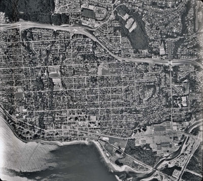
https://digital.westvanlibrary.ca/2840959/data?n=23

The highway got widened again in the 1970s

https://evelazarus.com/switzer-house-1960-1971/
     
     
  #936  
Old Posted Dec 24, 2021, 1:42 AM
aberdeen5698's Avatar
aberdeen5698 aberdeen5698 is offline
Registered User
 
Join Date: May 2010
Posts: 4,786
Here's a short VHS recording I made back in 1990 or 91 while driving along Cassiar when the connector was still under construction. The wonky borders are a result of stabilizing the footage.

In those days Cassiar and Hastings was billed as the busiest intersection in Canada.

Video Link
     
     
  #937  
Old Posted Dec 24, 2021, 2:17 AM
jollyburger jollyburger is offline
Registered User
 
Join Date: Dec 2015
Posts: 15,648
Weird didn't know that highway used to be called the 401


https://searcharchives.vancouver.ca/road-maps

And here's the Cassiar Connector before they switched over


https://searcharchives.vancouver.ca/view-from-crosswalk-showing-cassiar-street-on-the-right
     
     
  #938  
Old Posted Dec 24, 2021, 2:43 AM
Tvisforme's Avatar
Tvisforme Tvisforme is offline
Registered User
 
Join Date: Sep 2014
Location: Metro Vancouver
Posts: 2,150
Quote:
Originally Posted by jollyburger View Post
And even earlier when Taylor Way had a signal


https://digital.westvanlibrary.ca/2839172/image/2136962?n=8

It seems like Taylor Way/15th/21st had overpasses added from the 1950s when they built the Upper Levels Highway to connect to the new ferry terminal at Horseshoe Bay.


https://digital.westvanlibrary.ca/2840959/data?n=23

The highway got widened again in the 1970s

https://evelazarus.com/switzer-house-1960-1971/
I'm trying to verify this, but I think that the overpasses might date to the 1970s instead of the 50s. What is now known as the Upper Levels in North Vancouver appears to have opened in the 60s as Highway 401 (the Trans-Canada). Highway 1 passed through Vancouver (the route now known as 1A), crossing the Lions Gate Bridge and up Taylor Way to then head west to Horseshoe Bay. The two met at Taylor Way. The West Vancouver portion was widened in the early 1970s and as best I can recall that is when the overpasses were built. Highway 1 was moved to the 401 route in 1973.

Sources (so far):
  • Wikipedia
  • vague recollections of Taylor Way from the 70s
  • relative's house (since the 60s) borders the Upper Levels

(Could be completely wrong, but will keep looking.)

EDIT: Found a WVan photo from 1961 with Taylor Way and the Upper Levels as an intersection.

Last edited by Tvisforme; Dec 24, 2021 at 2:54 AM.
     
     
  #939  
Old Posted Dec 24, 2021, 2:54 AM
jollyburger jollyburger is offline
Registered User
 
Join Date: Dec 2015
Posts: 15,648
Quote:
Originally Posted by Tvisforme View Post
I'm trying to verify this, but I think that the overpasses might date to the 1970s instead of the 50s. What is now known as the Upper Levels in North Vancouver appears to have opened in the 60s as Highway 401 (the Trans-Canada). Highway 1 passed through Vancouver (the route now known as 1A), crossing the Lions Gate Bridge and up Taylor Way to then head west to Horseshoe Bay. The two met at Taylor Way. The West Vancouver portion was widened in the early 1970s and as best I can recall that is when the overpasses were built. Highway 1 was moved to the 401 route in 1973.
...
It must have been from the 1970s when the highway was widened since it was still just a two lane road from Horseshoe Bay to Taylor Way in 1966

https://www.tranbc.ca/2017/11/01/bc-road-trip-time-machine-see-vancouver-as-it-was-in-1966/

The Capilano Canyon and Mosquito Creek Bridges are from around 1968. A lot of the other over/underpasses were from that era as well

Quote:
Bridge Project No. 298—Trans-Canada Highway Underpass, Edgemont
Boulevard, North Vancouver Electoral District:

Bridge Project No. 299—Trans-Canada Highway Overpass (Lynn Valley Road) and Underpasses (Mountain Highway and Fern
Street), North Vancouver Electoral District:

PROJECT NO . 968—TRANS-CANADA HIGHWAY, TAYLOR WAY-SECOND NARROWS
(CONSTRUCTION, 5.75 MILES, FOUR LANES, AND 3.38 MILES OF INTERCHANGES):
https://open.library.ubc.ca/media/download/pdf/bcsessional/1.0356108/0

(Minster of Highways FOR THE FISCAL YEAR 1959/60)

Last edited by jollyburger; Dec 24, 2021 at 3:10 AM.
     
     
  #940  
Old Posted Dec 24, 2021, 3:03 AM
Tvisforme's Avatar
Tvisforme Tvisforme is offline
Registered User
 
Join Date: Sep 2014
Location: Metro Vancouver
Posts: 2,150
Quote:
Originally Posted by jollyburger View Post
It must have been from the 1970s when the highway was widened since it was still just a two lane road from Horseshoe Bay to Taylor Way in 1966

https://www.tranbc.ca/2017/11/01/bc-road-trip-time-machine-see-vancouver-as-it-was-in-1966/
That is a fun little video clip. From what I understand, part of the old route still exists as Westport Road out near the Caufield exit (Exit 4); it heads west from the interchange and dips under the bridge that forms part of the current Highway 1.
     
     
This discussion thread continues

Use the page links to the lower-right to go to the next page for additional posts
 
 
Closed Thread

Go Back   SkyscraperPage Forum > Regional Sections > Canada > Alberta & British Columbia > Vancouver > Transportation & Infrastructure
Forum Jump


Forum Jump


All times are GMT. The time now is 11:37 AM.


Powered by vBulletin® Version 3.8.7
Copyright ©2000 - 2026, vBulletin Solutions, Inc.