Here's something to pore over on a Sunday: a Calgary aerial photo mashed up from some City of Calgary index aerial photos available on archives Alberta. I have loaded a reduced resolution version of the original. If there is interest, I will upload the original KLM file I did in Google, which is fascinating to compare what was there before and what is there now. Both this map and the KLM are not perfect matches due to 3D. I've matched as best I can with a little stretching and rotation, in Google Earth.
Interesting things to find: - Deerfoot end - New Grandstand under construction - NB Edmonton trail bridge under construction - Old runways still visible where MRU is now -Acreages in the NE, soon to be bulldozed - Lynwood Ridge tanks that were going to be a problem for the houses to be built near them - Barlow SE ends before 61st Ave - All the housing north of 50th Ave, south of Peigan, east of the Bow River, still a few holdouts in this now industrial area - Drive in movie theatres, all gone now - huge gravel mines over what is now Riverbend - Racetrack in Braeside - An airport that Deerfoot now runs over - Edmonton trail freshly cutoff by Deerfoot
and as they say, many, many more!
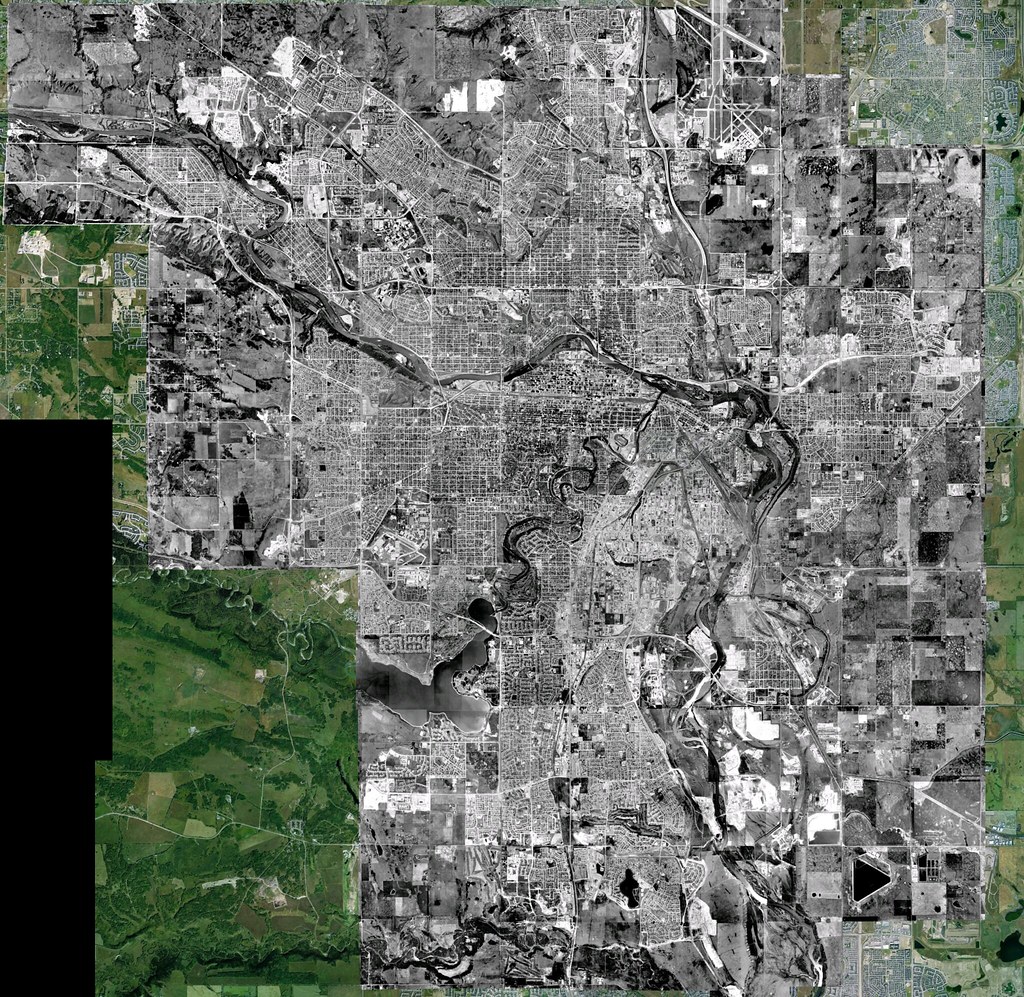 Calgary Aerial 1973
 by
ferreth, on Flickr


 Prev
Prev


 Linear Mode
