Here's
e_r's photo again, lightened a bit to show more of the building in the lower right corner:
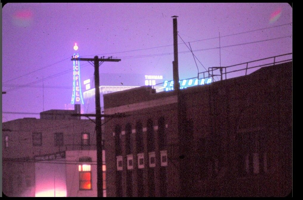
The building in the lower right corner of
e_r's photo (under the Seaboard sign) with the decorative white squares was
a Salvation Army facility at the SEC of 9th St. (now James M. Wood Blvd.) and Cottage Place, shown here in 1931.
The side of the building we see in
e_r's photo is on the right here, along Cottage Place:
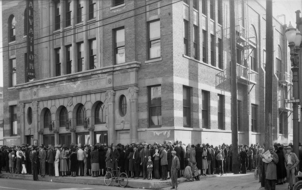 DW-1931-12-24-139~10.TIF
 @ USC Digital Library
At upper left you can see the de-lettered Richfield Tower (so, c. 1968-69), then moving down and to the right is the
Tishman Building and then the Seaboard sign on top of the Barker Brothers building at 7th and Figueroa/Flower.
At bottom, just left of center, a car is exiting the Harbor Fwy at 9th Street:
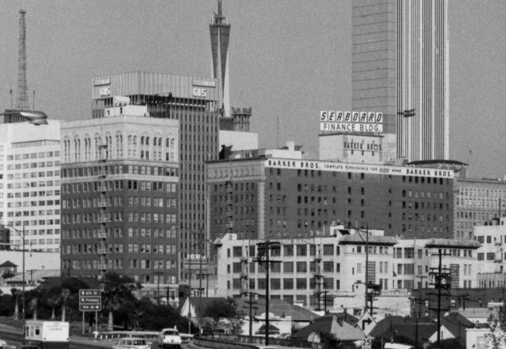 DW-F1997_4450-ISLA
 @ USC Digital Library
Now we're looking south from the Richfield Tower in 1930, with the roof of the Barker Brothers building at bottom.
The angled street we see is Figueroa, and the Salvation Army building on 9th Street has a red dot:
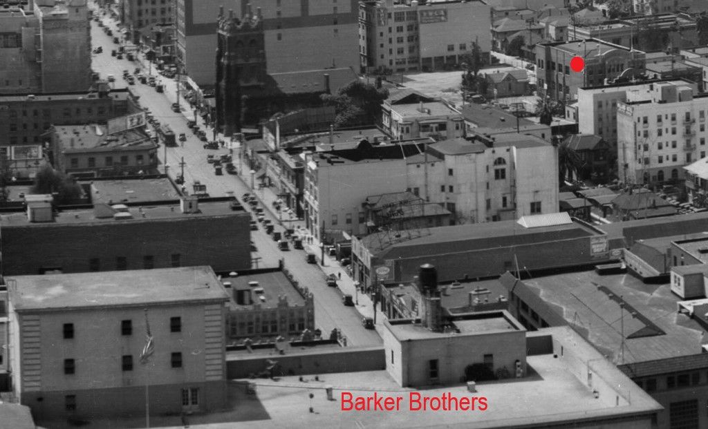 DW-SD-03-203-01_01
 @ USC Digital Library
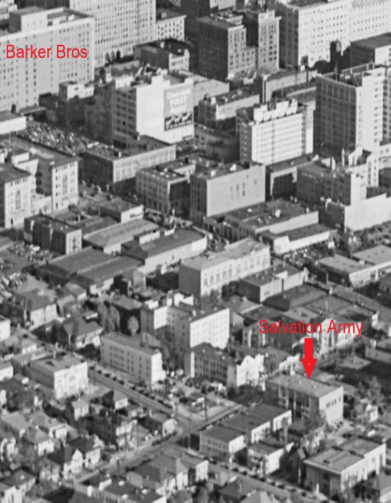
This 1940 aerial looks NE and shows the Barker Brothers and Salvation Army buildings. It looks like
e_r's photo was taken
from west across Cottage Place from the Salvation Army facility.
 dw-1940-01-00-011_02
 @ USC Digital Library
Here's the 1950 Sanborn Map showing 9th Street and Cottage Place, with the Salvation Army building at upper right.
LADBS records indicate the building stood from 1923-70. A new Salvation Army facility was built on the site in 1980:

ProQuest via Los Angeles Public Library


