I won't post everything all at once, so here's a glimpse.
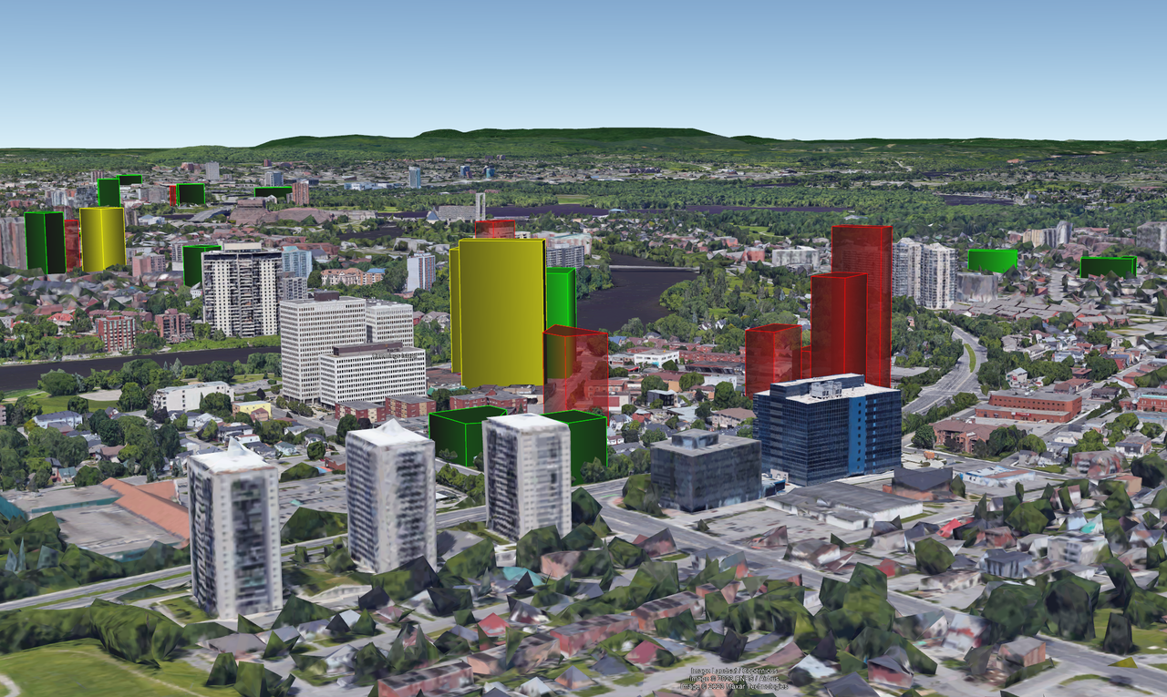
First one is Vanier, once an independent City, largely Francophone working class. It's right across the Rideau River from Rideau Street. Imagery also includes the east end further out (first pic) and proposals in the Rideau Street and Market areas (second pic).
Quote:
Originally Posted by Harley613

Alright folks, here is a sneak peak of what I have been working on.
All buildings heights exact when data available. When data is not available, I have interpolated as closely as possible. Let's just say these maps will be 95% accurate. I have a tonne of work left to do, so you will notice missing buildings in many shots until I finish.
Angle requests will be uploaded as soon as I have time!
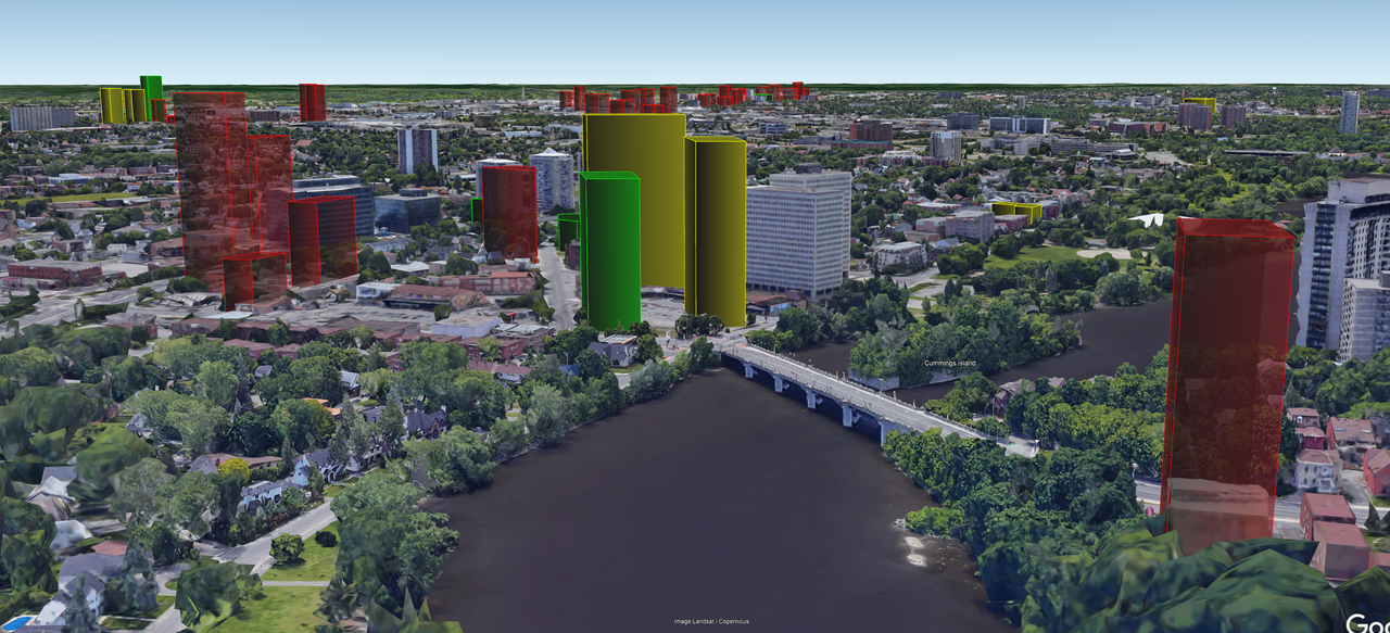
Legend:
Red - Proposed/Planned
Yellow - Approved
Green - Under Construction
Dark Green - Topped Out/Complete
Let's start with 'Downtown Vanier'!
 |
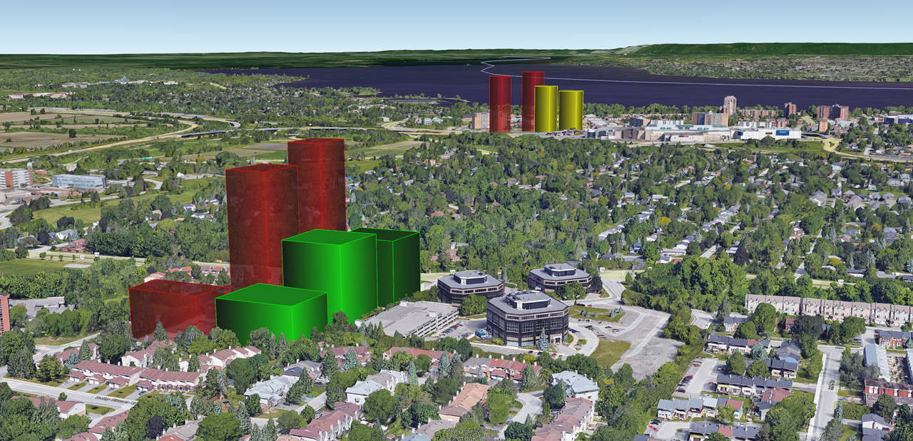
This one is the west end of Baseline (plenty of TOD for a BRT-lite that seems may never be built but continues to be used as justification for development) and Bayshore (closer to the river), an already dense area served by the Transitway, under conversion to O-Train.
Quote:
Originally Posted by Harley613
Future West End Gateway, Brigil Baseline in foreground, Bayshore in background.
 |
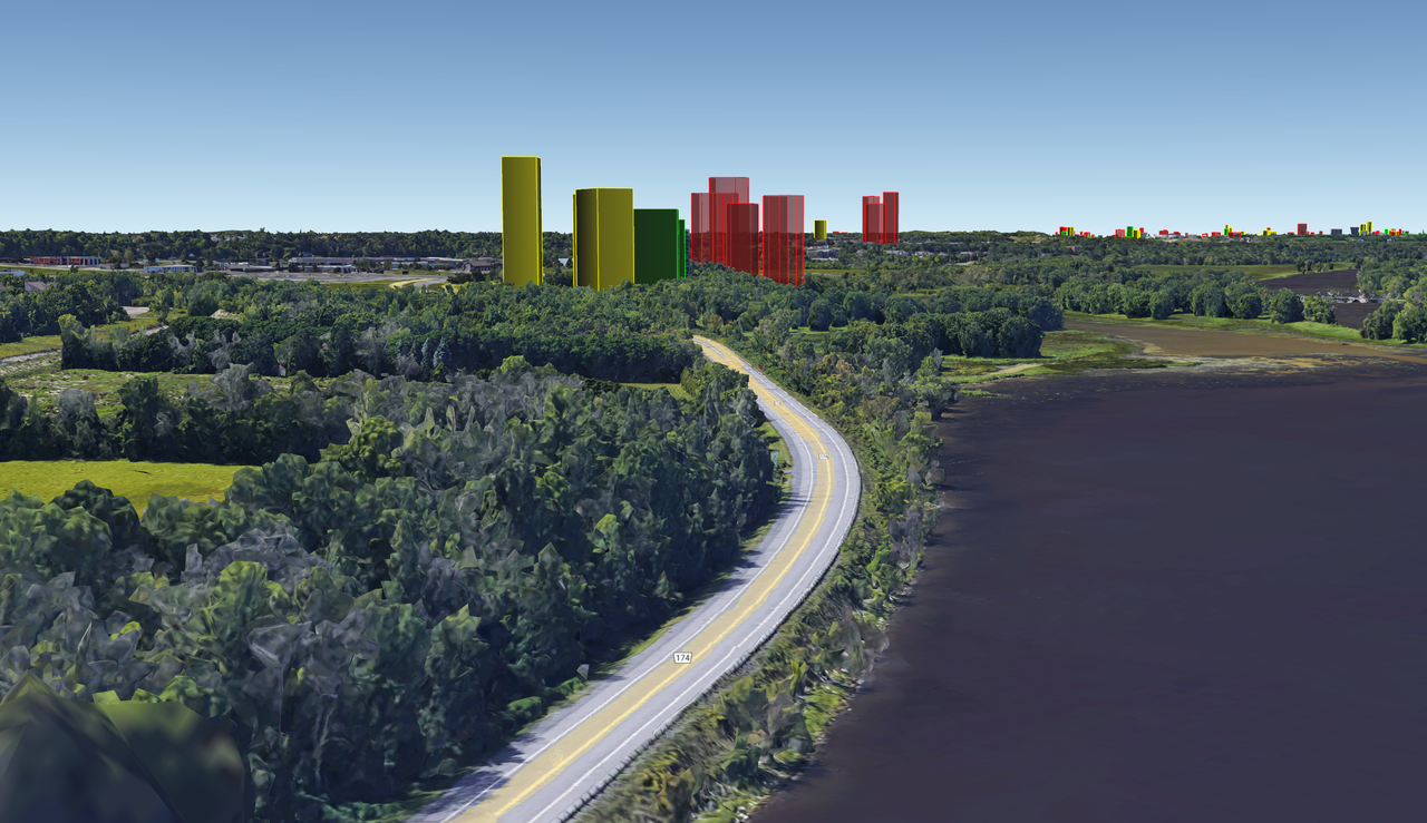
And Orleans, the eastern most suburb within the City limits. This coming into the City from Rockland (although you were actually already in Ottawa for over 10 km). This gateway is served by Trim Station, a park and ride that will soon be served by the O-Train.
Quote:
Originally Posted by Harley613
Future Orleans skyline coming in from Rockland
 |
Leaving the Downtown and LeBreton Flats future skylines for another day.


 Prev
Prev


 [/IMG]
 [/IMG]
 [/IMG]


 [/IMG]
 [/IMG]


 Hybrid Mode