Quote:
Originally Posted by ethereal_reality

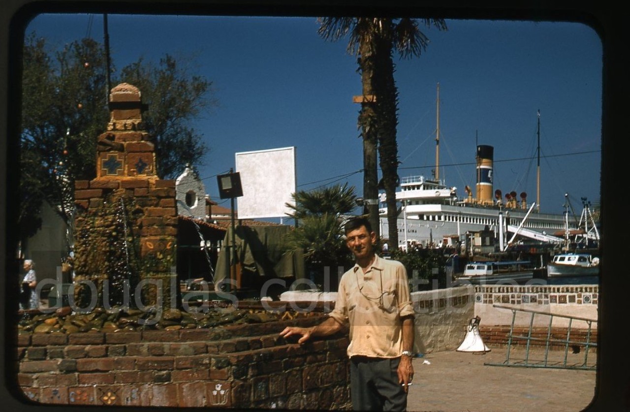
'mystery' fountain
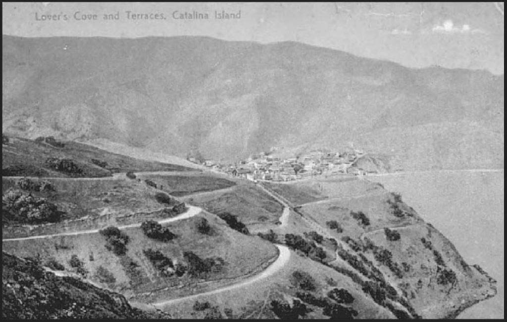
Since I've had Catalina on my mind the last dew days this slide from the 1950s caught my eye.
 EBAY
EBAY
What caught my eye is that rustic looking fountain. * Does anyone know if it's still there?
As you can see, it is somewhere quite close to the steamship pier.
I've been to Catalina twice, maybe three times, and I don't remember seeing this, rather large, impressive fountain.
*of course I was in my early twenties at the time, and a bit squirrely, so I might have just...walked right past the fountain) 
__
|
Oh, yes,
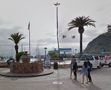
e_r, that fountain is still there, slightly rebuilt. (I happened to be there when they laid the last brick in the renewed surrounding paving.)
 gsv
gsv
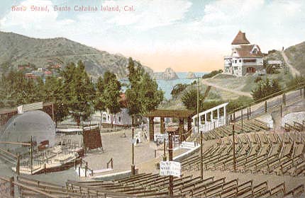
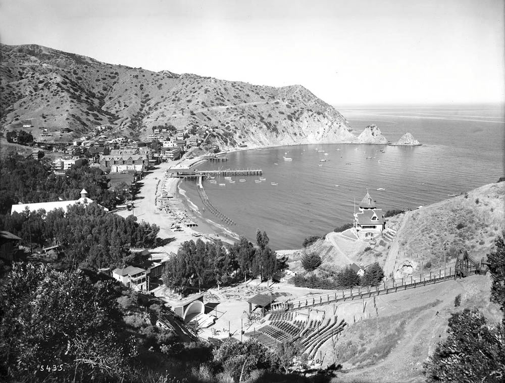
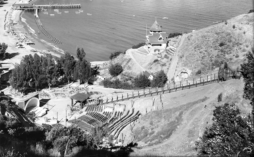
It has been there back to the beginnings of recorded history, by which I mean back to my first visits to Avalon in the late 50s; and probably a couple of decades before that. As you can see by the older pic, it was pretty much where the gangway off the steamer dock debouched the steamer's passengers; and it would serve as a meeting place, as in "I'll go buy the tickets for the Inland Tour, and you go pick up a bite to eat, and we can meet at the fountain at 2:30."
Avalon seemed a magical place to li'l odinthor, so different from the mainland. For those who did not experience it in the steamer days, at the steamer's original dock, let me describe how it was to come into port. As the steamer began to approach Avalon Bay, speed boats would jet out and circle the steamer in daredevil fashion--or so it seemed to us gawkers on board ship. A blast from the steamer signaled our arrival. As the ship docked, everyone would go to the side where the gangways were, and so the ship would list to that side. But meantime I would go to the front of the ship, as I would always have a feeling as if the ship was going to continue straight ahead, right up Sumner St. in the middle of town. When it
didn't, I'd go to where the passengers were tossing coins overboard for the swimmers to catch or dive and get. One would hear the rattle of the baggage carts on the planks of the pier, as the baggage was unloaded before the passengers would be allowed off. Then there was the press to get off the ship, walk along the pier, and onto
terra firma in Avalon, the ramp "aimed" pretty much at the fountain. A band would be playing songs reminiscent of imaginary old Spanish days, and the locals as well as visitors who had arrived previous days would be there to meet the steamer, the idea probably being that you'd likely unexpectedly meet someone you knew from the mainland. It was all thrilling, simply thrilling. At this point, my tale ends, as we leave the proximity of the fountain . . .


 Prev
Prev


 USCDL
USCDL


 .............


 Linear Mode
