Quote:
Originally Posted by ScottyB

Does anyone know where this "disheveled" adobe was located (description per USCDL)?
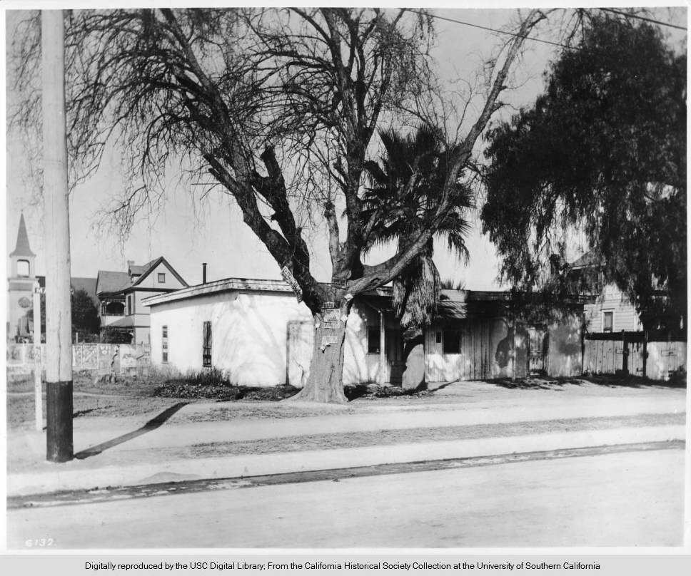 |
That's the Morris Adobe (aka Gonzales Adobe and General Fremont's HQ) at the NW corner of Main and Carr Streets.
Gonzales
might have built the place, but it was NOT Fremont's HQ, though it was widely advertised as such. At far left
in the photo above is a Seventh-Day Adventist Church, which is missing from the 1888 Sanborn Map but present on the
1894 Sanborn. Also, the two-story house behind the adobe's left/south side is not on the 1894 Sanborn, so my guess
is that photo was taken c. 1900.
Carr Street is now 14th Place, perhaps LA's only numbered
place that's north of the identically numbered
street. Twelfth
Street is north of Pico, which is the next street north of 14th Place; I guess when the city renamed Carr Street, no one
wanted 13th Street.
I think this undated photo (c. 1886?), with no phone line visible, was taken before the next photo:
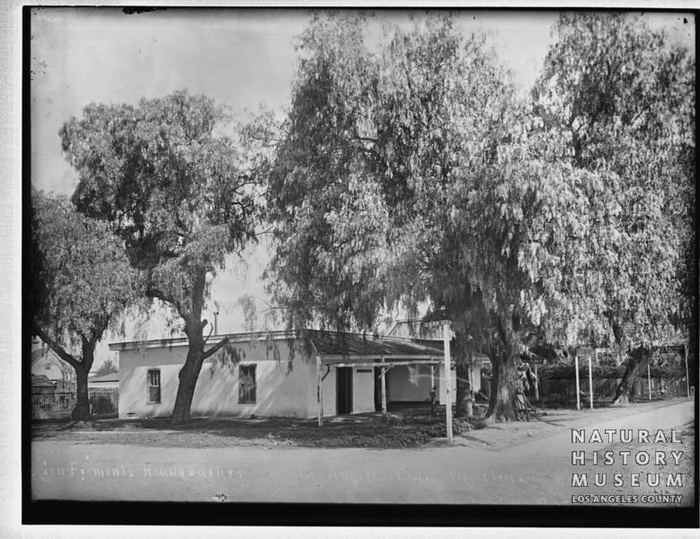
SCWHR-P-002.2-0400R @
Seaver Center
Maybe 1888?:
P-010-0117 @
Seaver Center
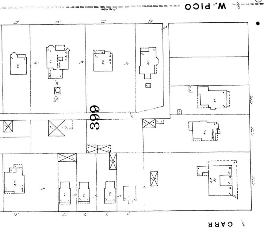
On the 1888 Sanborn, the adobe is at lower right with the angled patio corner that matches the two photos above:
ProQuest via LAPL
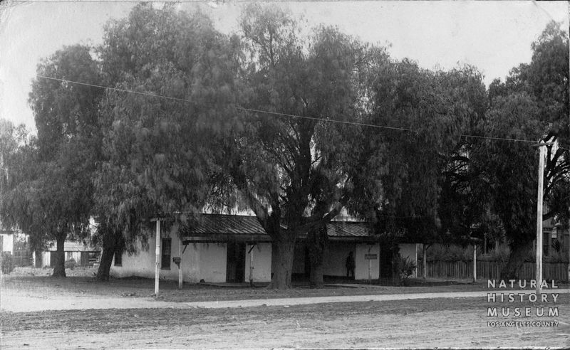
This one might be c. 1903, after some trees were cut:
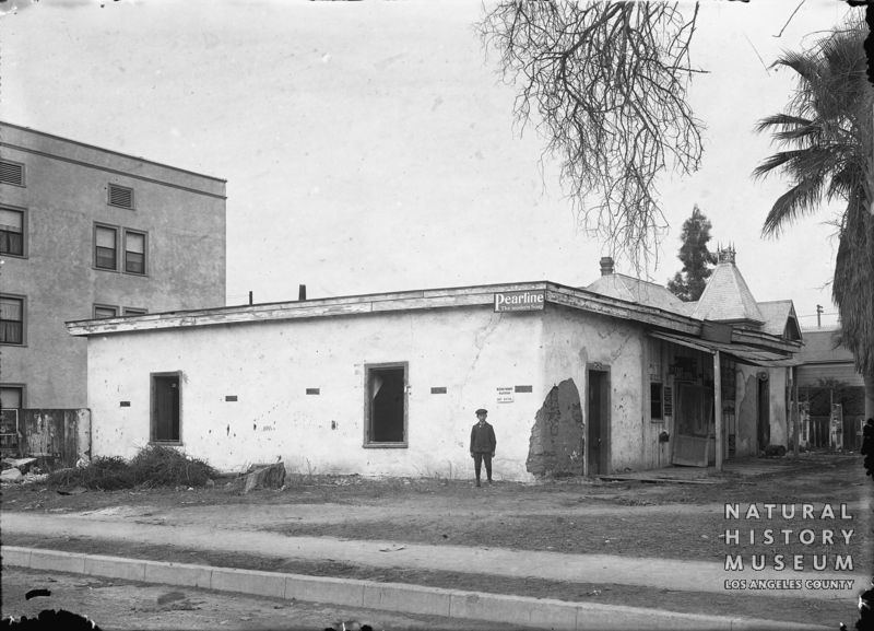
SCWHR-P-005-N0393 @
Seaver Center
The adobe is gone from the 1906 Sanborn, but we can see the apartments behind the adobe in the previous photo:
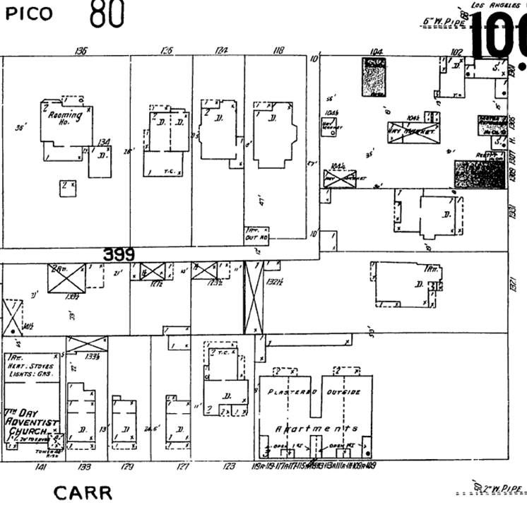
ProQuest via LAPL
I believe the flats on the Carr Street side, described in the last sentence below, are what we see at 109-119 Carr on
the map above and in the photo immediately above the map. I have no explanation for why the building described
below to be built facing Main Street is not on the 1906 Sanborn:
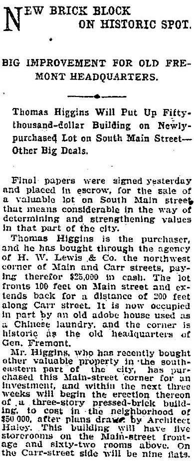
January 15, 1903,
Los Angeles Times: @ ProQuest via LAPL
The myth that the adobe at Main and Carr was General Fremont's HQ during the Mexican War was dubunked in the
obituary of
Morritz Morris, who gave his name to the adobe:
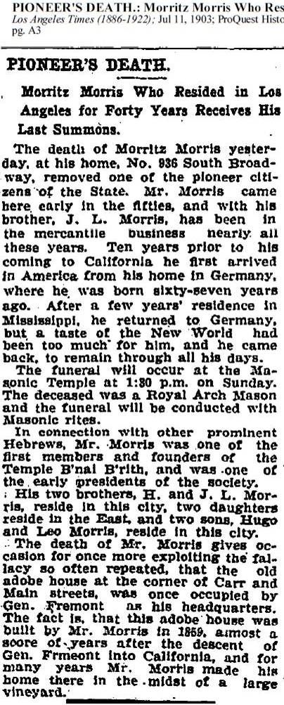
July 11, 1903,
Los Angeles Times @ ProQuest via LAPL
(This is the only source I found that connects Gonzales to the adobe) "Photograph of exterior view of adobe
home of Esteban Gonzales, 1886. The structure was built in 1857 by Esteban Gonzales (or Rodriguez) who also
made the brick for the house. About 1871 the land was subdivided and known as the Morris Vineyard tract.":
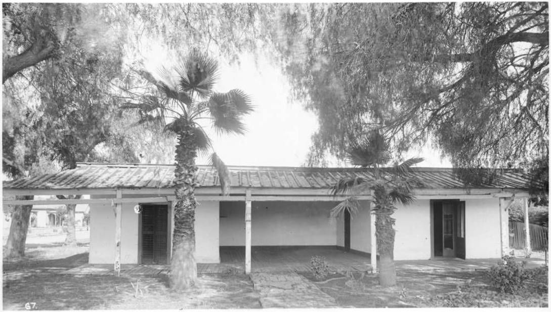
CHS-67 @
USCDL
The Morris Vineyard Tract, referenced above, can be seen on Stephenson's 1884 Los Angeles Map. Up by the
M in
Morris is the corner of Pico and Charity (Grand). Pine Street will become Venice Blvd. The two streets
with dotted lines are Main (at right) and Washington (lower left). I don't know when Mr. J. Carr entered the
picture, but that's where Carr Street came from:
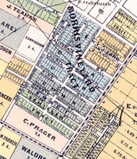 BigMapBlog
Perhaps Carr bought the property from Mr. Morris, who is last at his Main Street adobe in the 1873 LACD:

fold3.com
Originally, Morris' property stretched from Main to Charity/Grand and from Pico to Washington. The adobe is in the
lower right corner on this 1870 Morris Vineyard map:
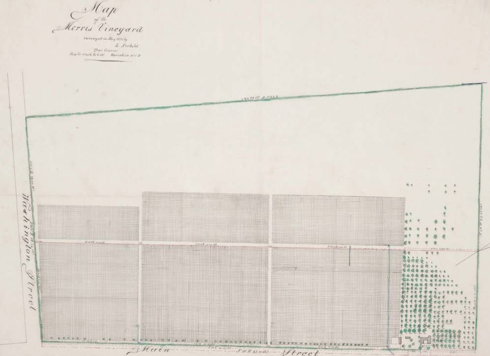
314768 @
Huntington Digital Library
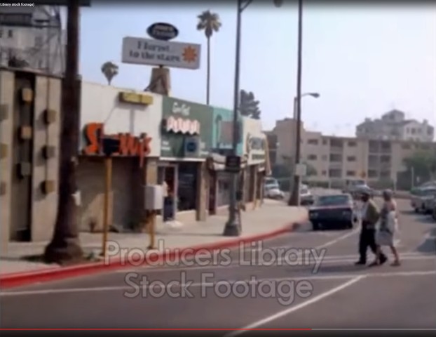
Here's the NW corner of Main and 14th Place (ex-Carr Street) in
June 2017.
I'd seen photos of this adobe before, but I never knew it was the Morris Adobe, so thanks for asking about it
ScottyB!


 Prev
Prev


 GSV
GSV


 I dig the inner courtyard of the original floor plan.


 Linear Mode
