HomeDiagramsDatabaseMapsForum About
     

Go Back   SkyscraperPage Forum > Discussion Forums > City Discussions


Reply

 
Thread Tools Display Modes


  #1  
Old Posted Oct 24, 2021, 4:31 PM
CaliNative CaliNative is offline
Registered User
 
Join Date: Sep 2016
Posts: 3,133
Quote:
Originally Posted by M II A II R II K View Post
Quote:
Originally Posted by Crawford View Post
I'm still confused why some believe the NY area is generally flat.

The entire region is hilly except for the coastal plains right on the Jersey shore and the south shore of LI. Even the coastal areas are hilly on the LI Sound. Really the defining characteristics of the region are hills and rocky outcroppings.
True. Pres. Teddy Roosevelt had a house at Sagamore Hill on Oyster Bay on the north shore of LI, and it is a hill. I think the Long Island hills are glacial morraines mostly. But the hills to the north and west of NYC are honest to goodness hills and low mountains, foothills of the Appalachians.

Same thing about Washington DC. A lot of people think its flat. And the tidal areas are. But all around the city, especially to the north and west are hills and low mountains. Capitol "Hill" is low, but the one a few miles north where they had the soldier's home during the Civil War is a real hill. Pres. Lincoln and family used to spend some of the summer there because it was a bit cooler than the city. Camp David maybe 20-30 miles northwest is on a low mountain, Catoctin, a genuine ridge of the Appalachians.

And the sunset picture of Chicago above could make a poster. Gorgeous.

Last edited by CaliNative; Oct 24, 2021 at 4:44 PM.
Reply With Quote
     
     
  #2  
Old Posted Oct 24, 2021, 4:38 PM
kingkirbythe....'s Avatar
kingkirbythe.... kingkirbythe.... is offline
Registered User
 
Join Date: Dec 2009
Posts: 2,595
Quote:
Originally Posted by Crawford View Post
I'm still confused why some believe the NY area is generally flat.

The entire region is hilly except for the coastal plains right on the Jersey shore and the south shore of LI. Even the coastal areas are hilly on the LI Sound. Really the defining characteristics of the region are hills and rocky outcroppings.
Because most people (Americans in this context because they are who I know) know very little about geography in general.
Reply With Quote
     
     
  #3  
Old Posted Oct 24, 2021, 4:43 PM
BG918's Avatar
BG918 BG918 is offline
Registered User
 
Join Date: Nov 2002
Posts: 3,553
Quote:
Originally Posted by kingkirbythe.... View Post
Because most people (Americans in this context because they are who I know) know very little about geography in general.
Very true. It isn't even taught in most schools anymore. Most know about their corner of the world and have pre-conceived notions about what the rest looks like.
Reply With Quote
     
     
  #4  
Old Posted Oct 24, 2021, 10:01 PM
Hudson11's Avatar
Hudson11 Hudson11 is offline
Registered User
 
Join Date: Aug 2011
Posts: 2,047
Quote:
Originally Posted by Crawford View Post
I'm still confused why some believe the NY area is generally flat.

The entire region is hilly except for the coastal plains right on the Jersey shore and the south shore of LI. Even the coastal areas are hilly on the LI Sound. Really the defining characteristics of the region are hills and rocky outcroppings.
Grand Central to Yorkville/East Harlem alone is a bit of a hike. You can have a nice, steady walk downtown, but a walk uptown in Manhattan is to be avoided if you're not looking for a workout. Uphill all the way.
__________________
click here too see hunser's list of the many supertall skyscrapers of New York City!
Reply With Quote
     
     
  #5  
Old Posted Oct 26, 2021, 10:21 AM
theOGalexd theOGalexd is offline
Registered User
 
Join Date: Dec 2016
Location: San Antonio
Posts: 451
Downtown San Antonio from about 20 miles out

dtsa by alexdskates210, on Flickr
Reply With Quote
     
     
  #6  
Old Posted Nov 3, 2021, 10:06 AM
JackWhite JackWhite is offline
Registered User
 
Join Date: Oct 2021
Posts: 2
Well, the best way for me to watch on a far distance city is through dragoneye. Regular cameras is cool, but as a fun of space and astronomy it's go-to way to watch all my favorite views
Reply With Quote
     
     
  #7  
Old Posted Dec 11, 2021, 2:16 PM
SAN Man SAN Man is offline
BANNED
 
Join Date: Nov 2021
Location: San Diego, California
Posts: 725
I saw this post and thought I would share Boatguy619's picture here. Tijuana's growing skyline in the foreground with San Diego's off in the distance. The TJ skyline is just south of the border, the brown rolling hills along the right margin of the photo are on the U.S. side of the border and within San Diego city limits. Pacific Gateway Park.

Skyline to Skyline are about 15 miles from each other as the crow flies. As for the location of the camera shot, I would assume at least 20 miles from Downtown SD.

Quote:
Originally Posted by Boatguy619 View Post
Reply With Quote
     
     
  #8  
Old Posted Dec 11, 2021, 2:55 PM
Obadno Obadno is offline
Registered User
 
Join Date: Jan 2010
Posts: 6,681
Reply With Quote
     
     
  #9  
Old Posted Dec 13, 2021, 5:37 PM
Streamliner's Avatar
Streamliner Streamliner is offline
Frequent Lurker
 
Join Date: Nov 2001
Location: San Diego, California
Posts: 583
^ Obadno, it would be helpful on these kinds of threads to mention what city this is. I'm not good at those "guess the skyline" quizzes so I have no idea what I'm looking at, or how far away it is.


Quote:
Originally Posted by SAN Man View Post
I saw this post and thought I would share Boatguy619's picture here. Tijuana's growing skyline in the foreground with San Diego's off in the distance. The TJ skyline is just south of the border, the brown rolling hills along the right margin of the photo are on the U.S. side of the border and within San Diego city limits. Pacific Gateway Park.

Skyline to Skyline are about 15 miles from each other as the crow flies. As for the location of the camera shot, I would assume at least 20 miles from Downtown SD.
Awesome picture. Looks like it was taken around here on Google Maps.
Reply With Quote
     
     
  #10  
Old Posted Dec 14, 2021, 12:13 AM
Spotila's Avatar
Spotila Spotila is offline
Map Guru
 
Join Date: Feb 2006
Location: New Zealand
Posts: 234
Quote:
Originally Posted by Streamliner View Post
^ Obadno, it would be helpful on these kinds of threads to mention what city this is. I'm not good at those "guess the skyline" quizzes so I have no idea what I'm looking at, or how far away it is.
Yea I had to think about that one for a while. Pretty sure it's Phoenix AZ looking from east to west
__________________
EZRD.info - Simple Movie, TV, and Game Release Dates

https://www.facebook.com/EZRDSocial
Reply With Quote
     
     
  #11  
Old Posted Dec 16, 2021, 2:14 PM
SAN Man SAN Man is offline
BANNED
 
Join Date: Nov 2021
Location: San Diego, California
Posts: 725
Mount Woodson

I took this yesterday from the summit of Mount Woodson.
Elevation 2,901ft on a chilly 45F afternoon.
As the crow flies, from the summit, it is 23.5 miles to Downtown San Diego and the Pinnacle residential towers in the East Village.
The islands are in Mexican waters and are about 44-48 miles away.
The tip of Point Loma is 28.4 miles out.

Can you spot DTSD, Point Loma and the islands?!?

Mt Woodson Summit by Manuel Sanchez, on Flickr


Bonus shot, Pinnacle residential towers in the East Village are 23 miles from Mt. Woodson summit, they're visible on the left side of the downtown cluster.
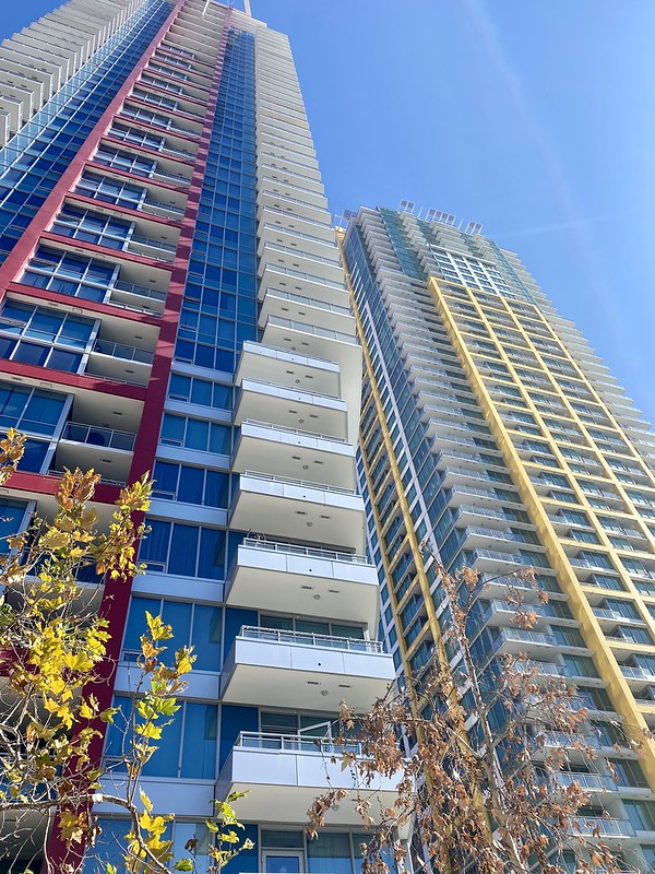
Pinnacle by Manuel Sanchez, on Flickr
Reply With Quote
     
     
  #12  
Old Posted Dec 16, 2021, 5:24 PM
edale edale is offline
Registered User
 
Join Date: Apr 2017
Posts: 2,298
Quote:
Originally Posted by SAN Man View Post
I took this yesterday from the summit of Mount Woodson.
Elevation 2,901ft on a chilly 45F afternoon.
As the crow flies, from the summit, it is 23.5 miles to Downtown San Diego and the Pinnacle residential towers in the East Village.
The islands are in Mexican waters and are about 44-48 miles away.
The tip of Point Loma is 28.4 miles out.

Can you spot DTSD, Point Loma and the islands?!?
no
Reply With Quote
     
     
  #13  
Old Posted Dec 16, 2021, 9:17 PM
SAN Man SAN Man is offline
BANNED
 
Join Date: Nov 2021
Location: San Diego, California
Posts: 725
Kate Sessions Park

This one is from Kate Sessions Park in the Pacific Beach neighborhood of San Diego.

Looking southward and in order from foreground to background you have Kate Sessions Park, Pacific Beach "PB", Mission Bay, Fiesta Island, Mission Hills/Hillcrest, Downtown 8.5 miles out, Coronado/SD Bay Bridge 9.6 miles out, high-rise cluster in Coronado 10 miles out, Tijuana on the hill in the distance approximately 23-28 miles out and faintly off in the distance the mountain range in Mexico is approximately 40 miles away.

Kate Sessions Park by Manuel Sanchez, on Flickr

For those who don't know who Kate Sessions is, she was an amazing woman especially of her time. Those of us that live in Southern California can thank her for our urban landscape environment.

https://en.wikipedia.org/wiki/Kate_Sessions
Reply With Quote
     
     
  #14  
Old Posted Dec 17, 2021, 12:13 AM
badrunner badrunner is offline
Registered User
 
Join Date: Oct 2016
Posts: 2,914
Found this great shot of the Southland on one of those rare unlimited visibility days.

Distances from the top of Mt Hawkins: DTLA - 32 miles, San Pedro Hill - 51 miles, Catalina Island - 75 miles, San Clemente Island - 110 miles, San Nicolas Island - 125 miles.


Source: https://youtu.be/sf2wjNfQ71s?t=393 <--- great channel btw
Reply With Quote
     
     
  #15  
Old Posted Dec 17, 2021, 12:48 AM
LosAngelesSportsFan's Avatar
LosAngelesSportsFan LosAngelesSportsFan is offline
Registered User
 
Join Date: Oct 2004
Location: Los Angeles
Posts: 7,861
Quote:
Originally Posted by badrunner View Post
Found this great shot of the Southland on one of those rare unlimited visibility days.

Distances from the top of Mt Hawkins: DTLA - 32 miles, San Pedro Hill - 51 miles, Catalina Island - 75 miles, San Clemente Island - 110 miles, San Nicolas Island - 125 miles.


Source: https://youtu.be/sf2wjNfQ71s?t=393 <--- great channel btw
I go hiking up in Angeles National Forest (mountains you see snow capped behind Los Angeles) often and the views from those peaks (up to 10,064 feet at Mt Baldy) are spectacular, especially on clear days. From certain peaks, you have 360 views from the ocean to the southern Sierra Nevadas. You even get great views from the first couple turnouts in La Canada, about 20 miles from dtla.
Reply With Quote
     
     
  #16  
Old Posted Dec 20, 2021, 8:57 PM
xzmattzx's Avatar
xzmattzx xzmattzx is online now
Registered User
 
Join Date: May 2006
Location: Wilmington, DE
Posts: 6,408
Quote:
Originally Posted by LosAngelesSportsFan View Post
I go hiking up in Angeles National Forest (mountains you see snow capped behind Los Angeles) often and the views from those peaks (up to 10,064 feet at Mt Baldy) are spectacular, especially on clear days. From certain peaks, you have 360 views from the ocean to the southern Sierra Nevadas. You even get great views from the first couple turnouts in La Canada, about 20 miles from dtla.
Which peaks can you access easily by car? Seeing a ton of southern California from a mountain top is one of the things I want to do out there some time.
Reply With Quote
     
     
  #17  
Old Posted Dec 21, 2021, 4:43 PM
LosAngelesSportsFan's Avatar
LosAngelesSportsFan LosAngelesSportsFan is offline
Registered User
 
Join Date: Oct 2004
Location: Los Angeles
Posts: 7,861
Quote:
Originally Posted by xzmattzx View Post
Which peaks can you access easily by car? Seeing a ton of southern California from a mountain top is one of the things I want to do out there some time.
You can take the angeles crest highway (2 freeway) lm la Canada (mile marker 26) all the way to about mile marker 60 or so right now, since there is a winter closure beyond that. Along the way, you will have the opportunity to pull over at multiple turn outs that give you amazing views of the city, mostly during the first 10 miles. Just be careful, it's a windy mountain road with a lot of motorcycle and car enthusiasts...

In regards to peaks, you can head to he Mount Wilson observatory for some cool hikes with views such as San Gabriel peak, Mount Lowe or to mount Wilson itself. If the road is open and you can get up mount Baden Powell, you can get to roughly 9500 feet with spectacular views of the la metro, and you can see pretty much to Mexico on one side and to the southern Sierra on the other. Mind blowing
Reply With Quote
     
     
  #18  
Old Posted Dec 17, 2021, 7:49 PM
SAN Man SAN Man is offline
BANNED
 
Join Date: Nov 2021
Location: San Diego, California
Posts: 725
Quote:
Originally Posted by badrunner View Post
Found this great shot of the Southland on one of those rare unlimited visibility days.

Distances from the top of Mt Hawkins: DTLA - 32 miles, San Pedro Hill - 51 miles, Catalina Island - 75 miles, San Clemente Island - 110 miles, San Nicolas Island - 125 miles.
That's a spectacular photo. I love these crisp winter days that follow a storm. Look at all the ships waiting to enter the port of LA/LB!
Reply With Quote
     
     
  #19  
Old Posted Dec 20, 2021, 8:45 PM
SAN Man SAN Man is offline
BANNED
 
Join Date: Nov 2021
Location: San Diego, California
Posts: 725
The distance is about 11 miles to downtown. Despite the haze, the picture does a good job showing just how hilly it is in San Diego. It also shows why the population density of San Diego seems low, it's nearly impossible to build a dense coherent and connected city. We have clusters of high density separated by natural features, federal lands, parks and water.

DT from Soledad by Manuel Sanchez, on Flickr
Reply With Quote
     
     
  #20  
Old Posted Dec 21, 2021, 7:09 PM
montréaliste montréaliste is offline
Registered User
 
Join Date: Jun 2010
Location: Chambly, Quebec
Posts: 2,006
Quote:
Originally Posted by SAN Man View Post
The distance is about 11 miles to downtown. Despite the haze, the picture does a good job showing just how hilly it is in San Diego. It also shows why the population density of San Diego seems low, it's nearly impossible to build a dense coherent and connected city. We have clusters of high density separated by natural features, federal lands, parks and water.

DT from Soledad by Manuel Sanchez, on Flickr
It’s such a buzz of a city do drive around. Beautifully set up for cruising in and out of nabes on the freeways, boulevards, and right sized too.
Reply With Quote
     
     
This discussion thread continues

Use the page links to the lower-right to go to the next page for additional posts
 
 
Reply

Go Back   SkyscraperPage Forum > Discussion Forums > City Discussions
Forum Jump


Forum Jump


All times are GMT. The time now is 2:37 PM.

     
SkyscraperPage.com - Archive - Privacy Statement - Top

Powered by vBulletin® Version 3.8.7
Copyright ©2000 - 2024, vBulletin Solutions, Inc.