I took some screen shots from Google Earth that I think do a pretty good job illustrating my point about sprawl in Freddy. All of them were taken at an elevation of 645 m, so the scale is the same with each.
For comparison, here's a shot of the North End in Moncton. Moncton's got pretty bad sprawl too, but when you compare how compact the new subdivisions in Moncton to the new ones in Freddy, you see a big difference.
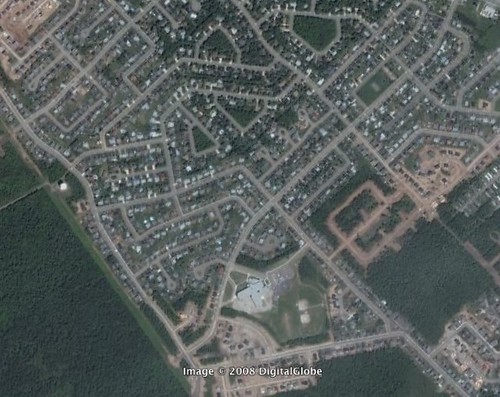
Here's a bad one east of the Nashwaksis on the North Side
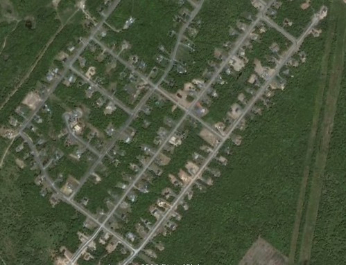
Here's a shot of Hanwell (I think). Anyway, it's off Hanwell Road

Even Skyline Acres and Forest Hill - both relatively new areas
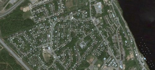
This is hardly scientific, but I think it shows just how badly Fredericton is wasting land.


 Prev
Prev


 Linear Mode
