Last fall, an adventurous bicycling group introduced me to the L.A. County Poor Farm. Also known as Sunny Acres, The Downey Insane Asylum, Hollydale Mental Hospital, and Rancho Los Amigos, the place has been mentioned on NLA a few times along with some photos. But the brief descriptions didn't really do justice to this huge, amazing facility. Incredibly, construction started in 1887, and many of the early structures still stand.
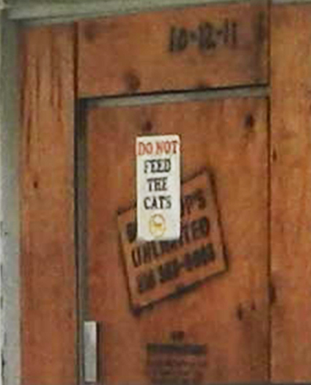
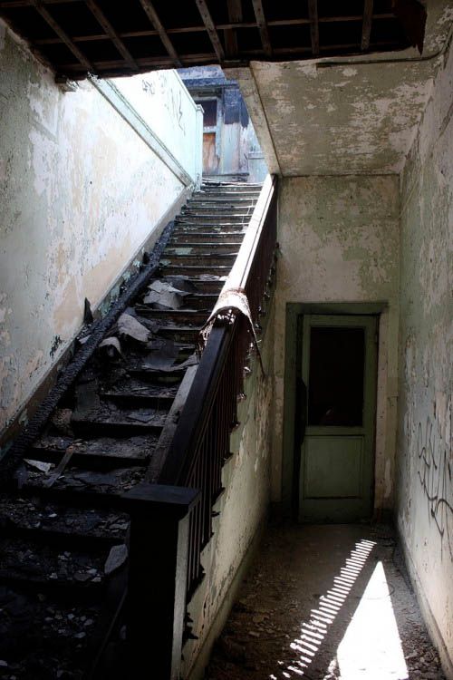
Lorendoc and I visited recently, under the near-constant eye of various security vehicles and guards. Without being there, it's hard to grasp just how big this place is, and how it seems to go on and on. It contains layers of history, is spread out, decrepit, quiet. Many of the buildings are fenced off and hard to see clearly. Dozens (hundreds?) of feral cats roam the fenced areas and seem well nourished, despite signs that state "DO NOT FEED THE CATS". Many of the buildings stand behind fences and locked gates, but others are more accessible and some even have open doors. It was obviously a very busy place, for a very long time.
Lots of articles about the Poor Farm can be found online, but many are confusing and don't portray the history of the place or its vast scale very clearly. But this 2013 L.A. Times article gives a quick overview:
The Poor Farm got its start in 1887 when the county purchased 124.4 acres and hired the team of architects who had designed the Pico House in the Olvera Street area, St. Vibiana Cathedral and USC's Widney Hall. They came up with a U-shaped design with a central courtyard separating female living areas on the north, male quarters on the south and a dining building at one end. The farm's first residents arrived by horse-drawn wagon in December 1888. During the 1890s, the population grew from 125 to about 200 indigents, most over age 60. The farm quickly expanded to 227 acres. In its day, the county Poor Farm was an anomaly. A 1902 story in The Times described the place as "wrapped in sunbeams and wreathed with flower gardens." "The Los Angeles County Poor Farm visibly resents the incongruity of it name," the story said. "The delightful innovation of housing the homeless and unfortunate in such environments belongs exclusively to Southern California, for no other part of America bears record of having done likewise."
The Times' account explained that the farm operated with an eye toward being self-sustaining, not profit-oriented. "There is no intention of going into extensive agriculture for financial profit because such an arrangement would bring pauper labor into competition with the farmers," it stated Still, the farm raised $10,061 in 1901 from the sale of oranges, livestock and dairy products, the report said. Operating costs that year totaled $32,914 -- or about 341/2 cents per day for each of the farm's residents. The story described male residents' living quarters as "immense," with as many as 30 beds along the walls. Three men's wards opened to a central courtyard, and each resident was provided with bedding, a chair and a small bed stand. There was a large reading room filled with several hundred books "for those who can read," the story reported. Another building housed female residents. By 1910, the Poor Farm covered nearly 400 acres. A Times report that year described the farm's four main brick buildings as being shaded by evergreens and palms. "At first glance the place might be thought a comfortable, old-fashioned country mansion." The paper noted that the farm's newest building -- "the insane ward" -- was a one-story structure that housed 25 "harmless" patients.
The Poor Farm was renamed "Sunny Acres" in 1931 by officials seeking a "less odious name," as one county supervisor put it. The farming operation was phased out in the '30s when President Franklin D. Roosevelt's social welfare programs kicked in.
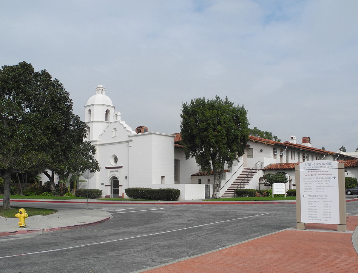
The place operated as the Rancho Los Amigos hospital for chronic illnesses until the 1950s, when a polio epidemic turned it into a rehabilitation center. Today, the farm's remaining 212 acres are split in two by Imperial Highway. The Rancho Los Amigos National Rehabilitation Center, one of the country's top spinal injury and stroke treatment facilities, is on 48 acres north of the highway. To the south, much of the remaining 164 acres has been redeveloped, although the actual Poor Farm structures remain -- at least for now.
The Poor Farm property, known to some as the Rancho Los Amigos "south campus," is tentatively planned to become the site of a county office building, according to county analyst Hannah Chen. Although those plans are probably several years off, the remaining buildings are so old that they're now unsafe to even enter. "But you see something like this sitting vacant and it breaks your heart. I don't think it's impossible to make this into a habitable place again," Atkinson said. "We already have this built and paid for."
http://www.latimes.com/
Another Times article adds this nourish footnote:
The macabre tale began Wednesday morning on the grounds of the Rancho Los Amigos National Rehabilitation Center, the noted county hospital in Downey, where a group of U.S. Marines were using abandoned buildings as part of a military exercise.
The troops spotted a freezer inside one of the buildings. Upon opening it, they discovered a package full of mummified body parts. David Sommers, a spokesman for Los Angeles County Supervisor Don Knabe, whose district includes the hospital, said the freezer was in what was once a hospital morgue.
On examination, a pathologist said the parts were amputated medical specimens and not the result of foul play. Hammond said the county-owned building hadn't been used for 25 years or so.
http://www.latimes.com/
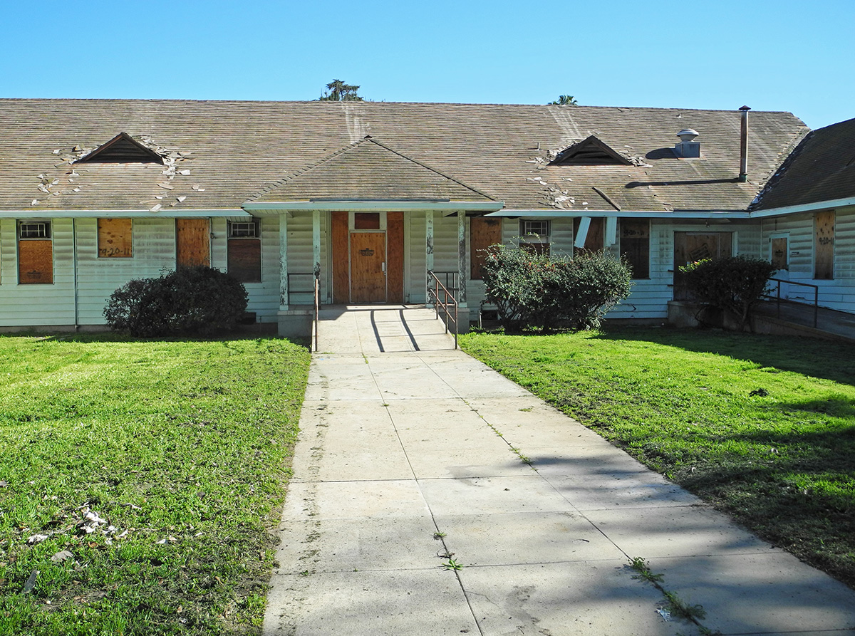
The facility straddles Imperial Highway, just east of the L.A. River. Nearly all of the early buildings are south of Imperial -- all of these are abandoned now; most are boarded up. The structures on the north side are more modern, and most of those are still in use. Lorendoc and I walked around the older section for quite a while, and a couple weeks later I returned for more photos. Here are a few, along with some vintage images.
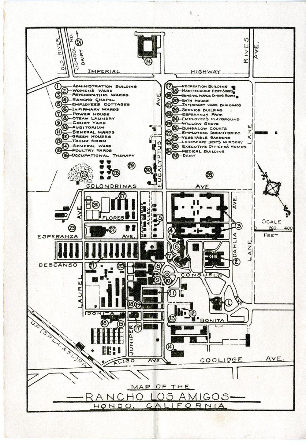
This great map from about 1930 gives a nice overview and identifies the major structures. Note that the locale is identified as "Hondo", named after the Rio Hondo, which is a tributary of the L.A. River.
 http://www.lapl.org/
 (not available online)
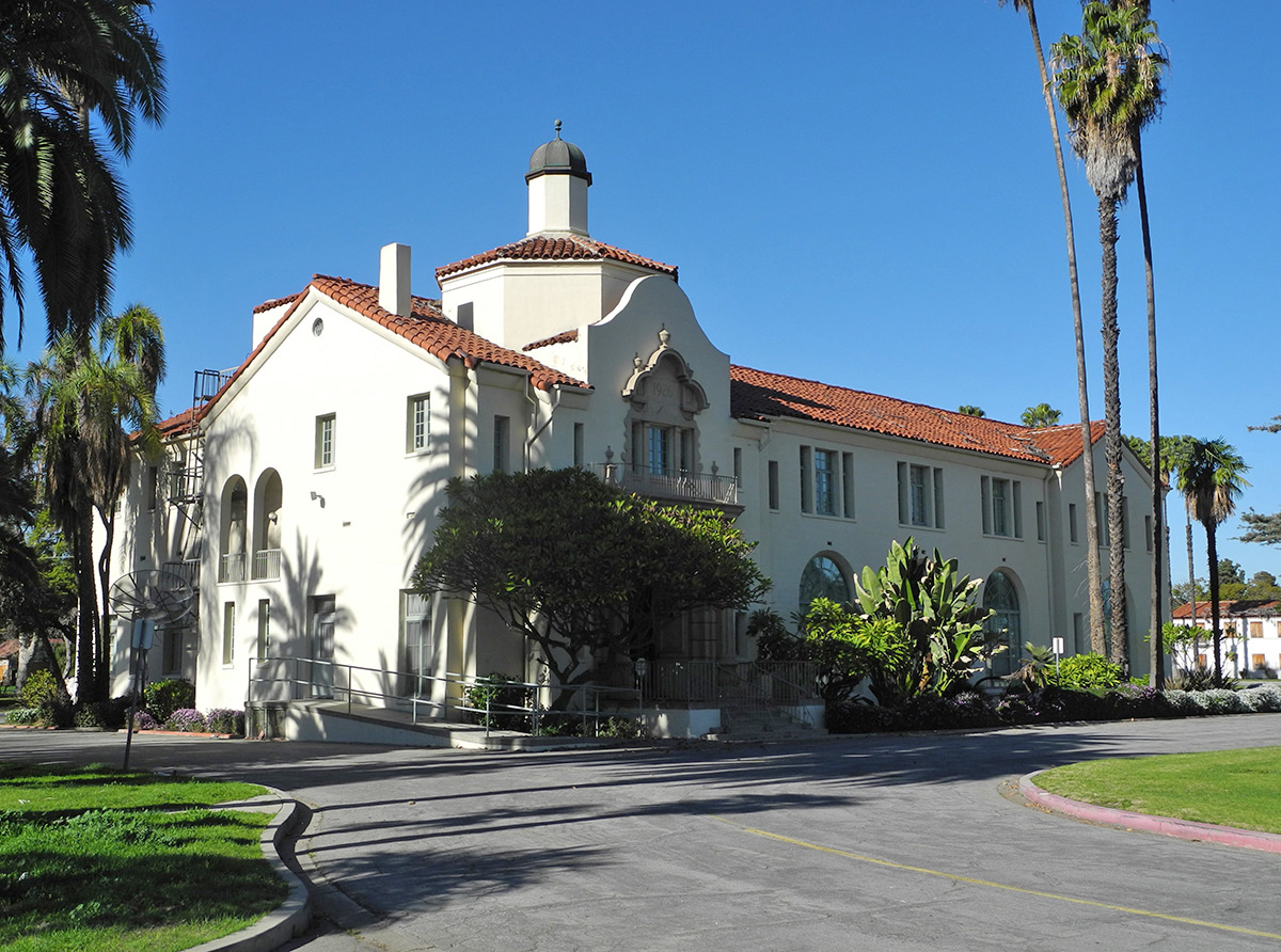
Then and now of the Administration Building on Dahlia Ave. near Bonita St:
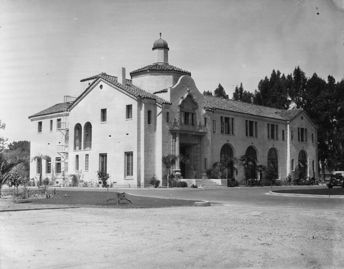 http://jpg3.lapl.org/pics46/00072850.jpg
And the Medical Building, on the north side of Imperial Highway:
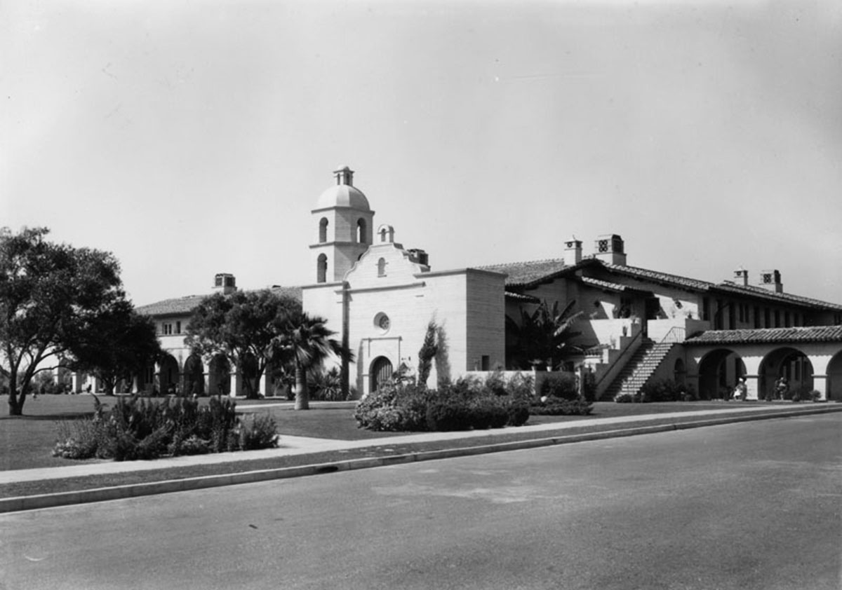 http://jpg3.lapl.org/pics46/00072834.jpg
An early, undated photo of the "psychopathic wards" on Erickson Ave.
I'd like to get a now version of that shot, but haven't quite figured out where it was taken from. Here are a few photos of those buildings though, starting with this view of Flores St., looking north from Erickson (Eucalyptus on the early map). The larger north psychopathic ward is on the left, the smaller southern section is on the right.
On Erickson Ave., looking towards the southern psychopathic ward.
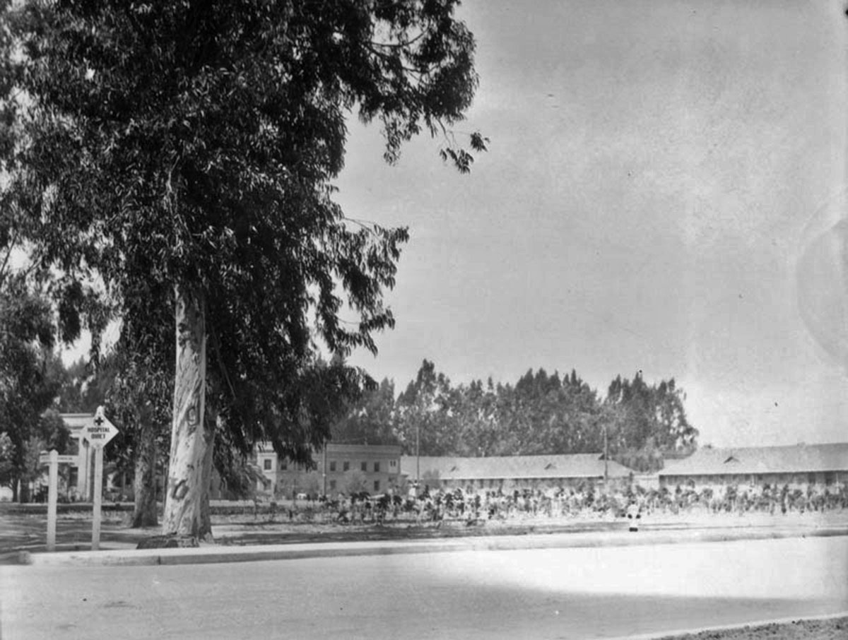
"Infirmary Row" in 1929:
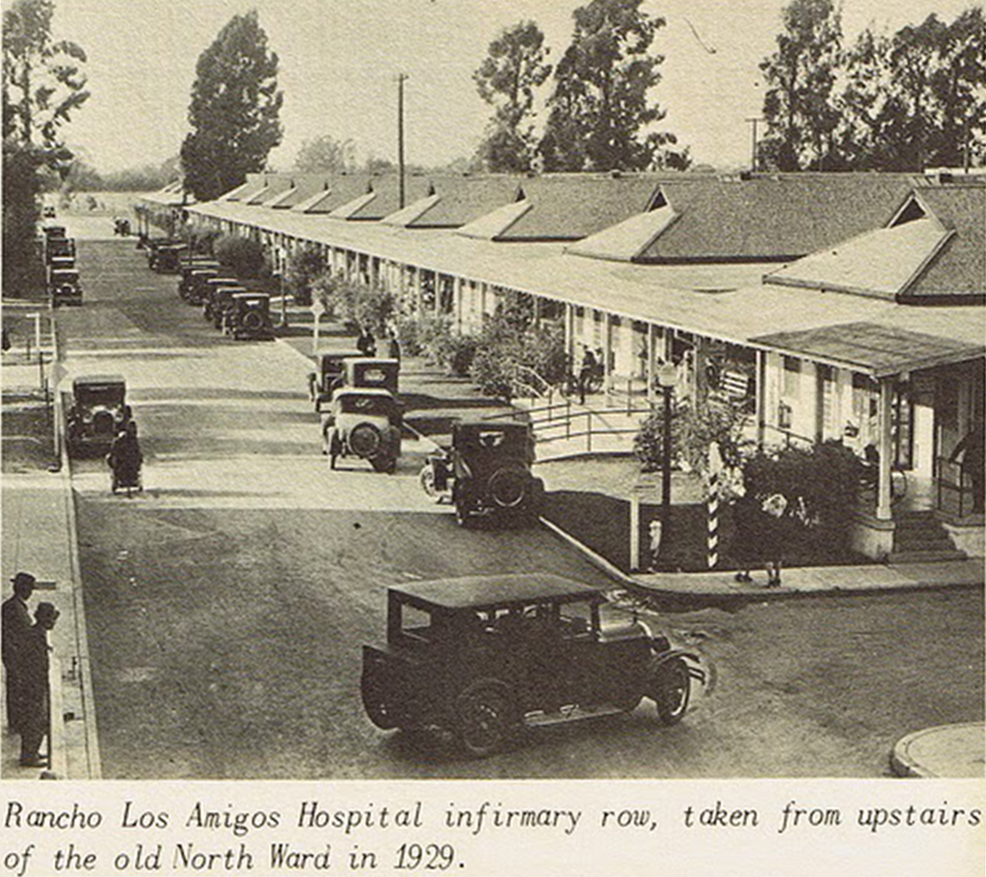 http://www.latimes.com/
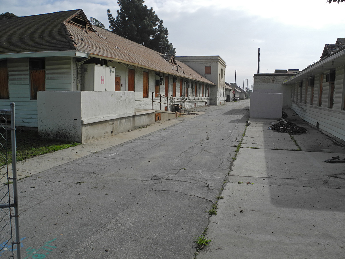
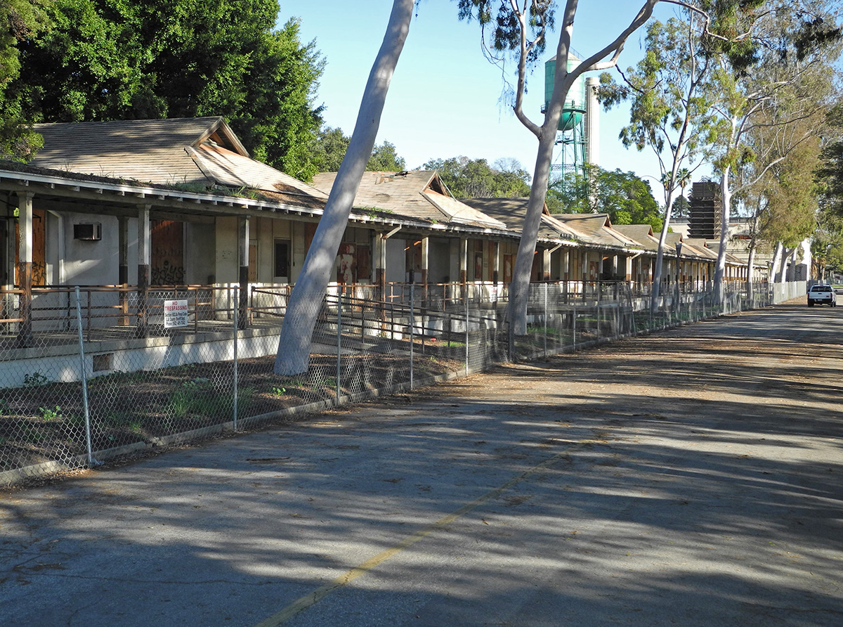
And my photo of those buildings, taken from the other end of the lane:
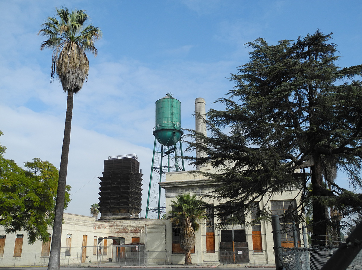
I was interested in the water tower, chimney, and especially the old wooden tower in the distance. Here's a view of those structures from Erickson Ave. The wood tower was associated with the early "power house" (on the right, partially blocked by the tree) and was used to condense steam from the turbines.
Some of the dozens of iron lungs in the polio ward, 1954:
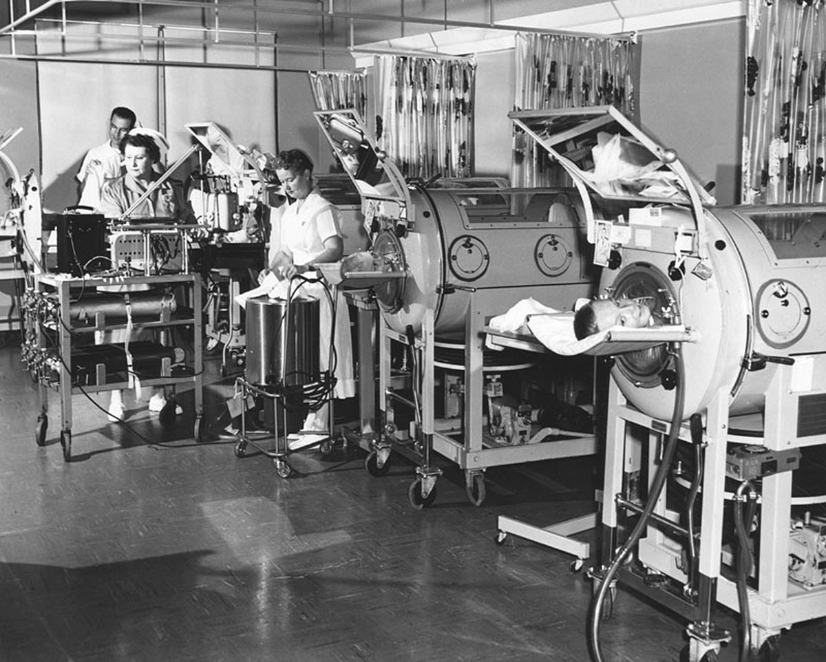 http://jpg2.lapl.org/pics25/00047242.jpg
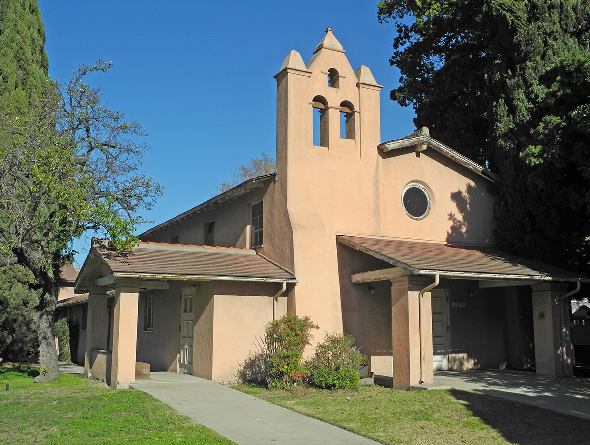
The chapel:
And if you ever visit this place, remember:


 Prev
Prev


 Amazing post 3940dxer!


 Linear Mode
