Quote:
Originally Posted by UrbanImpressionist

Hey Vkristof (or anyone else) know what's going on here? It's a frequent (annoying) nightly occurrence. Are these vacuum trucks? Sucking crud out of the sewers/drainage? :
 |
Please note that I am NOT a PE (Professional Engineer) nor a CE (Civil Engineer), though I do have a couple of friends who are.
The photo you have posted is of a couple of the Guzzler industrial vacuum loaders in action. These trucks are seen parked in in staging areas in other photos of the overall Hudson Yards.
Markcomm copy from the About Us page for GUZZLER: "
Guzzler is the world's leader in industrial vacuum loaders that efficiently clean up industrial waste or recover and recycle valuable raw materials"
So the short answer to your two questions is "Yes." I would also expand the answer a bit by noting that "recover and recycle valuable raw materials" could be applied to the track ballast in the rail yard, which needs to be removed in areas that will be excavated/drilled.
Please keep those photos coming.
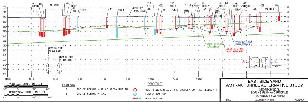
One of the Amtrak Gateway Tunnel box studies I skimmed was co-authored by Parsons Brinkerhoff, who is HQed @ the very nearby One Penn Plaza. According to this the water table is not far below ground surface of the yard. In addition, the storm sewers are divided into two sections due to the existence of the Empire Line Connection tunnel under the ERY.
From Nov 2012 Study, 11th Ave on left, 10th Ave on right:
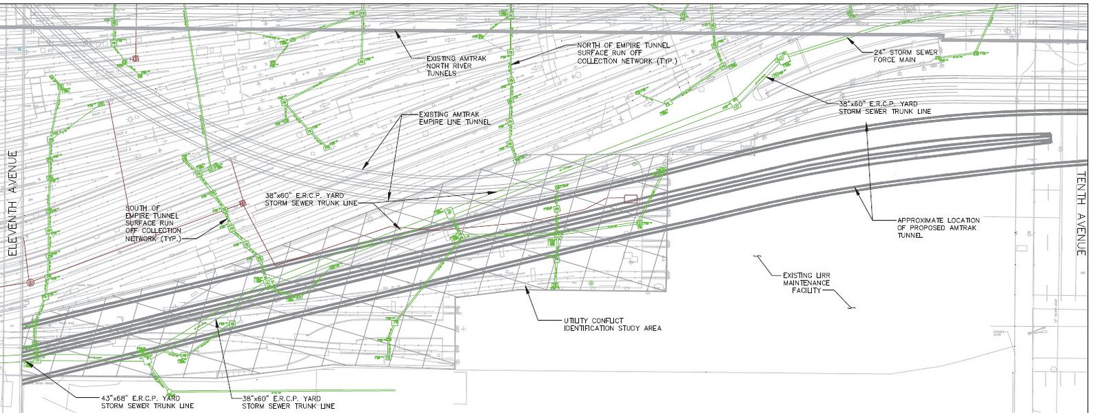
Note also that part of the rail yard is defacto floodplain - the existing Amtrak Hudson River tunnel that flooded was due to SS Sandy storm surge from the Hudson River flowing east through the northern part of the rail yard, under the 10th Ave viaduct and then into the tunnel mouth under the AP building. The existing storm sewer system in the yard was inadequate to deal with the storm surge.
I also safely assume there is a decent amount of industrial pollution in this area. The 1865 Viele map snippet below shows that this area was ~half "made land"/landfill (light brown) and ~half meadow in the mid1800s. 11th Ave is the western most Ave in the snippet and is mostly made land.
9th Ave is on the right edge and the current 12th Ave was the Hudson River.
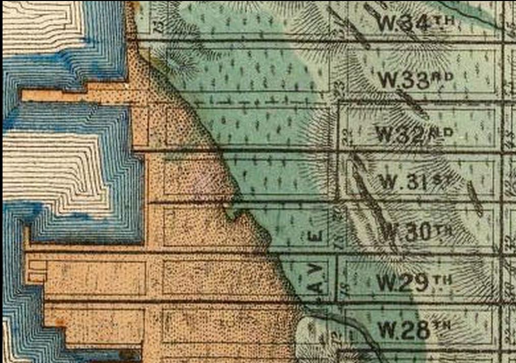
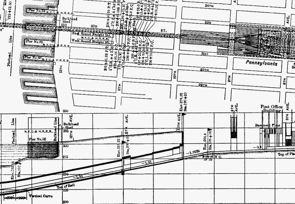
The 1874 update to this map shows the NYCentral and Hudson River RR running down 11th ave and curving to the east into this area/snippet. One spur runs east between 29th & 30th, another spur runs between 30th & 31st. The original LIRR yard design drawings date from 1982, BUT this area has had more than a 140 years of industrial activity/waste/pollution.
"Nightly occurrence" makes sense due to the various contractors and subs having to coordinate their work with the LIRR operations in the storage yard. The contractors/subs would be those for Amtrak (tunnel box) and Related/Oxford (platform over ERY).
I also ASSUME that some of the platform foundation work will involve drilling between the existing, operational LIRR tracks. I have seen recent photos of what I call a drill rig on the north side of the ERY.


 Prev
Prev


 Linear Mode
