Not answering the question, but just adding data:
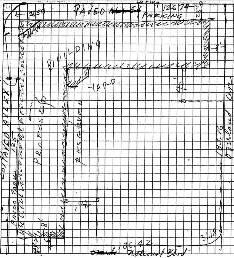
The grading and building permits for the building at 2999 Overland Ave. are dated 1/5/1978, and include this image:
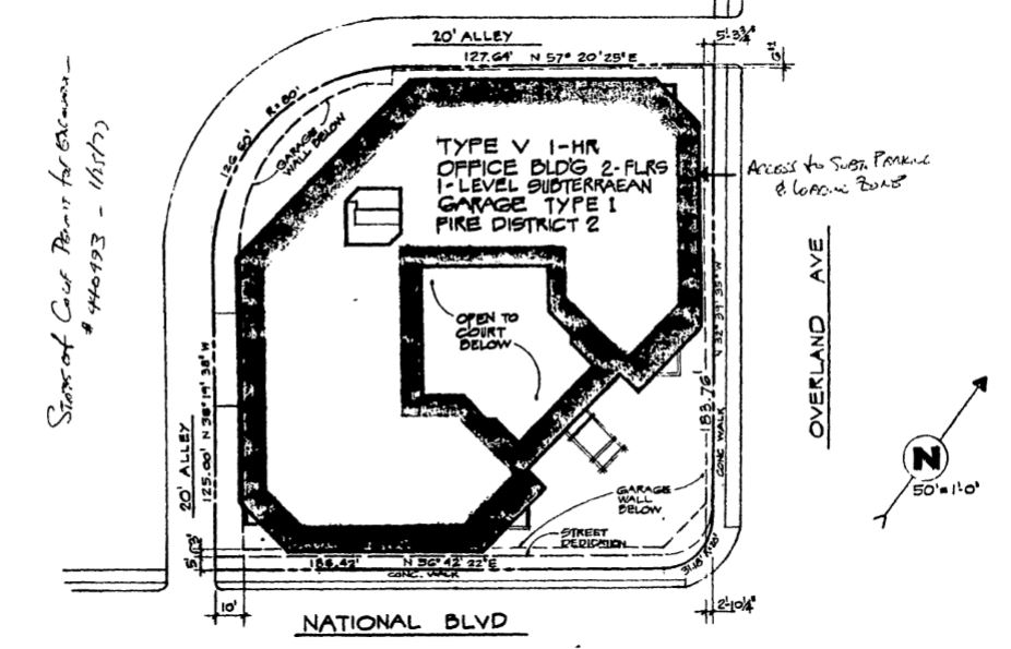 LA Building Records System for this address.
The 1942 Renié map--or at least a detail from same--for this area is:
 Renié Atlas of Los Angeles, 1942 ed., map 41 detail
It appears to be part of this parcel:
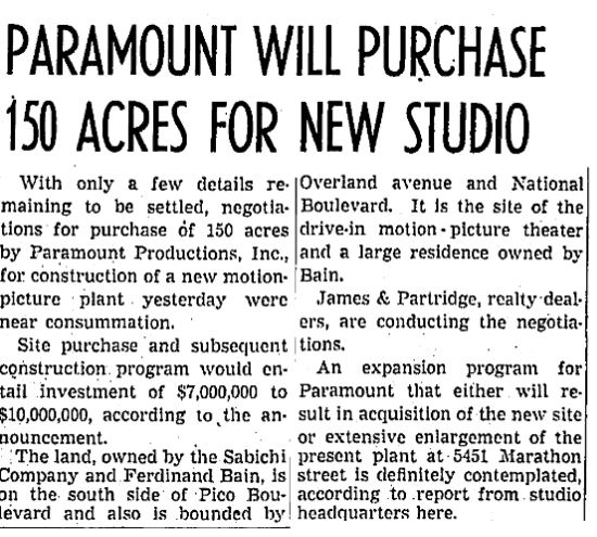 LA Times, 7/10/1937
Perhaps this is the corner before it was developed at all...?
 LAPL #00068319, from series of photos of La Lomita Ranch


 Prev
Prev


 ...wink


 Linear Mode
