There's an abandoned tunnel, or "concrete structure," under the northernmost runway at LAX. I believe it was begun as part of a subterranean roadway that would have connected Lincoln Blvd. just north of LAX with Main Street in El Segundo.
I haven't been able to find a single photo of the tunnel or contemporary news story about it, and the folks now at LAX aren't especially anxious to talk about it. One airport official denied that it even existed, despite being told by a lady that she'd visited the tunnel under construction while on a field trip in school!
But the tunnel is there, and here's LAX's description of its history, condition, and partial location:
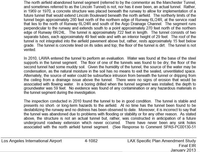
LAX SPAS Final EIR Jan 2013 (big PDF file) --
http://www.lawa.org/uploadedfiles/sp...2013-01-25.pdf
Here's how an LAX employee described the tunnel:
"The tunnel is actually four to six car lanes wide and is only accessible by a man hole. You have to drop down about 10 feet into the man hole then carefully climb down a small re-bar ladder another 20-30 feet. Once in the tunnel it is pitch black, a dirt floor, Pepsi cans from the 60’s scattered, and very cold. When you reach the end, there it is a giant concrete wall where they had stopped construction. The tunnel undergoes periodic inspections for structural integrity and after every earthquake."
From:
http://www.think-dash.com/2012/03/in...x-airport.html
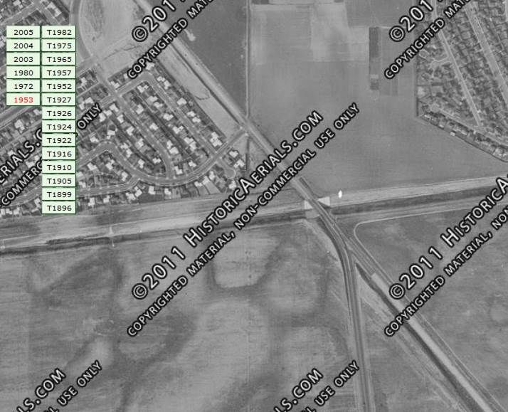
Well yeah OK but we'd like to know more. I think we know roughly where the not-a tunnel is. Here's the area in 1953:
Historic Aerials.com --
http://www.historicaerials.com/
Left to right across the center of the photo is the Argo Drainage Channel. Lincoln Blvd. runs from top left to lower right and crosses the channel over a bridge. The street that ends in a cul-de-sac near the center of the photo is Colegio Drive; parallel and to the left of Colegio is Loyola Blvd. Ninety-fourth Street ends at Lincoln just east of Colegio.
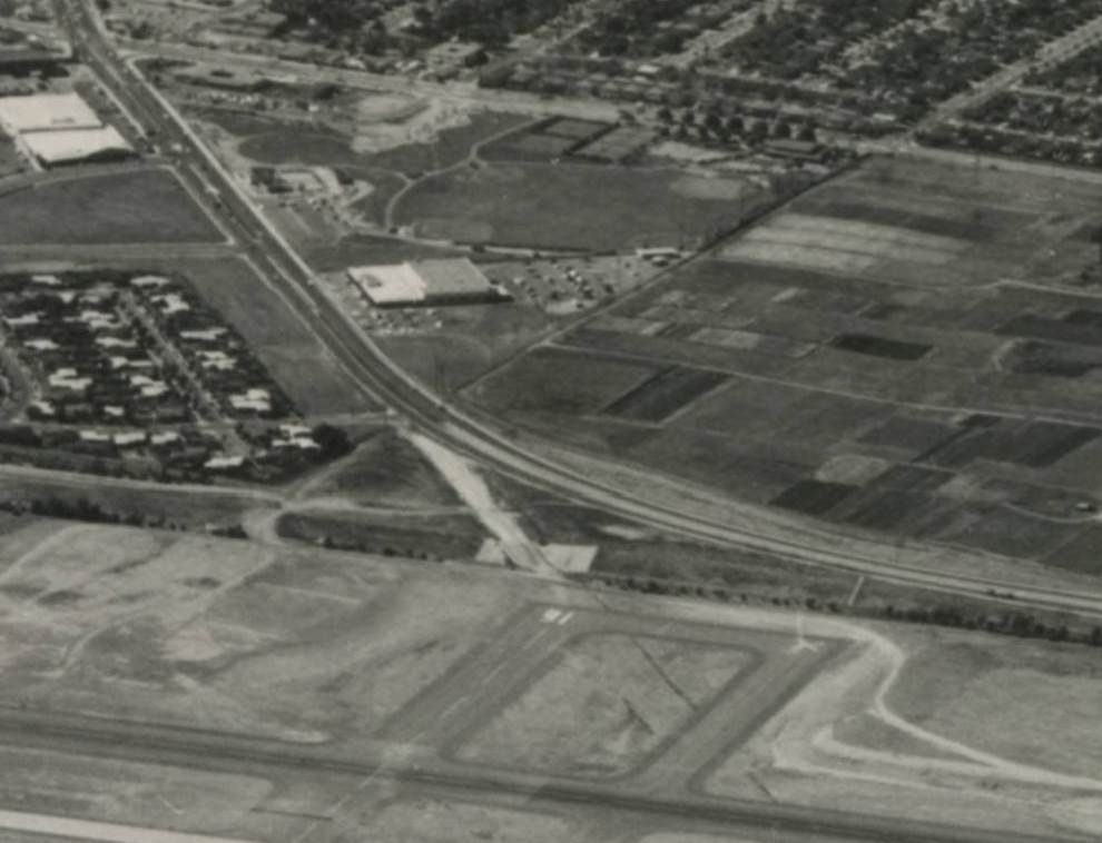
1963; Lincoln has been re-routed around the north side of the expanded airport but the old bridge remains:
LMU Digital Library --
http://digitalcollections.lmu.edu/cd.../id/1409/rec/1
1972; was the disturbed area between the Colegio cul-de-sac (where some homes have been removed) and the old alignment of Lincoln a staging area for the aborted tunnel project, or was it where the road leading to the tunnel would have gone? Or both?:

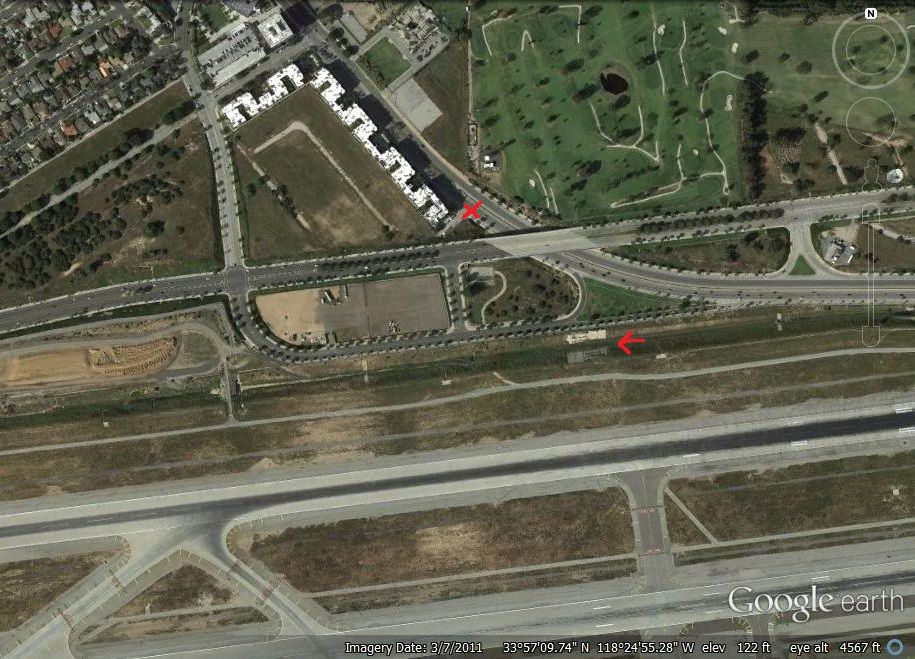
2011 aerial view; the arrow points to the site of the old Lincoln bridge over the Argo channel, and the X marks the rump stub of 94th Street. South of the Argo channel on the LAX north airfield, Runway 24R is at the top, with 24L below; the service road must be the prominent light gray line between 24R and the Argo channel. Loyola Blvd. has been rerouted and now connects with a new major east-west street, Westchester Parkway:
Google Earth
How the white-roofed condos/apartments got built after the houses surrounding them were torn out because they were too close to the airport is something I still haven't figured out.
If the tunnel stops 270 feet north of the north edge of Runway 24L and goes north for 722 feet -- 280 feet north of the north edge of 24R -- would that really be
at the service road? Both runways are 150 feet wide, if that helps anyone who wants to take a stab at this. Knowing exactly where the tunnel is east/west-wise would be nice too.
Oh and here's the site of the old Lincoln Bridge in 2013 (and if he'd held still instead of running away, you'd see a fox in the photo as well). Sorry but LAX has a fine mesh on their fence:
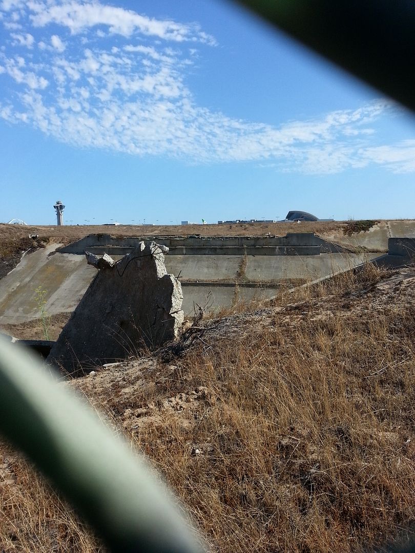
Photo by me


