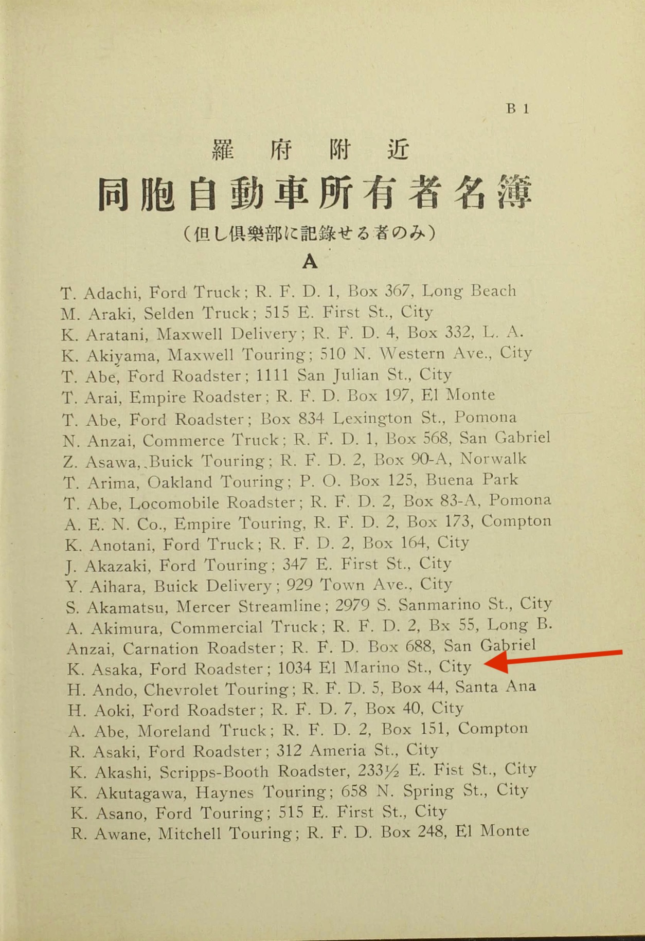
I realize this isn't a photo of the city but it is related to older Los Angeles places. The scan above is from the 1918 Japanese Auto Club of Southern California member book. Specifically, it's the first page of the member list for the Club and it includes people's names, the car they owned at the time, and a mailing address.
I'm trying to map all the member locations but I'm running into a situations where some of the street addresses either 1) don't exist anymore because those roads have been renamed or were developed over or 2) they were entered wrong to begin with (typos).
So, for example, there's an arrow there pointing to a street address of "1034 El Marino St" in Los Angeles but in consulting old maps of L.A. from 1920, I can't find an "El Marino St" listed anywhere. Closest I found in a 1921 Baist street index was "
El Moleno" (I haven't been able to find where that is on the Baist map but I think it's somewhere mid-city).
A friend of mine found a 1947 newspaper clipping where someone living on an El Marino Street in the La Crescenta area was quoted but in looking at a
vintage map of the La Crescenta/Montrose area from that era, there was an "El Moreno" street but not "El Marino".
Likewise, I thought maybe they meant San Marino St. but other addresses in the same member guide are listed as being on "Sanmarino St" and more to the point, in modern L.A., there aren't any "San Marino St" addresses that go as low as 1034.
And just to complicate this further, in both the
1920 and
1922 L.A. City directories, "El Marino" shows up as an address in both places, but only once in each case (and not for the same person/business).
So...I'm hoping folks here might point me to any other resources I could check out. I found this forum specifically because I was trying to figure out where "312 Ameria St" was in L.A. and that was a typo: they meant "312 Amelia St" which is located in present day Arts District and called N. Garey now. So thank you all for that!


