Quote:
|
Originally Posted by oldstuff
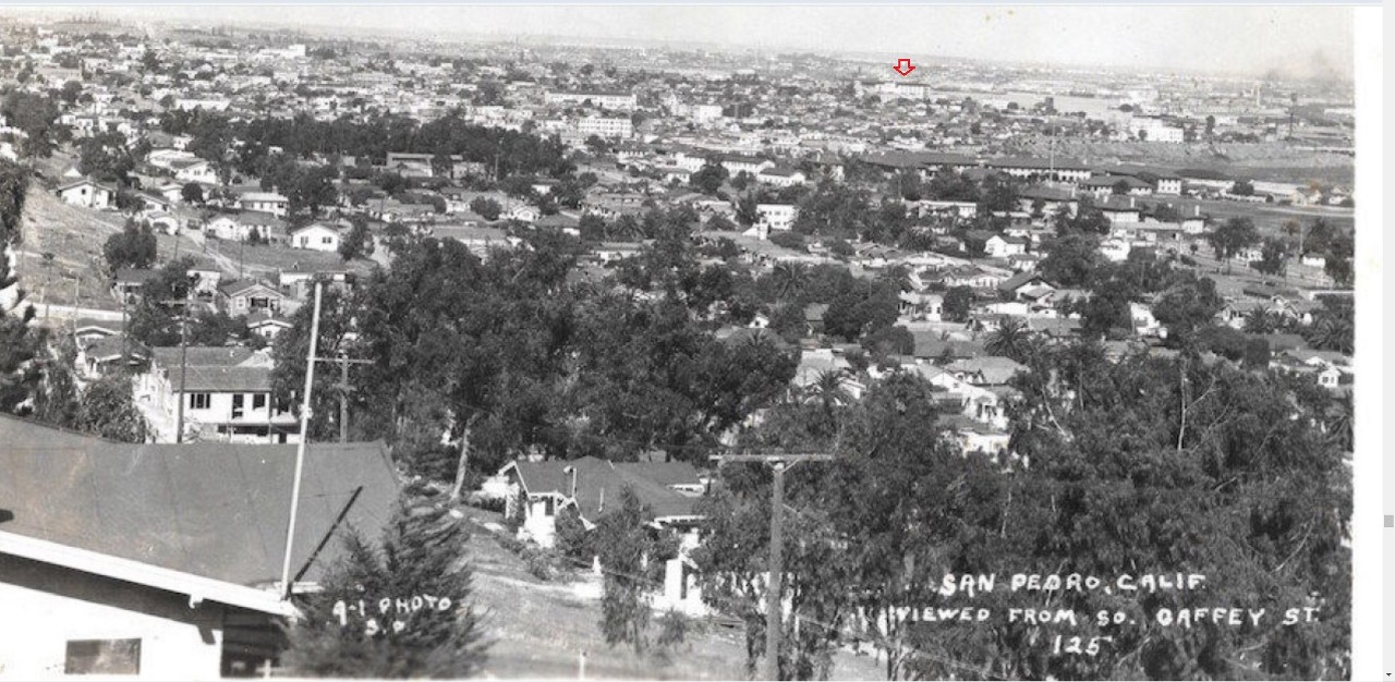
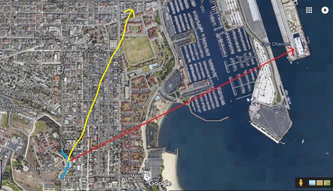
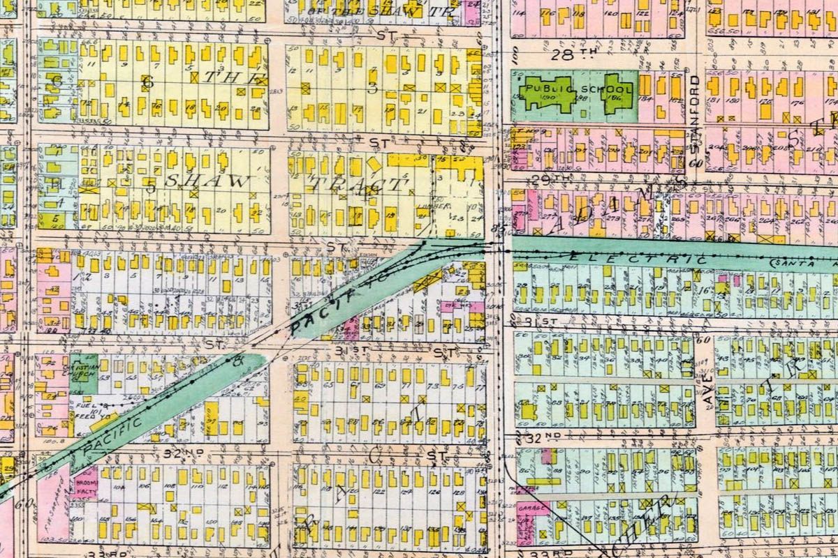
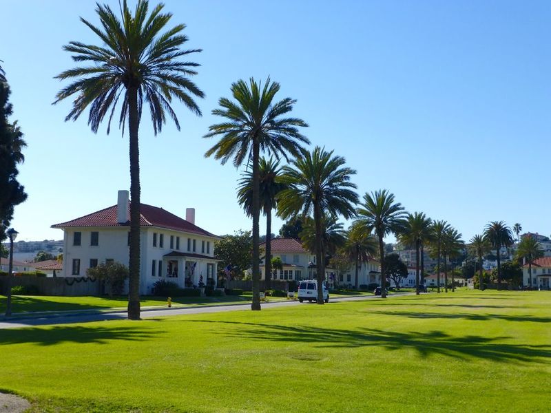
Top right you can see some barracks, administration building and the parade ground at Ft. MacArthur. Just below the parade ground you can see large uniform buildings, each with two chimneys. Those are officers' family quarters in a duplex set up. They would have been for more junior officers. There are some single family houses facing the long end of the parade ground for higher ranking officers and their families. A lot of the houses in the foreground, just below the edge of the hill have been replaced with apartments. Warehouse number 1 is also visible just above the fort buildings, next to the main channel. The view is just about due east from the area of the Gaffey Bulge. The street you can catch a glimpse of to the extreme left of the photo would be 34th. I went by there yesterday since we had just been talking about it.
|
Quote:
|
Warehouse number 1 is also visible just above the fort buildings, next to the main channel. The view is just about due east from the area of the Gaffey Bulge.
|
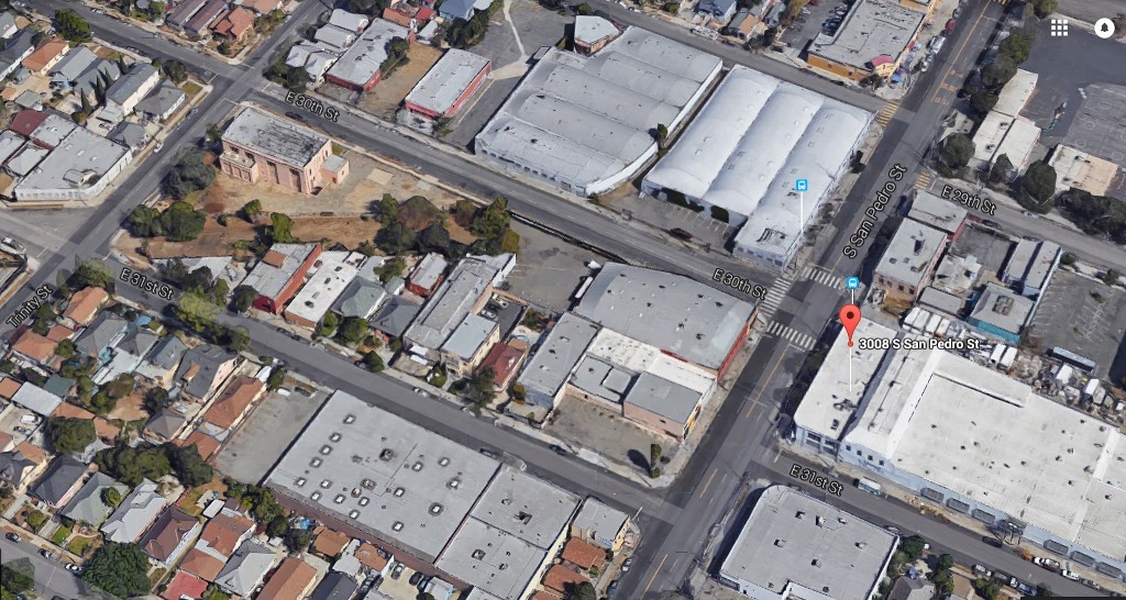
Thanks
oldstuff, I didn't see Warehouse No.1 until you pointed it out.
This is it, right? (red arrow)
eBay
Just for fun I thought I'd mess with this aerial with my very limited computer skills.
The BLUE curve is the
'Gaffey Bulge', and my arrow points to Warehouse No.1
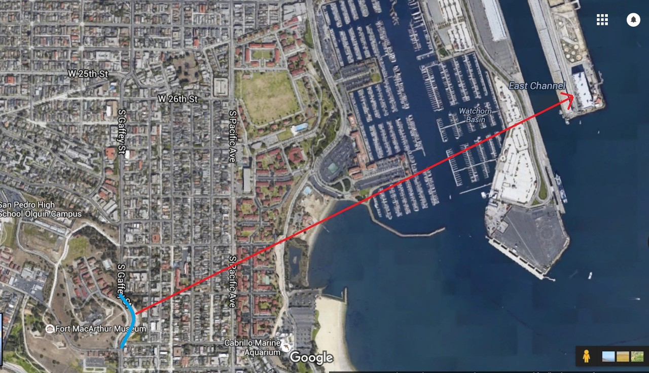
google_earth
Looking at this, it appears the parade ground doesn't line up correctly with the B&W postcard image.
So perhaps the photographer wasn't located at the 'Gaffey Bulge' after all, but further north on Gaffey Street.
Quote:
|
Originally Posted by oldstuff
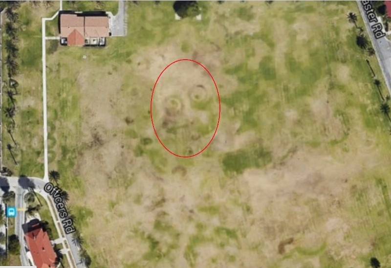
If you look at the Google earth pictures, you can still see outlines in the grass of the Fort MacArthur parade ground from WWI and WWII gun emplacements.
They appear as round circles, some with wings standing out from the circles and they stay visible in the grass for a long time, even though the area is now a flat field.
|
I believe these are the 'outlines'
oldstuff is talking about. She has a good eye.
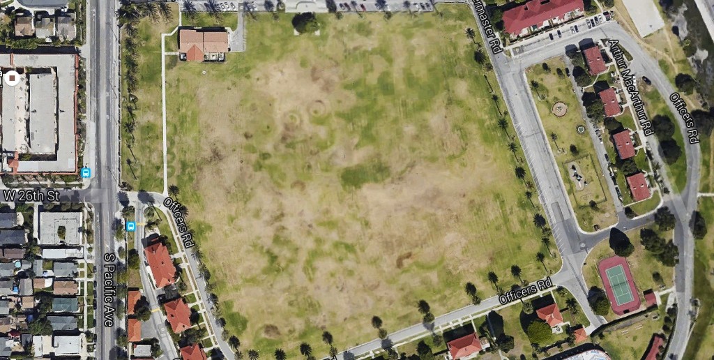
google_earth / old parade grounds
_


 Prev
Prev


 As you can see, there are other interesting things in this aerial, like the diagonal slash of land at left, no doubt a remnant of the former railway line.


 Linear Mode
