Forum member Lorendoc and enjoyed another exploration -- this one was a bit closer to home, in Elysian Park.
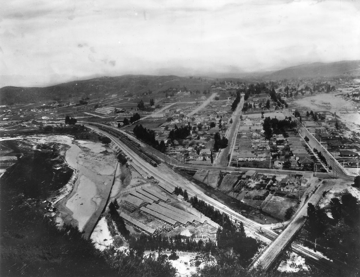
The priority on my wish list was snagging a "now" version of this undated Pigeon Farm photo from the USC site, an early topic on NLA. The farm was built in 1892 and was destroyed in February 1914 when a heavy Pacific storm hit the city, engorging the L.A. River and sweeping the coops towards the ocean. Popular Science Monthly wrote "Tens of thousands of birds were drowned. The few survivors hovered about their former home for weeks -- some of them for months; but they could not be brought together as a family again, and finally they scattered."
This area views fascinates me because it is home to so much essential infrastructure and communications and as Lorendoc remarked that day, it has all been dictated by geography, and the lay of the land. The river (whose headwaters lie north in the San Fernando valley) follows a gentle, nearly level southerly course to Long Beach. (Some accounts state that in the early 19th century the river joined ballon a Creek, emptying into Santa Monica Bay. A large flood in 1825 moved the river to its present course.) The Arroyo watercourse joins L.A. River just south of this location. The level course of the river and the water it provided led to development along its banks. From Downtown L.A. this was an easier though slightly longer route to the San Fernando Valley, San Francisco, Sacramento, etc., versus the Cahuenga Pass. L.A.'s north/south railway line follows the banks of the river, as does San Fernando Road, the original route to the Valley.
The channelization of the river and development in the valleys and hills have brought many changes since the Pigeon Farm days. I's interesting to see what remains, and what has changed. In the older photo the Farm occupies a prominent (but unprotected!) bulge along the left bank. The railroad tracks to the east of the Farm were the way north and west from DTLA, and points east and south.
The several block long street behind the farm nearly in line with the camera angle is Huron Street. Jeffries and Idell Streets are the two left of Huron; a mile or so behind them is the top of Mt. Washington. The hills south of Figueroa, on the other side of the Arroyo, are Montecito Heights.
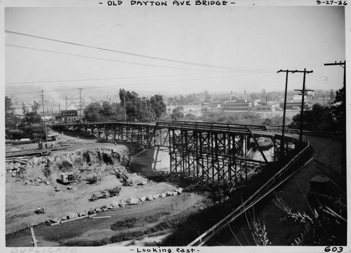
A block south (to the right) of Huron is Figueroa, which bends to the right and curves up the Arroyo, towards the horizon. In the foreground Figueroa doglegs to the original Dayton bridge. This span, the first of several at this site, was built in 1903. (It was demolished and replaced in 1927 / 1928, rebuilt in 1939, and is now being replaced again.)
 http://www.lapl.org/
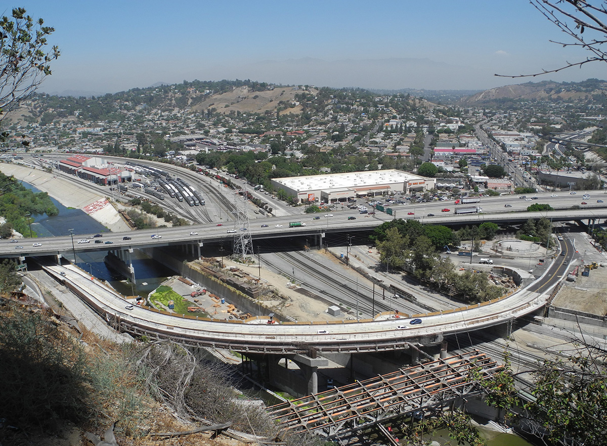
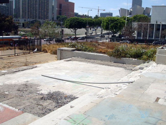
My "now" shot (taken from Grandview Point) shows how much busier this area has become! The river, encased in concrete in the late 1930's, has been slightly realigned. The bridge framework seen at the bottom of the frame is the old L-shaped Figueroa bridge, currently in the final stages of demolition. The wider, more elegantly curved new bridge lies adjacent. The riverbank area between the new bridge and Interstate 5 (crossing the frame horizontally), once home to tens of thousands of pigeons, is now a staging area for the bridge project, and on the other side of the tracks is Confluence Park. Positioned diagonally at the foot of Huron Street is a new Home Depot store. The group of railroad sidings is now a Metrolink maintenance yard. To the left of our old friend Figueroa Street is Mt. Washington, now mostly covered with homes. Across the Arroyo, Montecito Heights is still mostly undeveloped. But perhaps not for much longer, if The Church of the Foursquare Gospel (owner of the property for some 80 years) gets their way!
(I wonder how this location will look in another hundred years!)
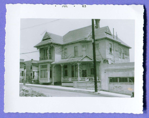
Before moving on, here's a photo I found of the original Dayton Bridge. This is the bridge seen in the old Pigeon Farm, viewed from the opposite direction. I don't think this has appeared on NLA before.
 http://www.usc.edu/libraries/
----------------------------------------------------------------------------------------------------------------------------------------
After visiting this spot, Lorendoc and I explored a few other places in Elysian Park. To me, Elysian is a very interesting but somewhat odd place. At 600 acres it's L.A.'s second largest park (after Griffith Park, of course) and was founded back in 1886. The park has lots of great views and many hiking trails, though I've never found a map that shows them. A number of old paved roads criss-cross the park but many are quite narrow and in poor condition, with large cracks and potholes. The picnic areas are popular but much of the park has a forgotten feeling. Some of L.A.'s steepest streets (Baxter, Fargo, and Duane) are nearby. Adjoining the park are some really interesting older neighborhoods -- Elysian Valley, Lincoln Heights, and of course Chinatown. With a little searching one can find some interesting and quirky things in and around Elysian.
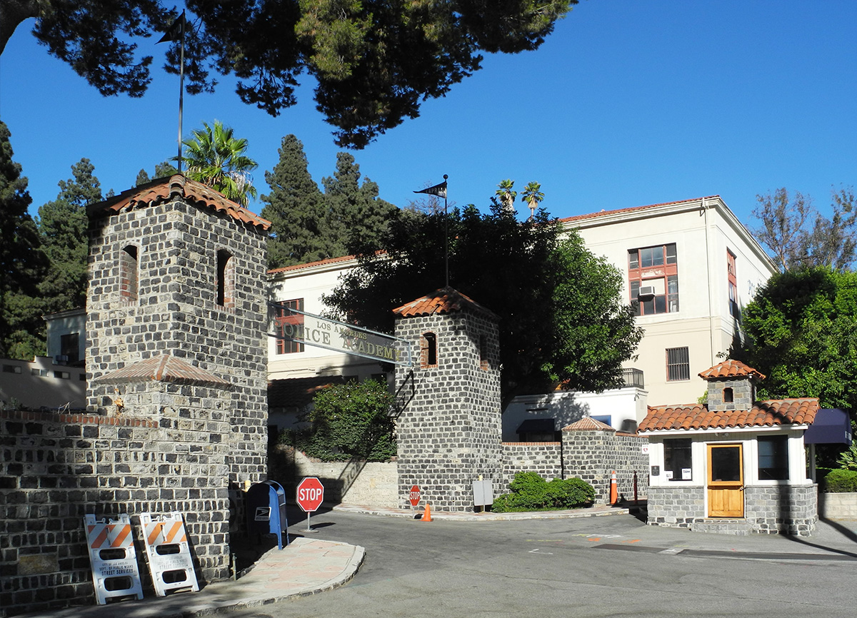
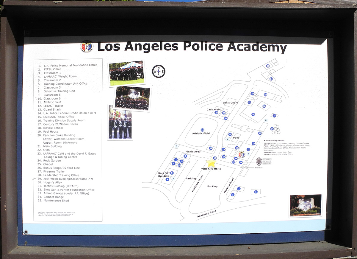
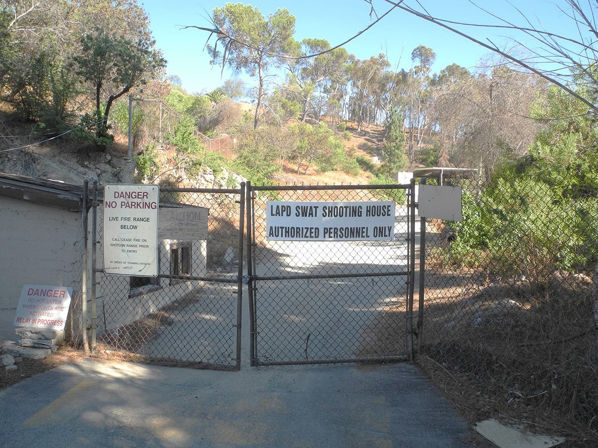
The Police Academy has been mentioned here a few times lately, so we decided to drive over to have a look. It was a Saturday afternoon with a ball game in progress at the stadium, so we weren't sure we'd be able to enter, but it wasn't a problem. A guard at the booth motioned us to park in the visitor lot. After doing so we spoke with him and were disappointed to hear that the 'Rock Garden", discussed here recently, is closed for about 2 years while the Cafe is being remodeled. But he explained that we were welcome to wander around the property and take photos.
The LAPD site offers a bit of history on the Academy campus. Here's an abridged version and some photos from our visit:
"The Los Angeles Police Academy is located in the 21-acre Elysian Park complex. The Academy is nestled in a picturesque setting of fountains, waterfalls, pine trees, and flowers. The classrooms, gymnasium, track, athletic field, obstacle course, and firing range, housed in and among Spanish-style buildings, are used for recreational and sports purposes, as well as training.
In the early 1900s, upon meeting minimum requirements, police officers were simply given their badges and assigned to protect the City. Since they received no formal training, they learned while on the job, from other police officers or through trial and error. In 1924, when a program of training for new officers was instituted, there was no regular training facility, and the Department had to use classroom space at an armory in Elysian Park.
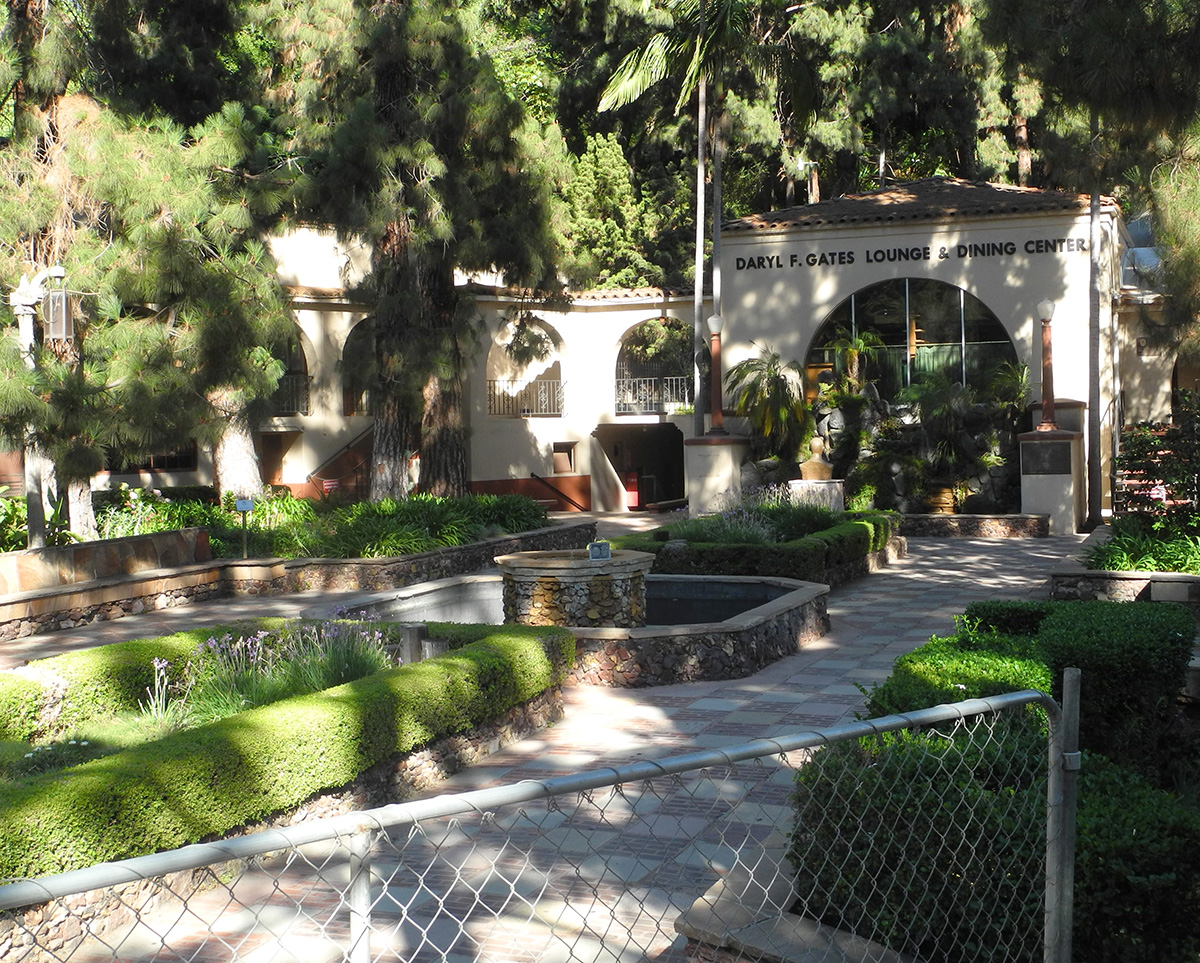
In 1925, the Los Angeles Police Revolver and Athletic Club (LAPRAAC) was formed, and a private organization of sworn members of the Department opened a pistol range in Elysian Park on the site of the present Police Academy. This range was to play a pivotal part in future training for the Los Angeles Police Department. That future began in earnest when, during the 1932 World Games, the Olympic Committee obtained permission to use the range for the pistol and rifle competition. When the games were over, the Department was given the dormitory building. The structure, which had been used at the Olympic Village in Baldwin Hills, was dismantled and transported to the Elysian Park site by off-duty officers, and then reassembled for use as a clubhouse. Later it became the basis for the present Academy restaurant and cafe.
In 1935, the Board of Park Commissioners approved the plans of the Los Angeles Police Revolver and Athletic Club for development of an athletic center that included the construction of a rock garden and waterfalls near the athletic field and shooting range. Francois Scotti, an expert landscape artist, was commissioned to design and build the rock garden, which includes a series of four pools, several cascades, a small amphitheater for band and stage settings, and an outdoor dining area. A large patio, barbecue pit, stairways, walks, and recessed stone seats were also included. The rock garden was subsequently dedicated by the City in 1973 as Cultural Heritage Monument #110. Today it is the most picturesque spot on the Academy grounds.
A variety of recreational facilities are available for use by Department personnel and their dependents, including a tennis court, swimming pool, gymnasium, weight room, sauna, steam room, two racquetball courts, 1/8 mile track, and picnic areas. The Academy Cafe is open to the public. The Police Revolver and Athletic Club store sells guns, athletic gear, and a variety of police equipment."
----------------------------------------------------------------------------------------------------------------------------------------
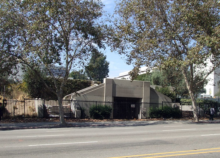
A final item: while walking along Lilac Terrace, south of the Stadium, we happened upon this historical marker, partly hidden by trees and bushes.
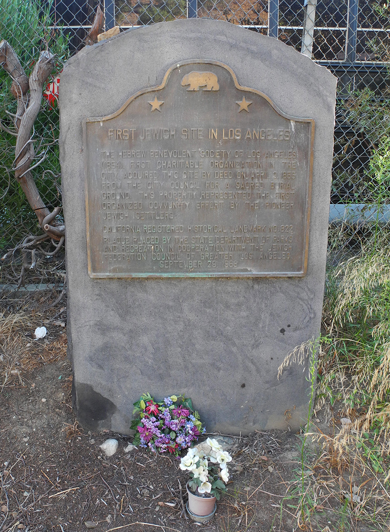
The marker reads:
FIRST JEWISH SITE IN LOS ANGELES
The Hebrew Benevolent Society of Los Angeles (1854), first charitable organization in the city, acquired this site by deed on April 9, 1855 from the City Council for a sacred burial ground. This property represented the first organized community effort by the pioneer Jewish settlers.
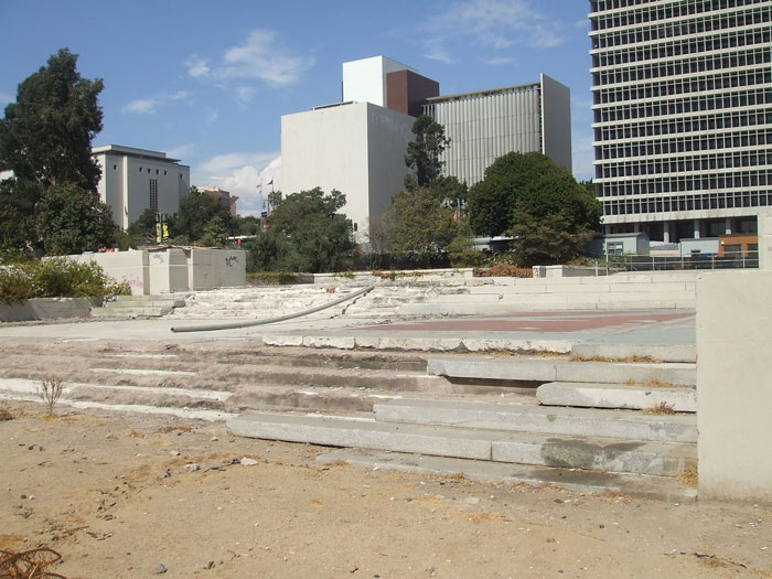
Neither of us had heard of this spot before and I think it is new to NLA. Doing a little research, I found an Times article dated April 24, 1986, with a little more info:
"When California was admitted to the Union in 1850, it has been reported that there were eight Jews living in Los Angeles. Nearly a century and a half later, that population has proliferated, with growth and contributions evidenced by the many historic sites around the city. (The former site of the) Hebrew Benevolent Society Cemetery (is located at) Lookout Drive and Lilac Terrace, Chavez Ravine. California Registered Landmark No. 822 is the first Jewish site in Los Angeles. Located south of Dodger Stadium, behind the armory, it is empty now, since the bodies were moved to the Home of Peace Cemetery, but the past is remembered by a plaque on the hillside of Chavez Ravine. The society, organized in 1854, is presently known as Jewish Family Service."
All photos mine, except where noted.


 Prev
Prev


 Oh it's so great to see the old Villa Carlotta again pwrof3. How can one apartment contain so much 'noirish'ment. I love every inch of it.


 -quite a disappointment.


 Linear Mode
