Quote:
Originally Posted by HossC

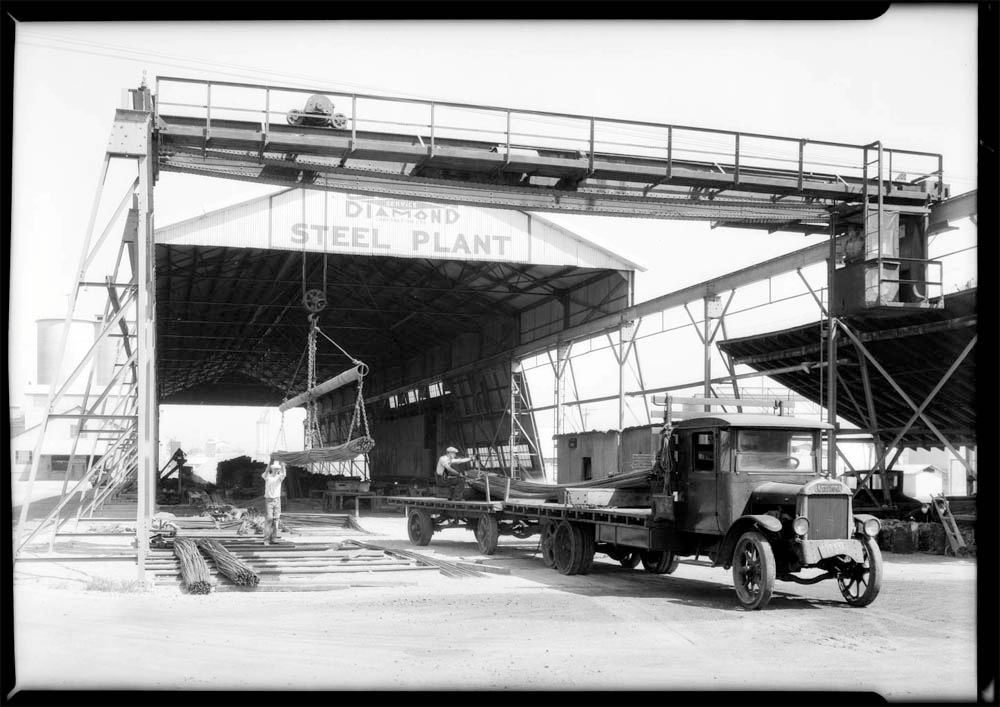
The truck in the image below is roughly where the dump entrance would be a few years later. The sign is for the Blue Diamond Corp which is listed at 1650 S Alameda (a couple of blocks north) in the 1932 CD. They were in the building materials and supplies business, so it's possible this was their yard just south of their office.
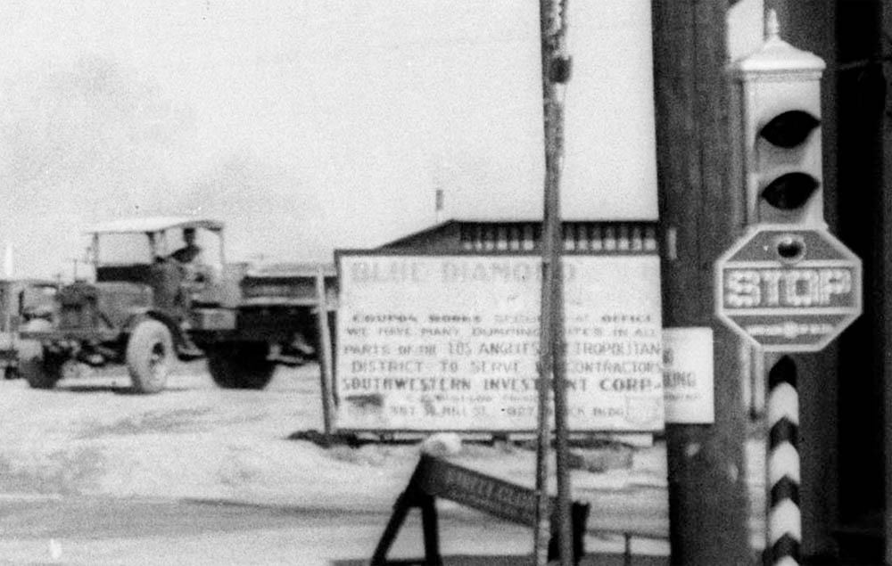
Detail of picture at USC Digital Library |
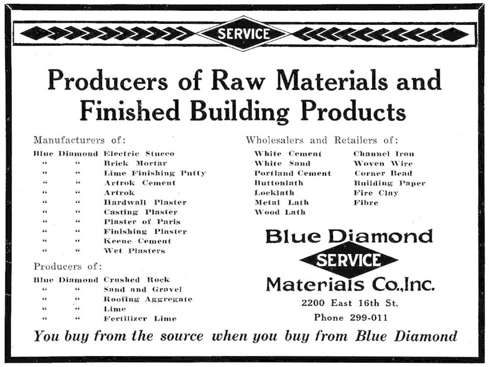
With the municipal dump still fresh in our minds, I thought I'd revisit the Blue Diamond Corp. The Blue Diamond Corp seems to have started off as the Blue Diamond Plaster Co at 2200 E 16th. Their entry in the 1917 CD (the first I could find) was only one line, but by 1923 they had become the Blue Diamond Materials Co, Inc with a half-page advert.
LAPL
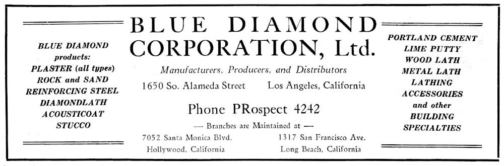
Their first listing at 1650 S Alameda appears in the 1926 CD, and they are first listed as the Blue Diamond Corp in the 1932 CD, but by then they had reverted to single line adverts. The one below is taken from the 1938 CD. They continue to appear in the City Directories until the late 1960s.
LAPL
The picture below shows an aerial view of Blue Diamond Plaster Company (USC's description), and is dated circa 1930. The large excavations may be why the area was chosen as the site of the municipal dump. Near the center they still had stables, even though USC has several pictures of their heavy duty delivery trucks, some with solid tires. They also had their own Blue Diamond baseball diamond!
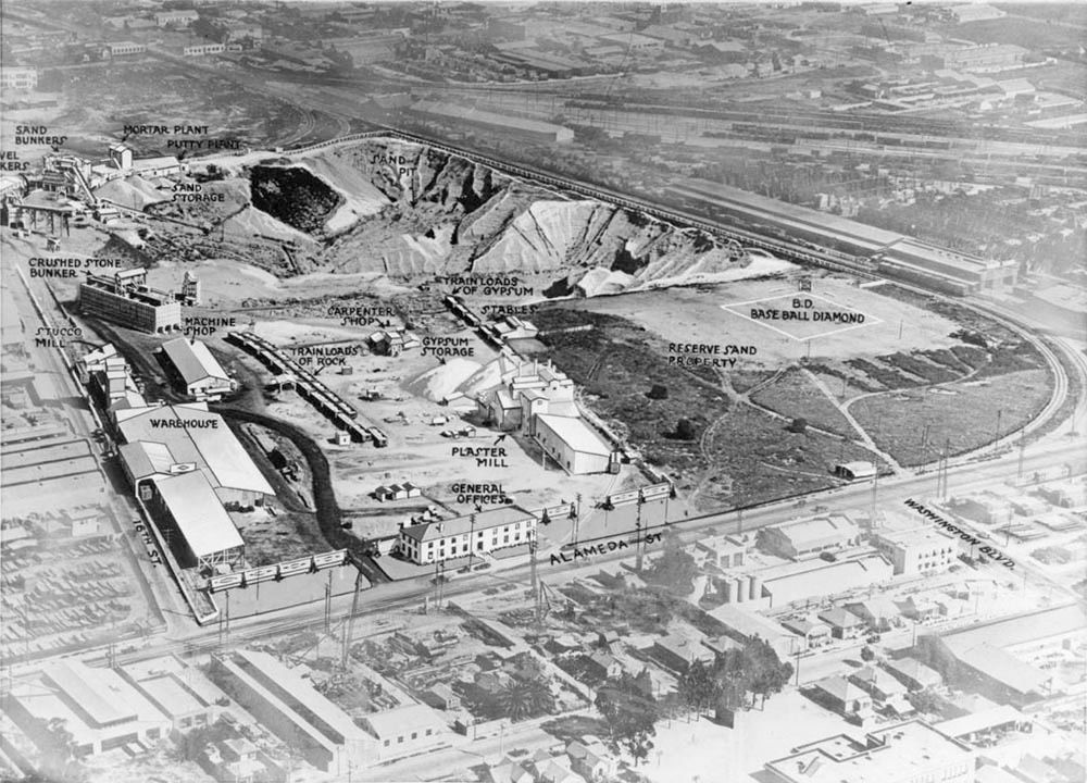 USC Digital Library
The steel plant doesn't appear on the aerial view above, so I tried to figure it out from the 1961 aerial view I posted
here. I think it was built behind the general offices on Alameda Street. This one is dated 1931, and is part of a set.
 USC Digital Library
The 1921 Baist map shows the area of the Blue Diamond Corp/municipal dump to be mostly empty, although there are a couple of buildings labeled "Blue Diamond Plaster Co" next to the railroad tracks (that must have been related to the 2200 E 16th Street address).
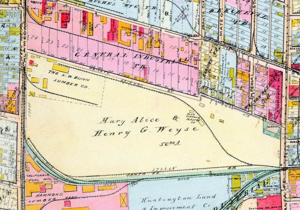 www.historicmapworks.com
Using Google Maps and Historic Aerials I've overlaid the routes of East Washington Boulevard between Alameda and Santa Fe (below). USC has a constuction picture of the first extension of Washington Boulevard
here. This picture itself only shows a big trench with a few industrial structures in the background, but the description is quite interesting:
"Looking over the excavation at the end of Washington Street at Alameda which city council paid $75,000 for right of way. Washington street would start in the center of the photo and continue straight over the gully." -- typed noted attached to verso, dated 12 September 1931. "Photo shows the gravel pit on the East Side which the city purchased for $175,000 and apparently cannot use. Diagram shows plans for extension of Washington street between Alameda and Alameda and Santa Fe." -- Examiner clipping attached to verso, dated 18 September 1931. "'Hole-in-the-ground' to cost city still more" -- Examiner clipping attached to verso, dated 5 October 1934.
That seems to date the building of the first extension as 1931, which ties in nicely with
e_r's original dump pictures. E Washington was still using the lower route in 1961 (see link to the 1961 aerial, above), but the Historic Aerials image from 1972 shows the current route fully in use (the path of the lower route can still be seen quite clearly). I'm guessing that the current route was built in the late 1960s, which is around the end of the Blue Diamond Corp at that location.
 www.historicmapworks.com
I did a quick search of NLA to check for previous mentions of the Blue Diamond Corp, and found one of my own posts about the Pigeon Hole Garage (the full post is
here):
Quote:
Originally Posted by HossC
Pigeon Hole Garage.
Under construction at Wilshire and Flower is a six-story garage in which an elevator will lift automobiles to the desired floor and park them in "pigeon hole" stalls. Blue Diamond Corp. is furnishing materials for the structure scheduled to open late next month. Photo dated: September 8, 1953.
 LAPL
LAPL |
I assume there's no connection between the Blue Diamond Corp and the Blue Diamond Produce Co which I mentioned in
post #19843 when I wrote about the Produce Terminal in the Central Manufaturing District.


 Prev
Prev


 Linear Mode
