Quote:
Originally Posted by GreaterMontréal

to me it's either between the Gardner, Décarie and A-720 Ville-Marie
|
Yeah, the Décarie is a good contender against the Gardner.
So, my re-posting of the current bundle of highway projects in Metro-Vancouver.
First is the highway 1 expansion from 200th (the eastern terminus of the Highway 1 Gateway project) and 216th interchange project.
 216A
216A by
Ian, on Flickr
 216B
216B by
Ian, on Flickr
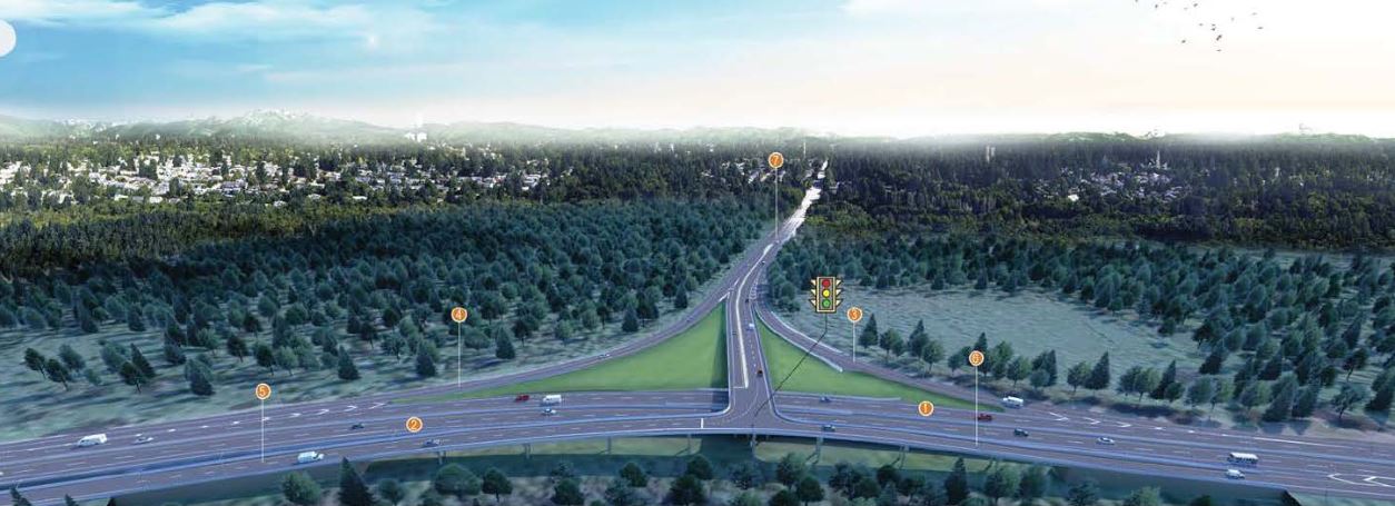
The proposed Blue Mountain / Brunette / Highway 1 interchange. Three options are being considered.
Simplified drawings of the options from the Golder Associates Environmental Impact Study:
OPTION A:
 http://engage.gov.bc.ca/brunetteinterchange/technical-reports/
OPTION B:
http://engage.gov.bc.ca/brunetteinterchange/technical-reports/
OPTION B:
 http://engage.gov.bc.ca/brunetteinterchange/technical-reports/
OPTION C:
http://engage.gov.bc.ca/brunetteinterchange/technical-reports/
OPTION C:
 http://engage.gov.bc.ca/brunetteinterchange/technical-reports/
Highway #1 North Vancouver on the North Side of the Iron Worker's Memorial Bridge.
http://engage.gov.bc.ca/brunetteinterchange/technical-reports/
Highway #1 North Vancouver on the North Side of the Iron Worker's Memorial Bridge.
Here are the original plans.
 http://www2.gov.bc.ca/assets/gov/driving...ainhwy/displayboards_january_19_2016.pdf
 http://www2.gov.bc.ca/assets/gov/driving...ainhwy/displayboards_january_19_2016.pdf
Phase one is to be completed in 2018 (my guess is more 2019 now).
What is interesting is phase 2 and 3 seem to have been re-designed with a larger C/D system. Here is what is known so far:


 Then there is the new Patullo Bridge.
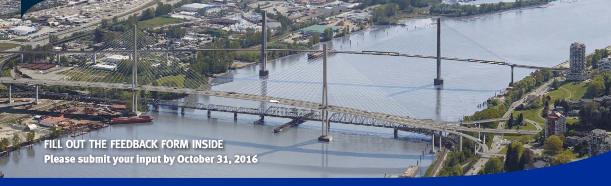
As stated before, it will open with 4 lanes (up from the current structures 3) but this is just a political maneuver to please New West, the bridge itself will be built for a future 6 lanes through. A quick look at the renders makes it obvious that the entire design has been drawn with a 6 lane structure in mind. There will be some choke points with the 4 lane iteration, so hopefully this will execrate the 6 lane conversion. The Bridge itself will be another impressive bridge structure to add to the regions repertoire. It also looks as if it will have a couple decent ramps (such as the one connecting to the SFPR westbound.
The money shot
 P1
P1 by
Ian, on Flickr
The bridge deck
 p2
p2 by
Ian, on Flickr
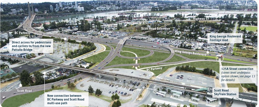
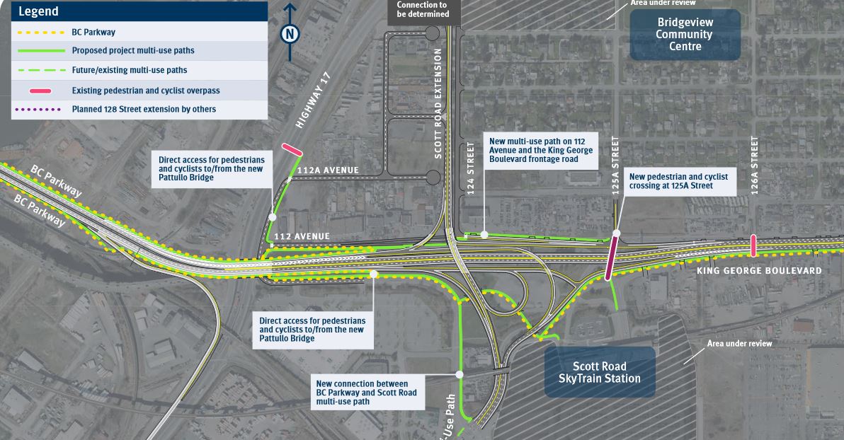
The south side. I like the general layout and the general level of grade separations.
 p3
p3 by
Ian, on Flickr
Note the two lanes merging to one on King George just before the Scott Road west bound to north bound on ramp.
 p4
p4 by
Ian, on Flickr
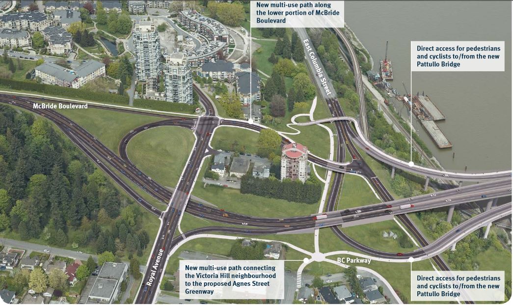
The North side. Again, I like the general layout (it was the version I was hoping for out of the options given)
 p5
p5 by
Ian, on Flickr
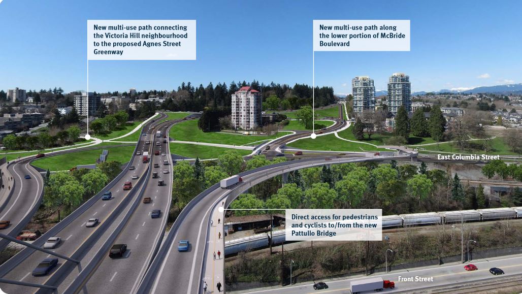 p6
p6 by
Ian, on Flickr
Again, note the two southbound lanes merging into one before the Royal Ave east bound to south bound on ramp. Also not the super short on ramp from Columbia Street. That is maybe the worst aspect of this design.
 p7
p7 by
Ian, on Flickr
The Big One, will be the longest Bridge in BC. The impressive highway 99 upgrade / George Massey Tunnel replacement.
Steveston Hwy interchange:
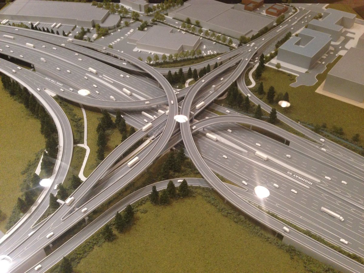
17A interchange:

First is a model of the bridge looking south, to go with the previously posted photos of the Steveston and Highway 17a interchanges:
 http://www.richmond.ca/agendafiles/Open_Council_10-11-2016.pdf
 (page 39)
Renders of the bridge, showing the BC Hydro transmission lines to be built adjacent:
 http://www.richmond.ca/agendafiles/Open_Council_10-11-2016.pdf
 (page 47)
Location of the transmission towers:
 http://www.richmond.ca/agendafiles/Open_Council_10-11-2016.pdf
 (page 352)
Another pic of the bridge model, this time including the Steveston interchange:
 http://www.richmond.ca/agendafiles/Open_Council_10-11-2016.pdf
 (page 40)
New angle of the Steveston interchange which was posted previously:
 http://www.richmond.ca/agendafiles/Open_Council_10-11-2016.pdf
 (page 41)
Another angle, looking south:
 http://www.richmond.ca/agendafiles/Open_Council_10-11-2016.pdf
 (page 42)
Looking south again, toward the Steveston bus station:
 http://www.richmond.ca/agendafiles/Open_Council_10-11-2016.pdf
 (page 46)
This angle shows how high the stack will be compared to the developments next door:
 http://www.richmond.ca/agendafiles/Open_Council_10-11-2016.pdf
And Last, the thorn in many people's side, the 72nd intersection in the 91 is finally getting an interchange.
http://www.richmond.ca/agendafiles/Open_Council_10-11-2016.pdf
And Last, the thorn in many people's side, the 72nd intersection in the 91 is finally getting an interchange.
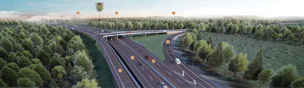 72A
72A by
Ian, on Flickr
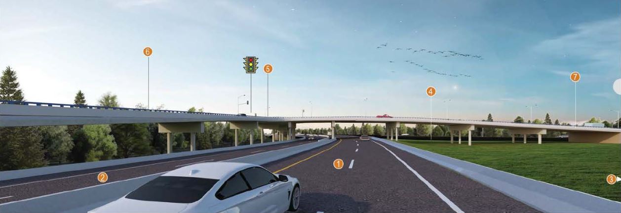 72B
72B by
Ian, on Flickr
 72C
72C by
Ian, on Flickr
This project costs 30 million, 20 being paid by the province, 10 from the feds. It has already been tendered, so it is happening for sure.
Again, a pretty decent list of projects, Metro Van will be adding two more major modern bridges to the region. The Eastern section of the metro will be particularly well served, with 4 new major bridges in the area (GEB, Port Mann, Pitt River, and Pattullo).




 Threaded Mode