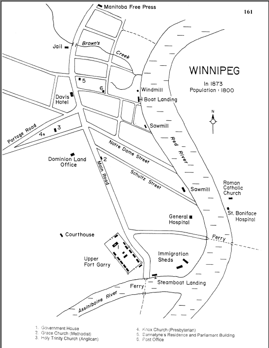
Was looking for a mid-90's street map of Winnipeg, but found this instead. It's a map the first Mennonite delegates from Russia/Prussia made & "
points out places of particular interest to the Mennonite pioneers."
Wish we were able to still have Brown's creek run through the Exchange. Also, that short street between Portage & Main would have made for some nice angled buildings today...
 [source]
(i'm still looking for that 90's street map tho... anyone have something?)




 Threaded Mode