Quote:
Originally Posted by ethereal_reality

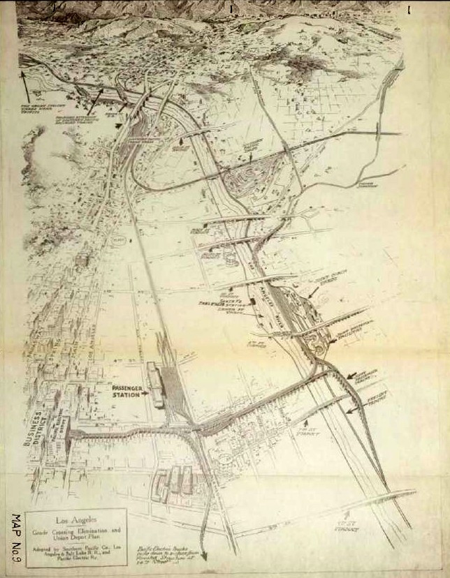
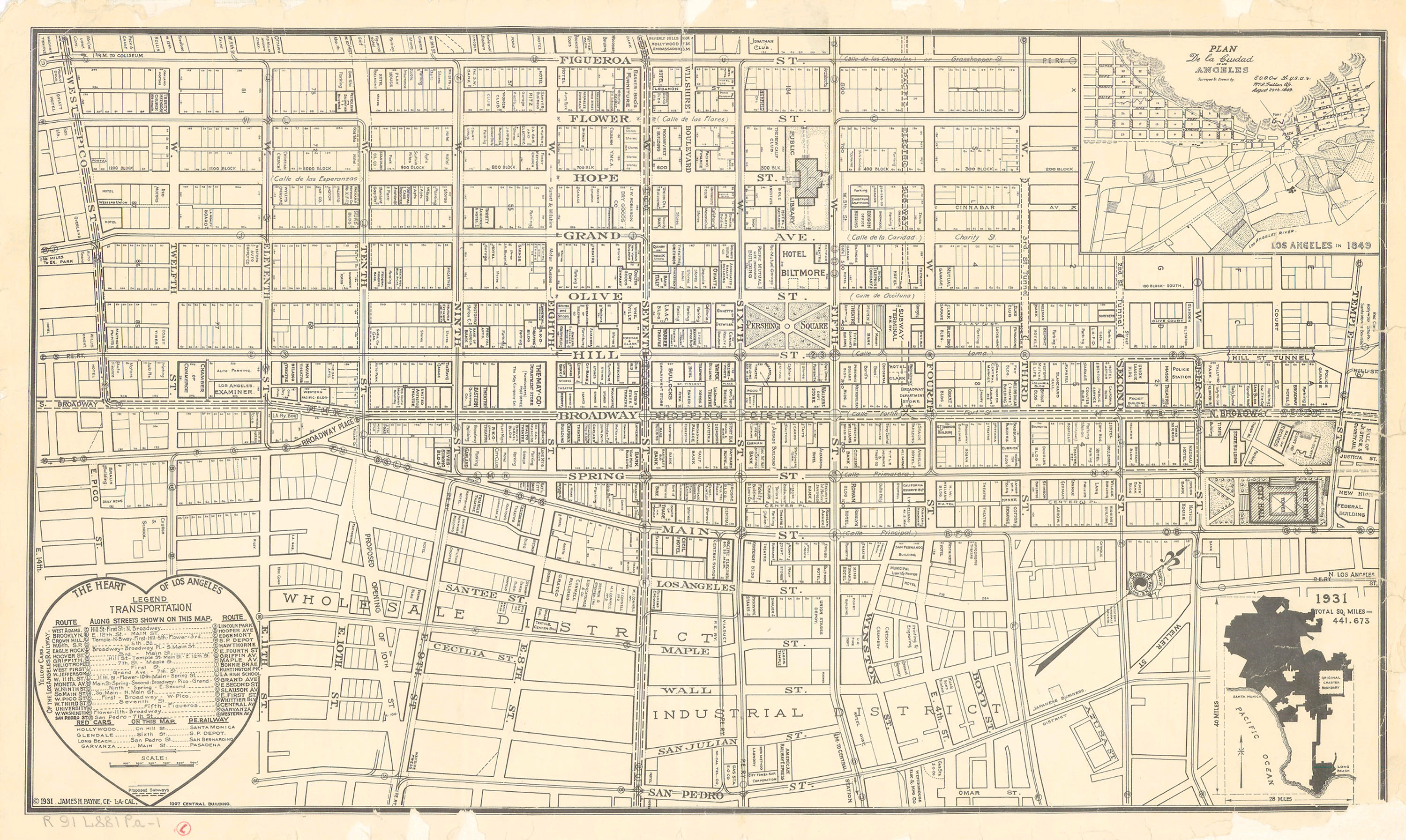
I'm hoping someone can dig up a larger scan of this 1922 map. (I don't believe we've seen it before on NLA)
 http://metroprimaryresources.info/19...or-relief/281/
"Grade Crossing Elimination and Union Depot Plan" 1922
Is that two side-by-side roundhouses east of the L.A. River? (I can only read a few of the captions) |
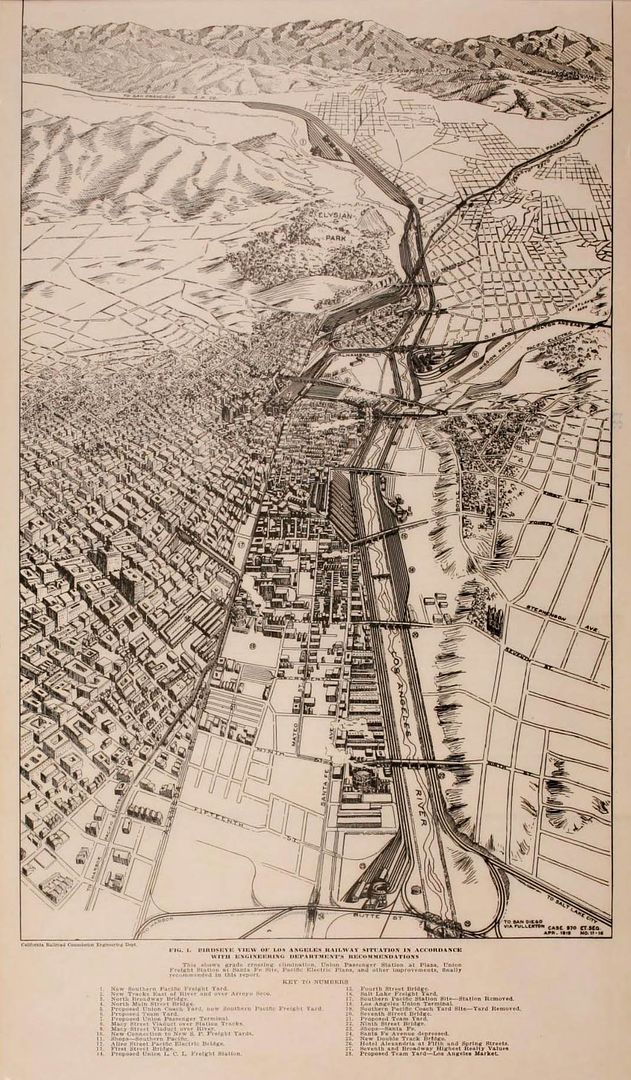
While looking for a larger version of
e_r's map, I came across a huge circa 1920 report titled 'Railroad Grade Crossing Elimination and Passenger and Freight Terminals
in Los Angeles' - you can find it on
archive.org. The full report is around 600 pages long, and it's packed with information, statistics, photos and diagrams. I've
picked out a selection of photos and diagrams for this post, although I may revisit the report at a later date. I'm sure other members will be able to pull completely
different information and images from the same document.
Despite searching the report a couple of times, I can't see the map above. The one below is the nearest I could find.
NB. I've kept most of the following images fairly large to try and preserve the legibility of the captions. Some of them have had their levels tweaked for clarity.
 archive.org
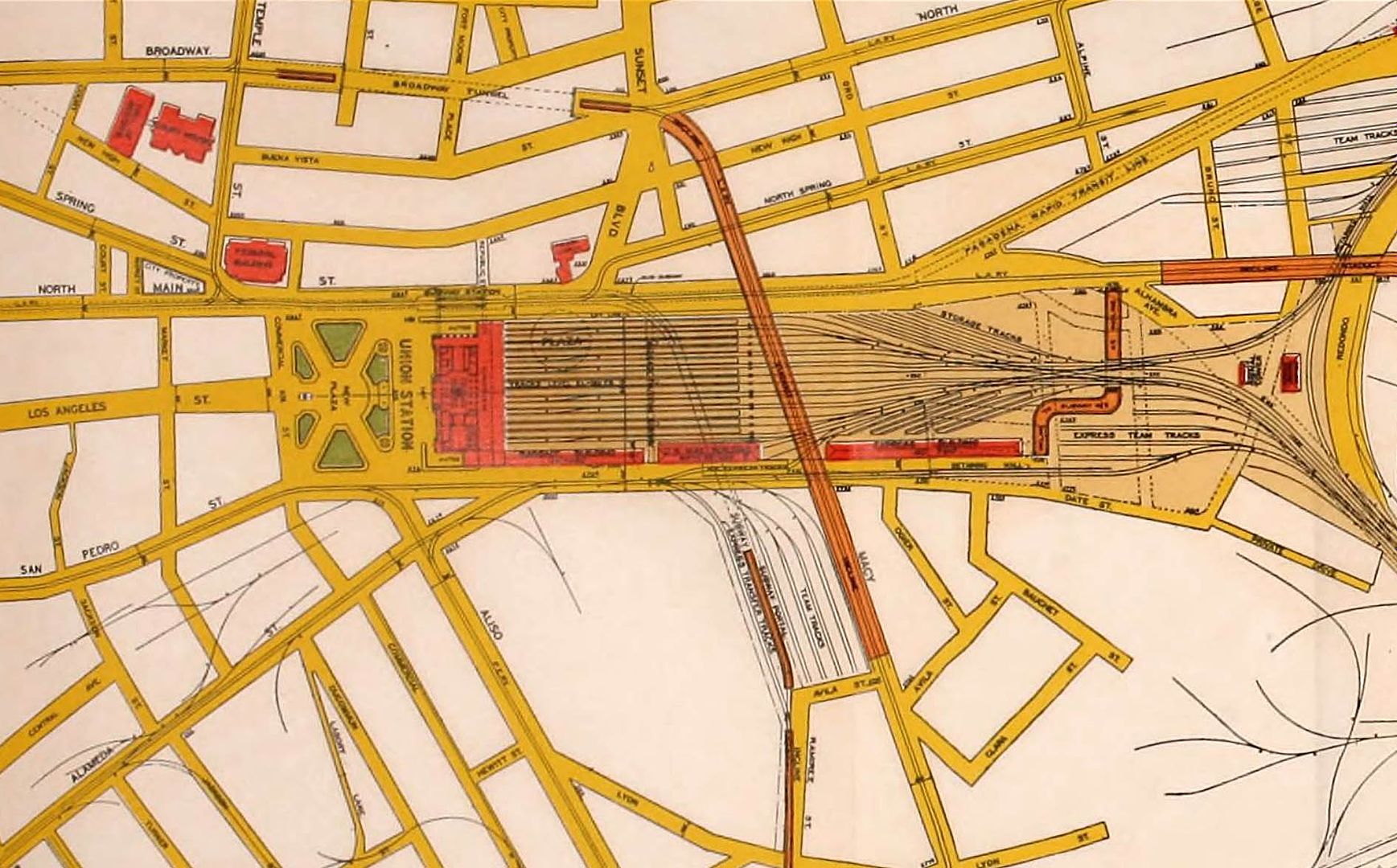
It may be hard to see on the map above, but one of the proposed locations for Union Station was west of Alameda Street, directly on top of the Plaza. The detail below
shows the old Plaza location under the platforms, while a New Plaza would be built to the south. The southwest corner of the New Plaza would have extended nearly to
the future site of the new City Hall. Macy Street would be elevated over the tracks and join up to the Broadway tunnel. It looks like Olvera Street, Pico House and the
Brunswig building were due to be obliterated instead of Chinatown.
 archive.org
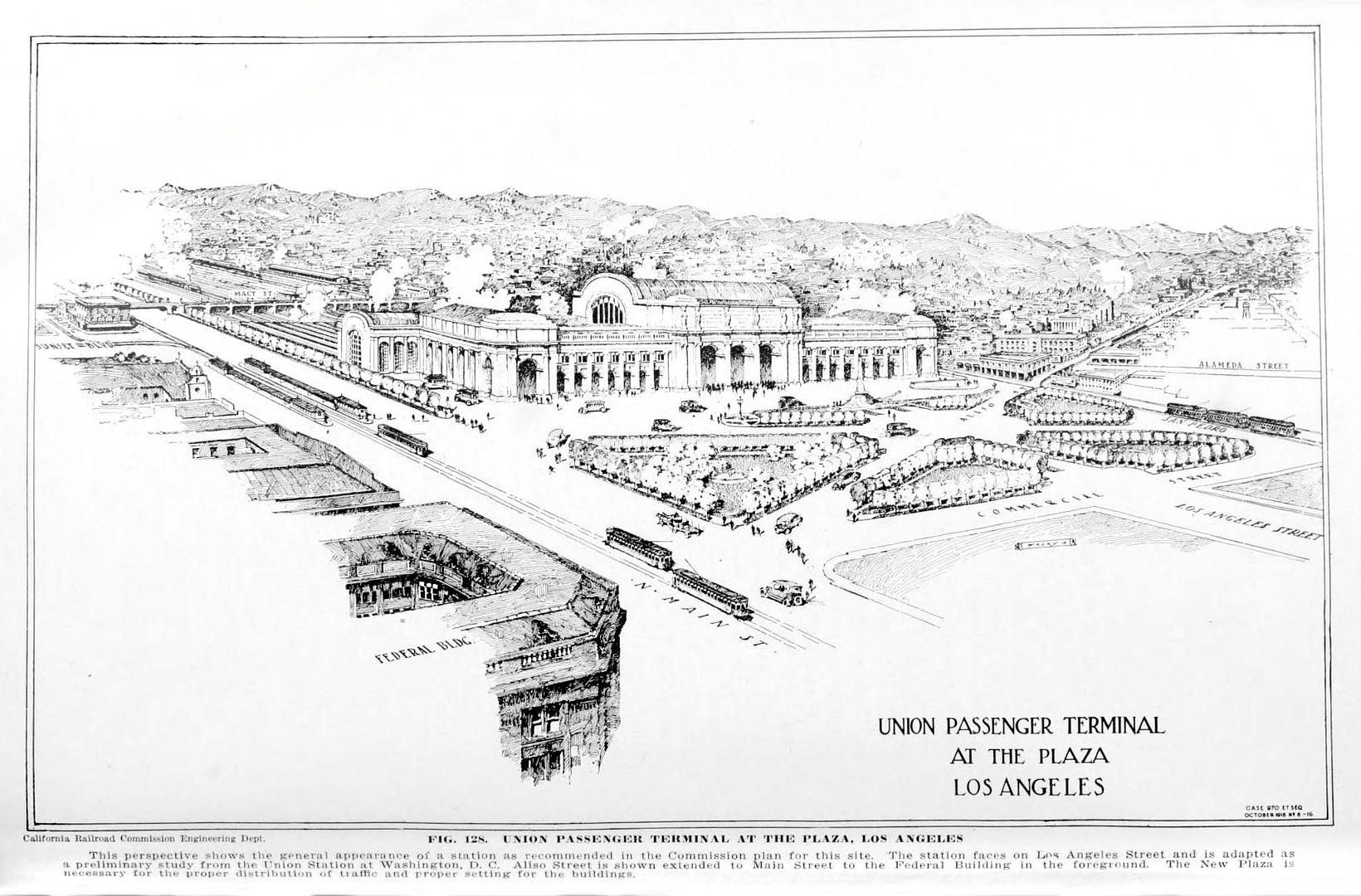
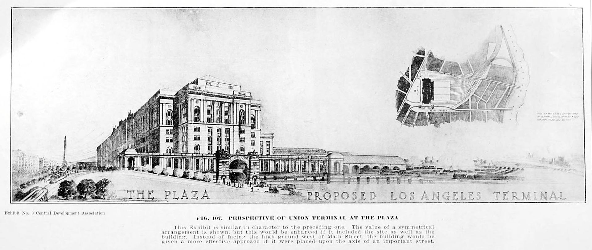
Here's an artist's impression of how the new station and plaza would look.
 archive.org
Another idea had the new station roughly where it was eventually built, although with the platforms running parallel to Aliso Street. The terminal building seems to bisect
Alameda Street, and the Plaza also gets a redesign.
 archive.org
Yet another scheme involved building the new terminal at the Arcade Depot site, and included a radial design for the New Plaza.
 archive.org
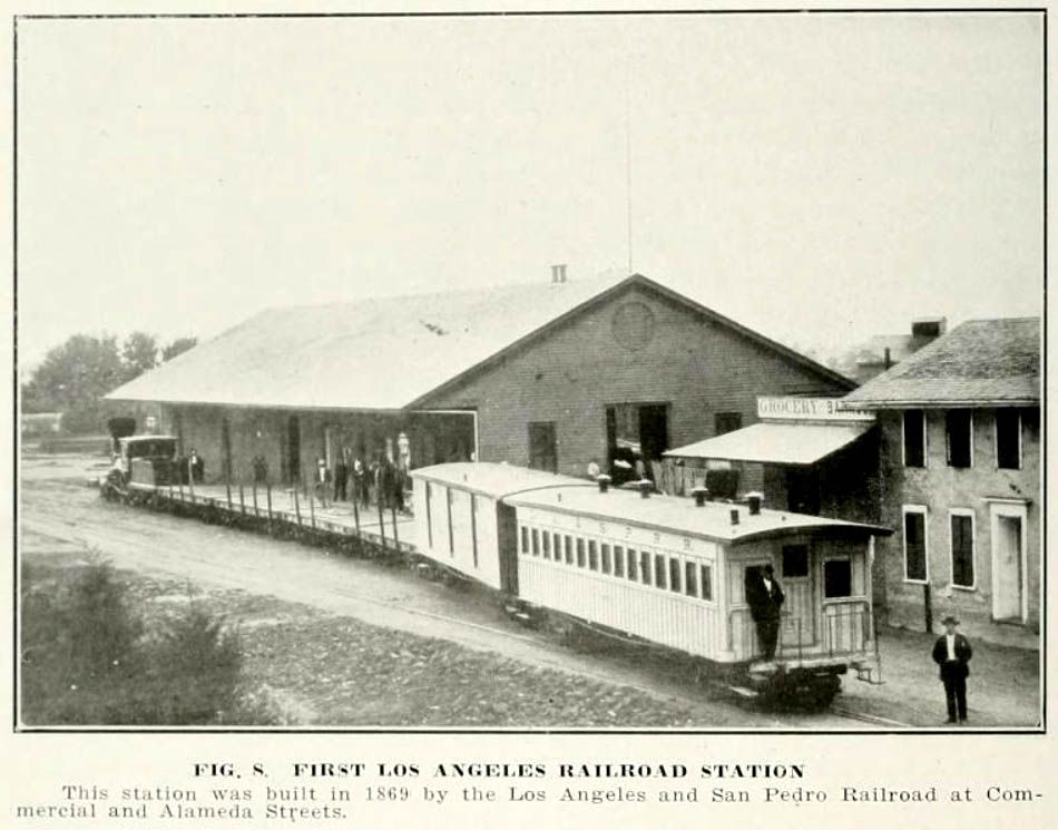
Have we seen this station before? Its caption says it was the first Los Angeles railroad station, located at Commercial and Alameda Streets.
 archive.org
This station has definitely appeared before -
BifRayRock posted an aerial view of Salt Lake Station in
post #7837, and noted that it was
"awfully
close to the LA River". In fact it was on the east bank of the LA River, directly south of First Street. I think the station was being demolished in
BifRayRock's picture, because the roof details have all gone. You can see a streetcar heading for the station in
post #14469 by
Chuckaluck.
 archive.org


 Prev
Prev


 LAPL
LAPL LAPL
LAPL


 )
) 


 Linear Mode
