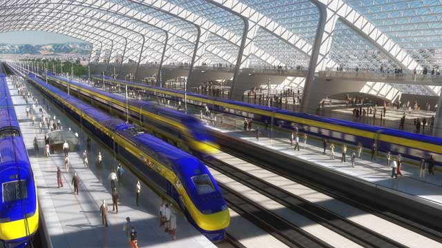
Before the advent of the freeways, the 199-year-old San Bernardino functioned as an urban core and the nexus of an extensive transportation system approximately 60 miles East of the center of Los Angeles and 90 miles North of San Diego's.
Today, the 65-square-mile San Bernardino is the 100th most populous city in the United States. And, the San Bernardino Valley is expected over the next ten years to add another million residents to the four million already living in the Inland Empire. So, the city, and its neighboring municipalities, have embarked on an ambitious and impressive strategy to re-establish the urban core and to dramatically reposition San Bernardino to compete in the category of: Los Angeles; San Diego; San Francisco; San Jose; and, other first-tier cities around the country and around the world.


The plan is specifically intended to avoid competing with Riverside, Ontario, and similar nearby cities that lack the powerful combination of an authentic urban environment and large tracts of developable land.
You can see more views of the project, along with a fairly extensive catalog of the existing visual and cultural resources of the city in this Flickr group:
http://www.flickr.com/groups/sanbernardino
You may also be interested in this group related to the whole of the Inland Empire:
http://www.flickr.com/groups/inlandempire
The current business activity in San Bernardino is concentrated in the Riverfront District between the 10 freeway and the Santa Ana River. At the far North end of the city is San Bernardino State University while Loma Linda University occupies the southern part of the valley.


In 2011, both institutions will be connected to the city center, and to the new "superuniversity" campus surrounding the existing American Sports University, by sbX, a B.R.T. tramway traveling along E Street and Hospitality Lane.

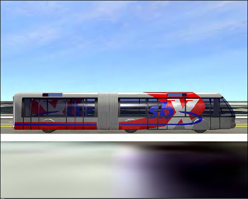
The sbX corridor is being developed as a series of self-contained urban villages. Beyond the city center described in the Vision & Action Plan are new mixed-use districts and neighborhoods that are expansions and redevelopments of existing activity centers and traditional neighborhoods. For example, the sbX station at North Mall Way will include new open-air and pedestrian-oriented development Macerich is adding to the Inland Center on the West, as well as new construction by Lewis Development Group surrounding the historic structures of the National Orange Show site to the East. That project is scheduled for completion in 2014.

Other stations have similar potential, and four will feature park-&-ride lots and structures offering shared parking available for even more development.
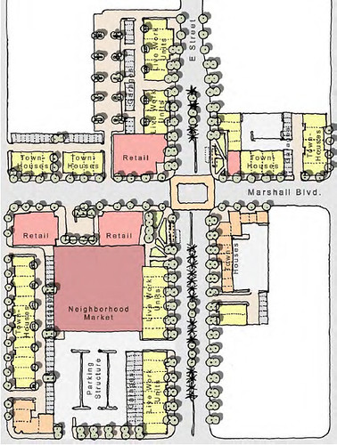
The North-South sbX service will provide two station-stops in the city center. The more southerly station is a multimodal facility that will connect sbX with the Metrolink extension from the nearby 1918 depot, which, itself, has already undergone extensive restoration and expansion with some interesting T.O.D.
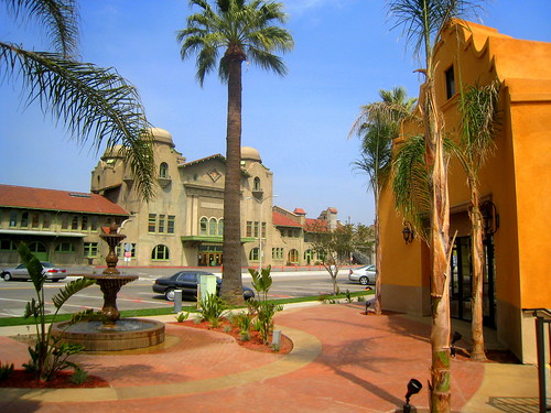
Utilizing the same Pacific Electric Redlands Subdivision right-of-way of the Metrolink extension, San Bernardino Associated Governments will connect, by light-rail or Diesel-electric multiple units, the depot and the multimodal transit station to: the Lewis project at the National Orange Show; the Riverfront District (Tippecanoe Ave. & Hospitality Lane); the San Bernardino County Museum at California Street; Citrus Plaza and Tri-City Shopping Center at Alabama Avenue; the E.S.R.I. campus and Jennie Davis Park at New York Street; Downtown Redlands at its historic Santa Fe Depot; and, the University of Redlands.

My pictures documenting the existing resources and assets in many of these areas are available here:
http://www.flickr.com/photos/pragmat...t/sets/217620/
Additionally, with the 2007 completion of the last leg of the 210 freeway, the 215 freeway is currently in the process of being expanded and modernized in order to facilitate North-South movement to and from the city center.
The San Bernardino Economic Development Agency is sitting on a proverbial gold mine to the South of the Vision & Action Plan boundaries since the agency owns a huge tract of "greenfield" land there that is intended to serve as a corridor of corporate headquarters, regional offices, and creative-technical campuses organized around one of two lake systems integrated into and immediately adjacent to the existing city center. San Bernardino is sitting on an underground aquifer that is estimated to be the size of Lake Tahoe, and the city has been draining the water, at great expense, to reduce the dangers of liquefaction during an earthquake. But, to sell more of the water to the rest of southern California and to avoid wasting said water, the San Bernardino Valley Municipal Water District needs to construct control reservoirs. The 215 widening is helping excavate land for the artificial wetlands in the South while more than two-thirds of the property for the North lake has already been purchased.
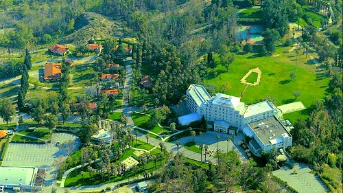
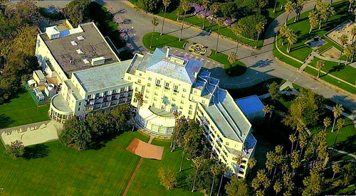
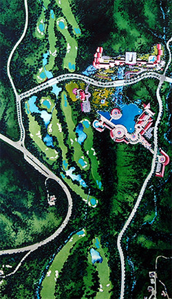
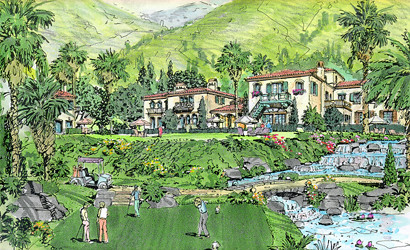
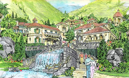
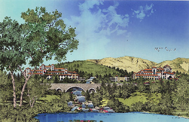
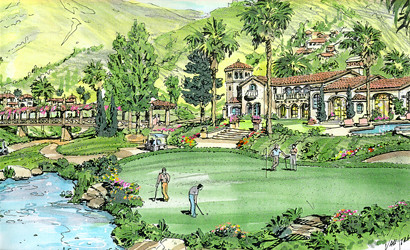
Beyond the Riverfront District, which currently serves as the new downtown for all intents and purposes, and the revitalized city center, which has been the historic urban core of the entire region since 1810, the uptown area is being remade as the Arrowhead Springs Resort District consolidating and enhancing the broad array of existing tourism assets in the area and expanding upon the 2,000 acres of the historic Arrowhead Springs Hotel, Spa, & Bungalows property from the foothills to the valley floor by developing extensive city-owned lands at Wildwood Park and by better utilizing the flood-control basins in the area and the usually dry East Twin Creek, which, together, create an immense piece of contiguous and developable land that has already been master-planned with a well-honed, fine-grained mix of uses, including a garden-style day spa with a business model similar to that of Glen Ivy Hot Springs in Corona.







All of these efforts to enhance quality of life and to attract a world-class labor force will work to expedite development of San Bernardino International Airport, which, in addition to other regional transportation hubs, will provide the number of non-stop flights necessary to attract even more interest from major businesses. And, incidentally, San Bernardino International is only a couple of miles away from the proposed route for California High-Speed Rail, so, while the C.H.S.R. Authority rejected years ago a proposal to extend the line to the city center of San Bernardino, a short spur along the Santa Ana River and to and from a functioning SBD airport is entirely conceivable.
