Quote:
Originally Posted by TANGELD_SLC

 Hey delts I've got about 200 photos that I took Sunday from that exact location! Hades it was gorgeous. Wait is that Tibble reservoir or Silver Lake? Looks kinda like Silver lake. |
Quote:
Originally Posted by jtrent77
The bottom lake is Silver Lake Flats Reservoir. Silver Lake itself is a few mile hike above Silver Lake Flats.
|
Hey jtrent77, Welcom aboard the forum.

Tangeld, Tibble Fork would be the first smaller lake/reservoir you came to at the bottom, before you left the paved road and took the right on the dirt road to your photo op. Like jtrent specified, your photo's/or the ones pictured above are of Silver Lake Flats Resevoir. Here's Tibble Fork below.
Tibble Fork Reservoir

wunderground.com
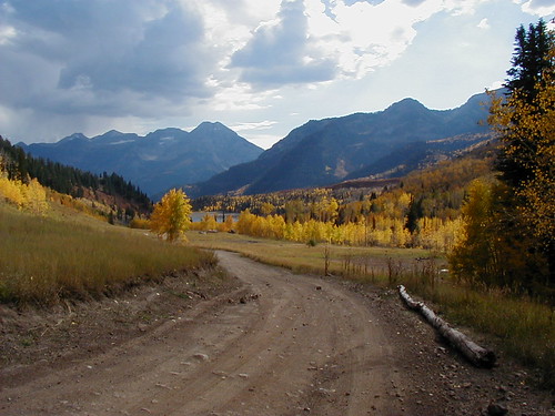
After the Reservoir Flats, you can cross the river in a jeep/horse/bicycle etc. and continue on up on this road pictured. If you're in a 4x4, I would reccomend a jeep or something with a shorter wheel base, because of many very tight switchbacks. I've taken allot of out of town visitors up to the top on this road. It is phenominally fun and incredibly beautiful. You can drive almost to the 11,000-plus foot level. A short hike at the end of the road, will take you up to the ridge, where you can look over to Alta/Snowbird and the Tram tower.
.


 Prev
Prev


 Linear Mode
