 Posted Feb 20, 2021, 3:58 PM
|
 |
Registered User
|
|
Join Date: Aug 2002
Location: Toronto
Posts: 52,200
|
|
|
How Car-Centric Street Networks Make Buses Less Efficient
How Car-Centric Street Networks Make Buses Less Efficient
February 10, 2021
By Laura Bliss
Read More: https://www.bloomberg.com/news/newsl...t?srnd=citylab
Quote:
.....
Cul-de-sacs and looping roads of suburbia may help reduce vehicle traffic jams, but "their discontinuity inhibits pedestrian access to facilities and amenities, while their curvilinearity lengthens and confuses walking trips." For the same reasons, gridded street networks are also more efficient for public transit.
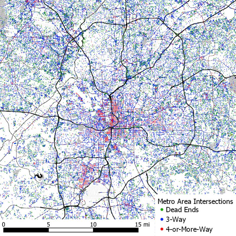
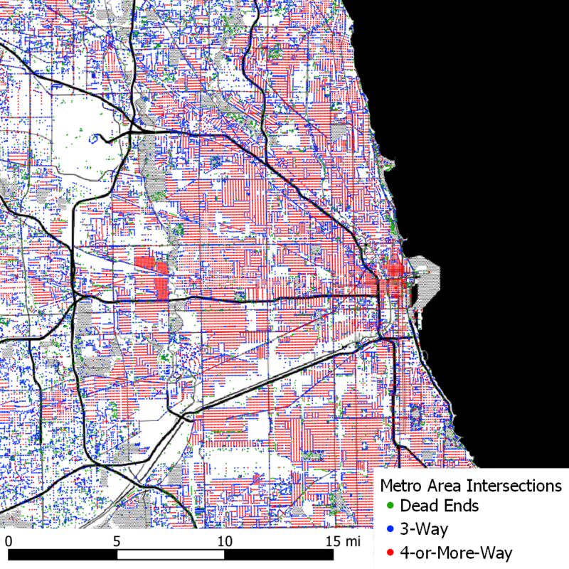
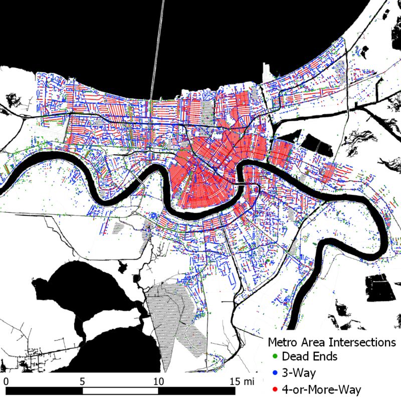
- It's with that mode in mind that DW Rowlands, a graduate student in human geography at the University of Maryland, Baltimore County, has been taking a quantitative approach to the study of urban connectivity. As part of her thesis research, she has mapped the street intersections in eight U.S. cities to reveal how some have inherent disadvantages that planners seeking to provide high quality transit service can't always overcome with more buses alone. "When we compare transit ridership in two cities, we’re often conflating two things," she said. "It's the quality of transit, but it's also a function of the types of neighborhood that they're serving." Rowlands used OpenStreetMaps street network data to code the number of roads that meet at every intersection.
- The X-ray-like results reveal the underlying structures that keep some of the country's largest human settlements moving efficiently, in the case of older cities like New York City or Chicago, or inefficiently, in the case of a newer, auto-centric cities like Atlanta or Tampa. Such maps may come as little surprise to regular transit users or enthusiastic flâneurs, who may have an intuitive sense of the styles of intersections surrounding them. — Confined to their neighborhoods during the pandemic, they may well have enlarged their map of "home." But Rowlands thinks these maps are timely given the existential questions facing big-city transit systems that no longer have the ridership that once sustained them financially. "A lot of cities need to sit down and look at how they're funding and providing their services," she said. And while it may be easier said than done, "it's also is a good chance to rethink the design of the street network."
.....
|
An intersection map of Atlanta, Ga. Photographer: Map courtesy of DW Rowlands
 An intersection map of Chicago, Il. Map courtesy of DW Rowlands
 An intersection map of New Orleans, La. Map courtesy of DW Rowlands
__________________
ASDFGHJK
|


 Threaded Mode