Quote:
Originally Posted by Tom Servo

what's more interesting is that lone yellow area looks like it's at Montrose harbor... but Uptown at least seems like it'd have much higher density numbers:
|
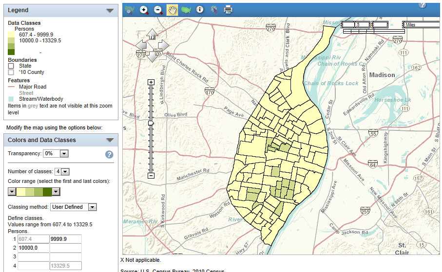
Just so you know... The park district allows live-aboards in the Chicago Harbor system. So the Census needs to have tracts that include the harbors to cover the people that live on boats. Those people obviously have to find somewhere else to live in the winter, but the Census doesn't do their counts in the winter...
A lot of cities have harbors that allow for live-aboards, so that is going to drastically skew a lot of tracts that have water borders. Chicago will be especially bad, since those tracts will stretch from dense neighborhoods, cross Lake Shore Drive, cross Lincoln Park, and then head into the water where the boats are not stacked on top of each other so they can count the 4 or 5 people that actually do live on a boat.
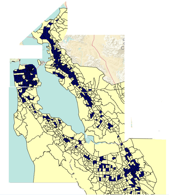
In the bay area, there are some harbors in Marin County that are pretty densely packed with boats that are specifically designed as residences. But Oakland, SF and Alameda all have harbors where the live-aboards are few and far between and the Census needs to stretch a tract out to get them, dramatically reducing the density of what would have probably been some fairly dense tracts.
I bet you can find 200-300 tracts around the country that are "unfairly" skewed just because of harbors.


 Prev
Prev


 .
.


 Linear Mode
