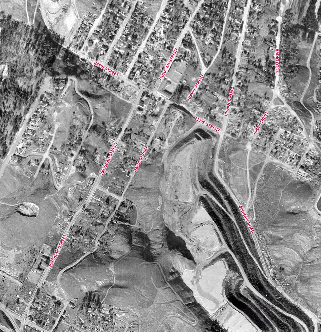
I've been looking for more pictures of Chavez Ravine before the Dodgers stadium obliterated most of the housing. I'll start with a larger aerial from 1952.
Historic Aerials
Quote:
Originally Posted by corriganville

Located on the northeast corner of Effie Street and Paducah Street was the Palo Verde Elementary School. In the late 1950's, the roof was removed from the school and the interior was filled with dirt. The entire valley floor along Effie Street and cross streets were land filled. This area is now beneath a parking lot of Dodger Stadium. By the time the "Highway Patrol" program (ZIV) filmed there, most of the housing had already been removed because of a 1949 U.S. law which allowed communities to be rezoned and affordable housing erected. The area was condemned and housing removed as people sold, moved, or were evicted. A few years later, a new mayor of L.A. decided not to go forward with the redevelopment of the area. Then the Dodgers baseball team came and the city gave/sold them the area that was already condemned. The final buildings were removed, except for the school, and the area filled with dirt.
|
Sebisebster previously posted a smaller version of this picture in
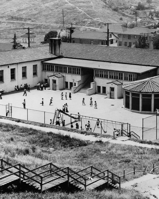
post #2558. The LAPL caption says
"Children are playing in the schoolyard behind Palos Verdes Elementary School in Chavez Ravine." That should be
Palo Verde Elementary School, which was at 1029 Effie Street (according to the 1942 CD). The 1942 CD also lists Paducah School at 1345 Paducah Street. On the aerial, the school is just above Effie Street to the right of Paducah Street.
 lapl.org
The school picture also appears in the KCET article
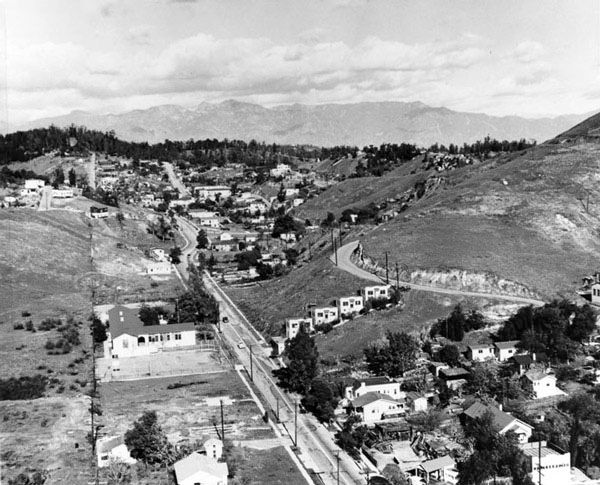
Chavez Ravine: Community to Controversial Real Estate, which is where I found the picture below. They credit it to LAPL, but I couldn't find it there. LAPL does have a similar photo (which appears in
Sebisebster's post), but they incorrectly identify it as Bishops Road. The photo actually shows the south-western part of Paducah Street, taken from near the lower left corner of the aerial above.
 www.kcet.org
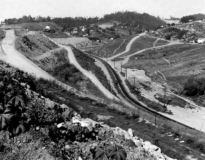
This picture shows the real Bishops Road. It was taken from near the lower right corner of the aerial above.
 California State Library
LAPL has this picture of Bishops Road taken slightly north of the one above. The car on the dirt track is heading up the hill toward the intersection with Effie Street, and on to Pine Street.
 lapl.org
Sebisebster
lapl.org
Sebisebster's four-part history of Chavez Ravine:
The history of Chavez Ravine - Introduction.
The history of Chavez Ravine - Part One.
The history of Chavez Ravine - Part Two.
The history of Chavez Ravine - Part Three.


 Prev
Prev


 That's an excellent detail GW!


 ebay
ebay


 ebay
ebay ebay
ebay 

 ebay
ebay 


 This is the Long Beach Pike in the 1930s.


 Linear Mode
