US - Russia maritime border:
wikipedia
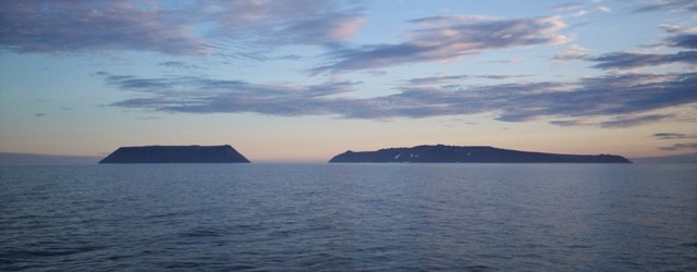
These two islands are located in the middle of the Bering strait. They're only 2.4mi apart and the US - Russia border runs in between. The little one on the left is in the United States - it's called Little Diomede, also known as Sarah Palin's favorite hangout spot

. The bigger one on the right - Big Diomede - is in Russia. The international date line also runs in between and the time difference between the two is 21 hours
A few fun facts about our maritime border with Russia, which most people sadly aren't even aware exists: During the cold war it was known as the Ice Curtain and was militarized. Also, another thing that very few people know is that the Bering strait actually freezes over every winter forming an ice bridge, so our maritime border with Russia actually becomes a land border for a few months every year. A few years ago someone actually drove across, I remember reading about it... Fun stuff.


 Prev
Prev


 Linear Mode
