Congratulations CarnyRocker (who I think we can safely assume is Signal) for getting the highest score this week!
The second Newfoundland round threw me for a loop. I found a sign for Fortune Harbour, which I erroneously assumed was the same as Fortune. So I was searching in the wrong area entirely.
I've created a spreadsheet to track the season scores and map picks, you can access it here.
Next week we'll be facing off in our first urban challenge - stay tuned!
That brings us to today's Funday Monday challenge. This week's map is simply titled Famous Places in Canada. What places does the author consider to be famous? I have no idea, but there are over 500 of them for the algorithm to choose from. No time limit, no restrictions on movement.
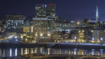
And here is our Mid-Week Friendly challenge. This week we're playing on the map 100 largest cities of Canada, created by Simi. The author does not indicate what data source/criteria were used to delineate/rank cities, but a cursory glance at CSD populations should put the cutoff around somewhere the size of Welland, ON. No time limit, no restrictions on movement.
Looks like we all found that one pretty easy - granted most of the locations had pretty obvious clues
This weekend's competition is on the same map, 100 largest cities of Canada. 5 minute time limit per round. Everyone is welcome to enter, even if you didn't compete last week.
Here are the results for this weekend's challenge:
The Quebec rounds were quite interesting. Didn't expect to land in Granby, and also didn't realize Terrebone had such a nice historic core.[/SPOILER]
You can view the updated leaderboard here.
Tonight's map is called every canada us border crossing on google street view. I expect it to be as simple as that. No time limit, no restrictions on movement.
Tonight's map is called every canada us border crossing on google street view. I expect it to be as simple as that. No time limit, no restrictions on movement.
Thanks..Good topic. Unfortunately 2/5 of those images are so grainy it is hard to read any signs to get clues. Part of the USA really need an image upgrade.
https://goo.gl/maps/Ht8mF87Vk8Teshyq5 USA/Canada border goes through this building which was a tavern and is now a freight forwarding/parcel pick up place. It could be included in the Ugly Canada thread.
Thanks..Good topic. Unfortunately 2/5 of those images are so grainy it is hard to read any signs to get clues. Part of the USA really need an image upgrade.
Forced me to make educated guesses based on physiography and landform. I was pretty close.
Couple of really lucky ones got me to over 23k somehow. The resolution on some of those US roads is horrendous. How did they not have better cameras in 2007?


 Prev
Prev


 Linear Mode
