HomeDiagramsDatabaseMapsForum About
     

Go Back   SkyscraperPage Forum > Photography Forums > Found City Photos

Reply

 
Thread Tools Display Modes
     
     
  #27441  
Old Posted Apr 3, 2015, 9:47 PM
fhammon fhammon is offline
Registered User
 
Join Date: Oct 2011
Location: Los Angeles, Ca.
Posts: 269
Quote:
Originally Posted by tovangar2 View Post
[I][COLOR="Blue"]"By 1855 the [Hebrew] Benevolent Society had dedicated a Jewish cemetery in Chavez Ravine, just south of the modern Dodgers Stadium. The burial ground was replaced in 1902 by Congregation B'nai B'rith's Home of Peace Cemetery on Whittier Boulevard in East Los Angeles."
Has this been posted yet?


Quote:
Plaque inscription: NO. 822 FIRST JEWISH SITE IN LOS ANGELES - The Hebrew Benevolent Society of Los Angeles (1854), first charitable organization in the city, acquired this site from the city council by deed of April 9, 1855. This purchase of a sacred burial ground represented the first organized community effort by the pioneer Jewish settlers.
Location: Chavez Ravine, behind US Naval and Marine Corps Reserve Center, 800 W Lilac Terrace near Lookout Dr, Los Angeles
GPS: 34.069591,-118.241161
http://landmarkadventures.blogspot.c...s-angeles.html
Reply With Quote
     
     
  #27442  
Old Posted Apr 3, 2015, 10:02 PM
HossC's Avatar
HossC HossC is offline
Registered User
 
Join Date: Aug 2013
Posts: 4,245
Quote:
Originally Posted by ethereal_reality View Post

below: 'mystery' location. ( I just found this last night on eBay)

So what hotel also had steam baths?


http://www.ebay.com/itm/LOS-ANGELES-...item5b0ef93ad1
Believe it or not, this is the building at the East 1st/Chicago loop. I'm not sure what year the picture above was taken, but in the 1942 CD I found public baths under the name Mrs Ruth Rabin at 2203 E 1st Street, and the Monte Carlo Hotel at the same address. The building still stands (albeit minus the top couple of feet of wall), but the trees in Lani Vest Pocket Park do a great job of hiding it. In lieu of a decent GSV image, here's an older image posted by Wig-Wag a few days ago.

Quote:
Originally Posted by Wig-Wag View Post

Photo 4., is from the Andy Goddard collection on the pacificelectric.org website and shows a March 1963 LAMTA excursion at the the loop where it curves up alongside the brick building still extant and facing the park. These are the rails seen behind the car in the first photo.

Reply With Quote
     
     
  #27443  
Old Posted Apr 3, 2015, 10:11 PM
CityBoyDoug CityBoyDoug is offline
BANNED
 
Join Date: Apr 2013
Posts: 2,868
Brutalism is noir.

Quote:
Originally Posted by ethereal_reality View Post
I've been trying to find out more information on this rather foreboding building at 2845 W. 7th Street, just west of Hoover.


GSV / 2007

Today it is the Central American Resource Center, but what was it originally?


*I used the 2007 street view because I thought it looked dramatic.
__
ER:

Many people call that style of architecture...Brutalist or Brutalism.

Here's a link to several other examples of LA Brutalism. Some people actually like it. I call it S&M architecture!

https://www.laconservancy.org/archit...tyle/brutalist
Reply With Quote
     
     
  #27444  
Old Posted Apr 3, 2015, 10:17 PM
fhammon fhammon is offline
Registered User
 
Join Date: Oct 2011
Location: Los Angeles, Ca.
Posts: 269
Quote:
Originally Posted by ethereal_reality View Post
Last but not least, here's 'mystery' location #3 for the day.


eBay
__
It strikes me as being somewhere along N. Broadway just above the Corn Field.
Reply With Quote
     
     
  #27445  
Old Posted Apr 3, 2015, 10:54 PM
tovangar2 tovangar2 is offline
Registered User
 
Join Date: Nov 2012
Location: West Los Angeles
Posts: 2,625
Quote:
Originally Posted by ethereal_reality View Post
Do you agree the architecture is somewhat odd? Certain parts of it are almost bunker-esque...well, except for the windows of course.
That's why I wondered about it's history.

__
CBD called it. My daughter was by today and we were both wondering if the building acquired a Brutalist jacket as part of a remodel at some point (?) It looks encased.

I agree with you on the whole CBD, but I retain a soft spot (if that's possible) for Paul Rudolph's Art & Architecture building at Yale. It's the derivative copies that are horrible. UCLA has been ruined with them.

I'm glad they put a plaque up fhammon. There should be a lot more.

Reading more about the building that replaced the cemetery, I see it's also listed as now being the LAFD Frank Hotchkin Memorial Training Center. Hotchkin died fighting the 1980 fire at this building when it was the Reserve Center.

Last edited by tovangar2; Apr 3, 2015 at 11:34 PM.
Reply With Quote
     
     
  #27446  
Old Posted Apr 4, 2015, 12:05 AM
ethereal_reality's Avatar
ethereal_reality ethereal_reality is offline
Registered User
 
Join Date: Feb 2008
Location: Lafayette/West Lafayette IN, Purdue U.
Posts: 16,352
HossC, I almost fell out of my seat when you said the 'steam baths/hotel' mystery photograph was located at the recently discussed (discovered) 1st and Chicago St. Loop.
That's quite a coincidence!!

Here is a 2009 street view of the old Monte Carlo Hotel and Steam Baths that isn't too bad.

GSV

I wonder if the building in my #2 'mystery' photograph is in this same general area?
Reply With Quote
     
     
  #27447  
Old Posted Apr 4, 2015, 1:17 AM
ethereal_reality's Avatar
ethereal_reality ethereal_reality is offline
Registered User
 
Join Date: Feb 2008
Location: Lafayette/West Lafayette IN, Purdue U.
Posts: 16,352
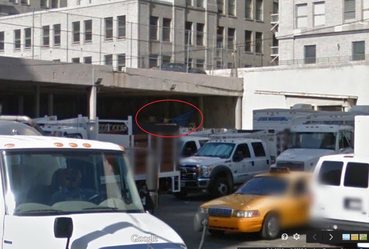
While searching for one thing, I found another.

This is a short video (1 minute, 20 second), showing something 'hidden' downtown.

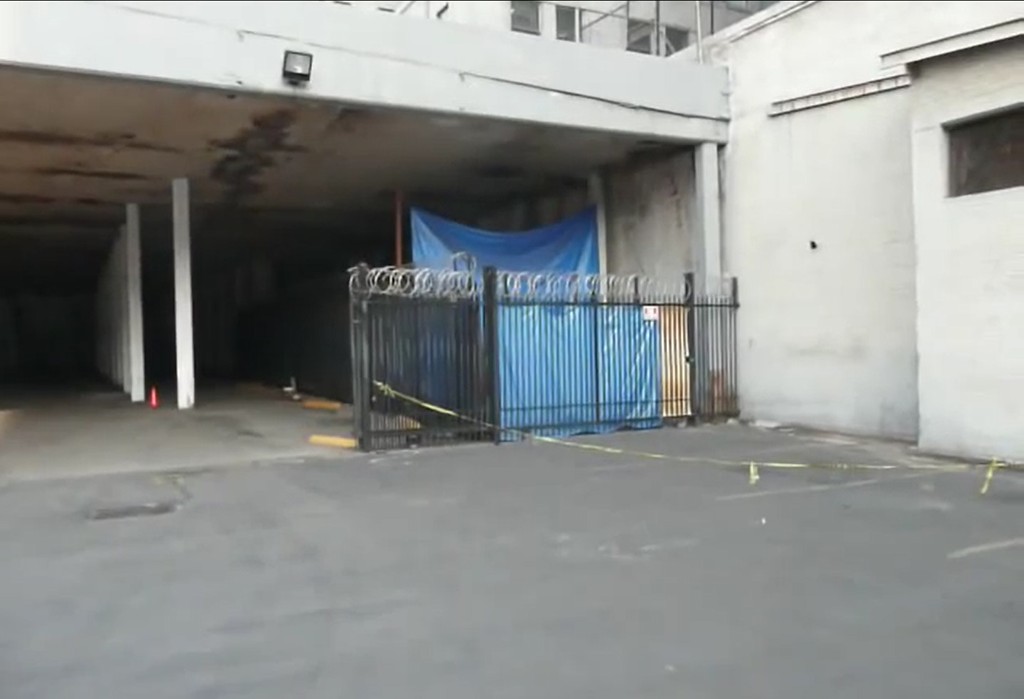
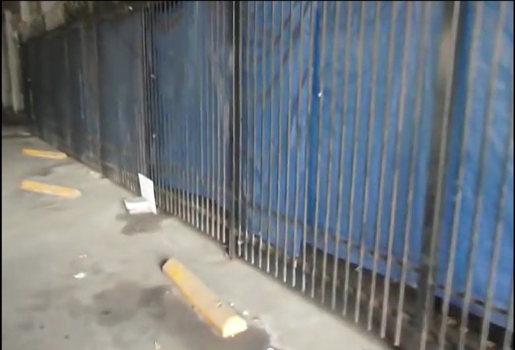
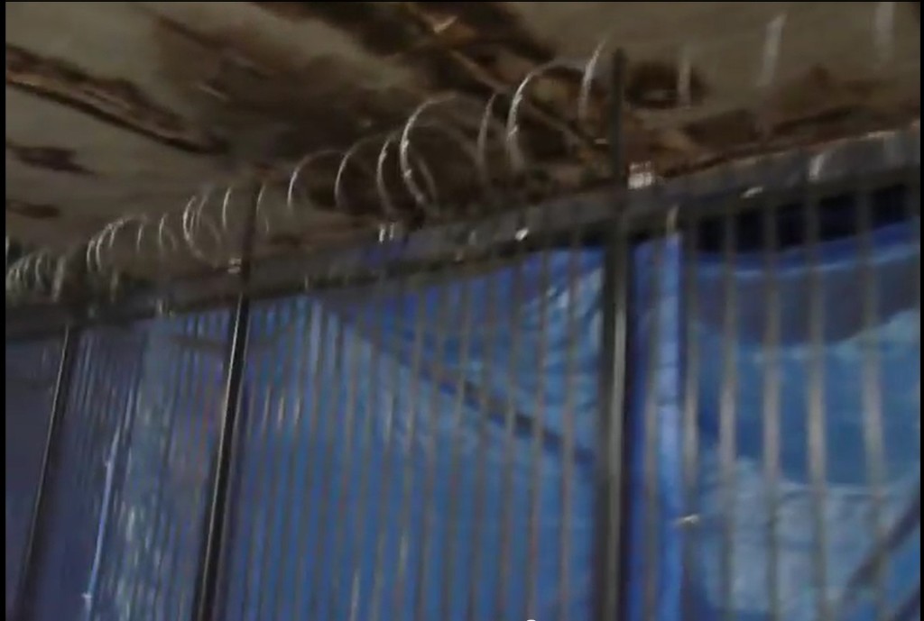
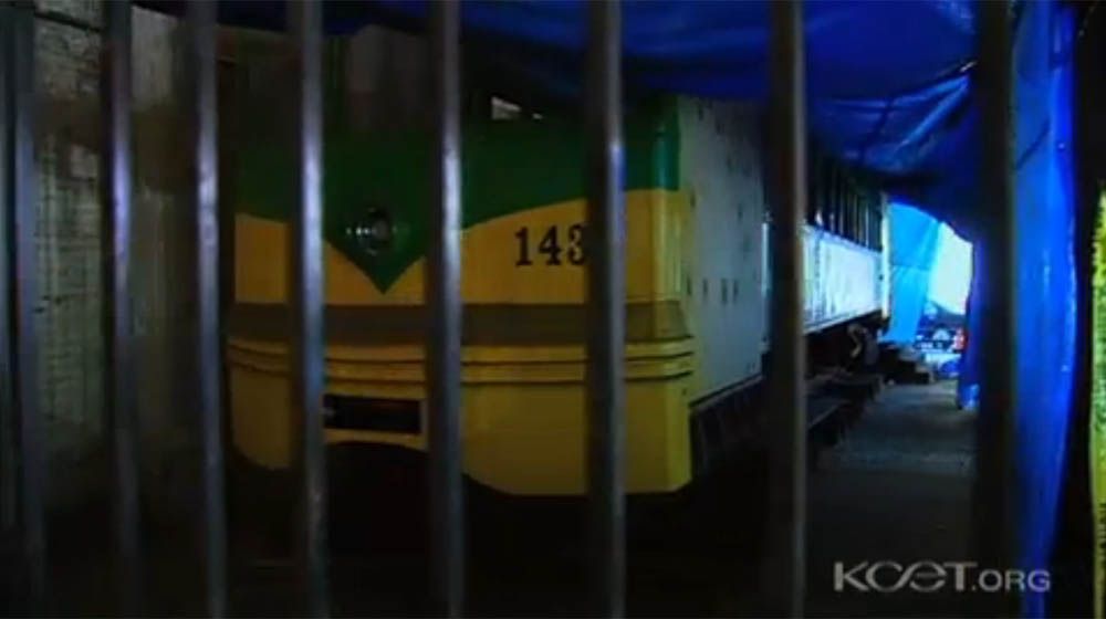
"So here's a mystery, what is behind this fence with razor wire on top, and this blue tarp?"

https://www.youtube.com/watch?v=gBN0KHgOLFc


"Whatever it is, it's long."

https://www.youtube.com/watch?v=gBN0KHgOLFc


"and they're protecting it with razor wire."


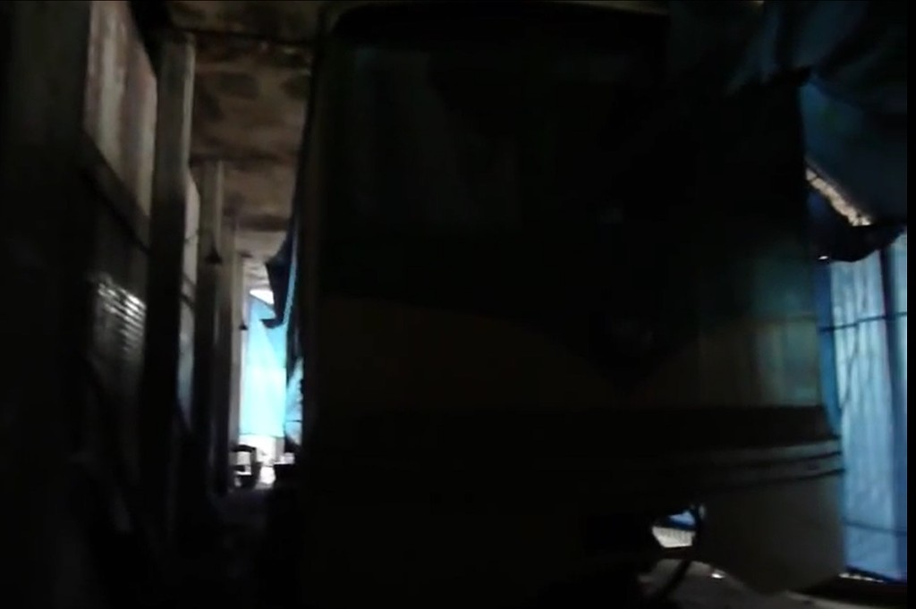
And at the very end, when he lifts up the tarp, he sees this.

"Well...I don't know, there's not enough light in here."

https://www.youtube.com/watch?v=gBN0KHgOLFc

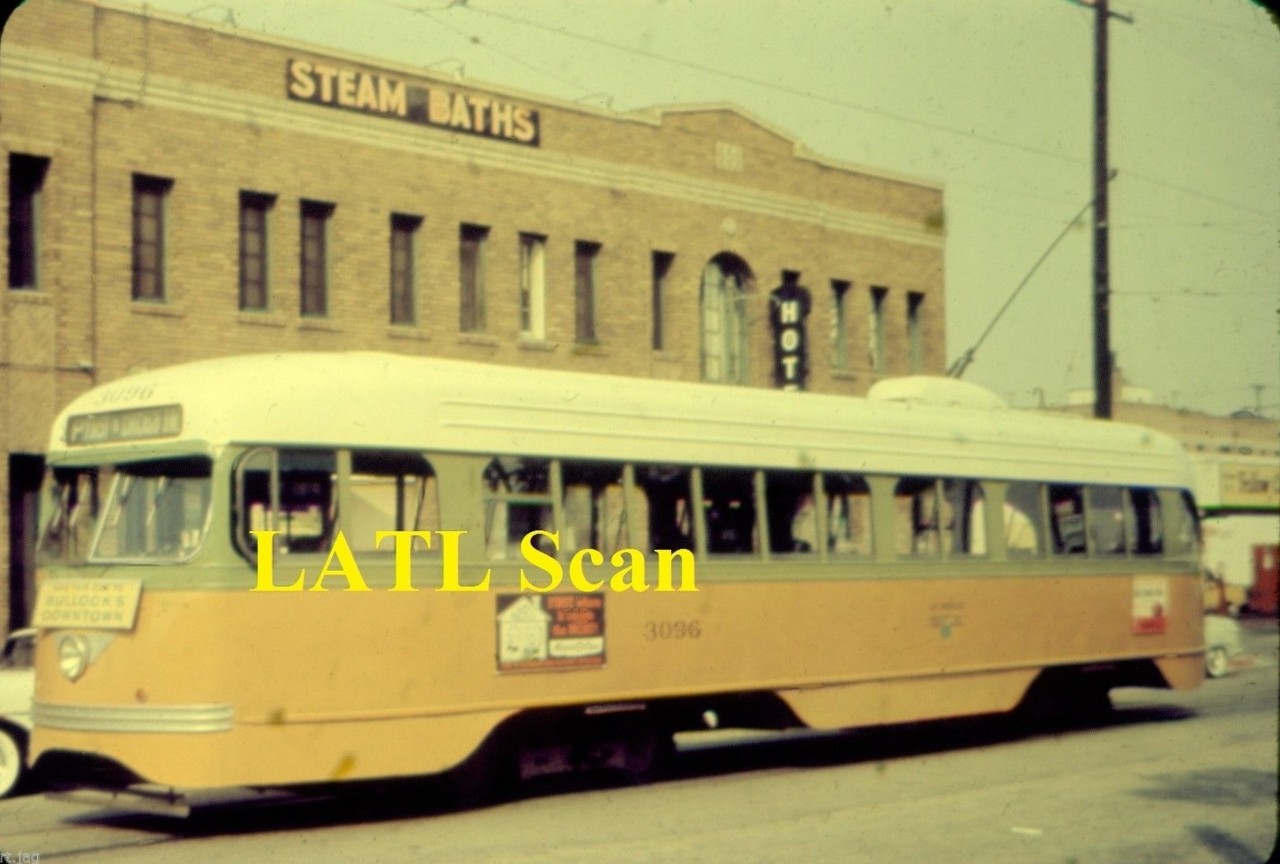
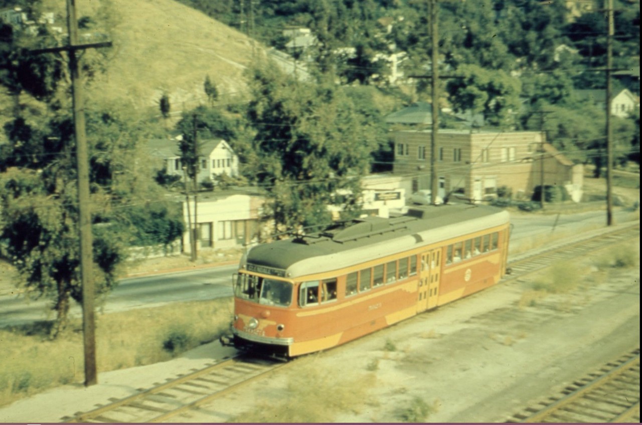
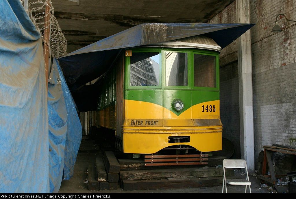
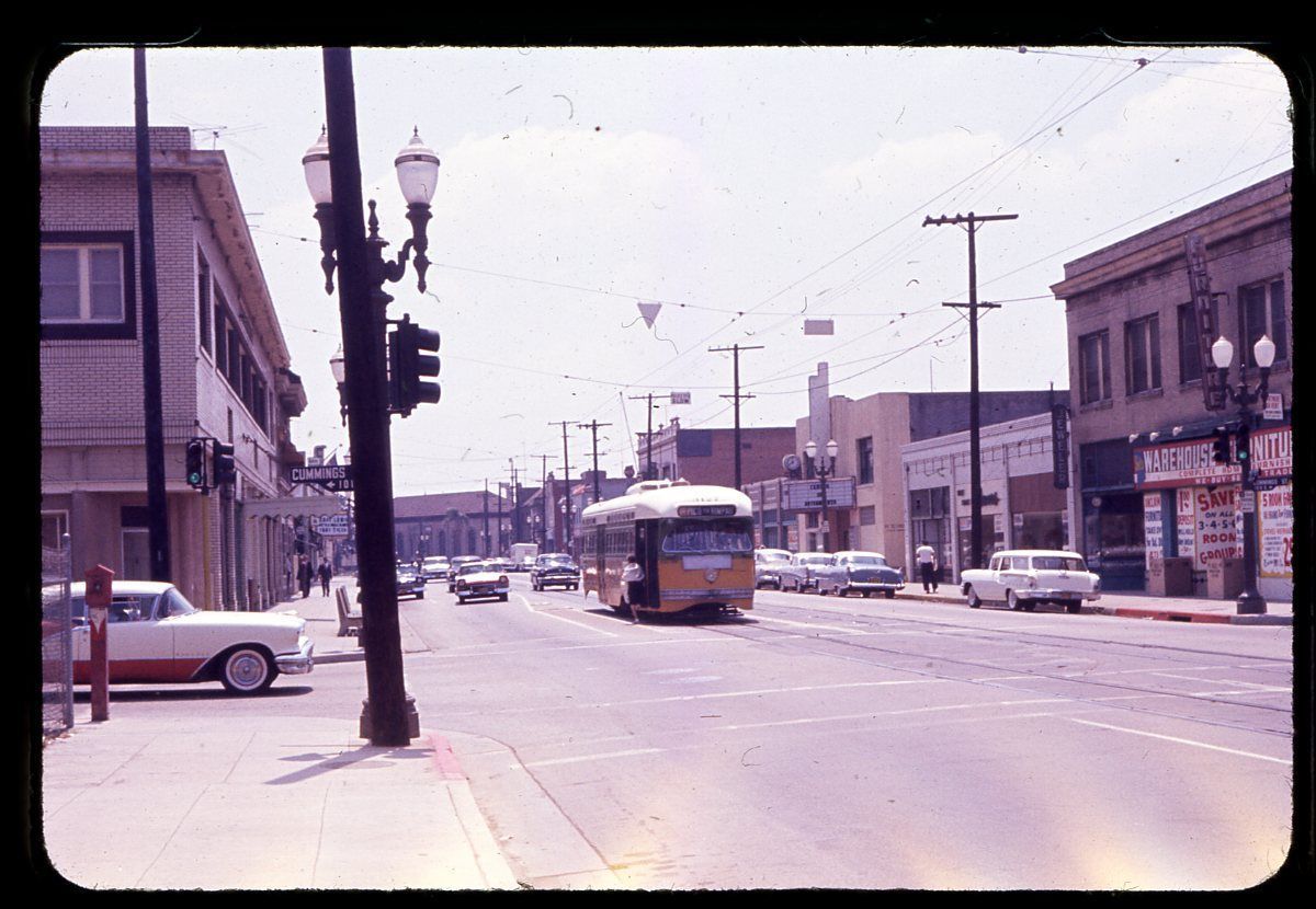
It's pretty obvious to me. Isn't that an old streetcar?

See the video for yourself here:
https://www.youtube.com/watch?v=gBN0KHgOLFc

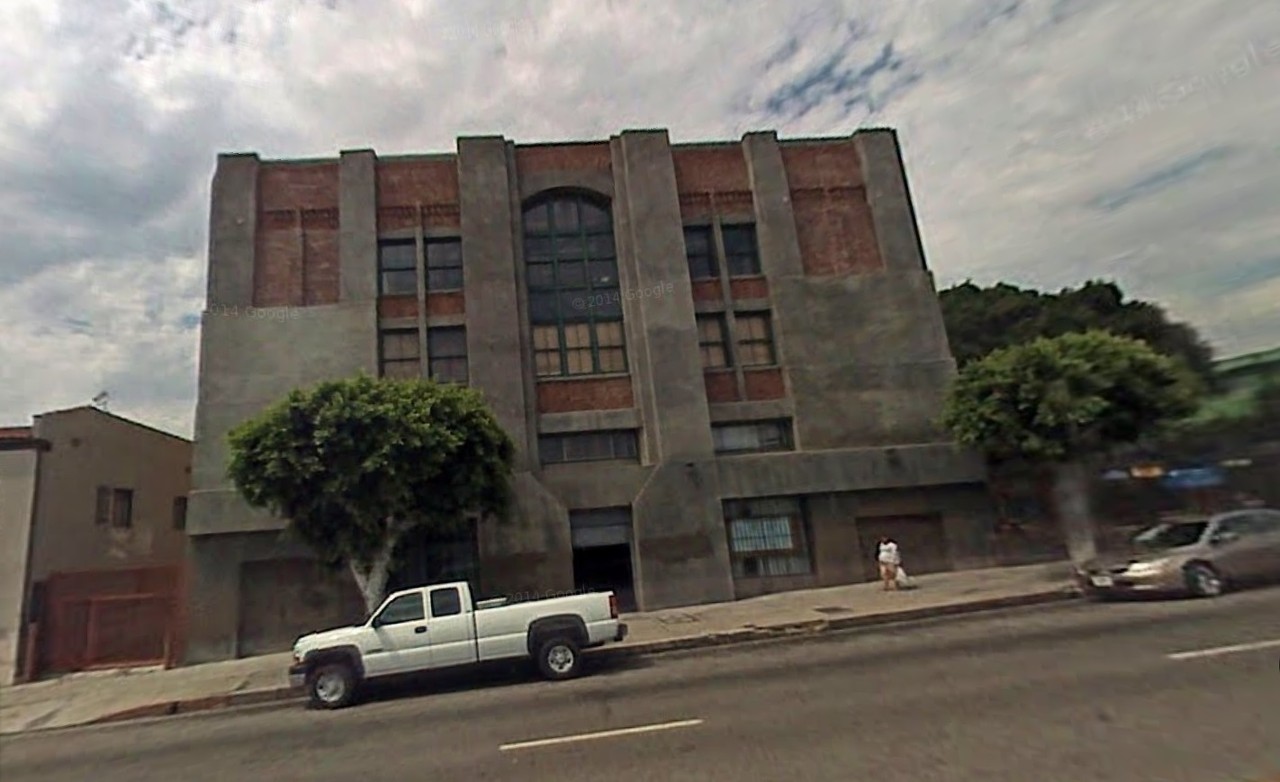
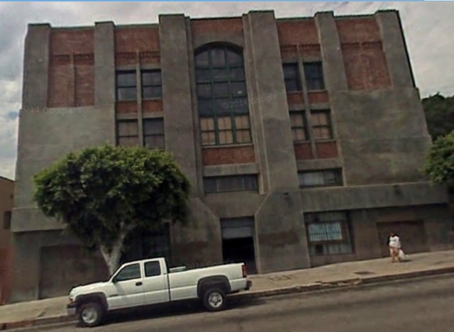
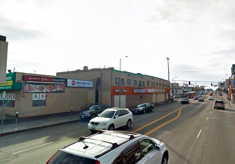
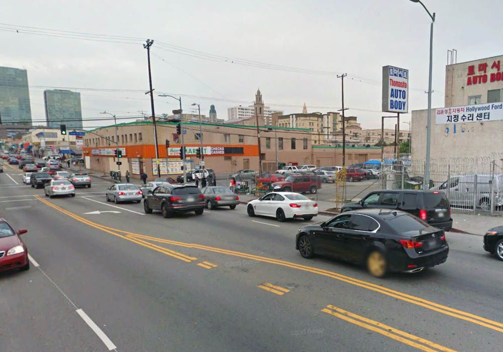
I got in the google-mobile and I'm pretty sure I found the location. It's next to the old Subway Terminal Building. (in the video the man says he's on Hill Street)


GSV


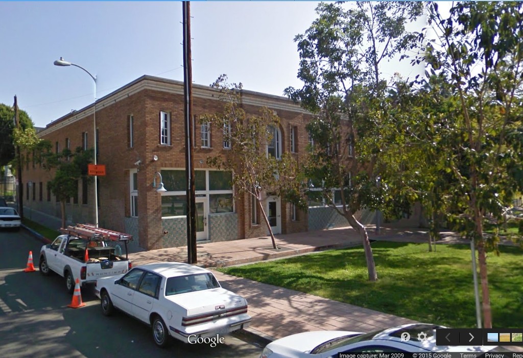
I jumped back to 2009, when the parking lot was less busy.

GSV

So rail fans:
Is there an old streetcar parked downtown next to the Subway Terminal Building?

__

Last edited by ethereal_reality; Apr 4, 2015 at 1:28 AM.
Reply With Quote
     
     
  #27448  
Old Posted Apr 4, 2015, 1:47 AM
HossC's Avatar
HossC HossC is offline
Registered User
 
Join Date: Aug 2013
Posts: 4,245


I thought I'd read the answer on NLA, but then I remembered I saw it in a video.

Check out 'Visiting with Huell Howser': 'Subway Terminal Update' at kcet.org. Skip to about 43 minutes in to see what appears to be the partly-restored streetcar #1435. If you have a spare hour, the whole video is worth watching.


www.kcet.org

I found this better picture at www.rrpicturearchives.net. The description says "This is a St. Louis Car (California Car Class H-3 or Type H) narrow gauge streetcar built in 1924. It was originally delivered to the Los Angeles Railway (42" gauge, LARy). After that, it served for Tahoe Valley Lines before going to Orange Empire. Today it sits in the Pacific Electric Subway Terminal, undergoing restoration to become a static display. "


www.rrpicturearchives.net/Charles Freericks
Reply With Quote
     
     
  #27449  
Old Posted Apr 4, 2015, 2:33 AM
HossC's Avatar
HossC HossC is offline
Registered User
 
Join Date: Aug 2013
Posts: 4,245
Quote:
Originally Posted by ethereal_reality View Post

Last but not least, here's 'mystery' location #3 for the day.


eBay
There's an almost identical picture on redcarproperty.blogspot.com, where the location is identified as "Glendale Line at Allesandro Ave. and Whitmore Ave." Another post incudes the 1960 picture below, showing the area when it was being cleared for the Glendale Freeway. The striped building on the corner of Whitmore Avenue still appears to be standing, although it's now surrounded by trees.


redcarproperty.blogspot.com

The 1948 aerial below is from my post about the Palestine/Holyland Exhibition. It just captures the area in the streetcar photo, with Allesandro Street being the diagonal road that goes most of the way up the right side, and Whitmore Avenue in the lower-right corner.


Historic Aerials
Reply With Quote
     
     
  #27450  
Old Posted Apr 4, 2015, 3:18 AM
Mstimc Mstimc is offline
Registered User
 
Join Date: May 2013
Location: So Cal
Posts: 239
Quote:
Originally Posted by ethereal_reality View Post
Thanks for the link Mstimc. -That's a very interesting article.
__
[QUOTE=tovangar2;6975957] Thank you for the info Mstimc. I'd been looking for more on the three smaller cemeteries, Agurdath Achim (1919), Mount Zion (1916) & Beth Israel (1907), tucked into a corner of Home of Peace:

Thanks guys. Not to get too spiritual on a Good Friday, but regarding the Times article, I've always thought there's a special level in Hell reserved for people who vandalize graves.
__________________
Tim C
Reply With Quote
     
     
  #27451  
Old Posted Apr 4, 2015, 3:52 AM
unihikid's Avatar
unihikid unihikid is offline
Registered User
 
Join Date: Dec 2010
Location: South Bay
Posts: 350
Quote:
Originally Posted by HossC View Post


I thought I'd read the answer on NLA, but then I remembered I saw it in a video.

Check out 'Visiting with Huell Howser': 'Subway Terminal Update' at kcet.org. Skip to about 43 minutes in to see what appears to be the partly-restored streetcar #1435. If you have a spare hour, the whole video is worth watching.


www.kcet.org

I found this better picture at www.rrpicturearchives.net. The description says "This is a St. Louis Car (California Car Class H-3 or Type H) narrow gauge streetcar built in 1924. It was originally delivered to the Los Angeles Railway (42" gauge, LARy). After that, it served for Tahoe Valley Lines before going to Orange Empire. Today it sits in the Pacific Electric Subway Terminal, undergoing restoration to become a static display. "


www.rrpicturearchives.net/Charles Freericks
I took a pic of this back in 07 when they were restoring the PE Subway building...I got to walk in the car before security saw me...either way per Ralph Cantos of the PERWYS "This car was in perfect condition until it was stored here" ..I know its been there for years. Maybe it will turn out like The Clark Hotel(which is across the street)... restored but tucked away.

[IMG][/IMG]
Reply With Quote
     
     
  #27452  
Old Posted Apr 4, 2015, 6:02 AM
tovangar2 tovangar2 is offline
Registered User
 
Join Date: Nov 2012
Location: West Los Angeles
Posts: 2,625
Does anyone know anything about the markers placed at the four corners of the original Los Angeles pueblo lands in 1980? I cannot find them via googlemobile.


LA City Historical Society


previous three images: Four Square Leagues, Los Angeles 200 years later

I did see an unidentified monument at Olympic and Indiana, but that doesn't match the description above.


gsv

Quote:
Originally Posted by Mstimc View Post
Not to get too spiritual on a Good Friday, but regarding the Times article, I've always thought there's a special level in Hell reserved for people who vandalize graves.
Graves have been despoiled since long before the Egyptians, but I guess hope springs eternal b/c folks keep burying their dead. I kind of get a kick out of exploring old graveyards, but my family's been cremated and the ashes scattered ("bake and shake" to the less reverential) since before anyone of us now alive can remember. I don't want to take up any space after I'm gone (it would sort of take the meaning out of the word "gone"). I can't help thinking that real estate's for the living.

It's the first full moon after the spring equinox tomorrow, "Easter" or "The Planting Moon" on the traditional calendar, a pair with the Harvest Moon in the second half of the year. It will be celebrated tomorrow by lots of folks, same as other planetary events.

Last edited by tovangar2; Apr 4, 2015 at 6:56 AM.
Reply With Quote
     
     
  #27453  
Old Posted Apr 4, 2015, 6:57 AM
CityBoyDoug CityBoyDoug is offline
BANNED
 
Join Date: Apr 2013
Posts: 2,868
Boundry Markers....old Los Angeles

Quote:
Originally Posted by tovangar2 View Post
Does anyone know anything about the markers placed at the four corners of the original Los Angeles pueblo lands in 1980? I cannot find them via googlemobile.


LA City Historical Society


previous three images: Four Square Leagues, Los Angeles 200 years later

I did see an unidentified monument at Olympic and Indiana, but that doesn't match the description above.


gsv
This bronze plate is called the North East Marker.


This website talks about the markers and their location...I think,

http://ericbrightwell.com/2015/01/03...ranklin-hills/
Reply With Quote
     
     
  #27454  
Old Posted Apr 4, 2015, 11:03 AM
HossC's Avatar
HossC HossC is offline
Registered User
 
Join Date: Aug 2013
Posts: 4,245
Quote:
Originally Posted by ethereal_reality View Post

slide 1960

http://www.ebay.com/itm/LAMTA-Los-An...item3f44ecdd1d

...and that impressive building down at the end of the street...
Quote:
Originally Posted by HossC View Post

The 1921 map isn't as sharp, but it shows the Boyle Heights Branch Library on the site of the old powerhouse.


www.historicmapworks.com
I know we've discussed the East 1st/Chicago intersection a lot recently, but I thought this 1927 image was worth posting. The streetcar loop and park are hidden behind the building on the left.


USC Digital Library

Here's a close-up of the building on the right. Just like the Baist map above, the lettering over the door identifies it as the Boyle Heights Branch Library. According to pcad.lib.washington.edu, the library was designed by Dodd and Richards, constructed in 1916, and demolished in 1974. At some point it became known as the Benjamin Franklin Branch Library - a page at openthesis.org says that the name change happened in 1927. The same page also says the original building survived until the 1971 Sylmar earthquake. The Benjamin Franklin name was retained by its replacement.


Detail of picture above.

There's a full history of the Benjamin Franklin Branch at LAPL. Here's the paragraph about the opening of the library:

"By 1915 plans for a Carnegie building were under way. Circulation had grown to over 76,000 and the entire stock of Russian books had been transferred from the Central Library to Boyle Heights. Land was secured by members of the local community and in June, 1916 the new building was completed. A Children's Librarian was added to the staff this year, and children's books were already accounting for one third of the total circulation. Circulation in the first year of the new library was over 106,000, with 6760 cardholders. The new building had five rooms and an outdoor reading room. Two assembly rooms held many classes and meetings. Some of these included a Shakespeare club, a metal workers' association, and lots of neighborhood musical recitals. Children's Librarian Gladys Crowe canvassed the local schools and soon children's materials came to represent half the total circulation."
Reply With Quote
     
     
  #27455  
Old Posted Apr 4, 2015, 12:57 PM
MichaelRyerson's Avatar
MichaelRyerson MichaelRyerson is offline
Registered User
 
Join Date: Feb 2011
Location: Houston, Texas
Posts: 1,155
Quote:
Originally Posted by HossC View Post


I thought I'd read the answer on NLA, but then I remembered I saw it in a video.

Check out 'Visiting with Huell Howser': 'Subway Terminal Update' at kcet.org. Skip to about 43 minutes in to see what appears to be the partly-restored streetcar #1435. If you have a spare hour, the whole video is worth watching.


www.kcet.org

I found this better picture at www.rrpicturearchives.net. The description says "This is a St. Louis Car (California Car Class H-3 or Type H) narrow gauge streetcar built in 1924. It was originally delivered to the Los Angeles Railway (42" gauge, LARy). After that, it served for Tahoe Valley Lines before going to Orange Empire. Today it sits in the Pacific Electric Subway Terminal, undergoing restoration to become a static display. "


www.rrpicturearchives.net/Charles Freericks

South Portal of the Broadway Tunnel, ca.1925

View of the south portal of the Broadway Tunnel, near Broadway and Temple Street. The ‘5 line’ streetcar 1435 can be seen headed southbound on Broadway. Better than average shot of the substantial staircase mounted on the south portal face serving Fort Moore Hill. Likely Roy Rosen used these stairs to get up to the Hancock Banning house where he was renting the attic apartment and Betty Katz who had use of the apartment when Rosen was in the sanitarium up in Elysian Park. And it's possible Edward Weston and Imogen Cunningham and almost certainly Margrethe Mather who was known to move around the city, and Bunker Hill especially, on foot. Makes me happy to think of them.

waterandpower.org

While the archive says '1435' it looks more like 1432 to me. But perhaps they are working from original notes or a higher res copy. In any event here is 1435 or one of her sisters. MR
Reply With Quote
     
     
  #27456  
Old Posted Apr 4, 2015, 1:49 PM
Tourmaline Tourmaline is offline
Registered User
 
Join Date: May 2012
Posts: 996


The wrought iron stairs are reminiscent of those found in a certain building (304 S Broadway) owned by a man named Bradbury.


https://s-media-cache-ak0.pinimg.com...0302da9a4e.jpg


http://rozenbergquarterly.com/wp-con...trium-1960.jpg


http://studentreader.com/files/los-a...3582-w100p.JPG

Last edited by Tourmaline; Apr 4, 2015 at 2:46 PM.
Reply With Quote
     
     
  #27457  
Old Posted Apr 4, 2015, 2:18 PM
HossC's Avatar
HossC HossC is offline
Registered User
 
Join Date: Aug 2013
Posts: 4,245
Quote:
Originally Posted by ethereal_reality View Post

And here's another.

At first, I thought this was the same building as in the previous post.


http://www.ebay.com/itm/LOS-ANGELES-...item58c1846ac9
South Vermont Avenue looking south towards 9th Street (James M Wood Boulevard). This building has also lost a couple of feet from the top of its wall, but the windows match up.


GSV

Here's the same building from a different angle. In the background you can see the tops of the First Unitarian Church on 8th and the First Baptist Church of Los Angeles on Westmoreland.


www.pacificelectric.org/Jack Finn Collection

The First Baptist Church is a little harder to see today.


GSV
Reply With Quote
     
     
  #27458  
Old Posted Apr 4, 2015, 2:31 PM
ethereal_reality's Avatar
ethereal_reality ethereal_reality is offline
Registered User
 
Join Date: Feb 2008
Location: Lafayette/West Lafayette IN, Purdue U.
Posts: 16,352
I wasn't expecting anyone to find that one! Good sleuthing Hoss!

__
Reply With Quote
     
     
  #27459  
Old Posted Apr 4, 2015, 3:07 PM
HossC's Avatar
HossC HossC is offline
Registered User
 
Join Date: Aug 2013
Posts: 4,245
The Maytime Motel at 1632 S La Brea Avenue.


eBay

Today it survives as the Royal Hawaiian Motel.


GSV
Reply With Quote
     
     
  #27460  
Old Posted Apr 4, 2015, 3:47 PM
ethereal_reality's Avatar
ethereal_reality ethereal_reality is offline
Registered User
 
Join Date: Feb 2008
Location: Lafayette/West Lafayette IN, Purdue U.
Posts: 16,352
Thanks to HossC for the location the Alessandro / Whitmore Ave. photo.

When I first saw the two story building with the covered stairs out front I thought it was a wooden structure covered with cheap siding.


eBay detail


Long story short: I believe the building is still there almost completely hidden by trees and shrubs.


GSV

If you look closer, you can see it's a brick building with a horizontal lines.


GSV detail


Detail of brick pattern.


below: You can see the horizontal brick pattern more clearly in this photograph.

posted by HossC

redcarproperty


Just for fun....here's an aerial.


google_earth


I also believe the building on the corner opposite corner is still there as well with a screwy alteration on the front.


GSv

__
Reply With Quote
     
     
This discussion thread continues

Use the page links to the lower-right to go to the next page for additional posts

Reply

Go Back   SkyscraperPage Forum > Photography Forums > Found City Photos
Forum Jump


Forum Jump


All times are GMT. The time now is 8:16 AM.

     
SkyscraperPage.com - Archive - Privacy Statement - Top

Powered by vBulletin® Version 3.8.7
Copyright ©2000 - 2024, vBulletin Solutions, Inc.