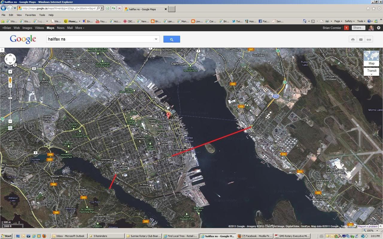
Based on the drawing you have, I find it difficult to believe that the view of George's Island won't be impacted. I found
this picture from google maps and it's very likely it will be impacted.
The levy idea would depend on how HRM's taxing authority would be based - I'd have to check the charter. I suspect a levy wouldn't work because you couldn't apply it to subdivisions already approved; levies typically can only be collected as development occurs. So it would only work if all existing subdivisions started seeing redevelopment...plus with a levy, the collection process can be slow (depending on the pace of development).
A property tax might work better (such as a certain percentage increase over a period of time to help fund a bridge/tunnel), which I would suggest should apply to all HRM since everyone will have an equal opportunity to use these facilities.
The south street idea is interesting but it require the bridge go up and over the farmers market. If you look at the land necessary for the end of the McDonald and McKay, it would be a huge impact in terms of taking out existing houses. I shuder to think that the westin could be impacted or need to be taken down or Cornwallis Park removed, considering how wide the end of the bridges is in terms of supports and land required.
In terms of the mainland side, a NW arm crossing will be problematic regardless of whether it's a tunnel or a bridge. The first problem is that Purcell's Cove road is no more than a 2 lane country road, so how will that be dealt with (would an interchange really be needed?). Then there is how the road would connect to 'mainland ring road' (NW Arm Drive). Because that road was never really extended, the ring is 'broken' because you would need to expropriate the shopping centre (where Sobeys is), homes and get around Catamaran Pond to get the most direct routing. Then of course there is the connection at Herring Cove Road - if you too the most direct line, you'd now have a multi-intersection with HCR and Williams Lake Road. So it would take a lot of work.
The benefit of this connection though would be that the land around Williams Lake and Colpitt Lake has been set aside as 'urban reserve' for
future urban growth, so if a crossing was planned, in this case a levy could be applied (in addition to a property tax) since any future subdivisions would likely have direct benefit to this peninsula connection and the connection to a ring road system.
Don't get me wrong - I like that you are thinking of routing, the crossing has to go somewhere, at some point. But sometimes people forget about how land intensive a bridge can be in terms of the approaches and intersections, unless I'm miss understanding where you expected the actual bridge to begin. Where would the physical bridge start on the Halifax side?


 Prev
Prev


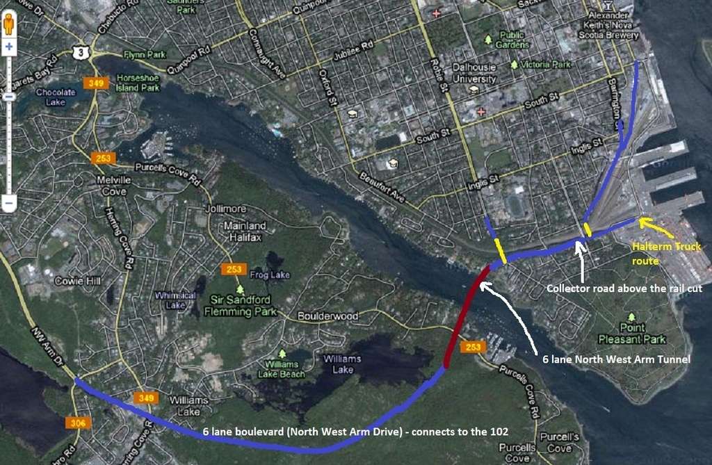


 The problem with a Coburg Road route is that trucks from Halterm Terminals would have to travel along Spring Garden Road to get to it. I think the most direct route from Halterm will be the best route and such a route would still be close to the major population centres around the universities and hospitals.
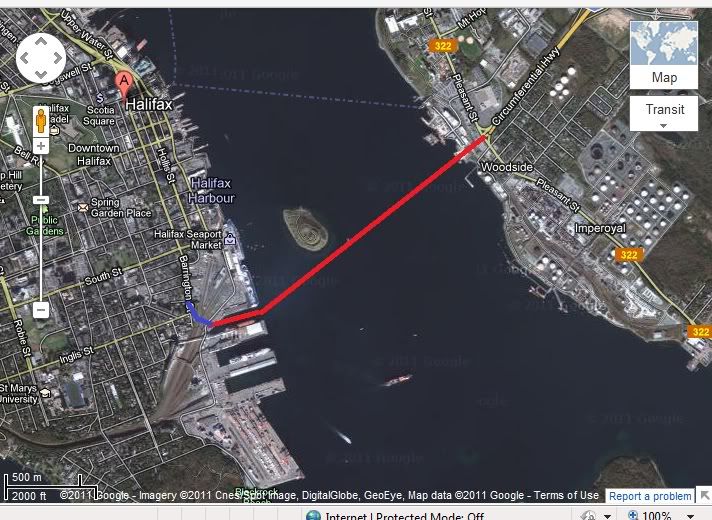


 Linear Mode
