Well, I did the full length of the connected Fundy Trail Parkway/Fundy National Park/Fundy Coastal Drive all the way from the airport connector on the Saint John Thruway all the way to the Gunningsville Bridge in Riverview earlier today.
The full drive was about 245 km, taking about three hours (not including stops). With the newly opened connector, the drive from the east gate of the Fundy Trail Parkway through to the north gate of Fundy National Park is only 26 km long, taking about 21 minutes!

They have done a really nice job on the new connector road - nicely levelled and sloped, with broad curves that can be taken at speed, and the drive was surprisingly scenic. Kudos to DTI for doing a really nice job.
 BUT
BUT, they have
really,
really,
REALLY HORRIBLE SIGNAGE for way finding tourists.

I was familiar with the route, and knew what to expect, but even I was taken somewhat unawares by the sudden turnoff on the existing connector (to Sussex) to the new connecting segment leading to Fundy Park and Alma. If I was taken by surprise, then what would happen to a tourist from Minnesota????
If I recall correctly, the sign was just a small standard rectangular green information sign with an arrowhead on it saying "Shepody Road." There was no mention of Fundy National Park, and I'm pretty sure there was nothing on the sign about Alma either. I mean - what the frig!!! Are tourists supposed to be mindreaders??? They
need a series of signs leading up to the turnoff clearly stating in no uncertain terms that this is the way to Fundy National Park, and the continuation of the Fundy Coastal Drive (let alone mentioning Cape Enrage and Hopewell Rocks).
Signage so far is a huge fail. I presume this is because the road is recently opened, and the tourist season is over, but still, there were out of province tourists on the Fundy Trail Parkway this morning, and I chatted to some of them at a couple of lookoffs, and they seemed well aware that the connector was now open. I wonder if they got lost? NB can do better..........
A couple of photos from my day trip:
 Low tide at St. Martins. This will be my last photo of the iconic old covered bridge. They are in the process of dismantling it. It will likely be gone in a couple of weeks.
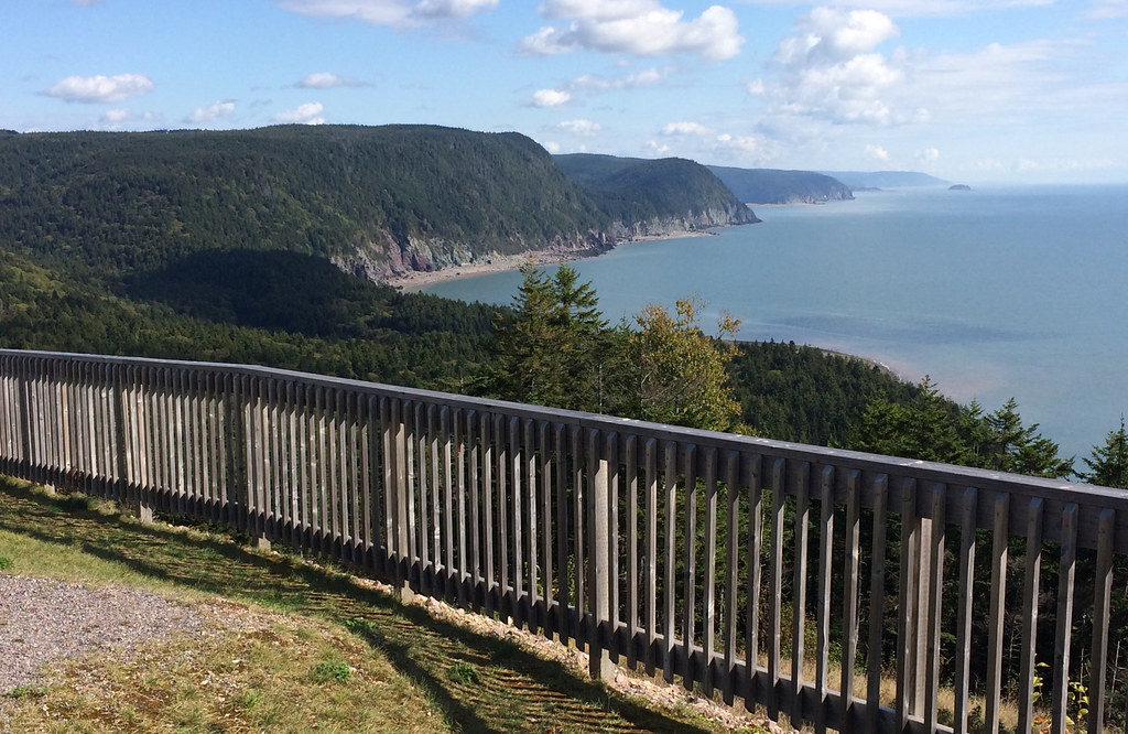 Looking towards the ironbound coast - Fundy Trail Parkway.
NB now has it's own Cabot Trail. We just have to promote it and market it, and put up some signs so the tourists won't get lost.


 Prev
Prev


 Linear Mode
