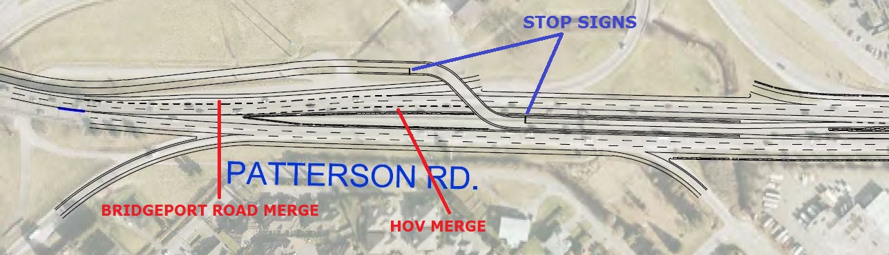
Here are a few of the things that I noticed with the alignments:
First (in blue), there are stop lines* at each end of the bus-only ramps at Bridgeport Road. I'm wondering if this is because the ramp is only one lane wide, so the buses need to stop to make sure no one else is on the ramp before proceeding? Probably a budgetary measure, but I don't have a problem with it. When the Oak Street Bridge is eventually rebuilt, I imagine the ramps will be rebuilt so that they slope downward as the bridge rises, to connect directly with Van Horne Way.
Second (in red), at the same location, I don't like how Bridgeport Road merges onto the highway at the same point that the HOV lane ends. Seems like that will cause traffic to slow a lot.
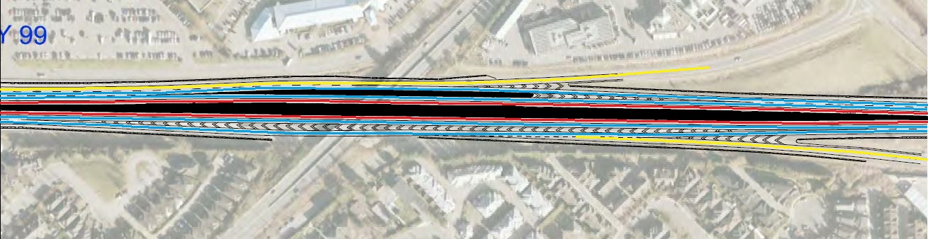
On this one, I really think they need to replace the Cambie Road overpass. They cheaped out and it really shows. You can't fit more than two lanes through each set of pillars so the highway is broken up similar to what they did at 192 Street on Highway 1. Except there, the HOV lanes briefly split off, but here it's all over the place. I tried to make it easy to see on this map, but it didn't turn out so well. Anyway... Red = HOV lanes; Blue = GP lanes; Yellow = Aux. lanes. What a mess!
Gotta go for dinner -- more to come...


 Prev
Prev


 Linear Mode
