Quote:
Originally Posted by Mille Sabords

Hey Warrior, I'm really glad you found your way to the Holt Plan. I own a copy of it (found it in a used bookstore years ago and jumped at it even for $80 bucks).
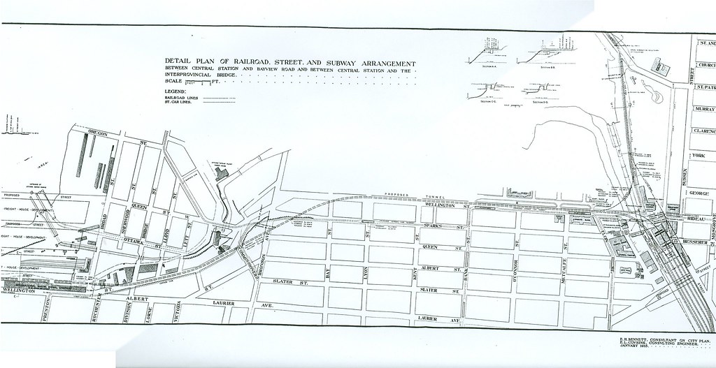
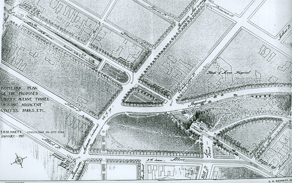
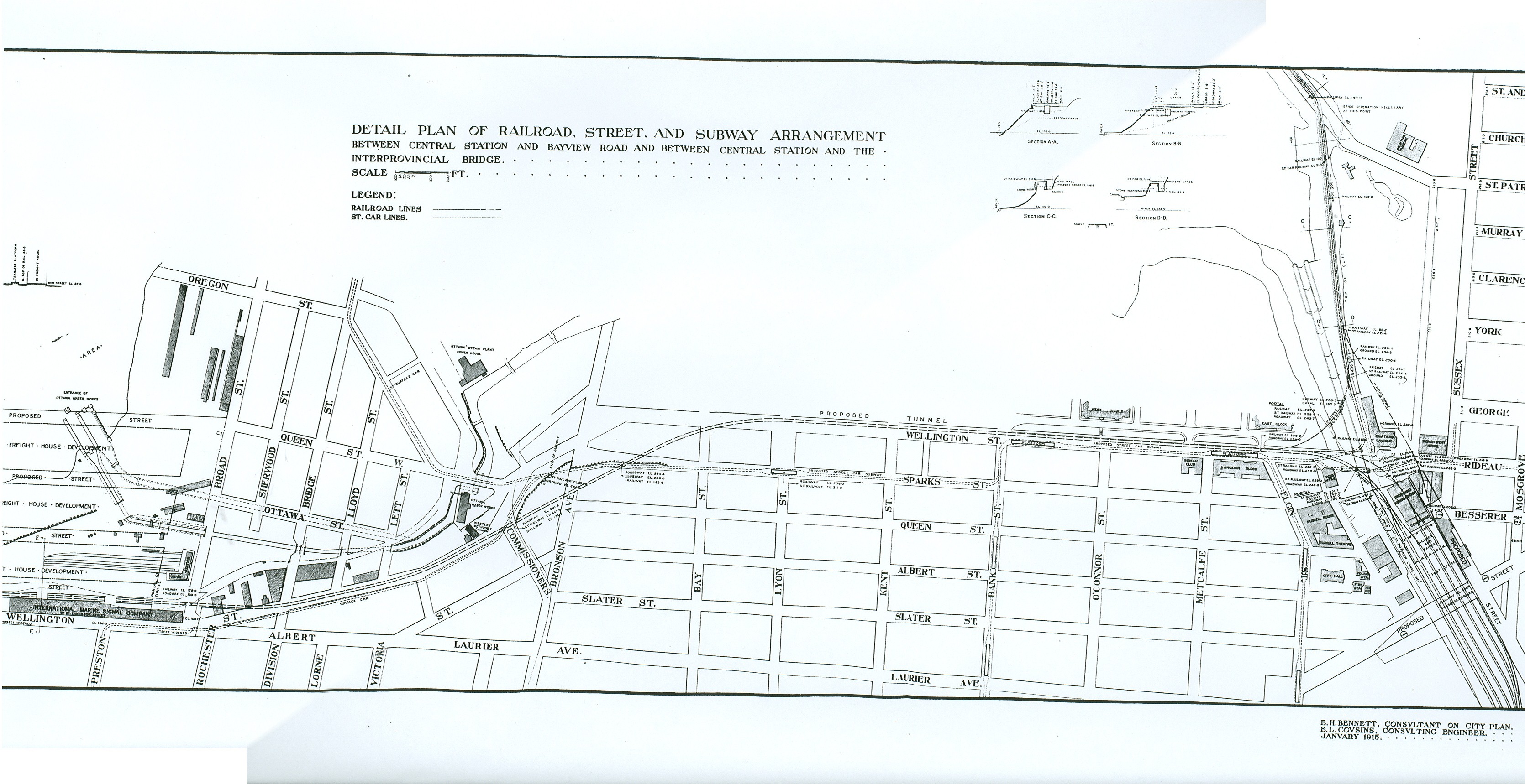
The grand Railway Plaza at the mouth of Elgin Street is probably the most majestic rendition of Beaux Arts planning this city will ever have known. As for the subway plans, did you see the alignments? Elgin was going to have a line. And did you also see the drawing showing the extension of Laurier westward past Bronson, through a bridge dug right into the cliff?
The big map of "Future Ottawa" in the Holt Plan (he was looking ahead to about 1950) is probably the most fascinating. He completely grids everything that turned out to be roughly our "Inside the Greenbelt" area. If we had actually implemented that grid and the lot pattern it supposes, I'm sure we could've fit today's entire population inside the Greenbelt with no need for the Kanatas and Orleans we have now...
|
yeah you can really see how strongly some of the old plans were influenced by the big planning movements like city beautiful, garden city, modernism etc. It's also neat to see how different parts/ideas were implemented or partially implemented across Ottawa and Gatineau. I was reading that the Holt Plan had problems getting implemented because of the war (no money left to build a subway

)
Here are the two drawings you mentioned.
 Downtown Subway Alignment (Click to enlarge).
Laurier Extension
I think this is from the 1969 Ottawa Central Area Study. So much for King Edward.

I think the Holt Report also showed a large chunk of the experimental farm area as developed. edit: Thanks for posting the link adam! Here's a direct link to the map of the extended grid system (Holt)
https://qshare.queensu.ca/Users01/go...awing%2021.jpg


 Prev
Prev


 Linear Mode
