HomeDiagramsDatabaseMapsForum About
     

Go Back   SkyscraperPage Forum > Regional Sections > United States > Texas & Southcentral > Austin


Reply

 
Thread Tools Display Modes
     
     
  #41  
Old Posted Dec 19, 2012, 5:20 PM
lzppjb's Avatar
lzppjb lzppjb is offline
7th Gen Central Texan
 
Join Date: Feb 2007
Location: Austin TX
Posts: 3,144
Thanks. I missed that.
Reply With Quote
     
     
  #42  
Old Posted May 2, 2013, 8:10 PM
lzppjb's Avatar
lzppjb lzppjb is offline
7th Gen Central Texan
 
Join Date: Feb 2007
Location: Austin TX
Posts: 3,144
Could the Statesman site be targeted for an outdoor market and permanent food trailer area?

I didn't think of this site south of the river when I first heard about the potential market. I can't read the whole article, so it's possibly they narrow the targets down and I don't realize it.

http://www.bizjournals.com/austin/pr...-a-market.html
Reply With Quote
     
     
  #43  
Old Posted May 14, 2013, 7:52 PM
LoneStarMike's Avatar
LoneStarMike LoneStarMike is offline
Registered User
 
Join Date: Aug 2006
Location: Austin
Posts: 2,264
These are some of the renderings on display last night at the South Shore Vision presentation held at the Hyatt Regency.

It's important to note that none of these things are set in stone. They're just possible concepts - what they referred to at last night's presentation as "scenario planning." The purpose of last night's presentation was mainly to talk about the new analytical tool the city has to figure out what to do with each parcel. (It was developed by one of the speakers at last night's presentation - John Fregenese - and has been "fine-tuned" so to speak - to fit Austin's needs.) It sounded like a cool program. It's sort of like Sim City, but you can set certain parameters - like required number of parking spaces, amount of impervious cover allowed, FAR's, setbacks, etc, and the program will "build" the building to show you what you could put there. It would also estimate how much it would cost a developer to build, how much tax revenue the project would bring the city and how much it would cost the city to provide services for.

The program is supposed to be online in a couple of months and it will also be available for the public to use. (I'm sure some of you will have lots of fun playing around with it.) It's really very fast. They were talking about being able to have public meetings, and if someone in the audience had an idea, they would be able to plug those parameters in and the computer would show you what the project or idea would look like in a matter of minutes.

Last night's presentation (and the slide show with a lot more renderings) will eventually be online (and/or on Channel 6) as well, and it's really worth watching.

My photos didn't come out very well because of the lighting, but thought I'd share them anyway.

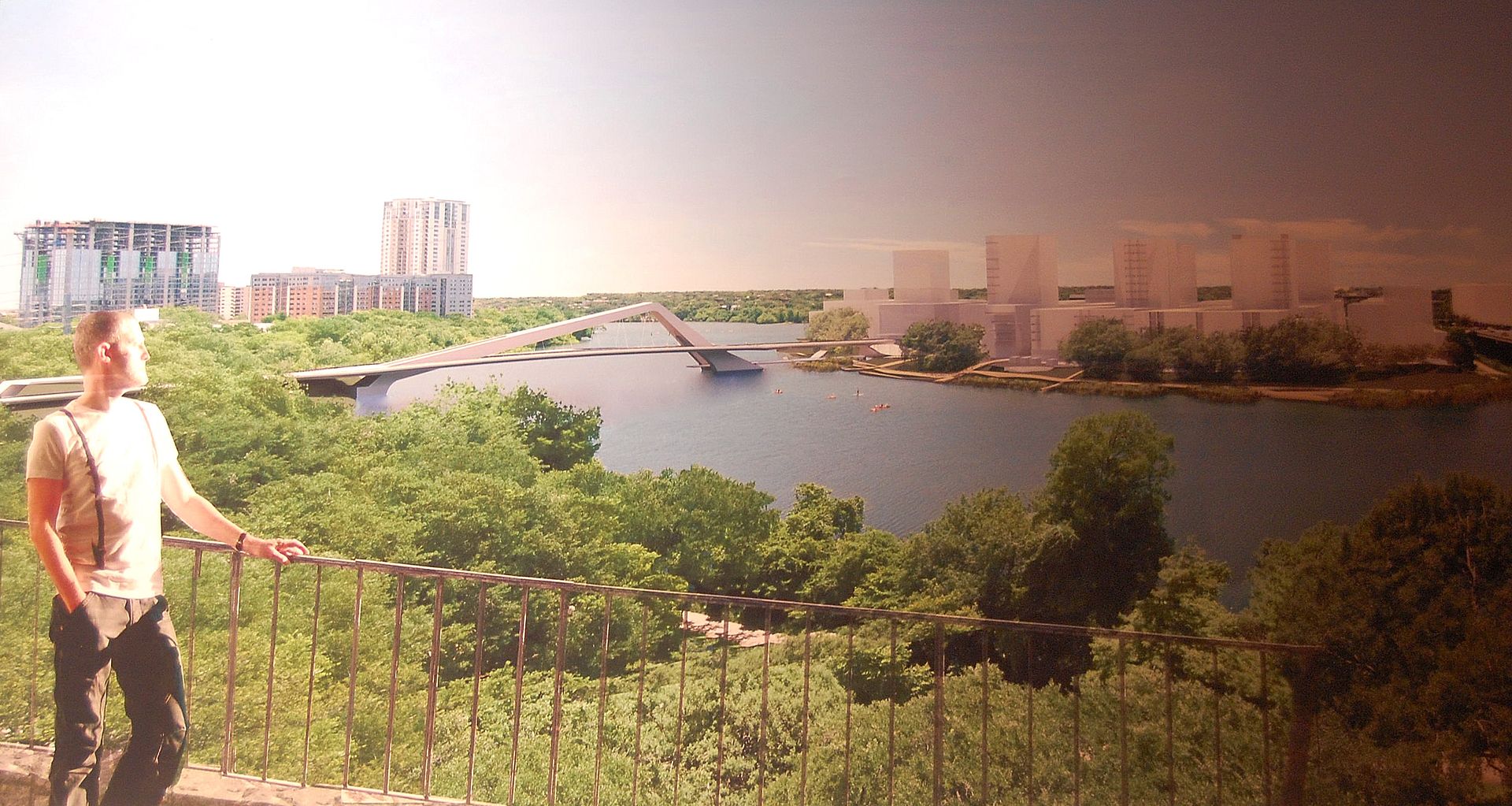
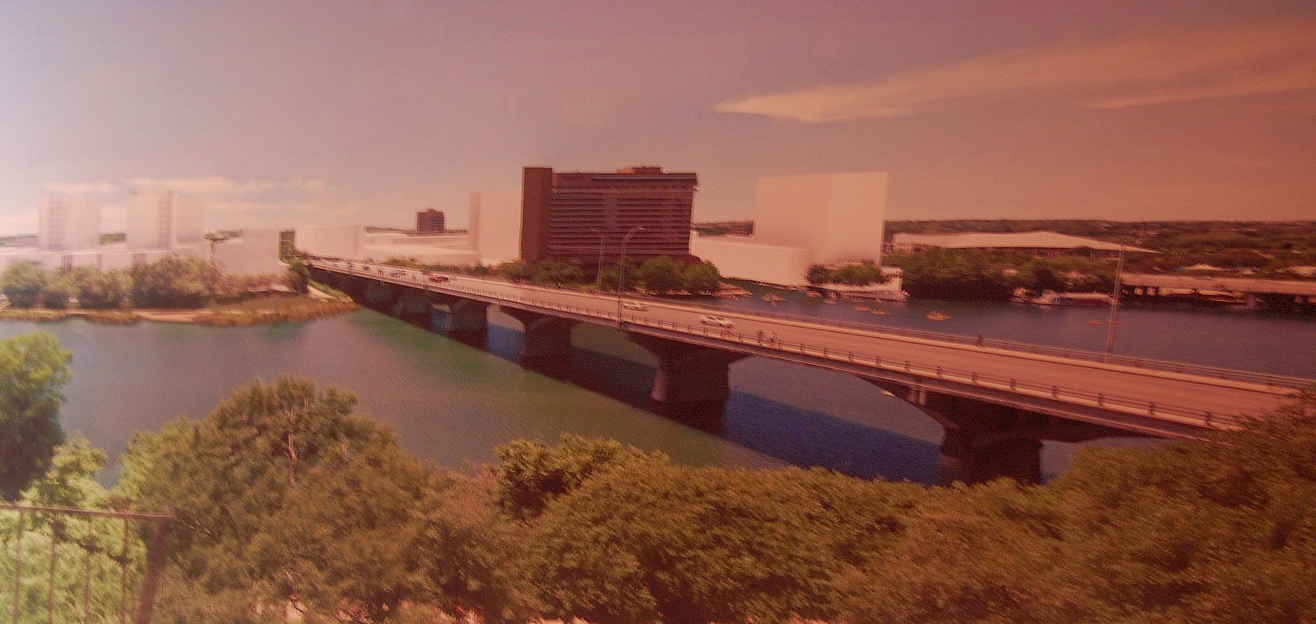
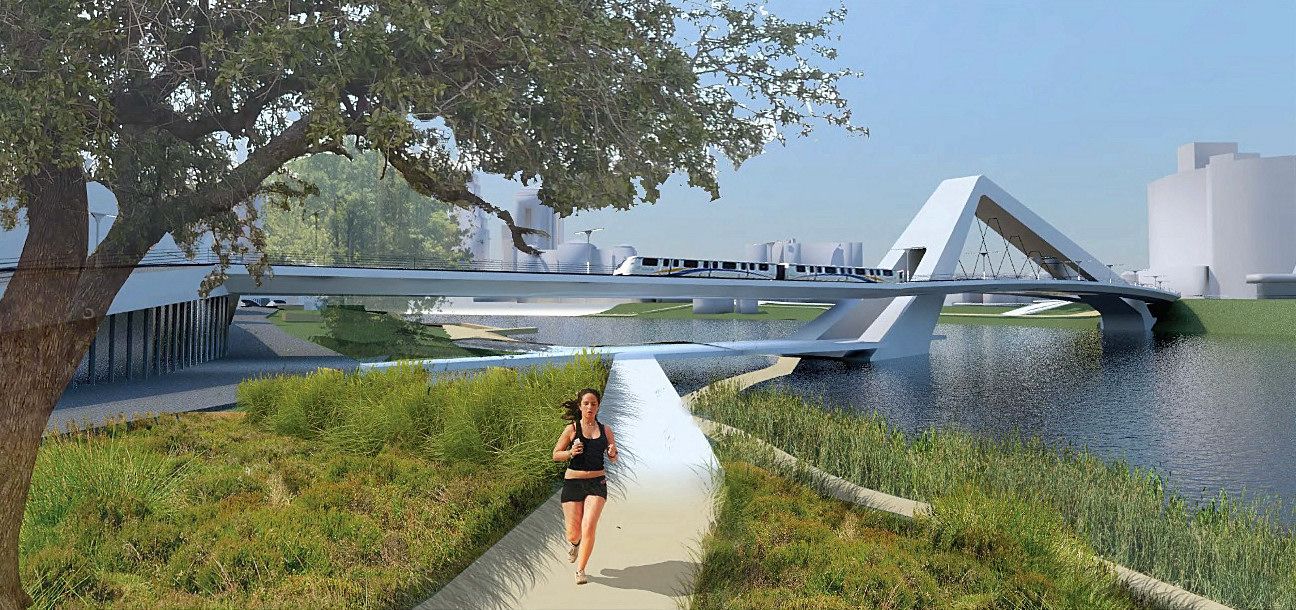
A wide view from the north shore of Lady Bird Lake:


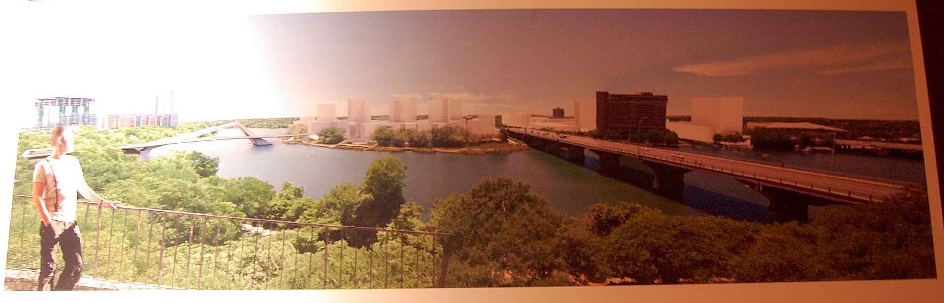
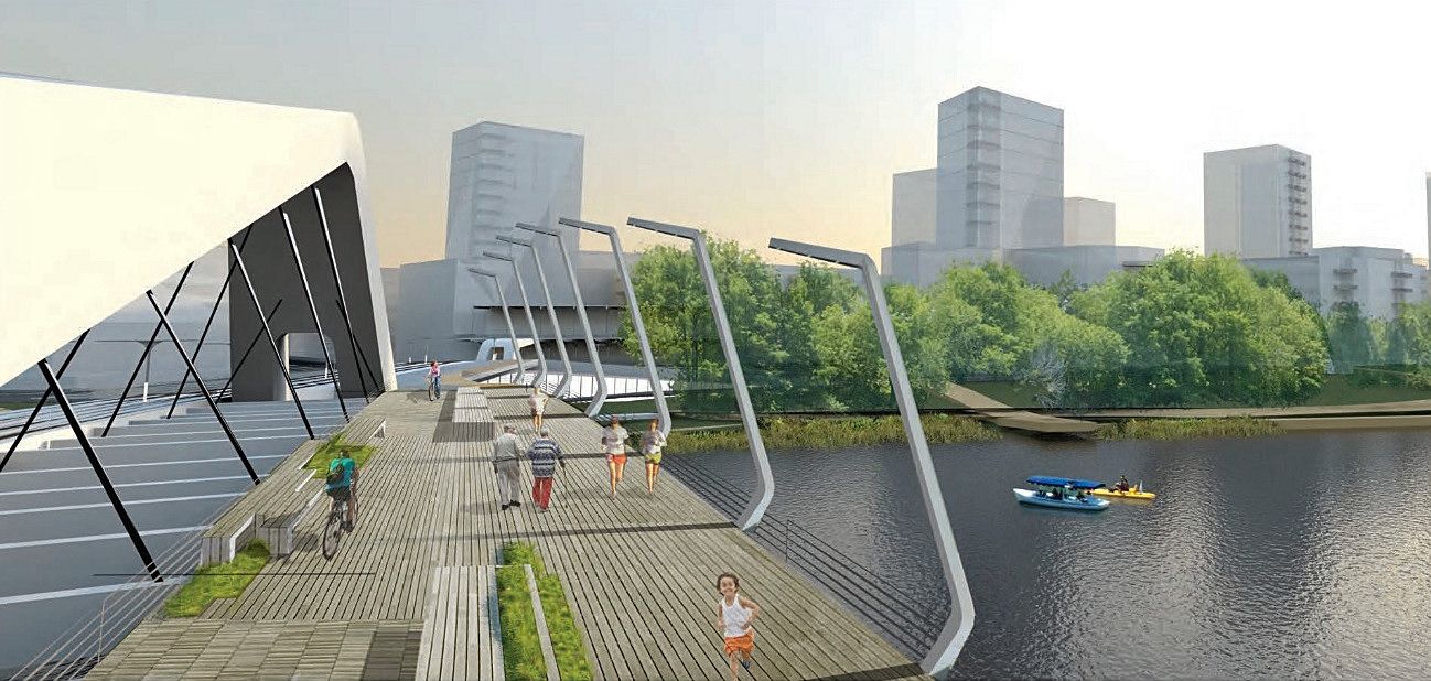
Left half of the above rendering. Note the possible urban rail/pedestrian bridge connecting Trinity Street to the South Shore.


Right half of the first rendering - showing the Congress Ave. Bridge and Hyatt.


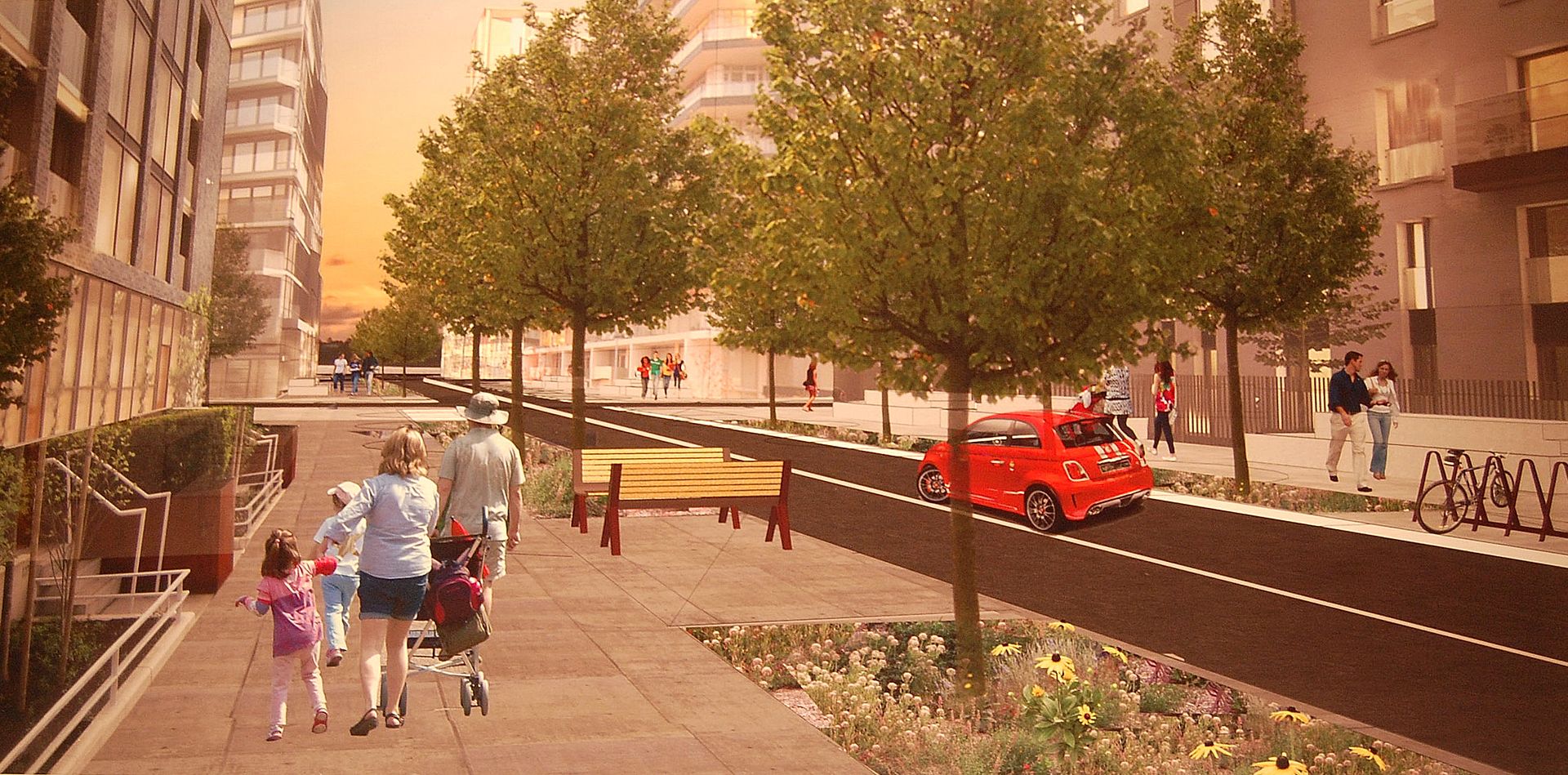
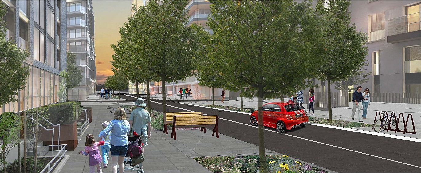
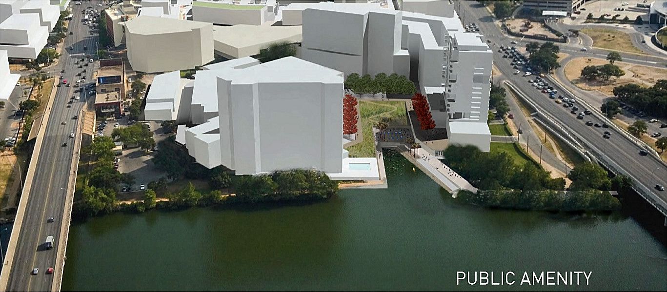
This concept is called a Green Finger. It would be different from a major artery. Although it would allow for limited traffic, it's mainly designed for pedestrians to have a pleasant walk to and from the lake and would include housing and retail.


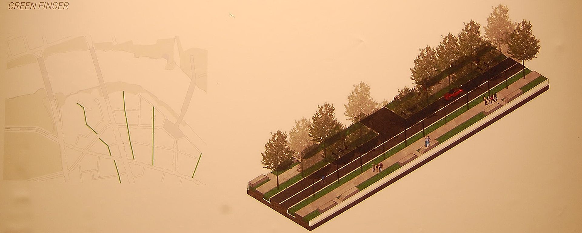
Green Finger Rendering


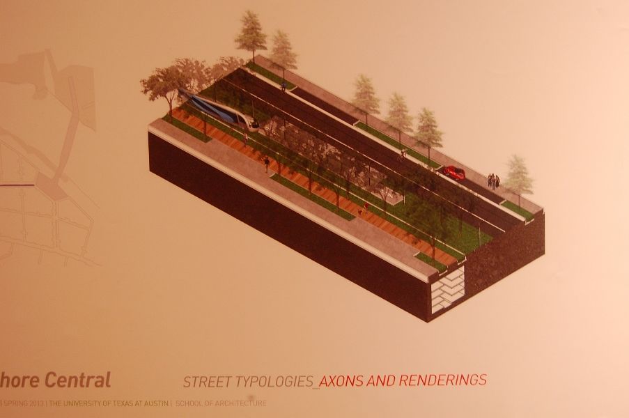
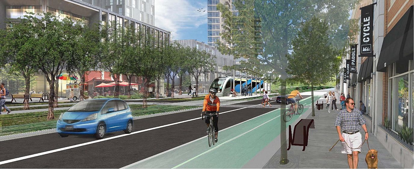
Street design with urban rail


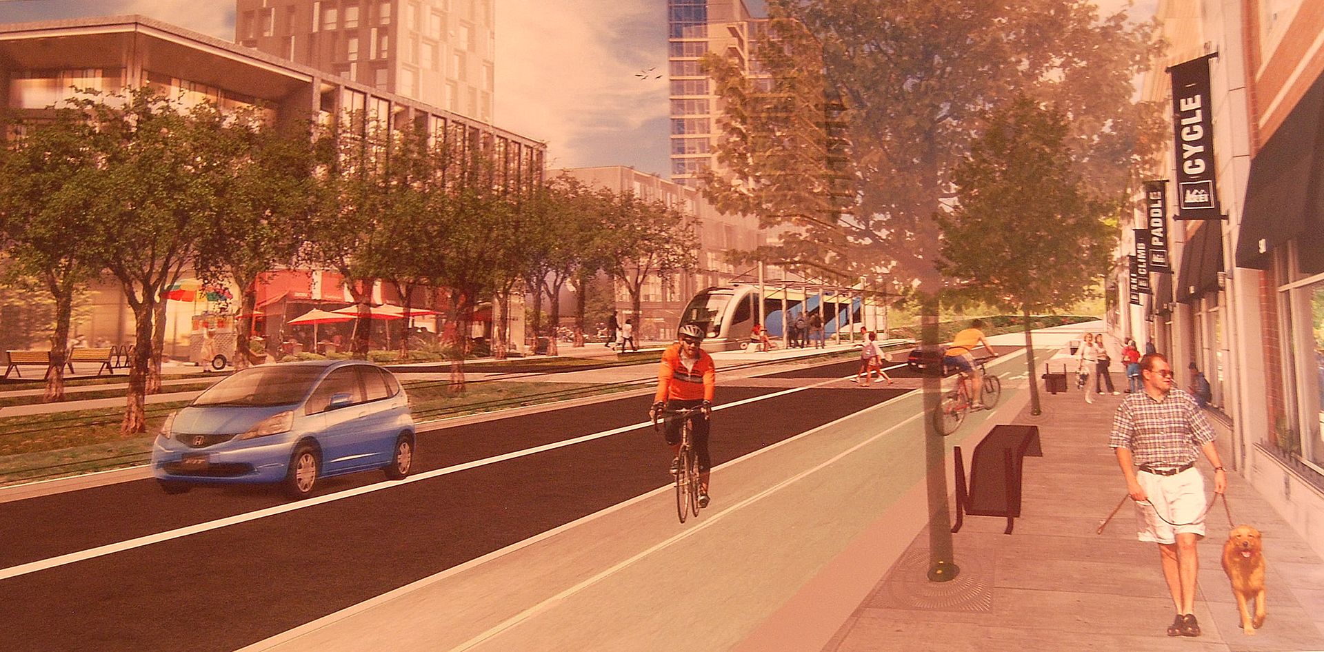
Rendering of Barton Springs Rd (East) with rail


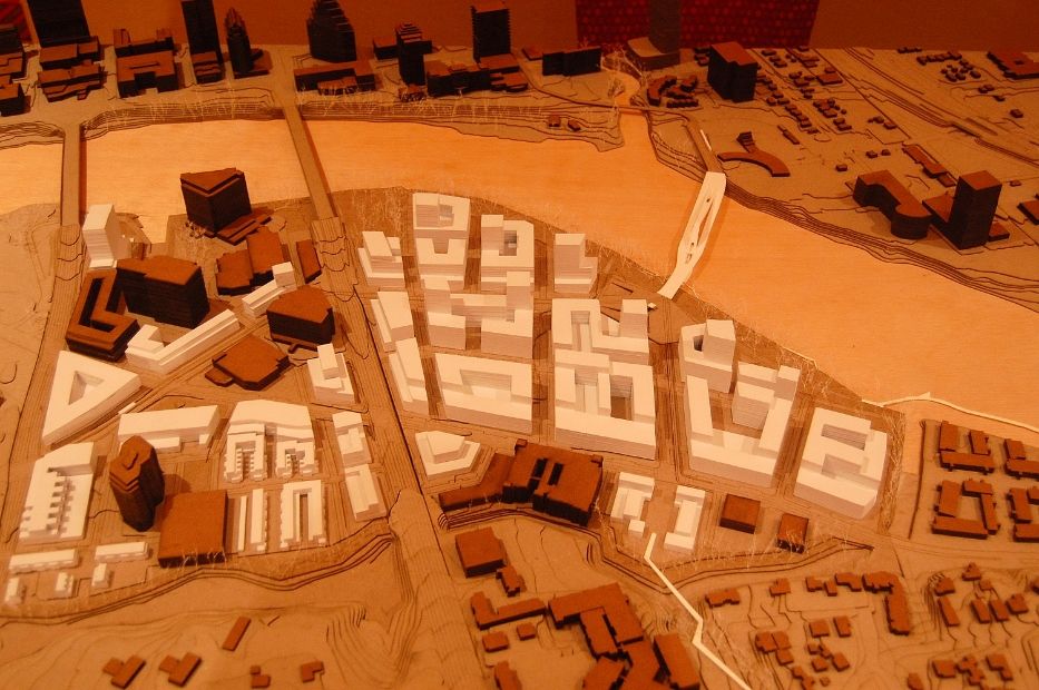
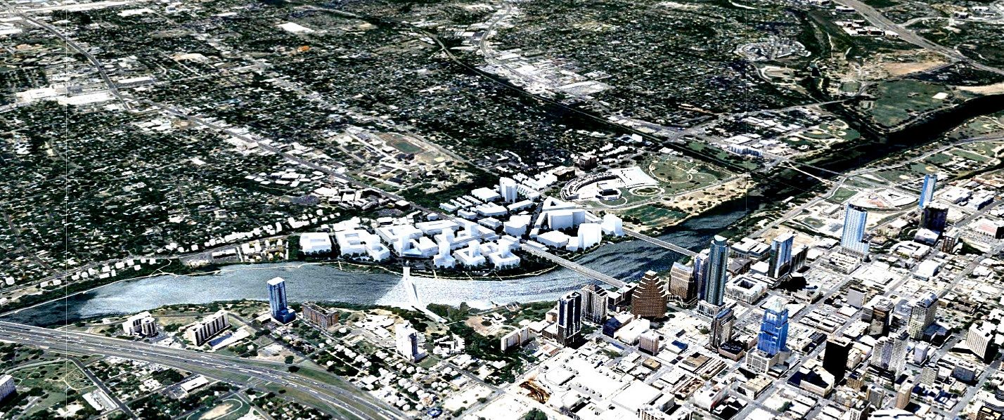
Map of the general area - bounded by South First on the west, Lady Bird Lake on the North and east, and Bouldin Creek on the south.


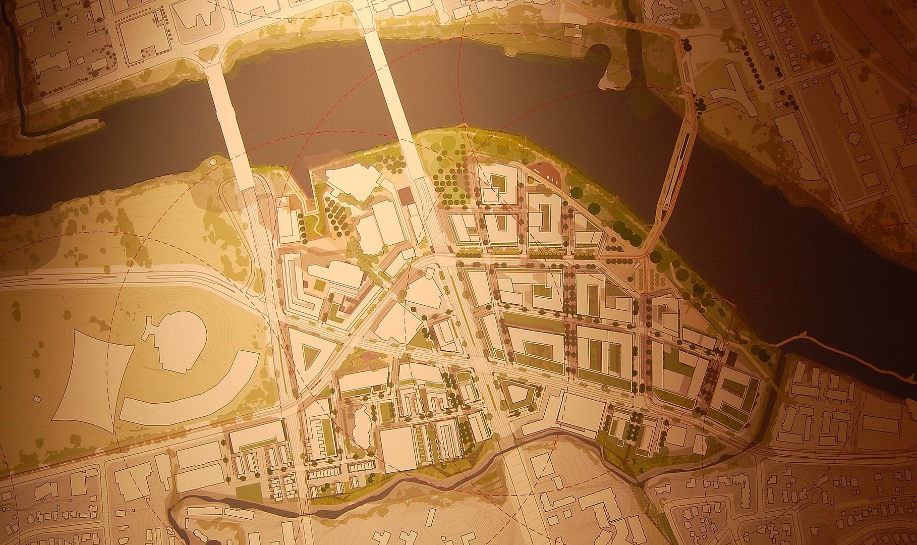
Compare the above map to an earlier one posted upthread by KevinFrom Texas. Does anyone see the big difference? In the earlier map, planners had wanted to "uncross" the intersection of Barton Springs Rd. & Riverside Drive. At last night's presentation, they said that was no longer feasible due to construction projects in the immediate area already underway.

Looking down on the 3-D model that was at last night's presentation.


I tried to take notes, but the presentation went so fast I wasn't able to take very many, but these were a few things I jotted down.
.
Although they did acknowledge that density promotes walkability, they said that diversity of land use promoted it even more - i.e. you want to have a mix of housing and retail within close proximity to one another. I think this has been one of M1EK's complaint about Mueller. (And I think it's a valid complaint.) The big box stores are so far away from most of the housing that most people will drive to get there. People were surveyed as to what types of retail establishments they wanted to be within walking distance and the number one (75%) was a grocery store.

Nature in the city is very important. (They used the Congress Ave. Bridge bats as an example.)

75% of the region's jobs are within a 20 minute drive of the South Shore District.

Currently there are 3.5 jobs per household within the district. Planners want to bring that number down to about 1.2 - 1.4 jobs per household within the district.

It was mentioned that it would be ideal to have a lot of underground parking, but that it wasn't really financially feasible, so we might be seeing what they called the "Texas Doughnut" - 5-5 stories of retail/housing wrapped around a parking garage.

They mentioned last night that the district has about 58 street intersections per square mile and that they'd like to bring that up to about 100 intersections per square mile.

If anyone's interested, you can go to

http://www.austintexas.gov/waterfront

and sign up for their email alerts.
Reply With Quote
     
     
  #44  
Old Posted May 14, 2013, 11:17 PM
lzppjb's Avatar
lzppjb lzppjb is offline
7th Gen Central Texan
 
Join Date: Feb 2007
Location: Austin TX
Posts: 3,144
Thanks for the report and pics! Can you explain their thinking behind more intersections? I figure it's better for walkability, but where are they adding all of those streets/intersections?
Reply With Quote
     
     
  #45  
Old Posted May 14, 2013, 11:51 PM
LoneStarMike's Avatar
LoneStarMike LoneStarMike is offline
Registered User
 
Join Date: Aug 2006
Location: Austin
Posts: 2,264
Quote:
Originally Posted by lzppjb View Post
Can you explain their thinking behind more intersections? I figure it's better for walkability, but where are they adding all of those streets/intersections?
I think it does have to do with walkability. There's nothing more maddening to be on one side of the street (especially a busy street like Riverside or South Lamar) and wanting to go somewhere right across the street, but having to walk half a mile or more to get up to an intersection with a cross walk, cross the street, and then walk all the way back down the other side of the street to get where you wanted to go.

I'm also thinking that "intersection" doesn't necessarily have to be an intersection where there is a traffic signal for cars. Near my neighborhood, there's always been a crosswalk at Prather & Manchaca, but there wasn't an actual traffic signal with "Walk" and "Don't Walk" signs. There was a painted crosswalk and one of those yellow & black "Pedestrian Crossing" signs. But you still had to be careful when you crossed there because cars always thought they had the right of way.

Now what the city has installed there is a lot safer for pedestrians. There's still no traffic lights for cars (It's basically a T-intersection) but they did install "Walk" and "Don't Walk" signs and they also installed flashing red lights above the roadway - like the kind you would see at a railroad crossing when a train is going by.

So now when a pedestrian needs to cross that intersection, they push the walk button, and those red lights above the roadway start flashing and if there's someone in the crosswalk, the cars coming in either direction have to stop. You have a set amount of time to make it across - I think it's like 20 seconds, and when the 20 seconds is up, the flashing red lights above the roadway turn off and the cars are free to proceed again. (And 20 seconds is plenty of time for that intersection because it's only 4 lanes of traffic (2 in each direction) with no median in the middle.

If it's a wider intersection with more lanes of traffic, you get more time to cross. At that section of South Lamar with Brodie Oaks Shopping Center on one side of Lamar and Lamar Oaks Shopping Center, a pedestrian is crossing 10 lanes of traffic (5 in each direction including left turn lanes with a median in the middle) you have about 45 seconds to complete your crossing.

As far as where these extra intersections would go (whether they be like the ones I described above or a traditional intersection with traffic signals for cars) I''m guessing more will be added as some of the larger tracts of land (like the Austin American Statesman tract or TXDOT's tract) get sold and redeveloped.
Reply With Quote
     
     
  #46  
Old Posted May 15, 2013, 12:46 AM
lzppjb's Avatar
lzppjb lzppjb is offline
7th Gen Central Texan
 
Join Date: Feb 2007
Location: Austin TX
Posts: 3,144
Crosswalks make sense. The one I immediately think of is the one on the Drag by the Co-op. I was a little thrown off by the use of intersection. Crosswalks will definitely help the walkability.
Reply With Quote
     
     
  #47  
Old Posted May 15, 2013, 9:21 AM
wwmiv wwmiv is online now
Registered User
 
Join Date: Sep 2009
Location: Austin -> San Antonio -> Columbia -> San Antonio -> Chicago -> Austin -> Denver
Posts: 5,303
Given the particular plans for the bridge, this is a better connection for the Rainey district and really serves as a great pedestrian connection between Rainey and SoCo (the two hippest areas of Central Austin).
Reply With Quote
     
     
  #48  
Old Posted May 19, 2013, 9:14 AM
LoneStarMike's Avatar
LoneStarMike LoneStarMike is offline
Registered User
 
Join Date: Aug 2006
Location: Austin
Posts: 2,264
Quote:
Originally Posted by lzppjb View Post
Could the Statesman site be targeted for an outdoor market and permanent food trailer area?

I didn't think of this site south of the river when I first heard about the potential market. I can't read the whole article, so it's possibly they narrow the targets down and I don't realize it.

http://www.bizjournals.com/austin/pr...-a-market.html
You can read the whole article now.

Quote:
Council Member Mike Martinez, who is chairman of the Capital Area Metropolitan Transportation Authority’s board, said that the 12 acres around Plaza Saltillo — on Fifth Street just east of I-35 — could be an ideal location.

The land is owned by Capital Metro, but it will soon be sold for redevelopment through a bidding process. While there are no requirements that plans include a market, Martinez said such a marketplace could boost the strength of a developer’s bid on the 12-acre property.

[SNIP]

Shannon Sedwick, owner of East Sixth Street staple Esther’s Follies and head of the Old Pecan Street Festival, said she thought a market along Sixth Street could bring daytime activity to a part of the city focused on nightlife.

“I would love it to be done near Sixth Street,” she said. “It would bring a variety of people of all different ages and tourists, all kinds of things that would help Sixth Street with its image.”
Sounds like it's still a long way from actually happening.

And btw, that presentation from the Hyatt Regency the other night is online now. The video works for me, but not the slide show presentation.

http://austintexas.gov/department/la...pecial-project
Reply With Quote
     
     
  #49  
Old Posted Aug 11, 2013, 3:23 AM
LoneStarMike's Avatar
LoneStarMike LoneStarMike is offline
Registered User
 
Join Date: Aug 2006
Location: Austin
Posts: 2,264
I found better versions of two of the renderings that were shown at that presentation back in May at the Hyatt, as well as some ones I hadn't seen yet here (It's the slide presentation that was shown that night, but there are some on here they didn't show - or at least I don't remember seeing them.) These were all concepts submitted the UT School of Architecture.


]


Reply With Quote
     
     
  #50  
Old Posted Aug 11, 2013, 6:38 AM
migol24 migol24 is offline
Registered User
 
Join Date: Sep 2008
Location: San Francisco, Austin
Posts: 1,603
goddammitt i hope this happens one day. i always envisioned that part specifically exactly the same way everytime i'd pass by there.
Reply With Quote
     
     
  #51  
Old Posted Aug 11, 2013, 9:10 AM
Jdawgboy's Avatar
Jdawgboy Jdawgboy is offline
Representing the ATX!!!
 
Join Date: Jan 2003
Location: Austin
Posts: 5,736
I agree, this better happen as envisioned. It is exactly how the city should be growing as Downtown continues to fill up, the South shore of the river is the logical area for core expansion. The neighborhood NAs gotta get it through their thick, narrow minded skulls that this is reality living in a fast growing city of this size and the fact that we are not going to slow down anytime soon.
__________________
"GOOD TIMES!!!" Jerri Blank (Strangers With Candy)
Reply With Quote
     
     
  #52  
Old Posted Aug 11, 2013, 12:39 PM
SecretAgentMan's Avatar
SecretAgentMan SecretAgentMan is offline
CIA since 2003
 
Join Date: Apr 2006
Posts: 346
Council approved going forward with a master plan for this area just this week, so there will be a lot more activity on this in a few months.
Reply With Quote
     
     
  #53  
Old Posted Aug 11, 2013, 9:01 PM
Komeht Komeht is offline
Registered User
 
Join Date: Sep 2012
Posts: 294
Anyone ever explained why they can't get rid of that silly and confusing cross thing?
Reply With Quote
     
     
  #54  
Old Posted Aug 11, 2013, 9:08 PM
wwmiv wwmiv is online now
Registered User
 
Join Date: Sep 2009
Location: Austin -> San Antonio -> Columbia -> San Antonio -> Chicago -> Austin -> Denver
Posts: 5,303
Silly and confusing cross thing?
Reply With Quote
     
     
  #55  
Old Posted Aug 11, 2013, 10:08 PM
KevinFromTexas's Avatar
KevinFromTexas KevinFromTexas is offline
Meh
 
Join Date: Jul 2001
Location: Austin <------------> Birmingham?
Posts: 57,327
I think he's talking about the intersections of Barton Springs and Riverside. They form an X in the middle of that area.
__________________
Conform or be cast out.
Reply With Quote
     
     
  #56  
Old Posted Aug 11, 2013, 10:53 PM
LoneStarMike's Avatar
LoneStarMike LoneStarMike is offline
Registered User
 
Join Date: Aug 2006
Location: Austin
Posts: 2,264
Quote:
Originally Posted by Komeht View Post
Anyone ever explained why they can't get rid of that silly and confusing cross thing?
It was mentioned on slide #117 in the presentation. It just said

Quote:
Opportunities Slipping Away"

Recent construction makes untangling the "X" intersection of Barton Springs Road and W Riverside Drive quite difficult.
Reply With Quote
     
     
  #57  
Old Posted Feb 4, 2014, 1:12 AM
Syndic's Avatar
Syndic Syndic is offline
Registered User
 
Join Date: Jun 2010
Location: Austin, TX
Posts: 1,945
So, there was some pretty extensive coverage on the future of the South Shore in the most recent City View episode.

The extensive involvement of current area residents always makes me nervous because I feel like these areas should be the habitat of all of us, not just those who can already afford to live there. That said, these talks are open to everybody, so maybe it's my fault if I don't take the initiative.
__________________
Anti-Leslie Pool. Bury I-35! Make The Domain public!
Reply With Quote
     
     
  #58  
Old Posted Apr 30, 2014, 4:42 AM
KevinFromTexas's Avatar
KevinFromTexas KevinFromTexas is offline
Meh
 
Join Date: Jul 2001
Location: Austin <------------> Birmingham?
Posts: 57,327
The American-Statesman has some renderings included with an article, but they're behind the pay wall. I don't have the paid subscription. Anyone care to save, host and post them?

http://www.mystatesman.com/news/news...popular_bottom
__________________
Conform or be cast out.
Reply With Quote
     
     
  #59  
Old Posted Apr 30, 2014, 6:13 AM
Digatisdi's Avatar
Digatisdi Digatisdi is offline
Registered User
 
Join Date: Dec 2013
Location: Downtown Austin
Posts: 415
Quote:
Originally Posted by wwmiv View Post
Given the particular plans for the bridge, this is a better connection for the Rainey district and really serves as a great pedestrian connection between Rainey and SoCo (the two hippest areas of Central Austin).
I agree-- Rainey is really underserved by transit, with this configuration it'll bring more people into the heart of Rainey and provide immense levels of connectivity between Rainey Street, the south shore, and the rest of the city core.
Reply With Quote
     
     
  #60  
Old Posted Apr 30, 2014, 6:37 PM
KevinFromTexas's Avatar
KevinFromTexas KevinFromTexas is offline
Meh
 
Join Date: Jul 2001
Location: Austin <------------> Birmingham?
Posts: 57,327
http://www.bizjournals.com/austin/bl....html?page=all
Quote:
Apr 29, 2014, 2:31pm CDT
Planners, residents consider possibilities for Austin waterfront

Jan Buchholz
Staff Writer-
Austin Business Journal

With development escalating at an unprecedented pace, preserving the best characteristics of the South Central Waterfront District in Austin while improving its less desirable aspects will be a tough proposition in the years ahead. The city of Austin, however, hopes that various stakeholders — from landowners to neighbors to Austin residents at large — can come together to embrace a plan reaching 20 years into the future.
__________________
Conform or be cast out.
Reply With Quote
     
     
This discussion thread continues

Use the page links to the lower-right to go to the next page for additional posts
 
 
Reply

Go Back   SkyscraperPage Forum > Regional Sections > United States > Texas & Southcentral > Austin
Forum Jump


Forum Jump


All times are GMT. The time now is 12:59 PM.

     
SkyscraperPage.com - Archive - Privacy Statement - Top

Powered by vBulletin® Version 3.8.7
Copyright ©2000 - 2024, vBulletin Solutions, Inc.