I too am glad that 3940dxer is back!
e_r's post :
 Los Angeles Daily Herald
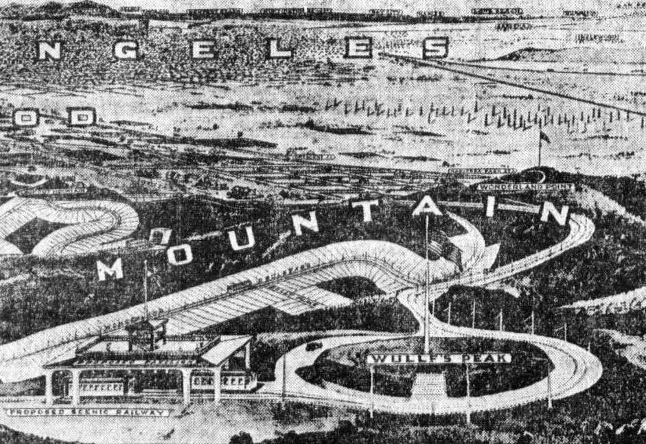
This image, from a 1909 newspaper ad for the new Lookout Mountain Park subdivision is an artist's rendition of what a bird might see looking SE over the development. We see Lookout Mountain at the left, Wonderland Point at the right center, and in the lower foreground, Wullf's [sic] Peak.
Locating these peaks is not easy, as contemporary maps of the area are sparse at best. Even though Lookout Mountain Park was subdivided in 1908, it didn't become part of the City of Los Angeles until the Laurel Canyon Annexation in 1923.
Here is the big announcement in the
LA Times of August 14, 1908, describing the tract and its main features:

The length of the ridge is exaggerated, and the altitudes of the three principal features are incorrect. And the Scenic Railroad never happened, nor were the roads "already built."
Five years go by, and the
LA Times has another article on the development:

Here, it is explicitly stated infamous oil baron E.L. Doheny is buying Wulff's Peak to be able to survey all his Beverly Hills properties. The seller is the Lookout Mountain Park Land and Water Company, the original developer.
Given that I knew the transaction date, and the names of the principals, I thought I might be able to find the 1913 deed which would contain a legal description of the land being soid. Then I might be able to overlay the boundaries onto a contemporary topo map to see if the
Times article was correct in placing Wulff's Peak in Doheny's new purchase.
So I went to the County Assessor's Office in Norwalk and after some difficulty obtained a copy of the August 1913 deed from LMP to Doheny, which gave enough information to determine where the land was.
Here is the deed:

Not being a surveyor, I ended up googling mapping software. I found one called "Metes and Bounds" that wasn't too expensive and didn't look like it had too steep a learning curve. Using it, I was able to turn the surveyors' jargon into a map plot and superimpose it onto a contemporary topographic map with the following results:

The boundary of Doheny's acquisition is marked by a thin black line. "Metes and Bounds" concluded the property was indeed 22.11 acres in size. The property contains a high point (el. 1554') which could only have been Wulff's Peak, just like the
Times article said it did.
Below is the current topo map of Section 6. Wulff's Peak is just southeast of the large water tank "WT" shown in the lower left quadrant.

To give you an idea of what the plat map for Lookout Mountain Park looks like, here is:

Even though the reproduction is terrible, the land sold to Doheny was part of lot D and is at the lower left-hand part of the map. You can see the shapes of lots adjoining Wonderland Avenue and Lookout Mountain Avenue.
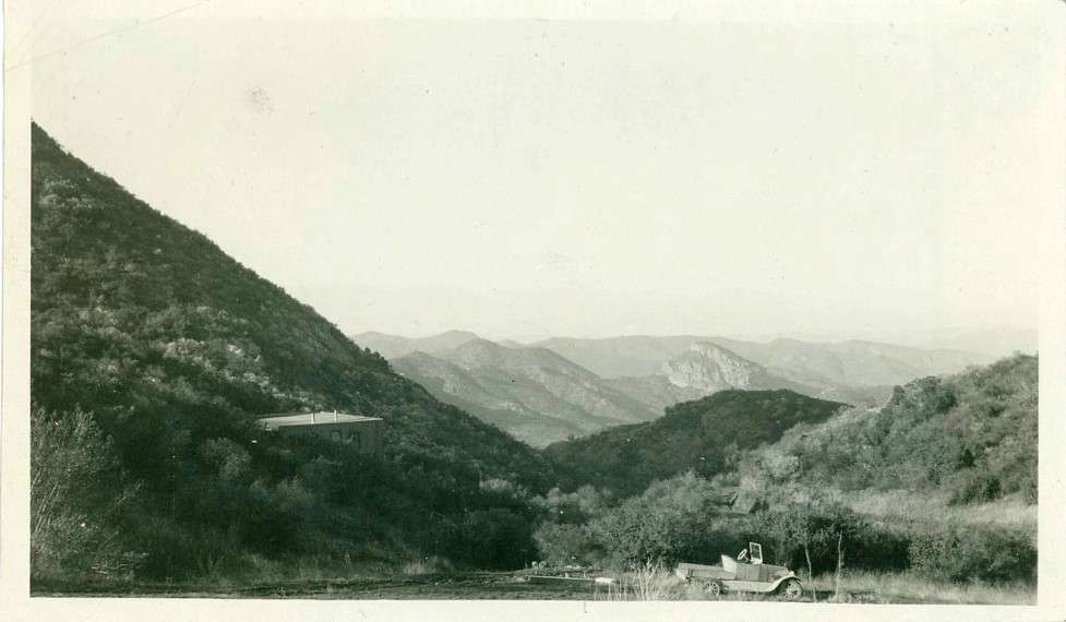
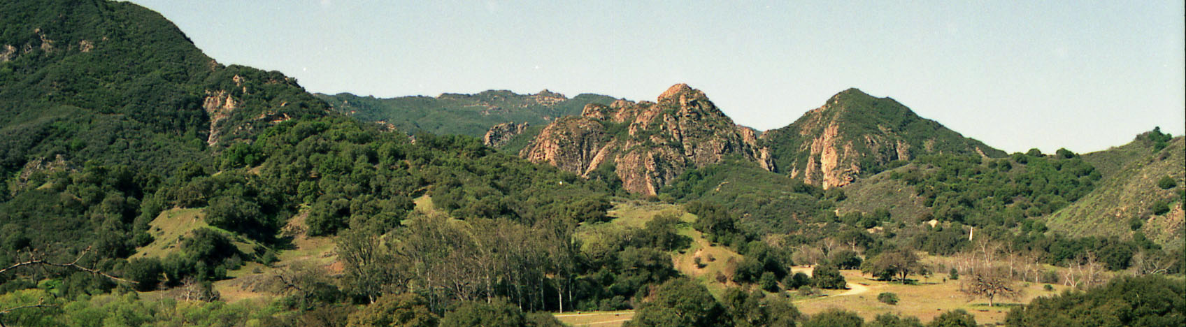
Today, the top of Wulff's Peak looks like this:

Not exactly glamorous for the "Belvedere of America."
Next I'd like to establish where Wonderland Point and Lookout Mountain were - here's looking at ya, 3940dxer, for help


 Prev
Prev


 rentatrip, you're probably in the right area but I don't see that particular formation.


 Linear Mode
