In 1825, the Erie Canal was completed, effectively connecting the upper Great Lakes to the Atlantic Ocean, with its terminus in Buffalo located at the junction of Lake Erie, the Niagara River, and the Buffalo River. Due to the barrier of Niagara Falls, for well over a century all Great Lakes vessels could go no further East than Buffalo, where cargo was transferred to Erie Canal barges, and later to railroad cars. In the early 1900s Buffalo had the 6th busiest harbor in the world, and thru the late 20th century was the 2nd busiest railroad junction in the USA.
With the opening of the St. Lawrence Seaway, and the expansion of the Welland Canal (11 miles from Buffalo) in the late 1950s, lake freighters and other boats no longer needed to stop and transfer cargo in Buffalo, and today very few commercial vessels stop in Buffalo. Much of the former slips and harbors are abandoned, but in the last few years there has been new development occurring, and for the first time in over 50 years the area's population has stabilized and businesses are growing.
The Commercial Slip, which was the terminus of the Erie Canal, where it met the Hamburg Canal. The original canal walls can be seen in the image, and were excavated during the creation of a new park and public space (Canalside) recently opened in the former industrial area.
 IMG_0883
 by
bpawlik, on Flickr
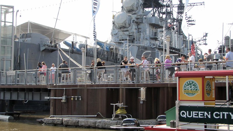
The Canalside area includes a naval park, museums, several restaurants, boat slips, tour boats, and is a popular summer concert and festival location.
 IMG_0876
 by
bpawlik, on Flickr
 IMG_0920
 by
bpawlik, on Flickr
Viewed from Canalside, the original Buffalo Lighthouse can be seen at the entrance, with Lake Erie and the Niagara River in the background.
 IMG_0924
 by
bpawlik, on Flickr
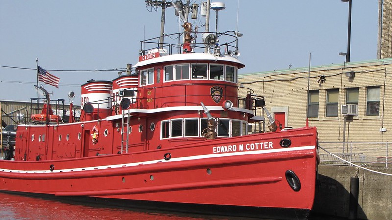
Along the Buffalo River (which zig-zags for several navigable miles East into the City of Buffalo) is the last operating fireboat in the harbor, which also performs as an ice breaker during the winter months.
 IMG_0889
 by
bpawlik, on Flickr
The development of the grain elevator in Buffalo in the early 1800s allowed rapid loading, unloading, and storage of grain from the midwest US and were a boom the the development of Buffalo and its waterways. At one time there were over 50 grain elevators in operation along the Buffalo River, which at one time inspired architects such as Le Corbusier in the development of modernism styles. Today, there are less than 20 elevators remaining, and fewer used for their original purpose.
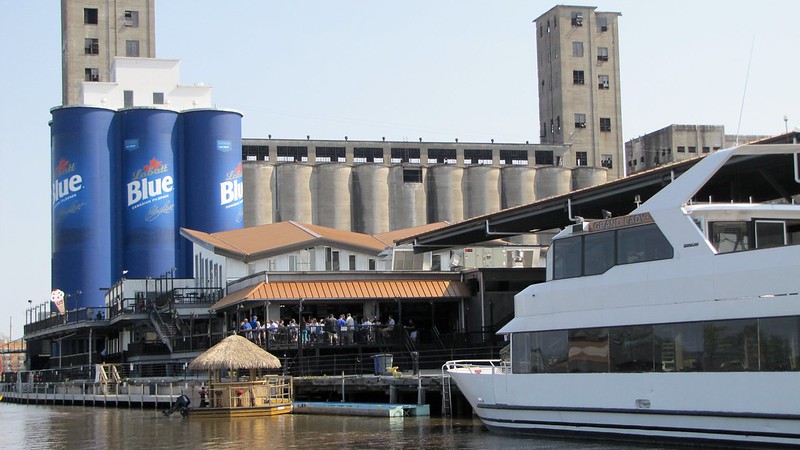
Elevator converted to sports and entertainment complex.
 IMG_0892
 by
bpawlik, on Flickr
Along "Elevator Alley" with structures over 20 stories in height, and over 400 meters in length.
 IMG_0903
 by
bpawlik, on Flickr
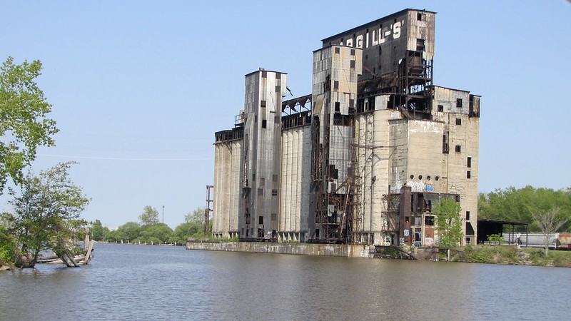
Abandoned elevator. Though many are unused, there are only 2 remaining elevators not under private ownership.
 IMG_0909
 by
bpawlik, on Flickr
The structures along the elevators were used to unload the lake boats. Boats up to 300 meters in length would navigate the river.
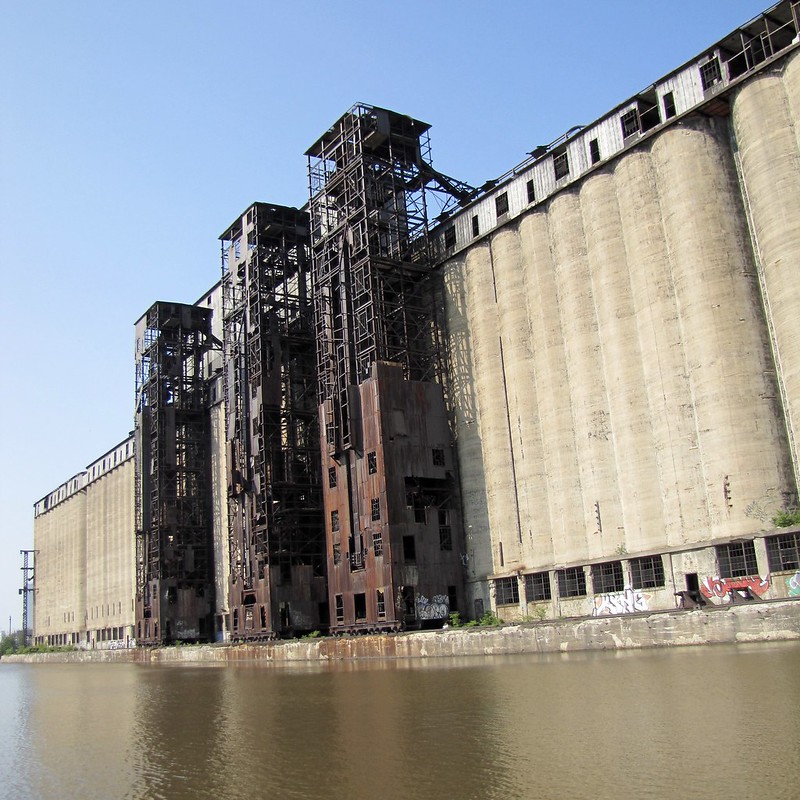 IMG_0910
 by
bpawlik, on Flickr
Since 2013 there has been a great effort to perform habitat recovery, and cleanup through dredging years of toxic sediment. There have been a number of new developments along the river since then, including parks, boat slips, apartments, entertainment venues, and many more activities both new and making use of the existing structures.
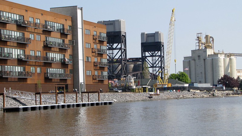 IMG_0902
 by
bpawlik, on Flickr
Heading back toward the Commercial Slip, viewing nearby Downtown Buffalo.
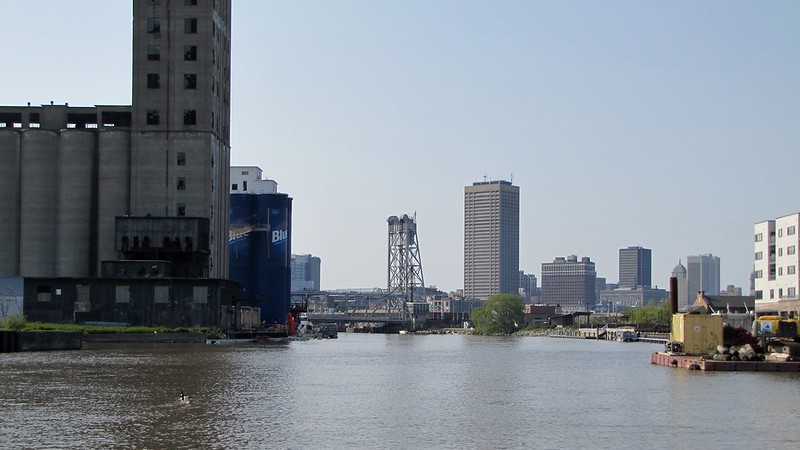 IMG_0914
 by
bpawlik, on Flickr
Heading out toward Lake Erie past the lighthouse, sailboats are docked along the City Ship Canal, which runs parallel to the Buffalo River, and was also home to several grain elevators. This canal today is primarily recreational, unlike the Buffalo River which still maintains some industry.
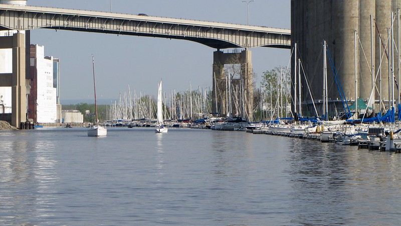 IMG_0933
 by
bpawlik, on Flickr
View of City Hall and Downtown Buffalo at the junction of Lake Erie, Niagara River, Buffalo River, City Ship Canal, and former Erie Canal - often referred to as the Inner Harbor.
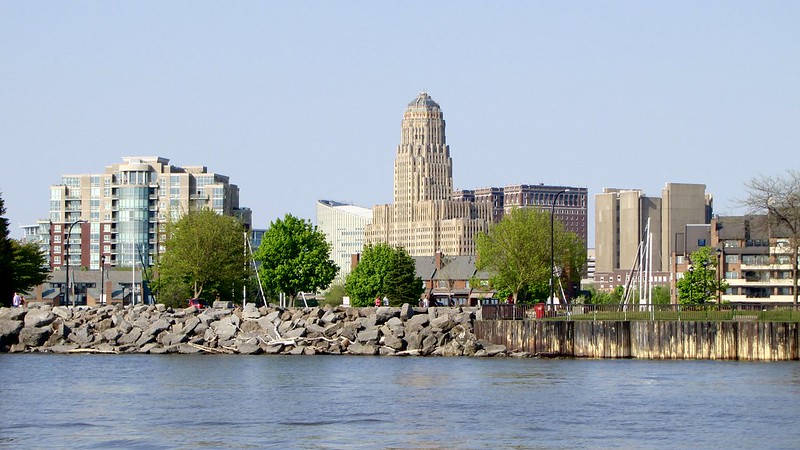 IMG_0927
 by
bpawlik, on Flickr
Last picture - sunset taken yesterday a few miles North along the Niagara River, near Riverside Park in Buffalo - looking West viewing Strawberry Island, Grand Island, and Fort Erie, Canada in the distance.
 IMG_1241
 by
bpawlik, on Flickr


 Threaded Mode