Quote:
Originally Posted by ns_kid

Thanks, fenwick, Keith and cormiermax for sharing the fascinating pics.
I am afraid I am old enough to have some recollection of the neighbourhoods buried under Scotia Square and I don't think that "slum" is an unfair description.
It is an interesting sociological question why Africville, which was an impoverished, underserviced community but home to a proud African NS population, is so celebrated today, while these largely white working-class streets, also bulldozed by the city in the name of urban renewal, are largely forgotten and unmourned.
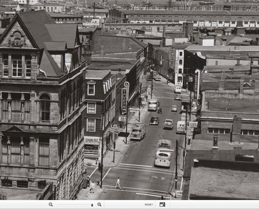
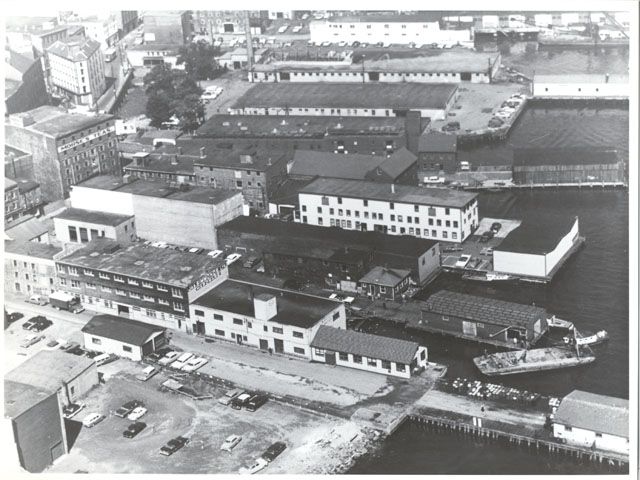
It's worth noting that some of the pictures Keith shares date from the 1940s. (The tram car and rails were gone by the summer of 1949.) I don't believe conditions improved over the ensuing 15-20 years. I cannot recall many structures on these blocks that would have been conducive to restoration or repurposing.
The hobby shop whose sign is visible in fenwick's photo at the corner of Barrington Street and Duke, just in front of the NSLP trolleycoach, was a favourite Saturday stop for my dad and me in those pre-Scotia Square days. (It survives, incidentally, as Maritime Hobbies on Grafton Street.) As a kid I was fascinated by the Peppermint Lounge and its blinking neon candy cane, also clearly visible just a couple of doors further up the street. I have less recollection of the tavern on the opposite side of Barrington. Sadly, by the time I was old enough to get to know these legendary Halifax drinking dens more intimately, the Peppermint was gone.
Say what you will about the merits of Scotia Square, the streets it replaced were mourned by virtually no one at the time.
|
Interesting post and good observations. My random thoughts as follows.
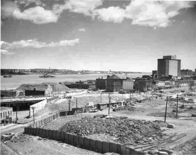
- My Dad grew up on the part of Grafton Street that is now covered by Scotia Square in the '30s and '40s. He described his neighborhood as being very rough, where you had to fight your way out of trouble as much as not. He also described as a teenager delivering coal all the way up to third storeys in come cases. He didn't talk about it too much, and unfortunately he is no longer around to ask about it, but I think it would be safe to say that by the fifties it wasn't any nicer. I don't recall him ever mourning the loss of that neighbourhood, though he had moved out of there by the mid-fifties.
So, yeah, I don't think there's any doubt that there were a lot of buildings, especially the century-old wooden buildings that were probably one joist away from falling down. Pics like those posted by Keith illustrate this very clearly. I think it's hard for many today to realize how bad it could get as our building standards have improved so much over the years, with good reason. Some of them were pretty dirty and dangerous, and yes, potential fire traps.
- The comment comparing these neighborhoods and Africville from a modern standpoint is interesting and thought-provoking.
- I remember Maritime Hobbies in two different locations in Scotia Square and even drop by their Grafton St. location from time to time to pick up hobby supplies, though I haven't been there in a while. I never realized they were originally on Barrington.
I'm too young to remember the Peppermint Lounge but was always attracted to similar bright lighted signs...


 Prev
Prev


 Linear Mode
