Quote:
Originally Posted by someone123

It probably would have been politically easier back then but the land ownership around the potential bridge approaches would have been similar to today (i.e. minimal and about as good as you can imagine for a non-greenfield setting). The big difference is that people, particularly rich property owners, were more amenable to building infrastructure in 1945.
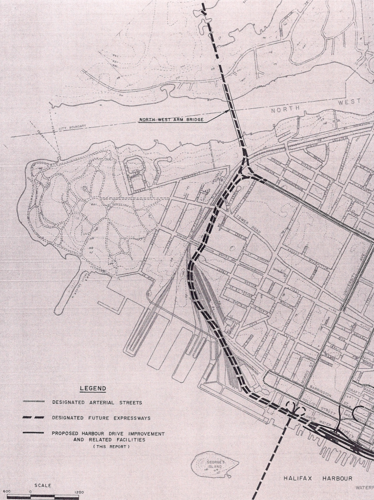
A Northwest Arm bridge wouldn't necessarily look like the Harbour Drive proposal. As an alternative imagine a crossing linking up with surface streets with one lane in each direction, plus one HOV-type lane, plus pedestrian and bike links. The bridge wouldn't just be to move more traffic. It would give people on both sides better access to more parkland and attractions. If there were a bridge you'd be able to walk from downtown to Fleming Park in about 45 minutes (~3 km instead of ~7 today), and it would be possible to connect it up with the Halifax Urban Greenway and Point Pleasant.
I agree that it's disappointing how often people in Halifax reflexively shoot down ideas like this instead of encouraging a bit of creativity and calculated risk taking.
|
I was thinking more along the lines that the land has been developed and subdivided more, making the land more valuable and with more 'players' having to agree to giving up their land/homes, or agreeing to increased traffic in 'their' neighborhood. Additionally, the general attitude among the public seems to be more along the lines of getting as much as you can out of the deal, and expropriation is much more politically sensitive than it was then.
Plus, using park lands and nature reserves are extremely sensitive issues (as in, you can't do it) now vs 70 years ago. Environmental concerns, while important, weren't seriously considered back then, making it 'easier' to move forward with projects like this. They just had to concern themselves with how to make it physically, legally, and financially possible to do, and damn the rest.
Governments in general were more paternalistic and controlling than they are now and environmental sensitivity was barely regarded. Think Africville, city dumps, incinerators, oil spills, etc. etc. Public protest really didn't become a 'thing' until the late 1960s (think Harbour Drive/Historic Properties, etc.)... this is why I chose the 1945 Master Plan as the ideal time for this level of thinking.
I agree with your idea, though I can hear the complaints over capacity not being enough, and thus traffic jams as 'everybody' wants to use it, but honestly looking at the map I'm having a hard time seeing where it could be viable, given current parkland and residential neighbourhood layouts.
Interesting discussion nonetheless...


 Prev
Prev


 Linear Mode
