Quote:
Originally Posted by Chuckaluck

|
The source has misidentified that wonderful photo. It's actually a 1935-36 photo looking west at storm drain construction near Rodeo and La Cienega just north of Baldwin Hills.
Not only is the familiar northern prow of the Baldwin Hills visible at left, but part of what is now the Culver Studios can also be seen.
USC has the same construction photo; it has no date but is identified as building the Slauson Avenue Storm Drain. Here's a zoom showing the studio water tank in the background,
with some sets from the adjacent "40-Acre" Backlot also visible:
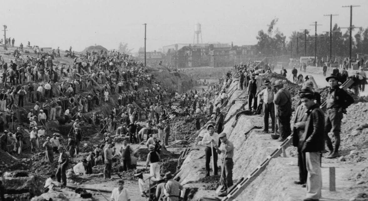
USCDL --
http://digitallibrary.usc.edu/cdm/si...id/5430/rec/46
Here's a link to a USC photo identified as looking east from Monier [sic] Lane, December 26, 1935; it certainly looks like the same project (Moynier Lane will be renamed La Cienega):
http://digitallibrary.usc.edu/cdm/si...id/5545/rec/58
In this 1930 south-facing aerial of the then-Pathe Studio, we see the same water tank from the construction photo. The tip of the adjoining "40-Acre" Backlot can be seen at top center:
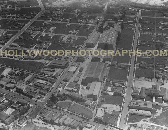
Hollywood Photographs.com --
http://hollywoodphotographs.com/deta...&c=-1&i=1&r=24
The "40-Acre Backlot, May 1938:
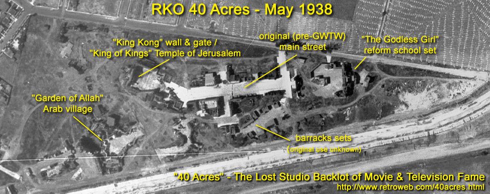
Retroweb.com --
http://www.retroweb.com/40acres_early_years.html
The semi-triangular backlot was bounded on the north by Higuera and on the south by Ballona Creek:

Google Map
I don't know if the purple line on the Storm Drain Map below is part of the Slauson Avenue Relief Drain, but I think that's what is shown in the construction photo, which looks
straight toward the backlot and studio:
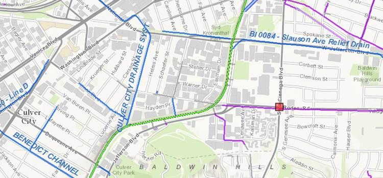
LA County Dept of Public Works --
http://dpw.lacounty.gov/fcd/stormdrain/index.cfm
# # #
As for the sewer, in 1888 Los Angeles proposed routing it along today's Expo Line (see RR tracks along Jefferson in Google Map above) and then dumping it in Ballona Creek:
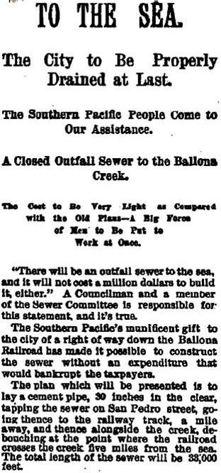
June 28, 1888
Los Angeles Times
Those living downstream understandably objected, so the plan was changed to build a bridge for the sewer pipe over Ballona Creek and then route the sewer cross-country to the ocean.
But an 1889 proposal was inordinately favorable to one of the property owners whose land the sewer was to cross:
http://chroniclingamerica.loc.gov/lc...arRange&page=2
The sewer went to Hyperion in 1894 instead, and Mayor Hazard was remembered for stopping the Ballona sewer route:
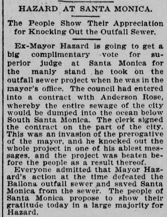
November 3, 1896 LA Herald @ LOC --
http://chroniclingamerica.loc.gov/lc...o_2805%2C2552/


 Prev
Prev


 GSV
GSV


 ):
):


 Linear Mode
