Los Angeles has many "centers" and "hearts," but for me anyway, LA's heart is the historic Los Angeles Plaza, in downtown LA, between North Main and Los Angeles Streets, north of Arcadia Street. Even though the Pueblo of Los Angeles was founded in 1781, the current plaza site dates from the 1810s, the original pueblo having been washed away in a flood, so the pueblo was relocated a little further from the LA River. Over the years, streets around it have been reconfigured and/or renamed, the Plaza shape itself has changed... but it's been there over 200 years.
https://www.google.com/maps/@34.0566...2!8i6656?hl=en
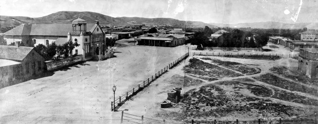
The Plaza in 1869:
 Wikipedia
The Plaza circa 1930:
 Wikipedia
I also think of the downtown intersection of First and Main as the "heart," of LA, address-wise; that is ground zero for where the north/south and east/west blocks of the City of Los Angeles address block numbering system originates (as well as unincorporated LA County, and some of the LA County cities that use the system). That's where 100 East 1st Street meets 100 West 1st Street meets 100 North Main Street meets 100 South Main Street. LA is so huge in area, and because the block numbers originate here, that's why you have addresses in the western San Fernando Valley like "
22347 Vanowen Street."
Interestingly, Beverly Hills has its own block numbering system, so you can be driving down Wilshire Blvd. and then when you enter Beverly Hills, the street address numbers change, and then when you re-enter the city of LA on the other side of Beverly Hills, the address numbers jump again, but are in the "correct" sequence as if BH also used them.
You encounter frequent address number changes in the San Gabriel Valley, where different neighboring cities have their own address numbering systems, punctuated with unincorporated LA County islands that use the city of LA numbering system.


 Prev
Prev


 Linear Mode
