• City-versus-city activity is flat-out banned from being posted here in all its forms.

    City vs city trolling sets up a rather nasty and personal fight between forumers from one place and forumers from another place, potentially affecting hundreds of members any time it breaks out. Nothing good comes of versus-trolling, but long after the insults and mockery have been removed, bad feelings between individuals and between groups tend to linger, oftentimes popping up in unrelated threads for months afterwards.

    Thus, when it comes to 'versus' trolling, a line must be drawn--sharply. Anyone who crosses that line shall be disciplined, up to and including suspension and even summary banishment without warning. Forum moderation and administration shall be the arbiter of what constitutes versus-trolling, so if you think your post might be perceived as an unfair attack on an entire city that will upset residents there, tread lightly or reconsider how you intend to express your opinion. No forumer shall successfully claim ignorance of our policy against versus trolling, and no forumer should believe he can get away with it.

    The ban on versus activity applies to all posts and all threads, even ones that are not initially set up as city-versus-city.

    If you see any troublesome posts please report them using the "report a post" icon -
    report.gif
    in the upper right corner of every post on the forum.

Downtowns are back


How is this sustainable without growth in transit to serve a growing population? The loss in downtown populations in the past matched the loss of streetcars and bus service in the 40s, 50s and 60s. Are we really prepared to spend to provide real transit improvements rather than just vanity projects.

Even Toronto is struggling with growing congestion. Who knows when the proposed Ontario Line will actually be built.

Depending on how one defines downtown, then you might not even need much transit.

If Toronto’s downtown area is 17 sq km, then that’s a pretty walkable area really. If it was a circle the radius would be about 2.3km, which is like a 25 min walk. Just get some bikes and scooters and you’re good. You certainly don’t need heavy rail.
 
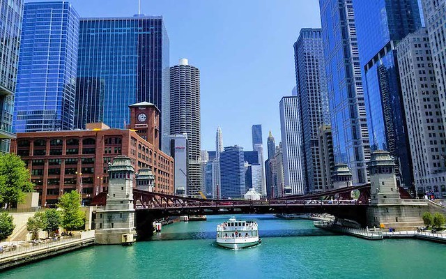
As you guys mentioned Chicago, I decided to put its numbers together:

Downtown Chicago


---------------------- 2020 ------ 2010 ------ 2000 ------ 1990

Near North Side --- 105,481 ---- 80,484 ---- 72,811 ---- 62,842 ----- 31.1% ----- 10.5% ----- 15.9%

Loop ----------------- 42,298 ---- 29,283 ---- 16,388 ---- 11,954 ----- 44.4% ----- 78.7% ----- 37.1%

Near North Side has 6.8 km² for a density of 15,500 inh./km² and Loop 2.9 km² and 10,800 inh./km². 20 and 6 census tracts, respectively.

Loop, from a CBD, turned into a very dense residential area. Ditto for the southern tracts of Near North Side, which are the ones growing like crazy. The other areas are more stable as they've always been residential.
 
is there an official definition of "downtown" that can be used to compare cities?

No. There are barely local definitions, depending on the place.


The Union Station might be the jail related lol.
I can't think of another reason why it would drop. There isn't much housing in that tract...yet.
I wonder if you counted the tracts west of downtown and around USC?

I used a 25 census-tract definition. I'd go with 20 at first, to respect freeway limits and Alameda St., but I'd left out areas that it's usually regarded as Downtown, like the Union Station and the west bank of Los Angeles River. So, nothing west or south the freeway loop. Just three ones north of the loop (because Union Station), but leaving Chinatown out.

And I'm using City Population as source, because it's much easier to navigate on it.
 
Downtown Toronto (17 sqkm)

1971: 115,070
1981: 106,498
1991: 133,836
2001: 154,149
2011: 199,330
2016: 250,000
2021 estimate: 295,000
2041 estimate: 475,000

61Ntm1g.jpg

:stunned: That’s a really big downtown- land wise.
 
is there an official definition of "downtown" that can be used to compare cities?

No, there is no official definition of a given city's "downtown", so this exercise is always open to lots of interpretation, and makes direct comparisons quite challenging, and usually meaningless.

The closest thing you can get to a somewhat direct apples-to-apples comparison is the census bureau's calculations of "x" number of people living withing "y" miles of a city's city hall, though that is also quite imperfect as most downtowns don't spread out from their city's city hall in perfect concentric rings. Water, topography, industrial zones/corridors, non-CBD city halls, and many other factors can greatly complicate that particular measure.
 
just wait until you have nimbys complaining about tall buildings downtown.

In earthquake country, there is at least a reason to oppose tall buildings having to do with the inability of fire departments and other "first responders" to really cope with disasters involving them.

I mean "The Towering Inferno" is a real issue as was 9/11.

I'm not saying I think this issue is enough reason to keep downtowns short and stubby. I don't. I'm a real skyscraper fan. But in San Francisco, at least, the issue always comes up when a new building, especially one taller than 400 or 500 ft, is proposed. And the Fire Dept. is usually asked to weigh in.
 
No, there is no official definition of a given city's "downtown", so this exercise is always open to lots of interpretation, and makes direct comparisons quite challenging, and usually meaningless.

The closest thing you can get to a somewhat direct apples-to-apples comparison is the census bureau's calculations of "x" number of people living withing "y" miles of a city's city hall, though that is also quite imperfect as most downtowns don't spread out from their city's city hall in perfect concentric rings. Water, topography, industrial zones/corridors, non-CBD city halls, and many other factors can greatly complicate that particular measure.

My purpose in this thread was to compare Downtown with the rest of the city/metro area than comparing Downtown X to Downtown Y, so the lack of an universal definition doesn't matter much.

What really stands out here is Downtowns, are booming pretty much everywhere. Some starting in the late 1990's, others in the late 2000's, but the trend is very clear.
 
Downtown Miami


Downtown Miami growth is nothing short of spectacular:

---------------------- 2020 ------ 2010 ------ 2000 ------ 1990

Downtown Miami ------- 58,439 ---- 31,697 ----- 12,885 ----- 9,218 ----- 84,4% --- 146,0% ---- 39,8%

Miami-Miami Beach --- 525,131 --- 486,880 --- 449,743 --- 451,533 ------ 7,9% ----- 8,3% ---- -0,4%


Almost 2/3 of the absolute growth of Miami-Miami Beach in the past 20 years took place there. It has a 4.34 km² area for a 13,500 inh./km² density.
 
No. There are barely local definitions, depending on the place.


I used a 25 census-tract definition. I'd go with 20 at first, to respect freeway limits and Alameda St., but I'd left out areas that it's usually regarded as Downtown, like the Union Station and the west bank of Los Angeles River. So, nothing west or south the freeway loop. Just three ones north of the loop (because Union Station), but leaving Chinatown out.

And I'm using City Population as source, because it's much easier to navigate on it.

That makes sense. But I think if you counted city west, it would be closer to 100k. It sounds like you left out the Arts District,
which is becoming a part of downtown for office and residential.
North of USC (south of the freeway) has probably added 5k, if not more.

Imo, USC is part of the greater downtown area, as it has the museum campus and several light rail stops.
 
That makes sense. But I think if you counted city west, it would be closer to 100k. It sounds like you left out the Arts District,
which is becoming a part of downtown for office and residential.
North of USC (south of the freeway) has probably added 5k, if not more.

Imo, USC is part of the greater downtown area, as it has the museum campus and several light rail stops.

Arts District is in. Freeways bordering South and West, Los Angeles River at East and Chinatown/Alpine St. at North.
 
The Union Station might be the jail related lol.
I can't think of another reason why it would drop. There isn't much housing in that tract...yet.
I wonder if you counted the tracts west of downtown and around USC?

Could it be homeless related? I visited Los Angeles on vacation last week (on a 3-day layover before Honolulu) and Hollywood is mobbed with homeless as is most of Downtown east of Grand Central. I couldn't even walk from the metro to the Last Bookstore because there were dozens of homeless and ghetto all over the street eyeing valuables.

I could definitely see the west side of LA's downtown booming since that area seemed very safe. But maybe there's some homeless/Skid Row counting effect? I walked from LA City Hall to Union Station on a previous trip and there are tent encampments all around there too.
 
Downtown Philadephia


Philadelphia is often discussed here in this section, but not its City Center specifically. I used a 29 census tract definition, roughky the area between South St., Spring Garden St. and the two rivers.


-------------------- 2020 ------ 2010 ------ 2000 ------ 1990

City Center --------- 91,510 ----- 68,836 ----- 57,552 ----- 51,302 ----- 32.9% --- 19.6% --- 12.2%

Philadelphia ----- 1,603,797 -- 1,526,006 -- 1,517,550 -- 1,585,577 ---- 5.1% ---- 0.6% --- -4.3%


The area has 8.92 km² and a density of 10,300 inh./km². Growth has been insane, with population almost doubling in the past 20 years. It's even more impressive as the area is pretty much built up for ages.

For comparison, Chicago Loop & Near North Side (posted above), with a much higher profile, is not so far ahead, with 148k inh. in a 10.7 km² area. Or Downtown LA, often discussed, with 74k inh. in a 14.9 km² area.

P.S. Guys, to convert the area and density to sq miles, just multiply by 2.59
 
As you guys mentioned Chicago, I decided to put its numbers together:

Downtown Chicago


---------------------- 2020 ------ 2010 ------ 2000 ------ 1990

Near North Side --- 105,481 ---- 80,484 ---- 72,811 ---- 62,842 ----- 31.1% ----- 10.5% ----- 15.9%

Loop ----------------- 42,298 ---- 29,283 ---- 16,388 ---- 11,954 ----- 44.4% ----- 78.7% ----- 37.1%

Near North Side has 6.8 km² for a density of 15,500 inh./km² and Loop 2.9 km² and 10,800 inh./km². 20 and 6 census tracts, respectively.

Loop, from a CBD, turned into a very dense residential area. Ditto for the southern tracts of Near North Side, which are the ones growing like crazy. The other areas are more stable as they've always been residential.

Thanks for posting these. What this shows is that the near north side’s growth accelerated—big time—from 2010-2020. Wow.

However you are only getting half the picture here. We also need to see data from the near south and near west sides, as those are also considered a part of what is now described as Chicago’s “central area”
 
However you are only getting half the picture here. We also need to see data from the near south and near west sides, as those are also considered a part of what is now described as Chicago’s “central area”

Yes, most Chicagoans would probably now agree that "Downtown Chicago", at its most generous, has expanded west and south of the loop into the near west and near south community areas.

The problem with using community areas though is that they can be awfully large. The near west side, for example, stretches west all the way past western avenue! I don't think many urban observers here here would consider an intersection like Madison/Western to be "downtown". At most you can probably make an argument for going west to Ashland, but once you get out to the moonscape parking lots of the united center, "downtown" is definitely over.

It's an exercise probably better executed with census tracts, but that's tedious and time consuming to add up.
 
Last edited:
Thanks for posting these. What this shows is that the near north side’s growth accelerated—big time—from 2010-2020. Wow.

However you are only getting half the picture here. We also need to see data from the near south and near west sides, as those are also considered a part of what is now described as Chicago’s “central area”

Yes, most Chicagoans would probably now agree that "Downtown Chicago", at its most generous, has expanded west and south of the loop into the near west and near south community areas.

The problem with using community areas though is that they can be awfully large. The near west side, for example, stretches west all the way past western avenue! I don't think many urban observers here here would consider an intersection like Madison/Western to be "downtown". At most you can probably make an argument for going west to Ashland, but once you get out to the moonscape parking lots of the united center, "downtown" is definitely over.

It's an exercise probably better executed with census tracts, but that's tedious and time consuming to add up.


Here you are:

---------------------- 2020 ------ 2010 ------ 2000 ------ 1990

Near North Side ------ 105,481 ----- 80,484 ---- 72,811 ---- 62,842 ----- 31.1% ----- 10.5% ----- 15.9% ------ 6.8 km²

Loop -------------------- 42,298 ----- 29,283 ---- 16,388 ---- 11,954 ----- 44.4% ----- 78.7% ----- 37.1% ------ 3.9 km²

Near South Side ------- 28,795 ----- 21,390 ----- 9,509 ----- 6,828 ----- 34.6% ---- 124.9% ----- 39.3% ------ 4.6 km²

Near West Side -------- 48,719 ----- 36,789 ---- 21,689 ---- 17,978 ----- 32.4% ----- 69.6% ----- 20.6% ------ 7.4 km²

Central Chicago ---- 225,293 --- 167,946 --- 120,397 ---- 99,602 ----- 34.1% ----- 39.5% ----- 20.9% ------ 22.8 km²

Chicago MSA ----- 9,618,502 - 9,461,105 - 9,098,314 - 8,182,076 ------ 1.7% ------ 4.0% ----- 11.2% -- 18,634 km²


For Near West Side, as it's way too big, I considered only the eastern half of it, using 10 censos tracts.

As it happens in Near North Side, it's the census tracts near Loop the ones booming, in both NSS an NWS. In fact, the southernmost census tract in NSS, majority Black, is actually collapsing. In 1990, it made up 40% of NSS population. Today, it represents mere 4%.

Another thing: Chicago city proper minus Central Chicago declined by 7,000 people.


Can someone please help me find the census tract data from the 2010 census? Thank you!

Go to City Population.


Back
Top