Highways in Canada


Status
Not open for further replies.
Some pictures of the 401/Future 412 interchange in Durham Region in Ontario:

401_dv_406_east_Mar15_forum.jpg

Eastbound view apporoaching the Lake Ridge Road overpass. The future ramp from the eastbound lanes of the 401 will meet Lake Ridge Road almost exactly overtop of where the current eastbound lanes of the 401 are today.

401_cl_406_west_EB_Mar15_forum.jpg

Westerly view from the Lake Ridge Road overpass. During the winter, the former westbound lanes of the 401 were obliterated. The crushed asphalt currently awaits transport off-site to be disposed of or recycled.

401_cl_406_west_C_Mar15_forum.jpg

Centralized view looking west from Lake Ridge, with a GO train passing by.

401_cl_406_east_oldalignment_Mar15_forum.jpg

Easterly view along the 401. The old Lake Ridge Road overpass is in the foreground.

401_cl_406_east_EB_Mar15_forum.jpg

Easterly view from the old Lake Ridge Road overpass.

401_cl_406_east_WB_Mar15_forum.jpg

Looking overtop of the westbound lanes of the 401 from Lake Ridge Road. The future on-ramp to the westbound 401 from the future 412 is almost entirely graded.

7_cl_338_east_Mar15_forum.jpg

Further north, this photo looks easterly along Hwy 7 at the future Hwy 412 interchange.
 
quite old, too. Its way more impressive now, and will be absolutely nuts by the end of the decade.

At first glance I thought that was someplace in Asia, then I remembered how much Toronto has changed around the Gardiner in just the past decade. The Gardiner is definitely not the eyesore it used to be thanks to all this development - I saw some photos recently from around 1973 (when the CN Tower was first under construction) and the Gardiner looked awful.
 
I'm not quite sure what happened either. I do know that there was a lot of public opposition to the project from the rural community that the highway would have passed through. I think they were going to relaunch a new study after this one with a broader Terms of Reference, but I am not certain if that ever got off the ground. (Maybe not, if there is nothing on the interweb about it).
 
At first glance I thought that was someplace in Asia, then I remembered how much Toronto has changed around the Gardiner in just the past decade. The Gardiner is definitely not the eyesore it used to be thanks to all this development - I saw some photos recently from around 1973 (when the CN Tower was first under construction) and the Gardiner looked awful.

I'd say it's still an eyesore, but it's certainly better hidden.

At the street level, it's still a very unpleasant barrier on the way to the waterfront.
 
At first glance I thought that was someplace in Asia, then I remembered how much Toronto has changed around the Gardiner in just the past decade. The Gardiner is definitely not the eyesore it used to be thanks to all this development - I saw some photos recently from around 1973 (when the CN Tower was first under construction) and the Gardiner looked awful.

First time I went to Asia, I had a stop in Shanghai... the transfer from Hongqiao Airport to the central train station was on an elevated expressway surrounded by highrises from one end to the other, and looked a bit like that shot. It blew my mind. It's amazing that Toronto is getting to that level!

Gardiner looks very undersized, though... I can see why it has earned its reputation for being a traffic logjam. But what can you do... the various US routes and Interstates through central Houston are all like 10-20 lanes wide at various points and traffic still gets brutally backed up at rush hour. You can't win.
 
Gardiner looks very undersized, though... I can see why it has earned its reputation for being a traffic logjam. But what can you do... the various US routes and Interstates through central Houston are all like 10-20 lanes wide at various points and traffic still gets brutally backed up at rush hour. You can't win.

Sounds familiar...

14-lane-traffic-401.jpg
 
Also man does that huge surface parking lot at Queen's Quay and Rees St. need to go. It's an awful stretch of an otherwise decent waterfront street.
 
fun fact: in a normal stretch of road (I.E. no on or off ramps), the widest point on the 401 is over 300 feet across. At a basketweave, the highway measures over 500 feet wide.
 
Automotive Glory :) haha. Transit Networks are good, but our cities are SO spread out that it makes little sense in a lot of places. Only hope is to have transit nodes which are dense and have. Such as you have around TTC Subway Stations.

But alas, I love me some highway driving :) And Saskatchewan, well, traffic jams are well part of "Rush Minute"
 
I still wouldn't call it pretty.


Anyone know what happened to the Brantford - Cambridge study?

http://web.archive.org/web/20110723085336/http://www.brantford-cambridge-ea.ca/whats_new_next.html

I found this, an archived edition of the EA study from 2011, and it says that they had finished the Terms of Reference and were ready to move onto the full EA as of 2009, but then nothing ever happened. Did MTO kill the study?

The Hwy 24 corridor study may have fizzled, but check out the proposed improvements for Hwy 7 and 8 between Stratford and New Hamburg. The proposal is for a new four lane highway predominantly on a new alignment:

http://www.7and8corridorstudy.ca/
http://www.7and8corridorstudy.ca/maps.html
 
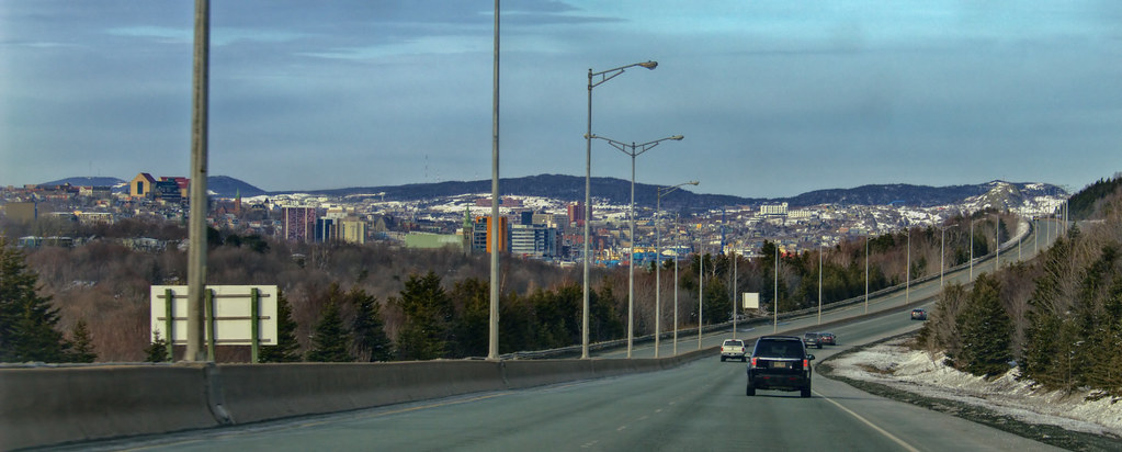
Pitts Memorial Drive today, the quickest route to downtown.

Cabot Tower and Signal Hill on the horizon to the right; downtown just below that. I don't know what this little road is called... probably still Commonwealth. It runs from Old Placentia Road to Ruby Line, but you can turn onto Memorial roughly in its middle (just ahead of me in this view). Somewhere left of that white truck the border between St. John's and Mount Pearl winds through the houses.

The Spout by Rabbittownie, on Flickr

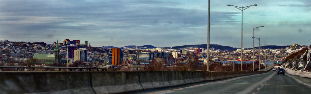
View of downtown from the stretch of Memorial roughly in between the Old West End (left) and Kilbride (right and behind).

The Spout by Rabbittownie, on Flickr

And just about downtown...

The Spout by Rabbittownie, on Flickr

The distance from first picture to the third. Second is somewhere in between, closer to the end:

zvefdj.jpg
 
Last edited:
A few observations along the 401 today:

- Clearing of trees along the 401 east of Cobourg has begun, presumably in anticipation of the next phase of widening the highway to six lanes.

- There's a new sign westbound between Milton and Guelph advertising the next OnRoute stop as a "Text Stop". This is the first I've seen this in Ontario; is this going to be a widespread public awareness program? I know NYDOT has been pushing text stops along at least I-81 in the last couple of years.

- There is good progress with the new interchange at Wonderland Road South in London. The ramps have been graded; however, I noticed that there is no upgrading work taking place on Wonderland Road itself between the 401 and 402. Currently it is not particularly wide, with no shoulders, typical of a paved low-volume rural two-lane road. I would have thought either the City of London or the province would upgrade the road, as was done north of the 402 when the interchange was built at the 402 in 1997. Considering that Wonderland will become the main north-south route through the west half of London connecting to the 401, I'm surprised by this.

- The former Highway 4 between the 401 and 402 is in horrible shape, particularly south of Decker Drive. It would never have been allowed to deteriorate to this point under MTO jurisdiction.
 
Looks like a fun ride into St. John's!

A few observations along the 401 today:

- Clearing of trees along the 401 east of Cobourg has begun, presumably in anticipation of the next phase of widening the highway to six lanes.

Found a news story for this: http://www.northumberlandtoday.com/2015/03/26/widening-of-401-to-begin-this-spring

- The former Highway 4 between the 401 and 402 is in horrible shape, particularly south of Decker Drive. It would never have been allowed to deteriorate to this point under MTO jurisdiction.

I agree it is in bad shape. I have been going to from London to Windsor a lot this year and until the Wonderland interchange is built this is what I have to use to get to the 401 as I live in the west end. I would assume it will get a facelift when the cloverleaf interchange (also horrible if using the loops) is redesigned once the Wonderland interchange is done.

Random Google Streetview of that stretch of Highway 4 from last year: https://www.google.ca/maps/@42.8652...m4!1e1!3m2!1sHsjWwh3rl4u0KAj6r-oXQQ!2e0?hl=en
 
I just heard these stats mentioned as part of an unrelated story on the radio:

The Outer Ring Road is the busiest in this province with 30,000 vehicles using it daily. The Conception Bay Bypass linking St. John's with its southwest suburbs is second-busiest and used by 24,000 vehicles daily.

Obviously, small city, small potatoes. But those seem exceptionally low to me. Are they?
 
Status
Not open for further replies.


Back
Top