noirish Los Angeles


Status
Not open for further replies.
This entrance to the Ambassador Hotel seen in 'Knight Rider' was covered recently by e_r in post #23740 and post #23795.

The Ambassador Hotel was used as a location in well over 100 shows and films. Of the shots recorded of the west entrance, I think the one below is my favorite, even though the Ambassador was only standing in for the Beverly Hills Hotel.

The great, curved glass brickwork within the entrance was also saved for the Robert F Kennedy Community Schools, now on the site.

Fullscreen%2Bcapture%2B2112015%2B33545%2BPM.jpg

Netflix: Fear and Loathing in Las Vegas (1998) Rhino Pictures


One curiosity I found in the details of the image above was the presence of one of those electric arc light masts in what appears to be the backyard of someone's mansion atop Brooklyn Heights. Whose house was this, I wonder?

arclightonbrooklynheights.jpg

U.S.C. Digital Library


Also, if you look down below and just to the left of the light mast, you can see Macy Street's old covered bridge over the Los Angeles River. I could be wrong, but its presence here, I think, makes the date of the photo more likely to be the mid-1880s, rather than the 1890s as stated on the U.S.C site.
 
Last edited:
I just came across this amazing color slide on ebay. We've seen this view before on NLA, but not this particular photograph.

That's the peaked roof of the old Hall of Records in the lower right corner, so we're pretty much looking straight down Court Street. The seller didn't include a date.


http://www.ebay.com/itm/Vintage-Kod...280?pt=LH_DefaultDomain_0&hash=item35e4fe6270

Years earlier we would have seen the tracks of Court Flight at center bottom. (below the white fence....where there's litter, and something red & square)

-photo taken from atop City Hall
_

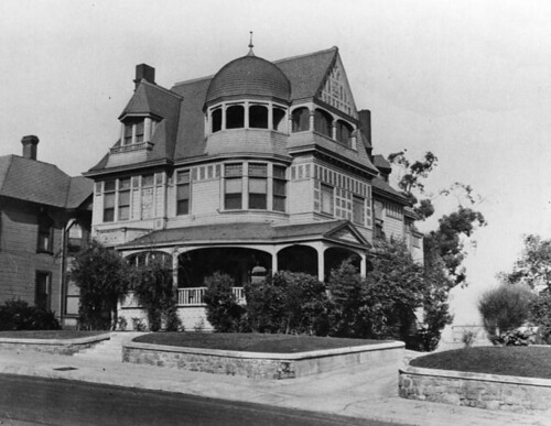
This shot is too amazing. Since it's one of my favorite LA Victorians, I have to point out that you can even see the Rochester lurking in the background at far right. :D
 
One curiosity I found in the details of the image above was the presence of one of those electric arc light masts in what appears to be the backyard of someone's mansion atop Brooklyn Heights. Whose house was this, I wonder?

arclightonbrooklynheights.jpg

U.S.C. Digital Library

Could it be W.H. Perry's house? Sorry, nevermind, Perry's House still exists and doesn't look like the one in the photo detail.

The bridge lasted until 1904: http://boyleheightshistoryblog.blogspot.com/2014/05/historic-photos-of-boyle-heights-macy.html
 
Last edited:
LOL, thank you!
Was 28 Court Street a real address?

Nope- Such a low number for Court Street only occurred prior to erection of current City Hall-where Court was at a low site near Main . On the elevated part #s began at 331 for the Hopperstead house and on west to Flower's steep drop in the 800 block- only one bitty house-#817-819 at that point...
 
arclightonbrooklynheights.jpg

U.S.C. Digital Library

Could it be W.H. Perry's house? Sorry, nevermind, Perry's House still exists and doesn't look like the one in the photo detail.

The bridge lasted until 1904: http://boyleheightshistoryblog.blogspot.com/2014/05/historic-photos-of-boyle-heights-macy.html


Thanks for that! I always wondered exactly how long the covered bridge stood.

I still think the photo dates to the mid-to-late 1880s, though. If it were the '90s, the areas in the distance would have been much more built up and filled in than they are as shown.
 
Last edited:


In addition to some fascinating information, that article features a superb stereograph photo of the covered bridge over Old Aliso Road (Macy Street).

Aliso+Street+Bridge+Payne+1870s+detail+2.jpg

Workman and Temple Family Homestead Museum, City of Industry, California.


Kind of difficult to see much of little Los Angeles itself at this enlargement, but clearly standing out in the distance can be seen the great sycamore El Alisal.

Another fact I didn't know until I read that article was that what we think of as Aliso Street was apparently not the original road that bore the name Aliso.

Learn something new every day!
 
One curiosity I found in the details of the image above was the presence of one of those electric arc light masts in what appears to be the backyard of someone's mansion atop Brooklyn Heights. Whose house was this, I wonder?

NB. I've just tweaked the contrast of this detail shot posted by JScott.

LABoyleHeightLight1.jpg

Detail of picture in USC Digital Library

Another entry on the blog posted by tovangar2 is titled The Introduction of Electric Light to Los Angeles and Boyle Heights, Pt. 3. It has various information and newspaper clippings about the first electric light in Boyle Heights in the early 1880s. The address is given as First and Boyle, which is where you'd find the Cummings Block today. The blog post also has an early map of Boyle Heights - this is the original from the Huntington Digital Library. The title is "Map of the Workman Orchard Tract Los Angeles City, Cal.; surveyed in Sept. 1888. / by J.A. Bernal."

LABoyleHeightLight2.jpg

Huntington Digital Library

In the top corner, the electric light is clearly marked.

LABoyleHeightLight3.jpg

Detail of picture above.
 
NB. I've just tweaked the contrast of this detail shot posted by JScott.

LABoyleHeightLight1.jpg

Detail of picture in USC Digital Library

Another entry on the blog posted by tovangar2 is titled The Introduction of Electric Light to Los Angeles and Boyle Heights, Pt. 3. It has various information and newspaper clippings about the first electric light in Boyle Heights in the early 1880s. The address is given as First and Boyle, which is where you'd find the Cummings Block today. The blog post also has an early map of Boyle Heights - this is the original from the Huntington Digital Library. The title is "Map of the Workman Orchard Tract Los Angeles City, Cal.; surveyed in Sept. 1888. / by J.A. Bernal."

LABoyleHeightLight2.jpg

Huntington Digital Library

In the top corner, the electric light is clearly marked.

LABoyleHeightLight3.jpg

Detail of picture above.


I already knew about the mast at First and Boyle, but the one in my photo detail can't be that one. The mast in the original photo is clearly located north of the line of Macy Street; First and Boyle is to the south of Macy, and out of view beyond the right edge of the picture. Even Aliso Street, which is north of First, isn't visible in the photo.

Judging by the angle of Macy Street (indicated by the covered bridge), the bluff in the photo is, to my eye, clearly the same one that now rises directly above I-10, northeast of today's Macy St. Viaduct, in old Brooklyn Heights. (The house shown in the drawing of the Boyle Heights light mast doesn't resemble the house in the photo, either.)

EDIT: A map from 1884 showing the relative locations of streets named above. The light mast in the photo appears to be in the general area of the "Morris" tract.

1884laparcelmapdetail.jpg

Public domain.
 
Last edited:
:previous:

Agreed. I got so excited when I found the picture of the light on the old map that I didn't stop to check the angles properly. I also wasn't expecting there to be two electric lights that close together in Brooklyn/Boyle Heights.

Here's a detail from an 1877 lithograph looking back towards the Plaza - Pico House is the large white building just left of center. I'm sure some houses have been omitted for clarity, and it's too early for an electric light, but it does show the relief of the area.

LABoyleHeightsLights4.jpg~original

www.bigmapblog.com

Skipping on to 1910, I stitched together two Baist maps hoping there may be a clue, but I can't see anything.

LABoyleHeightsLights5.jpg~original

www.historicmapworks.com/www.historicmapworks.com
 
One curiosity I found in the Plaza photograph is the presence of one of those electric arc light masts in what appears to be the backyard of someone's mansion atop Brooklyn Heights.
Whose house was this, I wonder?

arclightonbrooklynheights.jpg

U.S.C. Digital Library

-sorry if I'm joining this conversation a bit late (I was out of town)

I don't know if anyone noticed but there is a second electric arc mast in that same Plaza photograph.
It's much more difficult to spot / it's probably twice the distance from the Plaza than the other mast.

below: I've circled it in the upper left...the mast JScott discovered is circled on the right.


http://digitallibrary.usc.edu/cdm/fullbrowser/collection/p15799coll65/id/5329/rv/singleitem


Here's the closest I could get to this second tower.


http://digitallibrary.usc.edu/cdm/fullbrowser/collection/p15799coll65/id/5329/rv/singleitem

Anyone know what the large building is just to the right of this tower? It's pretty impressive.
________


BRR, I had forgotten all about the crazy ski jumps. I'm amazed every time I see those precariously built structures.
 
Last edited:


ER, this is my home town of North Hollywood, and this is where I developed my interesting in railroading and electric traction as we did not have a car.
The PE Hollywood cars were my ticket to adventure!

:previous: That's so great. -glad you liked the slide Jack.

Here are two more slides by the same seller.

below: The no frills Universal City stop.


http://www.auctiva.com/hostedimages...,814285217,814285223&formats=0,0,0,0&format=0


This one is a bit of a mystery, but the seller mentions "Sana[sic] Anita",
Enchandia. etc.


http://www.auctiva.com/hostedimages...,814285217,814285223&formats=0,0,0,0&format=0


The sellers description is here:
http://www.ebay.com/itm/Vintage-Mem...914?pt=LH_DefaultDomain_0&hash=item5b0c6f45e2
__
 
Last edited:


:previous: That's so great. -glad you liked the slide Jack.

Here are two more slides by the same seller.

below: The no frills Universal City stop.


http://www.auctiva.com/hostedimages...,814285217,814285223&formats=0,0,0,0&format=0


This one is a bit of a mystery, but the seller mentions "Sana [sic] Anita",
Enchandia. etc.


http://www.auctiva.com/hostedimages...,814285217,814285223&formats=0,0,0,0&format=0


The sellers descriptions are here:
http://www.ebay.com/itm/Vintage-Mem...914?pt=LH_DefaultDomain_0&hash=item5b0c6f45e2
__

"Sana Anita" may be a typo. Most likely is Santa Anita in the Arcadia/San Gabriel area. By the hills in the background, I'm leaning in the area of Huntington Dr going through the El Sereno/ Monterey Hills area.
 
"Sana Anita"

"Sana Anita" may be a typo. Most likely is Santa Anita in the Arcadia/San Gabriel area. By the hills in the background, I'm leaning in the area of Huntington Dr going through the El Sereno/ Monterey Hills area.

Santa Anita is correct. The red cars in the photo are en-route to the Santa Anita Race Track. During horse racing season the PE ran Race Track Specials for the public and delivered "Horse Cars" carrying thoroughbred race horses to the track.

Were it not for the blur on the front of the first car we could read Santa Anita Race Track Special on the dash sign.

Cheers,
Jack
 
Last edited:
Here you see the Edison Building (later called One Bunker Hill) being built on the corner of Grand and 5th. It looks like they're repaving the narrow sloping street, and they're also putting in a retaining wall.
00044274.jpg

LAPL


Here's the Edison Building circa 1930s.
onebunkerhillcirca1930s.jpg

publicartinla.com


1930 - The "new" Edison Building takes shape.

ajaxhelper
ajaxhelper

ajaxhelper
ajaxhelper
http://hdl.huntington.org/cdm/singleitem/collection/p16003coll2/id/5659/rec/24


The lamented Engstrom
ajaxhelper
ajaxhelper

ajaxhelper
ajaxhelper


Quaint, conveniently located residence.
ajaxhelper
ajaxhelper

ajaxhelper
ajaxhelper


ajaxhelper
ajaxhelper

ajaxhelper
ajaxhelper

ajaxhelper
ajaxhelper
http://hdl.huntington.org/cdm/singleitem/collection/p16003coll2/id/5659/rec/24


Yes, we've seen this image before (e.g., http://forum.skyscraperpage.com/showpost.php?p=5311855&postcount=4023 ). This one adds a skosh more detail?

ajaxhelper
ajaxhelper

ajaxhelper
ajaxhelper
http://hdl.huntington.org/cdm/singleitem/collection/p16003coll2/id/5661/rec/40


ajaxhelper
ajaxhelper

ajaxhelper
ajaxhelper


Last edited:
-sorry, if I'm joining this conversation a bit late (I was out of town)

I don't know if anyone noticed but there is a second electric arc mast in that same Plaza photograph.
It's much more difficult to spot / it's probably twice the distance from the Plaza than the other mast.

below: I've circled it in the upper left...the mast JScott discovered is circled on the right.


http://digitallibrary.usc.edu/cdm/fullbrowser/collection/p15799coll65/id/5329/rv/singleitem


Here's the closest I could get to this second tower.


http://digitallibrary.usc.edu/cdm/fullbrowser/collection/p15799coll65/id/5329/rv/singleitem


Yes, indeed! Very interesting. Two hitherto undocumented arc lamp masts! Or maybe they were documented. I vaguely recall seeing a list of all the L.A. masts somewhere before, maybe here, but I couldn't find it with a search. So, these two masts might actually be on a list somewhere. A pity my memory isn't good enough to remember where I found it earlier.


Anyone know what the large building is just to the right of this tower? It's pretty impressive.


I wondered about that building, too. Actually it looks to me like a complex of two or even three buildings – a white-roofed structure that looks much like a typical schoolhouse, and behind that a much wider and longer dark-roofed structure (or structures). Whatever it is, it was evidently deemed important enough to have its own light mast nearby. Is it perhaps the original hospital on the site of the present General Hospital? Just a guess...
 
In addition to some fascinating information, that article features a superb stereograph photo of the covered bridge over Old Aliso Road (Macy Street).

Aliso+Street+Bridge+Payne+1870s+detail+2.jpg

Workman and Temple Family Homestead Museum, City of Industry, California.

Kind of difficult to see much of little Los Angeles itself at this enlargement, but clearly standing out in the distance can be seen the great sycamore El Alisal.

It is a big tree, but it's not El Aliso...

Forgive me JScott. I got fatally turned around for a bit. Great find! When I first looked at that photo I didn't even see the tree.


In early days, old Aliso branched off to the NE from Aliso just west of the tree, at the Ramirez property, and did, I think, eventually cross or join the Macy street roadway (someone will know much more than I do about this). The Aliso St bridge was south of the covered bridge. Wait, now I remember, Old Aliso was renamed Lyon St and crossed Macy:

I still think the photo dates to the mid-to-late 1880s, though.

As C.C. Pierce took the photo from an upper-north window, or the roof, of the Vickrey-Brunswig building, it cannot be earlier than 1888.

I wish I could confirm the date of the Plaza design shown in the USC photo, as that might help. It looks very new. The Plaza was first cleaned up, rounded and landscaped in stages starting in 1871 (after demolishing the reservoir, of course), an attempt, I think, the clean up our collective act, probably in response to the Chinese Massacre (I'm sure Pio Pico had something to do with it too, as Pico House was very new). The fountain was elevated then; one had to access it with steps.

In time, the Plaza landscaping became very overgrown and was again redone. The Morton Bay figs were saved from the old landscaping (they're still there BTW) for the lovely new Wheel-of-the-Year design of the park, but what year this happened, I don't know. I was hoping Nathan Masters would know, but he didn't say on his blog.

I talked to Jack Feldman over at the Water & Power Museum. He was not at all surprised to see the light masts. He says 240 of these 150-foot-tall masts were in place by the mid 1880s, some quite far-flung.

Here's a second C.C. Pierce photo to compliment the one HossC posted. Time to play spot-the difference (hint: they were not taken on the same day):

Fullscreen%2Bcapture%2B2122015%2B34425%2BPM.jpg

usc digital library zoomable version


Anyone know what the large building is just to the right of this tower? It's pretty impressive.

LA Orphans Home/ the Poor Home?
 
Last edited:
Status
Not open for further replies.


Back
Top